

Locomoting around Llandaff
Friday 15th September
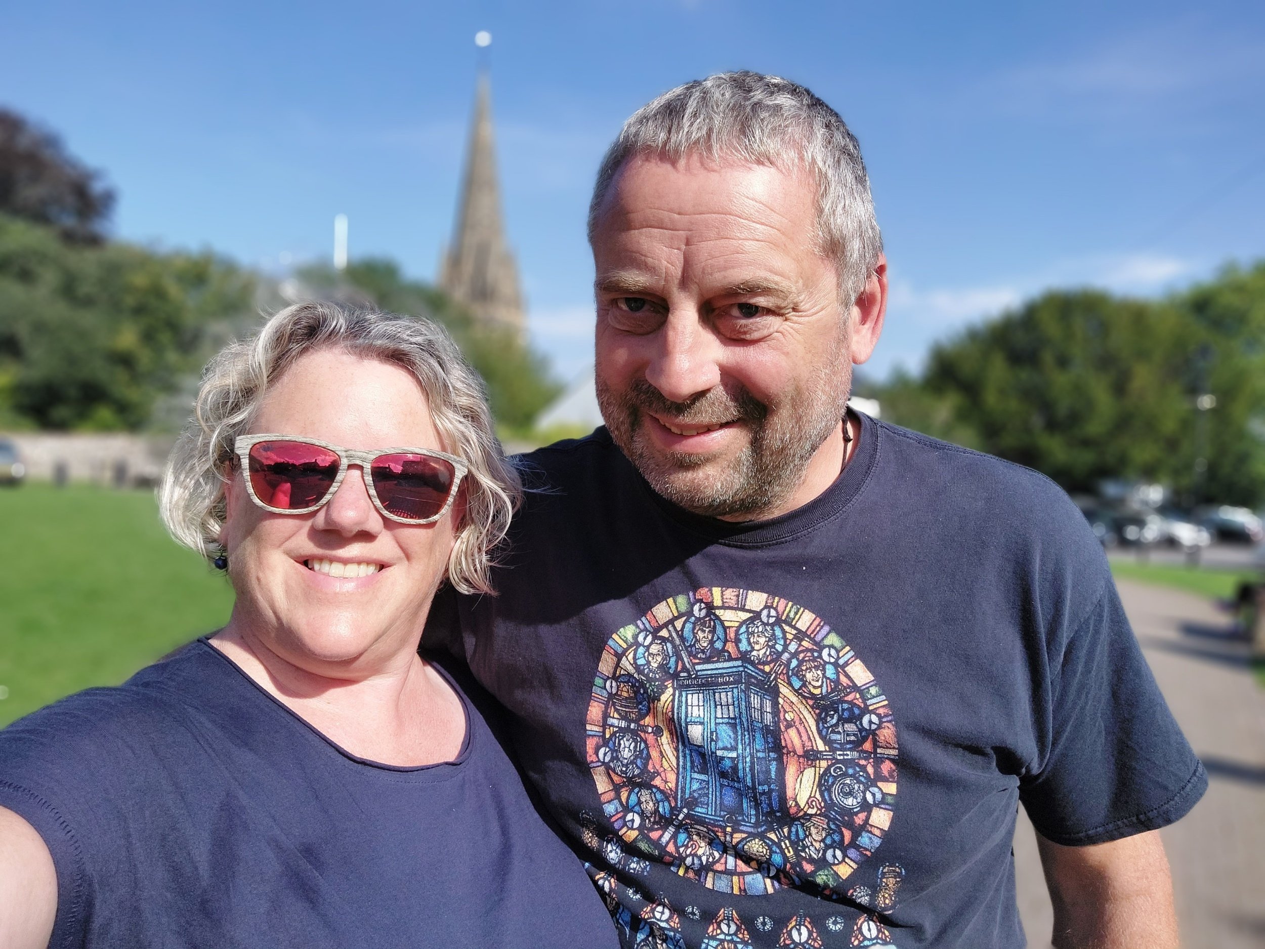
We left the campsite in Llangennith just after 10.30am and drove through the Gower Peninsula to Swansea and then headed on the M4 towards Cardiff. Llandaff is our destination today, it’s a city within a city! Roald Dahl, celebrated children’s author was also born and lived here. Other ‘celebrities’ from Llandaff include Charlotte Church (Singer/Songwriter) and Terry Nation (Screenwriter and novelist) Llandaff is a small historic city about 2 miles to the north of Cardiff’s City Centre, it lies on the west bank of the River Taff. It wasn’t part of Cardiff until 1922 when the county borough of Cardiff was extended to include it. It has a village feel to it with a small High Street and village green around the top near the Cathedral. Which is why we are here, it’s the last of six Welsh Cathedrals that Steve (my husband) is visiting and I have made up a 5km ish Nordic Walking route from the Cathedral through many of the local parks using the OS Map App. Our daughter was based here during the first year of her Degree course at Cardiff Metropolitan University a few years ago so we have visited the area before, but not really explored it beyond the local Tesco, Ice -Cream Parlour or Toby’s Carvery!

The Cathedral Green
We arrive around 12.30pm and manage to park right by the Cathedral Close so decide to have our packed lunch on a bench in the sunshine (We’ve been so fortunate with the weather on this trip!) There’s lots of impressive looking buildings around the green and some are associated with the Cathedral (the Bishop’s House and the Dean’s House) There’s also a Bronze statue to a Vicar - James Rice Buckley who was Vicar of Llandaff (1878-1924) and then Archdeacon from1923 until his death. The inscription reads “a man he was to all the country dear”

War Memorial on the Cathedral Green and other items around the Cathedral Green.
“The War Memorial on The Green is in the form of a statue showing a female 'Llandaff' remembering her two sons. The figure on the left represents the young men from the Cathedral School who died, and the figure on the right represents all the young men from the parish who lost their lives. The class difference between the two figures is clearly, and touchingly, drawn, as they are bound together in death. It was created by Sir William Goscombe John, whose work is displayed throughout the village, on The Green and at the Cathedral.” From Peoplescollection.wales
After our lunch we went our separate ways, me having a wander around the Cathedral Green before embarking on my Nordic Walk route, Steve off to the Cathedral.

Down the Dean’s Steps!
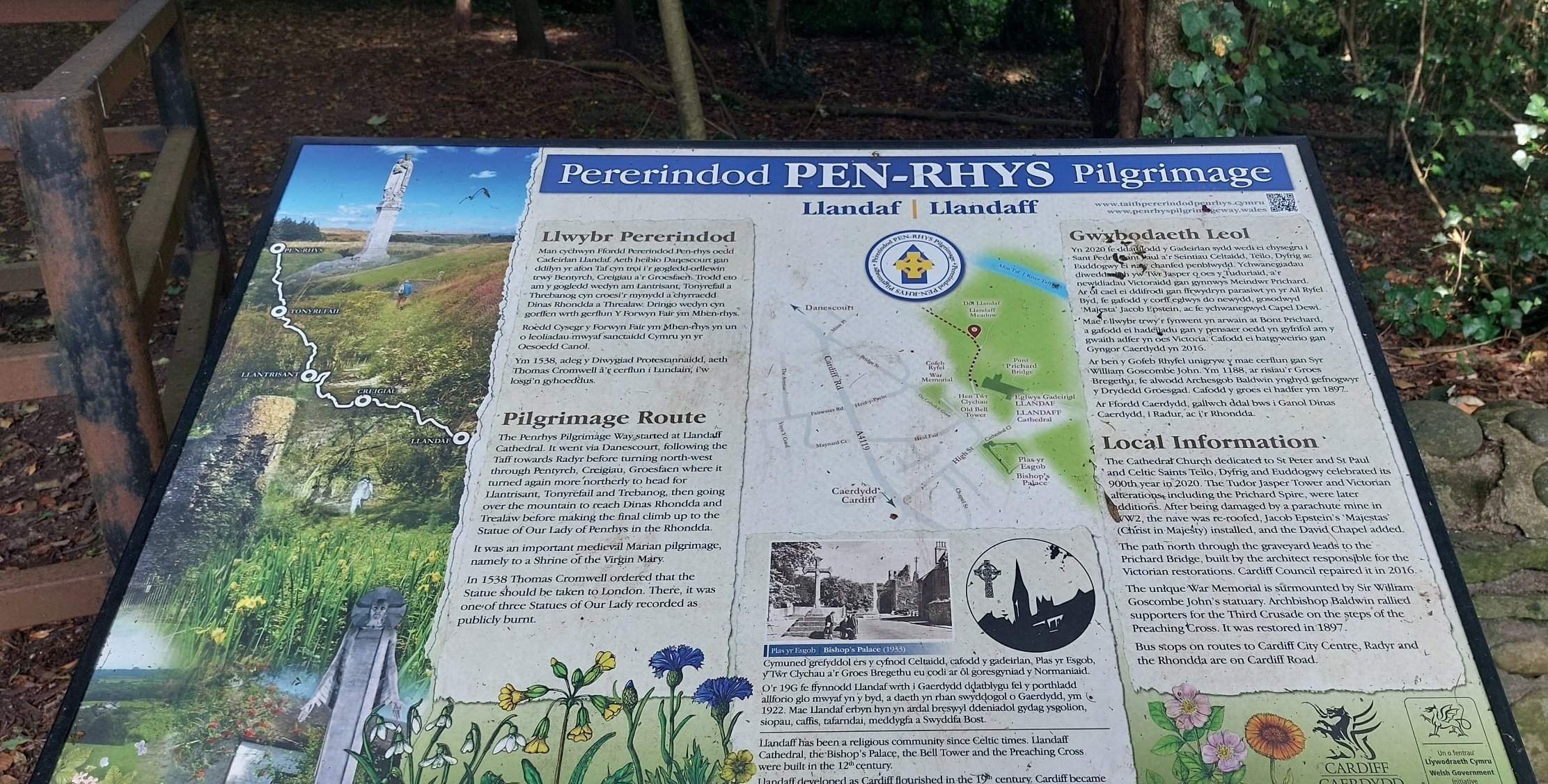
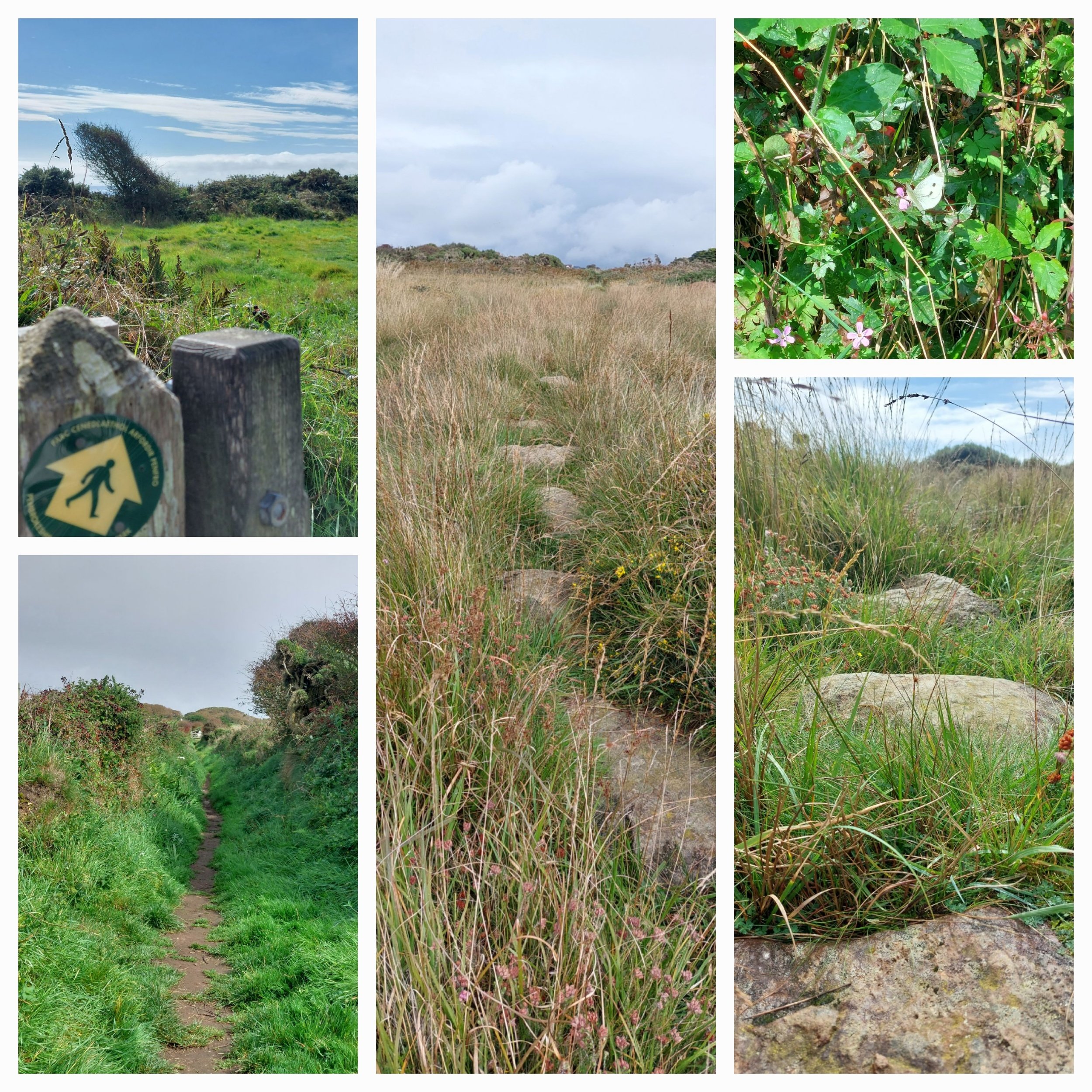
I set off down the Dean’s Steps to reach the Cathedral to pick up the footpath to the river, passing the start of the Pilgrimage route from Llandaff to Pen-Rhys in the Rhonnda.

The Nordic Walking route today takes me on parts of The Cambrian Way and the Taff Trail and on a traffic-free cycle way!
The first part of the route takes me through sports fields owned by Cardiff Met Uni and then past the Uni itself along the River Taff, crossing the busy A48 and onto a traffic-free cycle way.
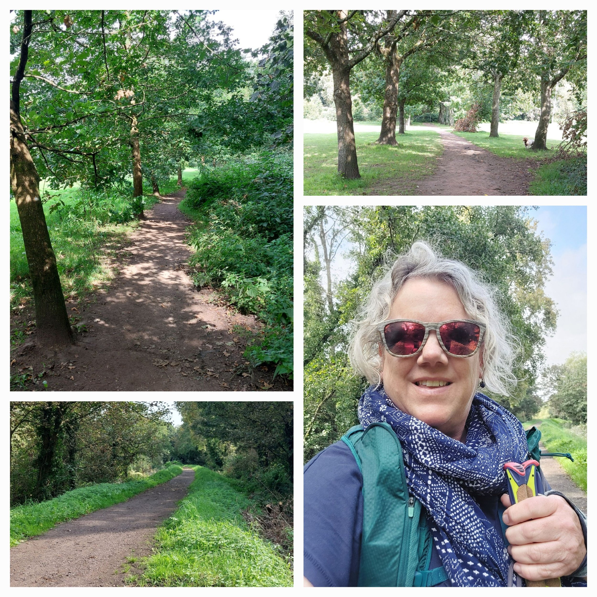
it’s quite a green, leafy start!
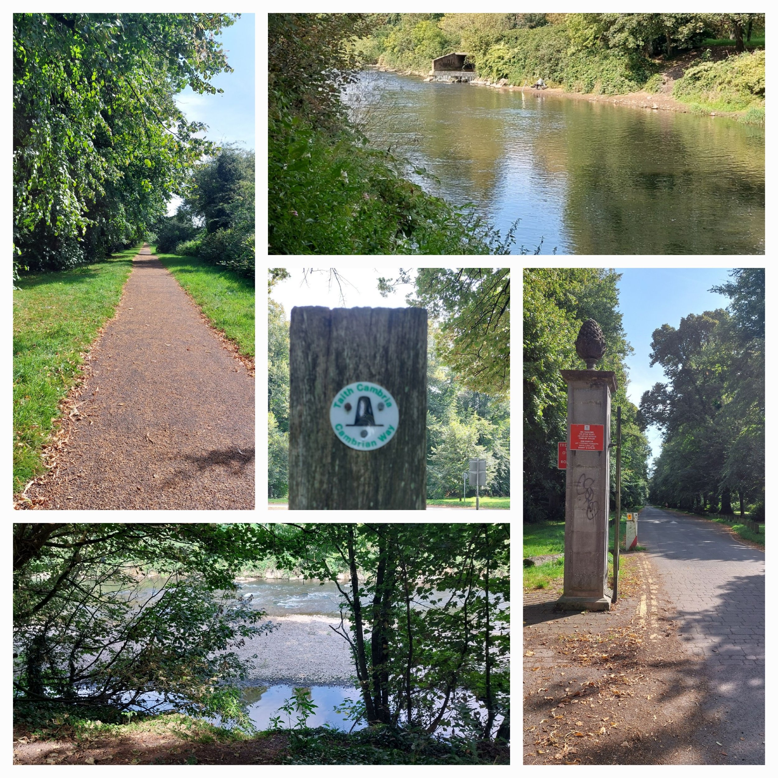
The river Taff and some of the footpaths
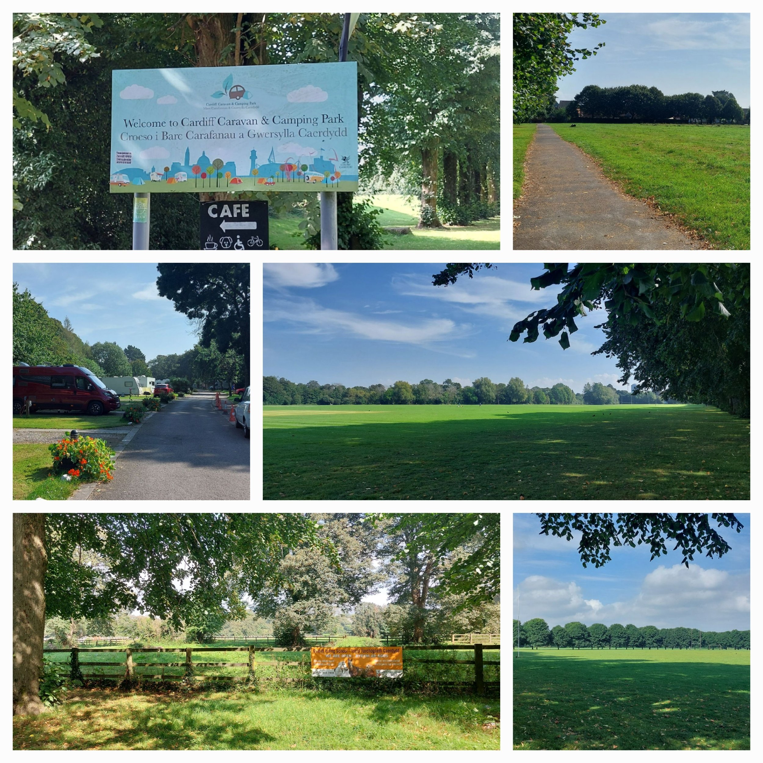
I pass the Pontcanna Allotments, the Cardiff Riding School and the Cardiff Caravan and Camping Park (who knew!) I had to have a gander for research purposes!

Plenty of wildlife to spot in and around the river!

At the end of Pontcanna Fields I head back across to the River Taff back on the Taff Trail and then cross the Blackweir Bridge back on to the Cambrian Way. I’m on the edge of Bute Park.

The Sports Fields and footpaths are full of dog walkers, Mums pushing prams, cyclists, runners and others walking to who knows where! I’m soon in familiar territory - Tescos looms up on my right hand side!
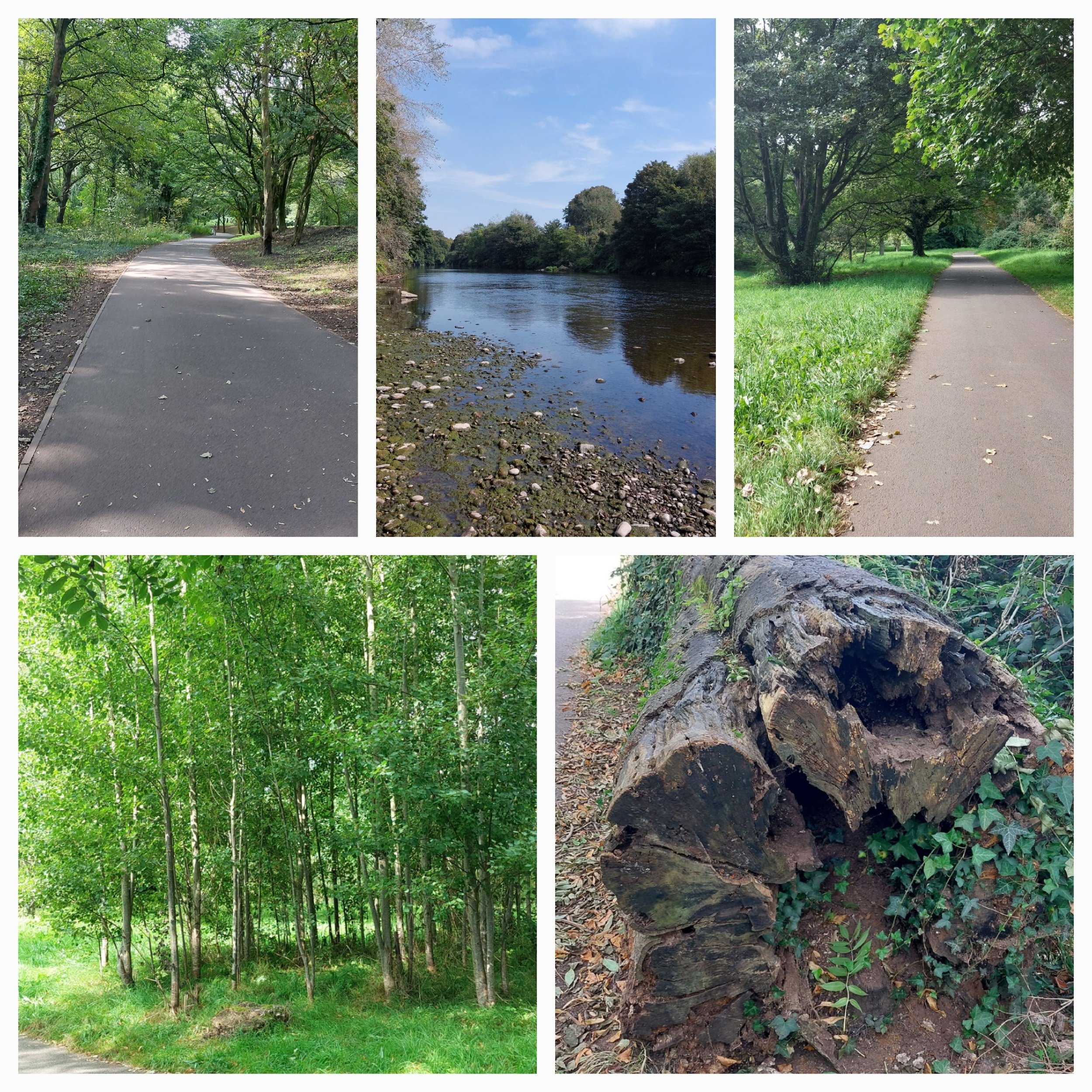
I head under the underpass and here I’m meant to cross back over to the Cathedral side of the river, but a quick squizz at the OS Map App and I decide to carry on to the next bridge as I’m having such a lovely Nordic Walk!

Cathedral Spire in the distance, rower on the Taff, Llandaff Rowing Club behind the weir and the Pilgrimage Way waymarker.
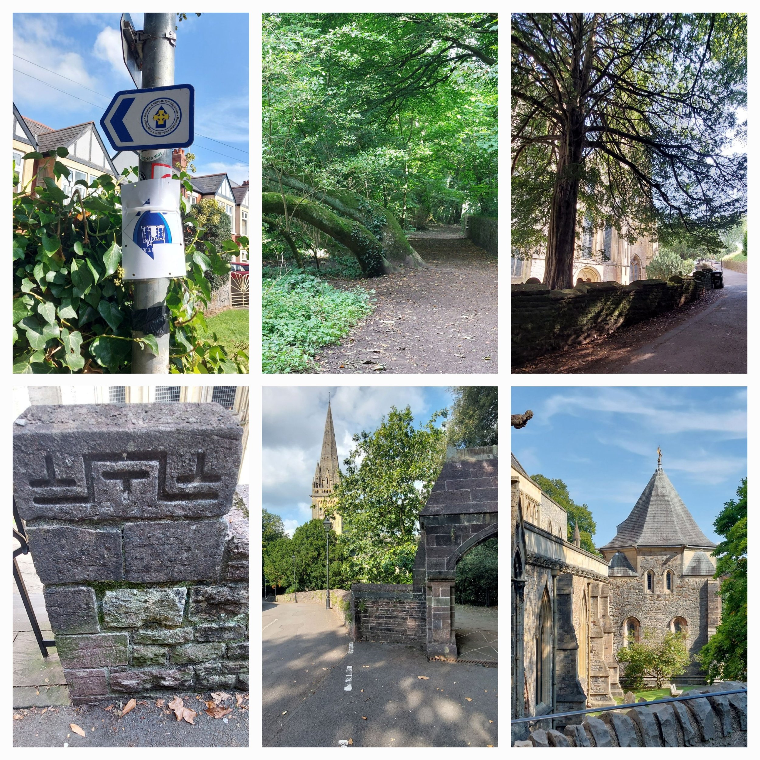
I lost the path around the Llandaff Rowing club, had to retrace my steps and scrutinise the OS Map! Eventually the Cathedral comes into view through the trees and I walk up past it to explore the area at the top.

At the top I find ruins of a 13th century bell tower, a preaching cross and the ruins of the former Bishop’s Palace. Also Saint Teilo’s Well, an ancient well sited on a spring line above the Cathedral. Teilo was one of three Celtic saints in honour whose the Cathedral Church at Llandaff was originally dedicated. Teilo was the second Bishop consecrated to Llandaff in the sixth Century.

Ruins of the former Bishop’s Palace. Now provides space for locals and visitors to enjoy the peace and beauty.
and that’s all folks! Six welsh Cathedral cities visited and Nordic Walked and our Welsh tour of 2023 is complete!

Sauntering in St Davids
11th September 2023
After a very relaxing weekend spent celebrating our 29th Wedding Anniversary in a Tipi near Fishguard we set off for St Davids, a 30 minute journey and we soon arrived. I’ve never been to St Davids, but have heard a lot of people enthusing about it. My first impression – it’s tiny!

A cottage in the city of St Davids, gives you an idea of the sort of city it is!
“St Davids is a city with a cathedral in Pembrokeshire, Wales. It lies on the River Alun and is the resting place of Saint David, Wales's Patron Saint, and named after him. St Davids is the UK’s smallest city. St Davids was given city status in the 12th century. In England and Wales it was traditionally given to cathedral towns under practices laid down in the early 1540s, when Henry VIII founded dioceses. City status was lost in 1886, but restored in 1994 at the request of Queen Elizabeth II.” From Wikipedia

After capturing Clara and the Priest outside the Cathedral, I set off for the National Park information centre a fifteen minute walk up through the city from the Cathedral car park. It was drizzling enough to be annoying, but not enough to put my rain coat on! This walk turned out to be fruitful in terms of interesting doors and a house name that made me laugh.
Not far from home then!
The Information Centre was built in 2007 by the Pembrokeshire National Park and as an eco-friendly building. Located within in the National Park Information Centre, Oriel Y Parc Gallery has a landscape gallery, exhibiting art and artefacts from the collection of National Museum of Wales. Using objects from the art, natural history and industry collections, visitors are able to view a regularly changing exhibition programme. There’s also a shop and café.
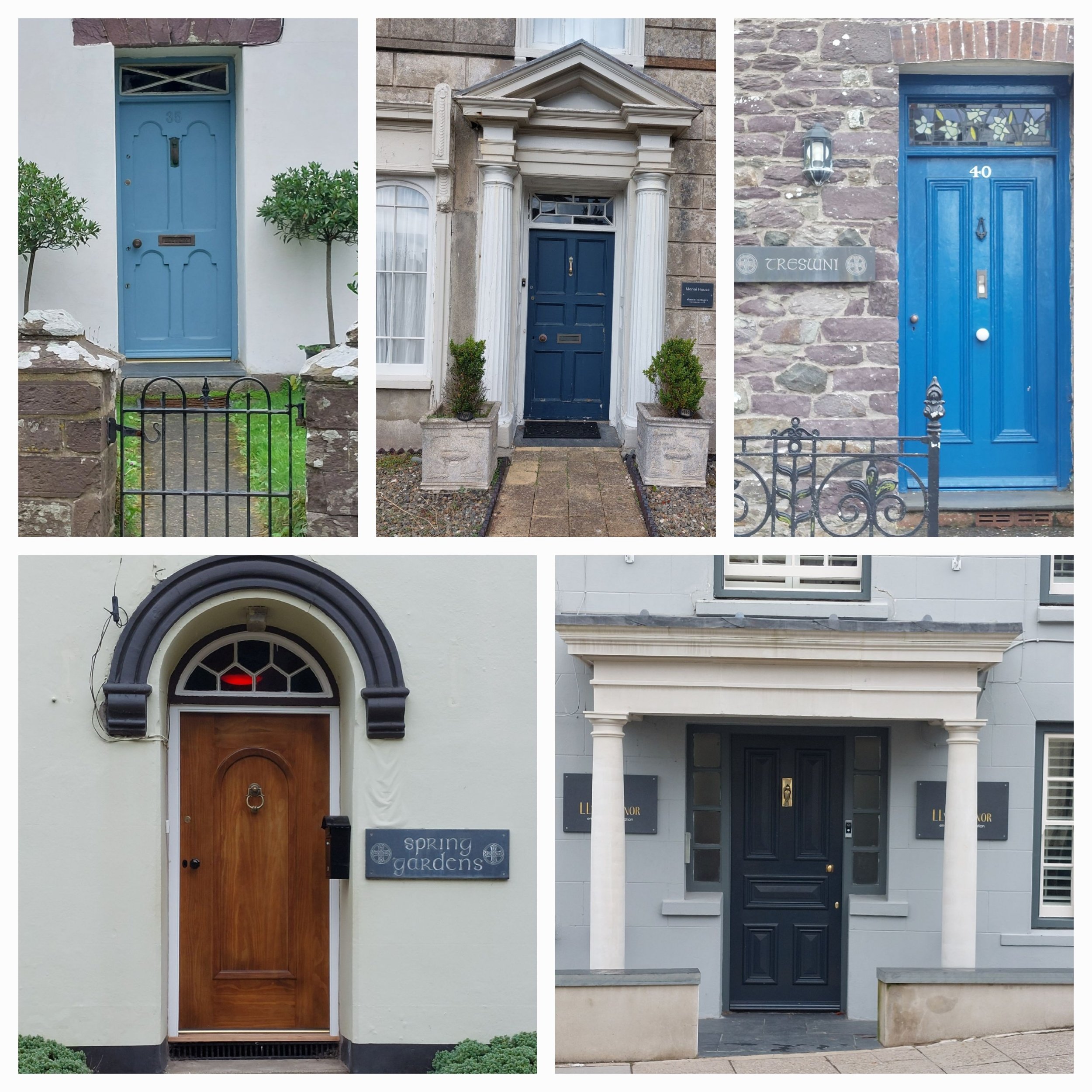
Doors of St Davids
The lady at the information desk was very helpful and handed me a couple of A4 pieces of paper with walking trails on. I selected the one that took me around the city and past the Cathedral.

always look up!
In the first instance I mis read the very sketchy map and headed in the wrong directions, this soon became apparent and opening the OS app helped me orientate myself and took me down through a footpath through the houses and out onto open land.

finally on the right track

It was a bit soggy underfoot and I regretted the choice of walking trainers over walking boots.
(Maybe it’s time to re-waterproof them!)
The route takes me on a lovely walk in the countryside surrounding St Davids through hawthorn tunnels and Autumn is showing signs of taking hold. The misty, hazy sky and light drizzle add to the mists of mellow fruitfulness ambiance! Sloes, Hawthorn berries and Blackberries are in abundance and the ferns are turning a beautiful rust hue. The trees are shedding their leaves slowly, but steadily.
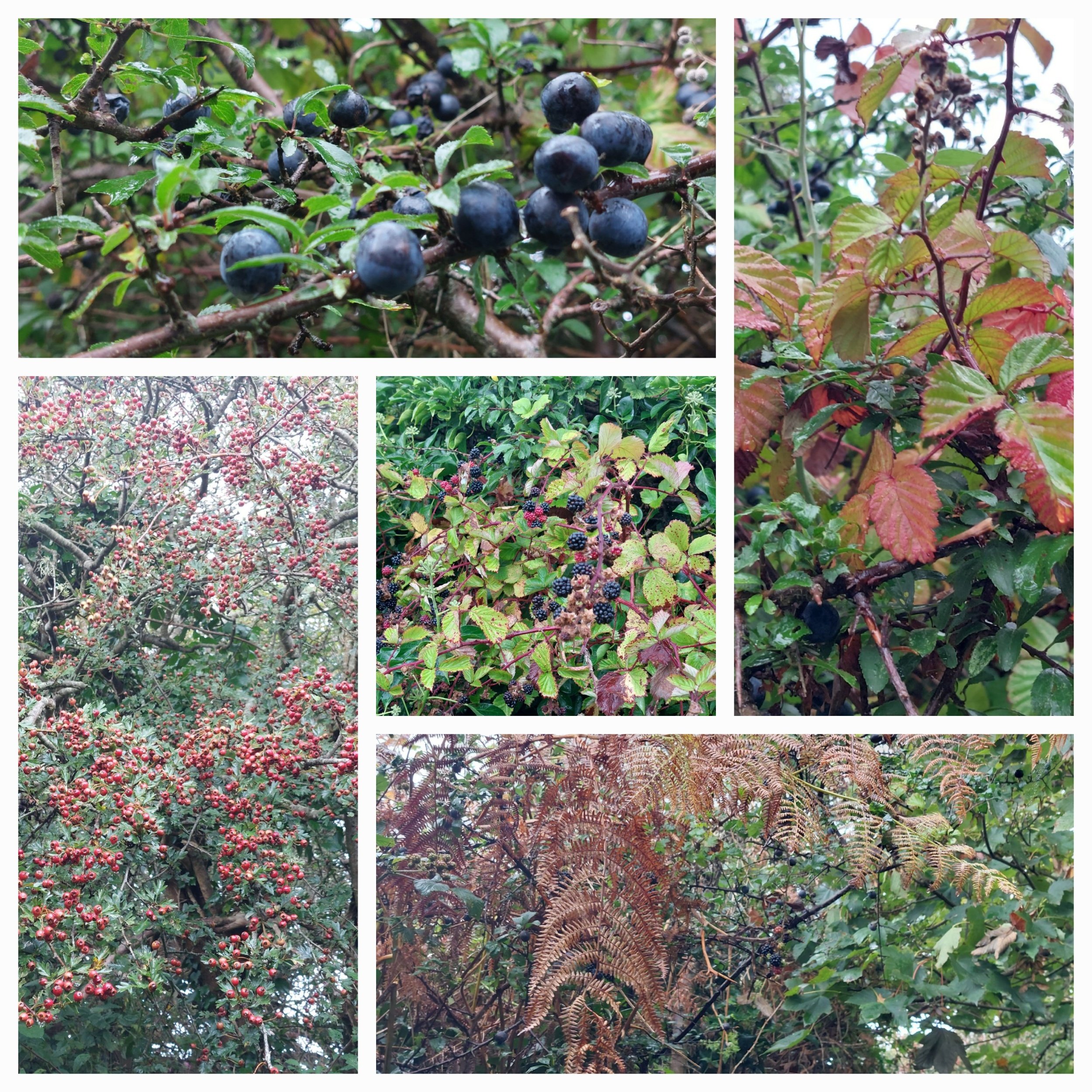
Mists of mellow fruitfulness

tunnels in nature
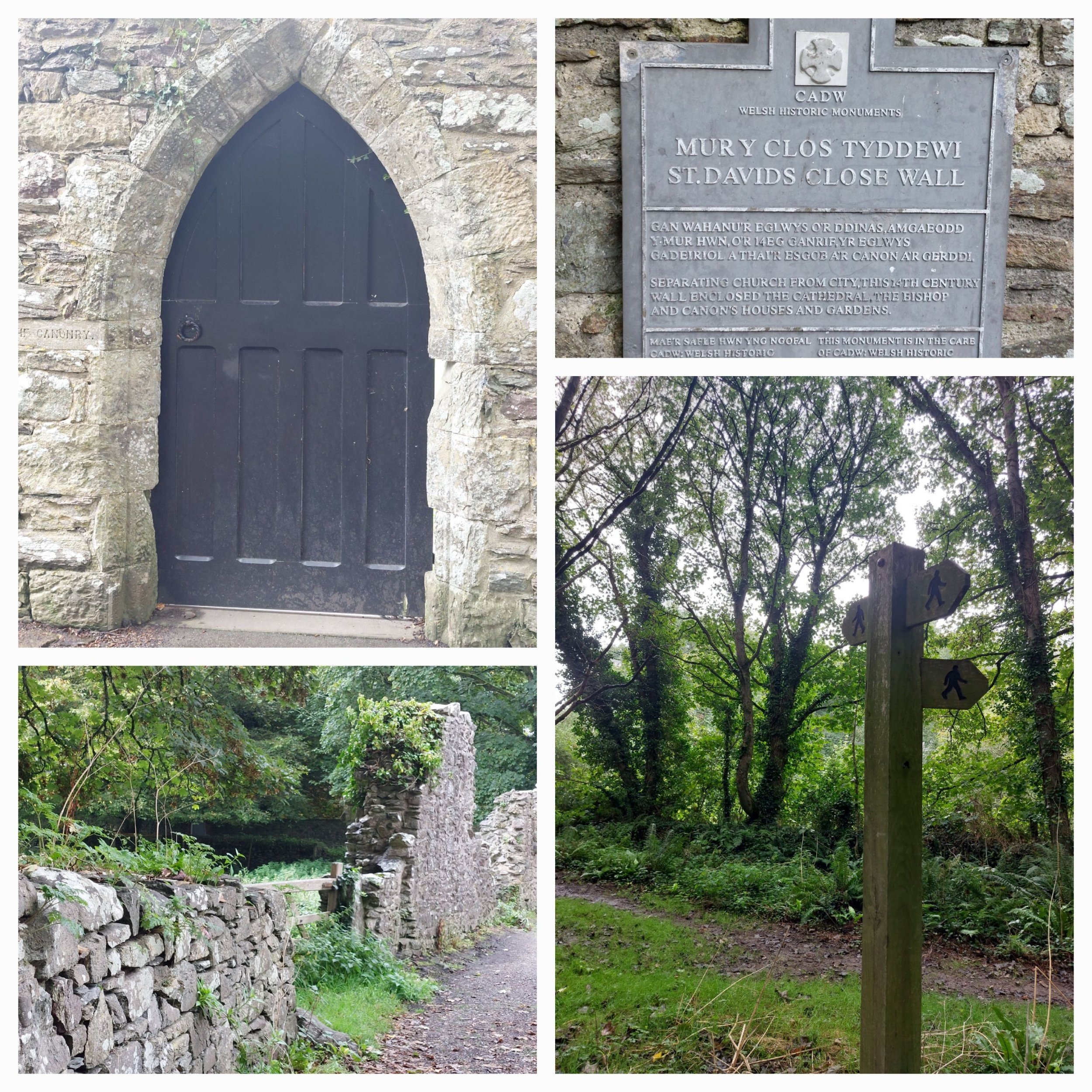
After this first part of the walk I come to St Davids Close Wall, which originally separated the church from the city, the Canonry door and eventually the ruined Bishops Palace and the resplendent St Davids Cathedral. The Bishops Palace is stunning even in ruins, I’m too tight to pay to go in and just take a few photos from the outside, another time perhaps.
The brooding Gothic ruins of the Bishop’s Palace lie on the opposite bank of the river from the cathedral and provide a suitably dramatic backdrop for open air theatre performances in the summer. Bishop Henry de Gower’s legacy consists of the simpler east range, his private domain, and the grander south range, built for banqueting in the great hall. That rose window would have been a sight to see!


Previously rather an imposing building
Steve’s blog will tell you everything you ever needed to know about the Cathedral, but from my viewpoint it looks vast and grey, but on a sunny day I imagine it would look a lot more inviting!

St David’s Cathedral
On from the Cathedral the route takes me back up through Merry Vale and to Lower Moor, where it goes through an area of access land – Carn Warpool and onto a footpath signing me towards the Pembrokeshire Coast Path…unfortunately going the other way! So no coastal views for me today. The weather has no cleared up and I’m regretting the decision to leave my sunglasses in the van – squinting hurts!
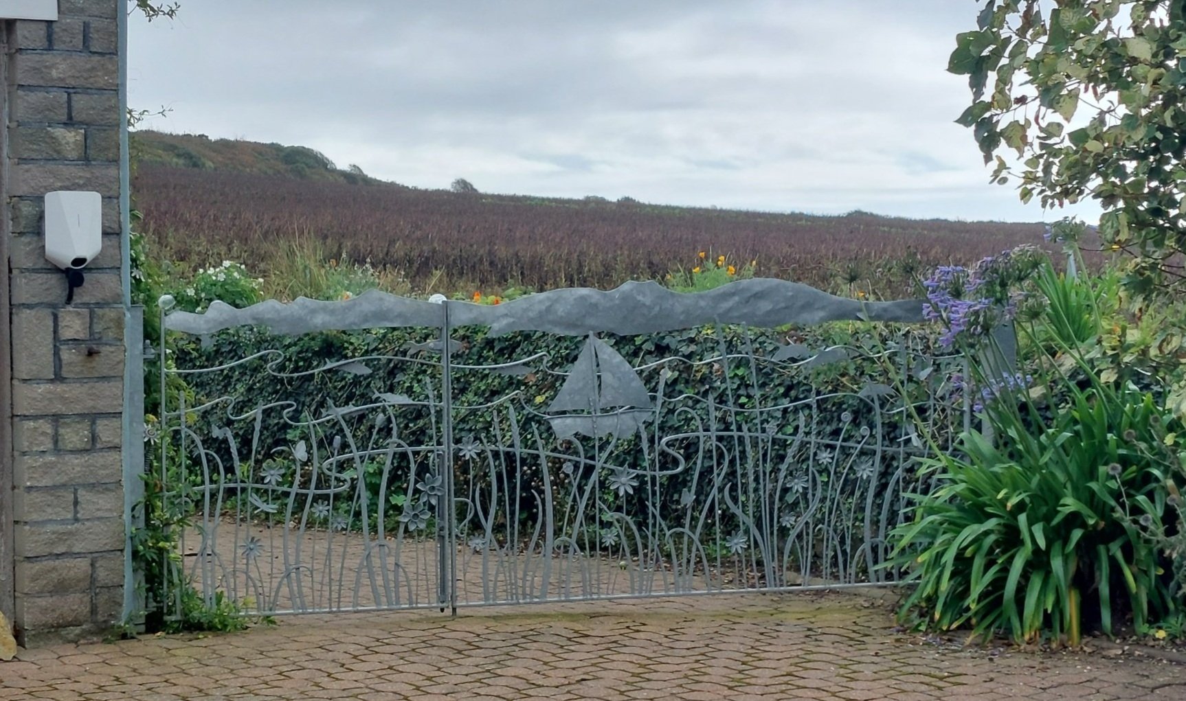
What a beautiful gate!

Hawthorn laden with berries and a blue sky
This footpath takes me through a National Trust area called Bryn-Y-Garn and skirts around the city housing, past stables and horses fields and even a Pigeon Loft. A proud Welsh household has a Y Draigh Goch (Red Dragon) flying high in the breeze.
Passing beautiful overspills of back gardens in the hedgerows the path comes out back near the Parc Y Oriel. I have a bit of a funny turn here and feel like I’m going to faint and luckily I have my poles to lean on and the feeling passes relatively quickly.

Steve is now finished at the Cathedral and we meet up for a spot of lunch and a bit of a wander and grab a delicious ice-cream from Nook on our way back to Clara. More photos of Clara and St Davids and we set off for our next camping spot in Talbenny, Pembrokeshire.

St David’s Cathedral from the city above
Exploring Brecon
31st August 2023
After a quiet night spent in the van we awoke to very rainy rain, we packed everything away in the van including our soggy tent ‘garage’ and even soggier swimming things (it was optimistic thinking they would dry) and Alun invited us in for a delicious cooked Brekkie, it was great to catch up with their youngest daughter Chloe too. Before we said our goodbyes we had to get Alun to tow us off his field! Goodbyes were then said and we drove off to Brecon.

Llanwrtyd
Brecon is a town at the heart of the Brecon Beacons National Park with the Black Mountains to the East nestled in the Usk valley.
I can’t remember if I’ve ever been to Brecon before and I’m not sure what I was really expecting, but it was bigger than I thought as we drove through to find the Cathedral. We were meeting an old friend of mine from our Cambridge days at the Cathedral to have a coffee and catch up, which we did in the café in the Cathedral grounds. We chatted while we drank and then left Steve to his Cathedral visit whilst we embarked on the Brecon Poetry trail I’d found online.

Brecon Cathedral
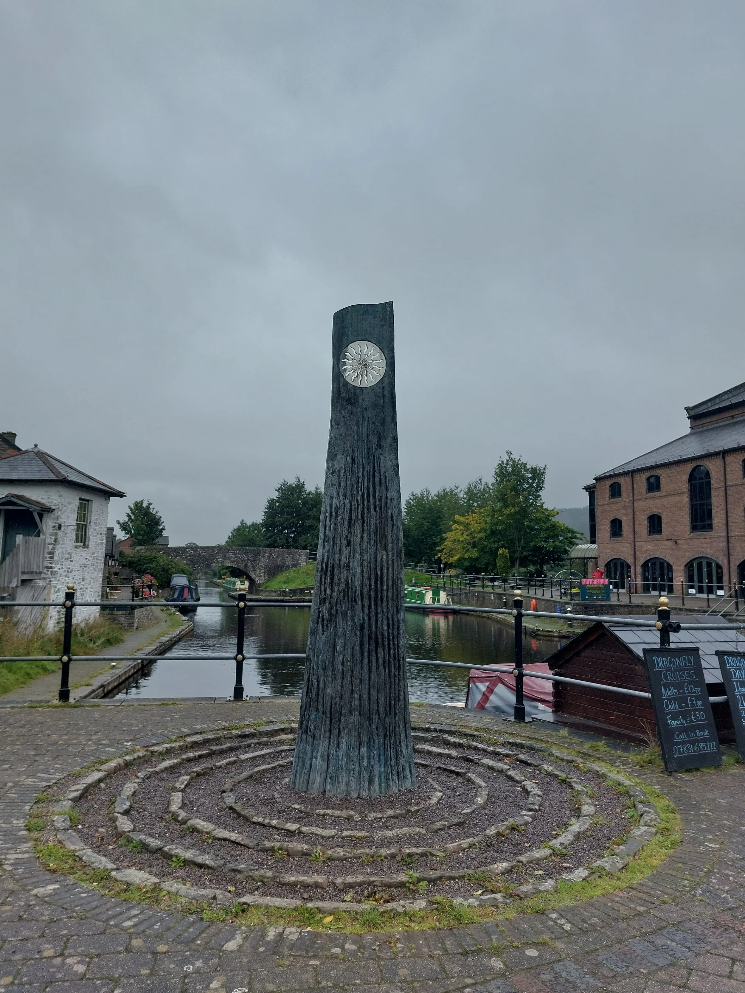
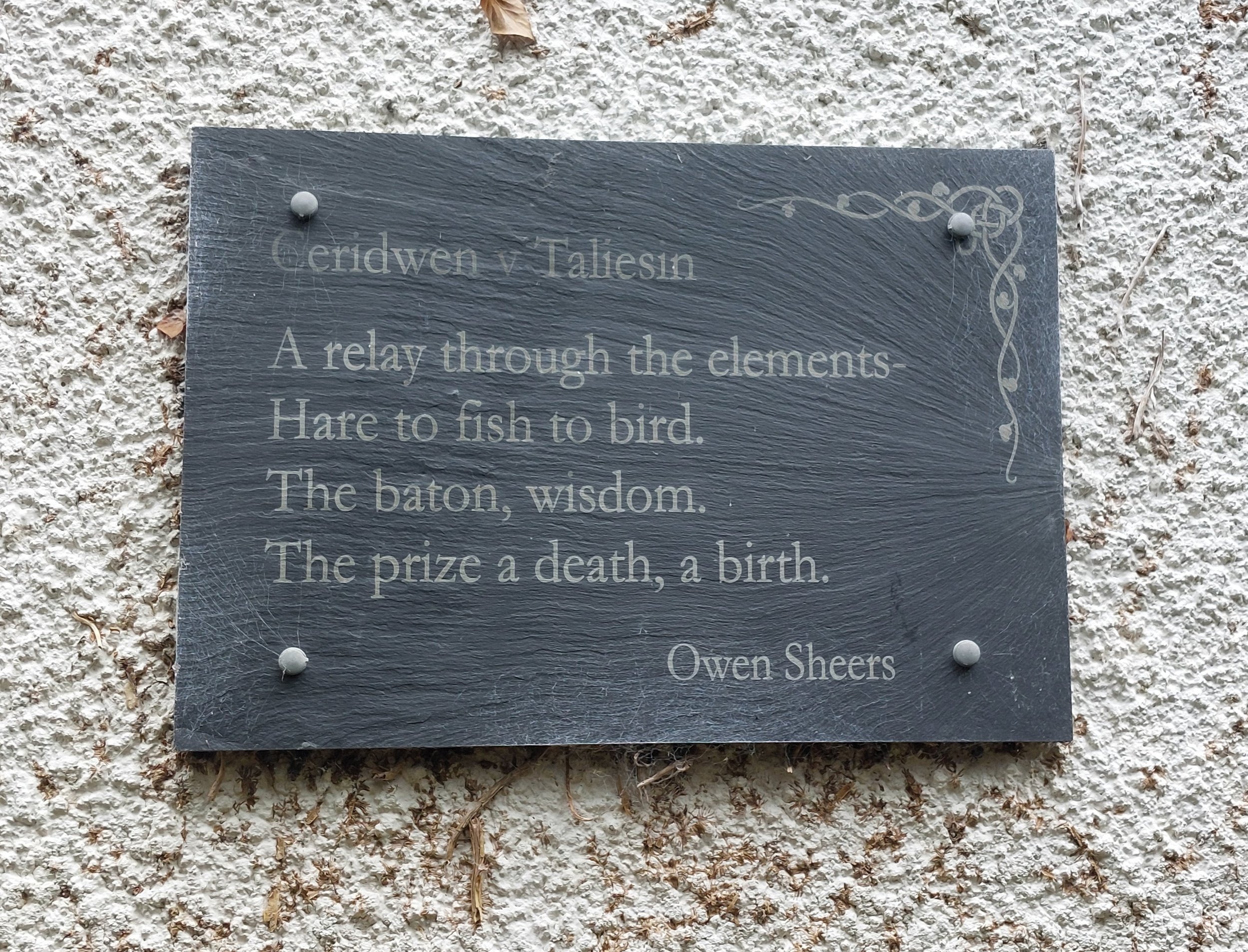
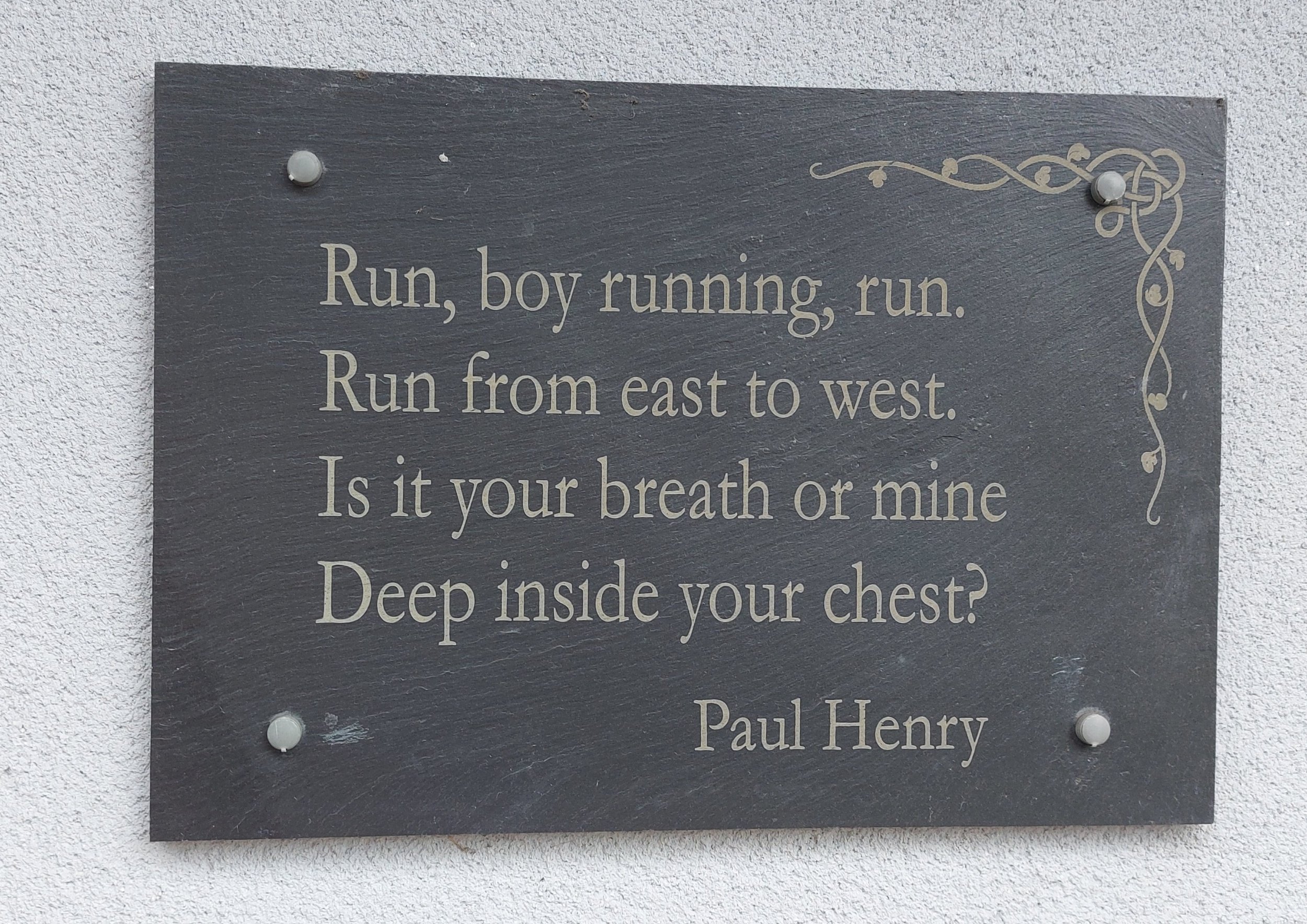
The trail said it began at the Theatr Brycheiniog so that is where we headed, Amanda weaving me through the town an pointing out landmarks on the way. Reaching the Theatr I spotted a slate plaque with a poem on it in Welsh which matched the description on the trail. Good so far, we popped into the Theatr to the information desk hoping to pick up a hard copy version of the trail as the online one only seemed to give details of where to find the first two poems. However the staff behind the info desk had never heard of the Brecon Poetry Trail and despite me showing them where I had found it online they had no further information about it. The trail was set up as part of the Cultural Olympiad for the 2012 Olympic Games, each poem has a Olympic theme, I knew there were 10 poems! Anyway the area by the Theatr is very pretty with a Wharf, you can get a canal cruise from there and Amanda tells me the canal is very pretty.

Down by Theatr Brycheiniog
“Brecon’s poetry trail invites everyone to explore the streets, rivers and landmarks of the ancient market town of Brecon and its connection to the myths and legends of the magical, mystical land of Wales. The poems include references to names and events from The Mabinogion, verses recalling the deeds of Guto Nyth Bran, Taliesin, Gwenllian and others including the modern Olympian long jump legend Lynn Davies.
There is a strong Olympic theme throughout, as the trail was inspired by the Cultural Olympiad of the 2012 Olympic Games in London and the desire to embrace the whole of Britain through sport and culture.
Theatr Brycheiniog was one of seven arts organisations in Britain, and the only one in Wales, chosen to join the celebration, commissioning a permanent artistic installation for the enjoyment of the people of Brecon and visitors to the town.
Ten Welsh poets were commissioned to compose four-line verses incorporating Olympic elements of their choice within a framework of Welsh myths and legends or imagery with a strong Welsh resonance. The collective result is an outstanding monument to the wealth, depth and breadth of the richness and diversity of modern Welsh poetry in both languages.” Excerpt from the online description of the trail from Breconbeacons.org
We left the area by the Theatr and despite not really knowing where we were going we had some clues about the next plaque and after a bit of toing and froing we found it! Now we really were clueless, so Amanda started taking me to various landmarks in the town hoping we would spot a poem! The next poem we spotted was in the window of a second-hand bookshop, so Amanda went in to ask if they had any info…alas no.

A fo ben (Menna Elfyn)
He who would lead must be a bridge
Over streams of gold, silver and bronze
The Thames echoes to Pen y Fan
The rejoicing of champions from every land
(Translated by David Lloyd Pope)
A friend (thank you David) has helped me with some translations of the Welsh poems, but he made this very valid point. “Just as in English, Welsh poetry can be difficult to translate and to understand, even if you know what the words mean. There are cultural and literary references and sometimes language that is archaic or not often used in everyday speech. Also, Welsh poetry uses a number of fixed meters that are very rarely found now in English, like sonnets.”
The next poem we spotted was in the window of a second-hand bookshop, so Amanda went in to ask if they had any info…alas no. Just up from there was the Tourist Information Centre (small shop) and finally we found someone who knew about the trail!! They gave us a copy of the town map which has the locations of the poems marked on it, but no trail as such. We told them that the staff in the Theatr didn’t know anything about the trail!
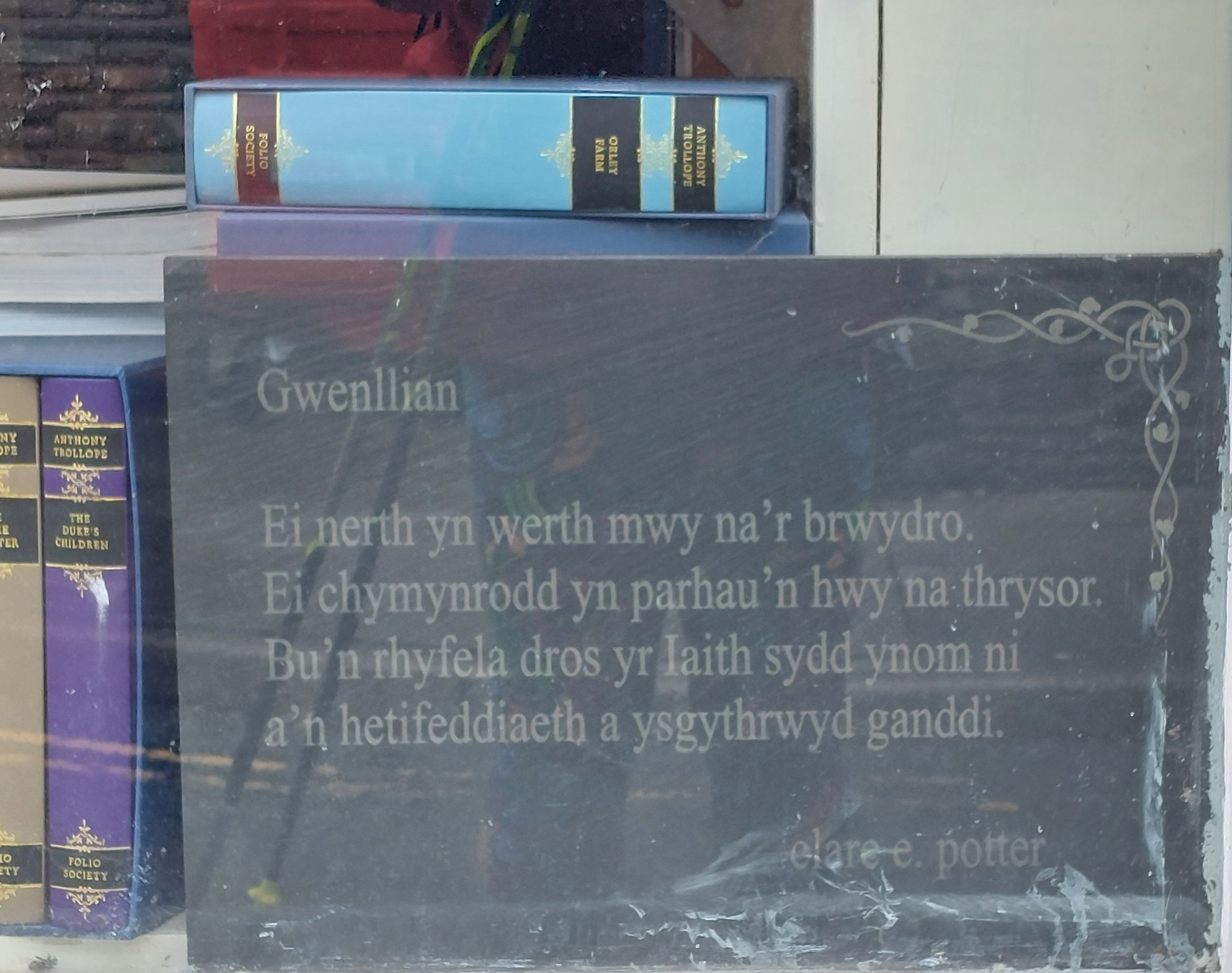
Gwenllian (Clare Potter)
Her power worth more than the struggle
Her legacy lasting longer than treasure
She fought for the language inside us
And our heritage was carved by her
Amanda had to leave me at this point as she had to get back to her car, so I was now on my own. I then made my way back down to the river waterfront to find the third poem by Graeme Davies, then heading back towards the town I found the poem in the Art Gallery window (after asking as I couldn’t see it at first!)

Yr Afon Wysg (Grahame Davies)
The river Usk that you remembered in the past
Is brighter today, when you return
And the last rose of autumn at the side of the lane,
Is sweeter as you come home with wisdom

Nearly missed this one!

Down by the river Usk
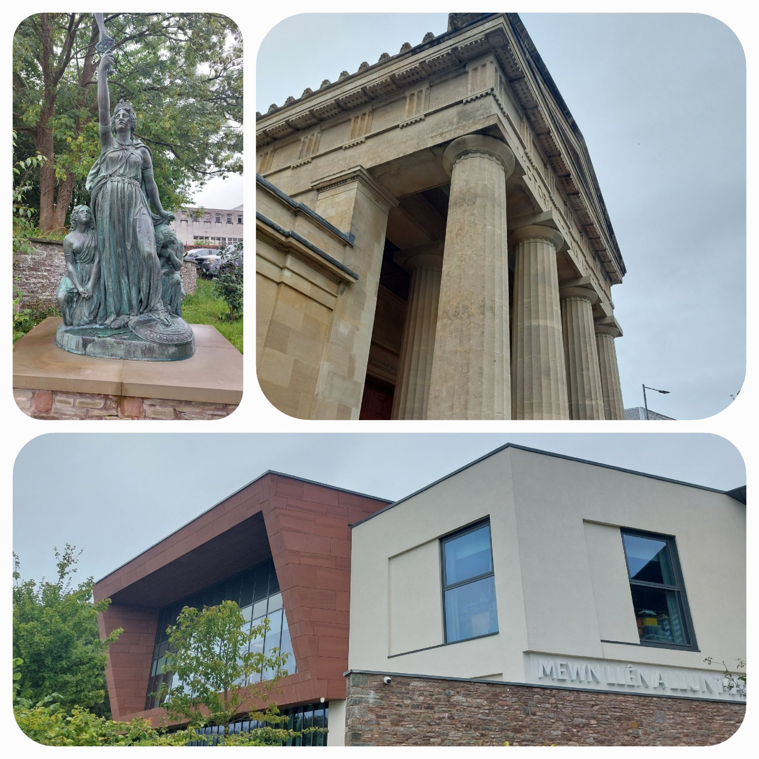
Boudicca statue outside Y Gaer, which is an “exciting and inspirational new cultural centre in Brecon, which brings together the refurbished Brecknock Museum & Art Gallery with a brand new Brecon Library to create meeting and event spaces to stimulate the senses – space for poetry, music, reading, art and learning, with peaceful corners for study and contemplation. The Museum & Art Gallery in the Grade II* listed former Shire Hall, has seen the restoration of the Assize Court, the opening of the subterranean cells and the provision of redesigned galleries, which contain the nationally-important museum collections and works of art and also offer space for special displays and exhibitions. The Brycheiniog Gallery on the top floor features on the different parts of Breconshire and their special features. Y Gaer Library has a fabulous range of books for all ages, plus Wi-Fi and computer facilities,” from Visit Wales

Y Gaer
Why is it that if you stand looking at a map people always presume that you are lost??? I was trying to get my bearings and work out what the old TIC building was when a friendly chap asked me if I needed help, so I told him about the trail, he’d lived in Brecon since he was born, but knew nothing about the trail! I showed him what I was looking for and he offered to take me there! I thanked him and he bid farewell and good luck. He also pointed me into the right direction for another poem located at a school, however I wasn’t specific enough and he inadvertently sent me to the Infants School rather than the junior school! The staff in the reception were mildly amused when I asked them where the Poem slate was!

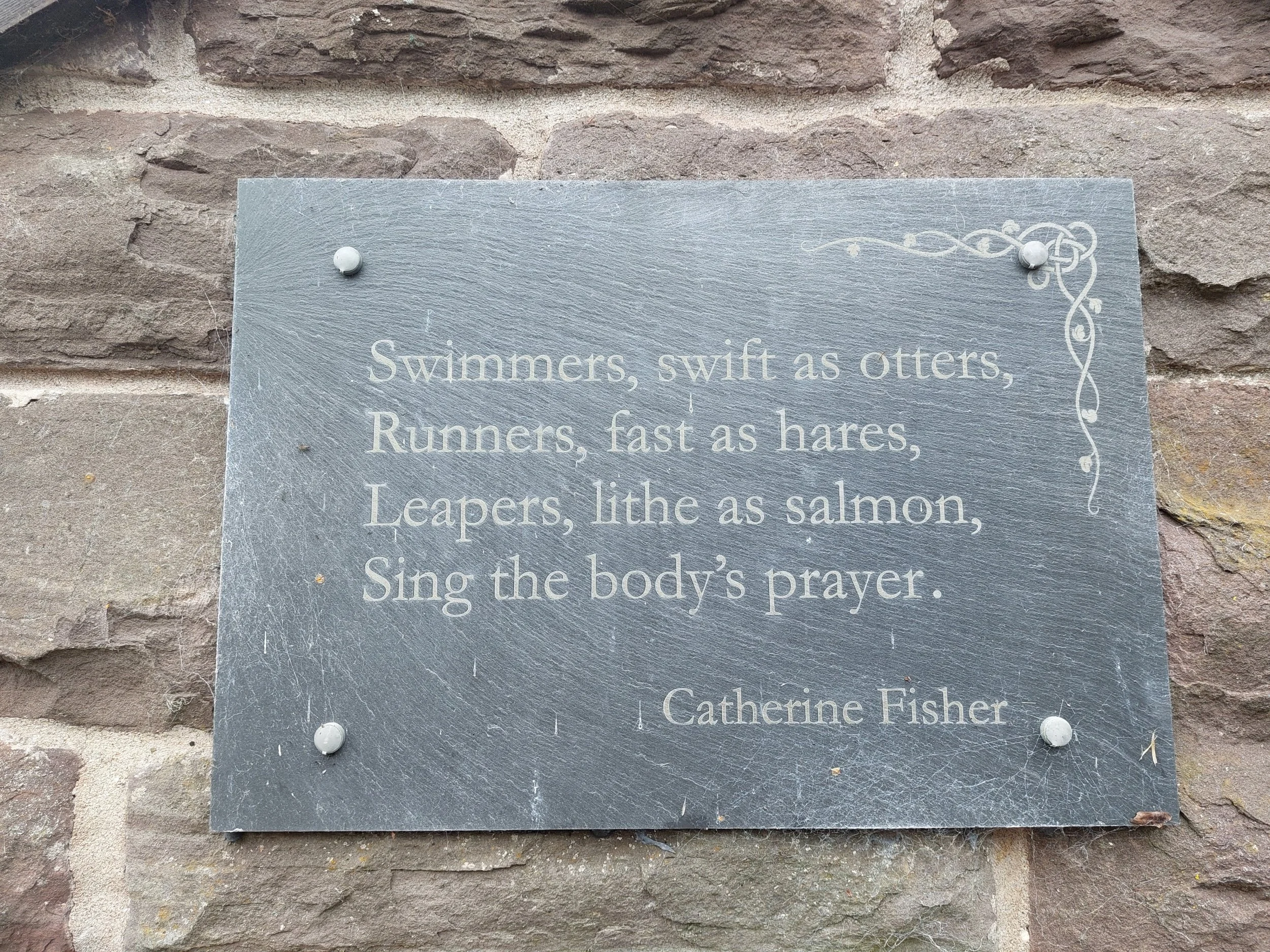
Mwyalchen y Mynydd (Chris Meredith) – (apparently a ring ouzel)
A flash of black
With a fierce song
Prince of the rock
With a silver collar

King Charles Steps
Back on the right track and eventually locating the slate, I was once again looking at the map for the next location when another friendly chap offered his assistance, he too knew nothing of the trail, although he knew the existence of the poem by the school. I needed to head back to the Cathedral and he kindly gave me directions and we walked down a few steps of the King Charles Steps before he disappeared into one of the houses!
At the bottom of the steps I spotted Steve along the road and shouted at him to wait. Catching him up we set off to find the next poem together not far from the castle. Brecon Castle is now part of a hotel, but was originally built as the administrative and military headquarters of the Lordship of Brecon (Bernard de Neufmarche) in 1093. After a bit of a wander and a visit to an eco shop and a chocolatier we headed back to the Cathedral for some lunch and discovered another slate poem in the bookshop!! Steve and Clara had their picture taken outside the Cathedral and we headed off on a long drive in the rain to reach our camping destination in North Wales.

Lynn Davies (Ceri Wyn Jones) – Lynn ‘the Leap’ won the Olympic Long Jump medal in 1964
To the stream we come on a venture again
Back to the measureless leap
Black and white, staying true,
A salmon’s golden leap through the air
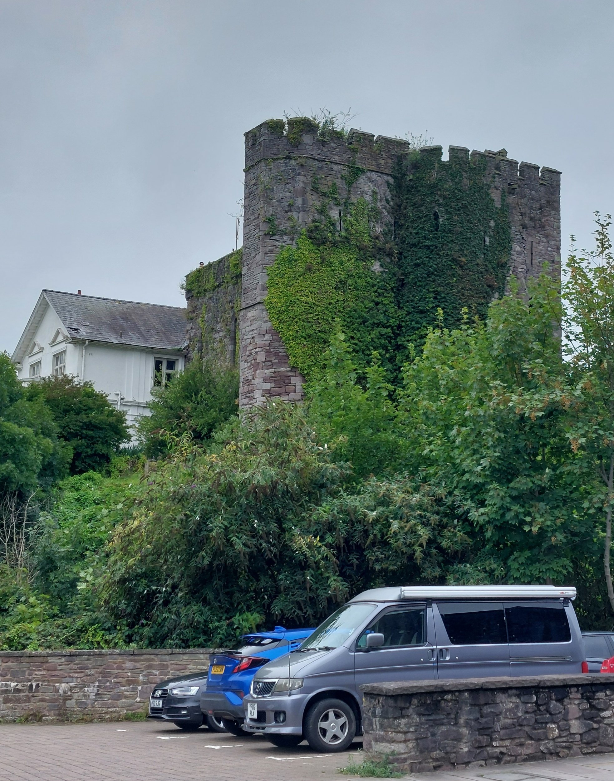
Brecon Castle (Hotel)

In the shop in the Hours Cafe & Bookshop in the Cathedral grounds (which we didn’t spot on our first visit!)
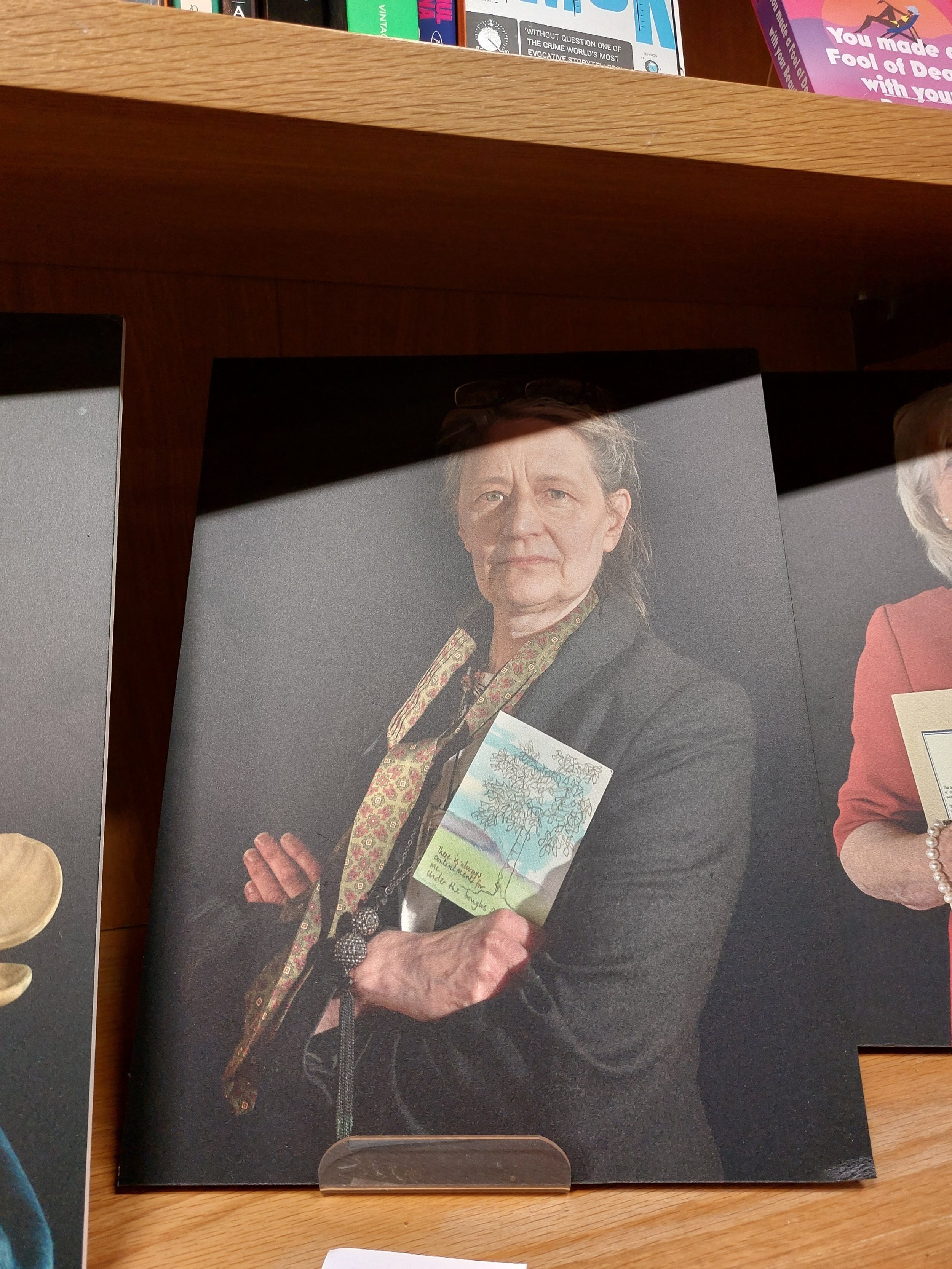
My friend Amanda is one of the featured women in a Photographic exhibition in the Hours Cafe & Bookshop, Brecon. This stunning photograph (badly captured by me) represents her as an artist.
On our way out of Brecon we drove Clara past the Bus Station so I could dash out and capture the last Poem!

Interesting spots around Brecon. Not sure I’ll ever understand Welsh or pronounce it!

A beautiful house in Brecon

Bimbling in Bangor
Bangor
Tuesday 5th September

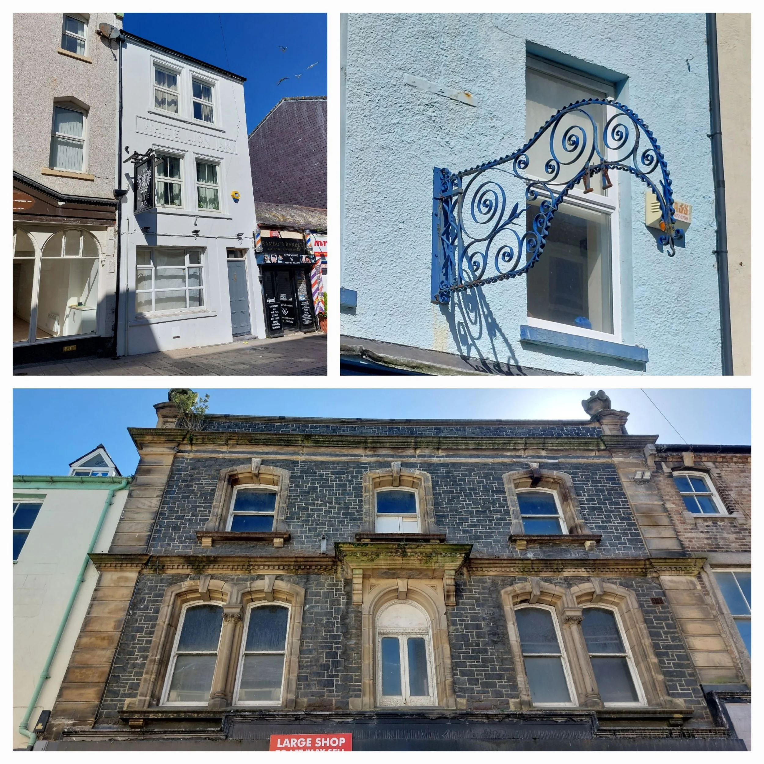
Bangor is in Gwynedd, North Wales and is the oldest city in Wales. It’s a small, but lively city and probably most famous for its University. Bangor Cathedral has ancient roots right back to the 6th Century. The High Street is reputed to be Wales’s longest High Street and Bangor also has Garth Pier a Grade II listed Victorian Pier, voted Pier of the year in 2022!
I have had difficulty finding any visitor information online and no hint of any kind of walking trail. The most information I’ve found is that tourist information is at the Council Offices, so that is where I will head first! After getting Steve his Clara picture we head to the Canonry car park and we part company. I find the Council Offices and I have to say it doesn’t look promising. I ring the bell on the front desk and a gentleman greets me with a cheery hello. So it turns out there is no Tourist Information in Bangor and he apologizes that he doesn’t have an information for me, but sends me over to Storiel – the Museum building as he’s sure they will be able to help. I interrupt the two ladies speaking Welsh behind the counter (lovely to hear it) and they looked puzzled when I ask them about any kind of History trail or self-guided walk around Bangor and even suggest the Council Offices might be able to help. They do mention a slate timeline on the High Street, so I decide to go for a wander to see what I can find for myself. I find the slate timeline and on my way to find the start of it I pass a Trespass shop and pop in (I’m looking for a pack of guy ropes and zip pulls as well as some shorts as it’s so warm!) the guy serving in there is very friendly and agrees that there isn’t any kind of trail and that Caernarfon probably has better history!

Bangor Cathedral (St Deiniol)

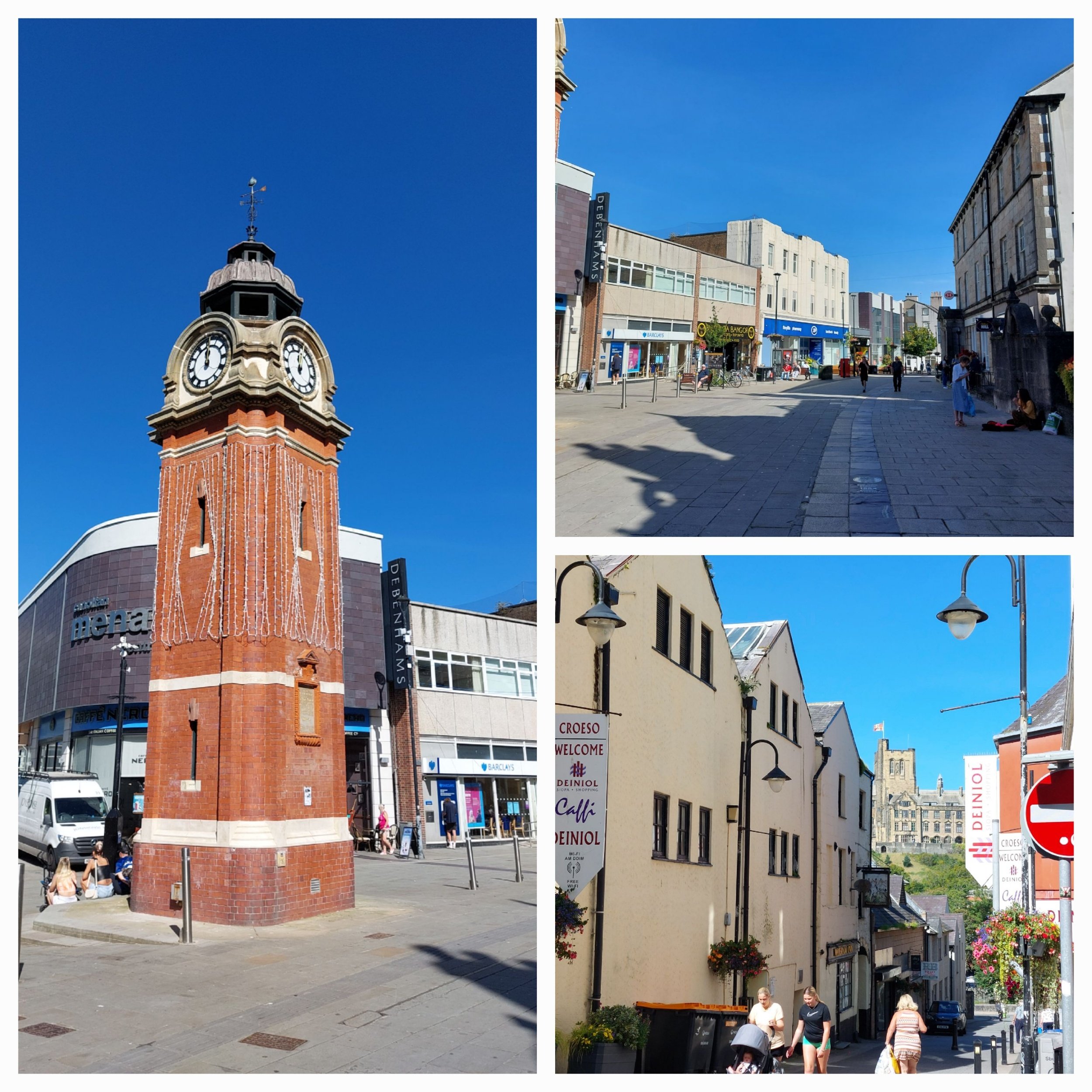
Clock Tower and High Street
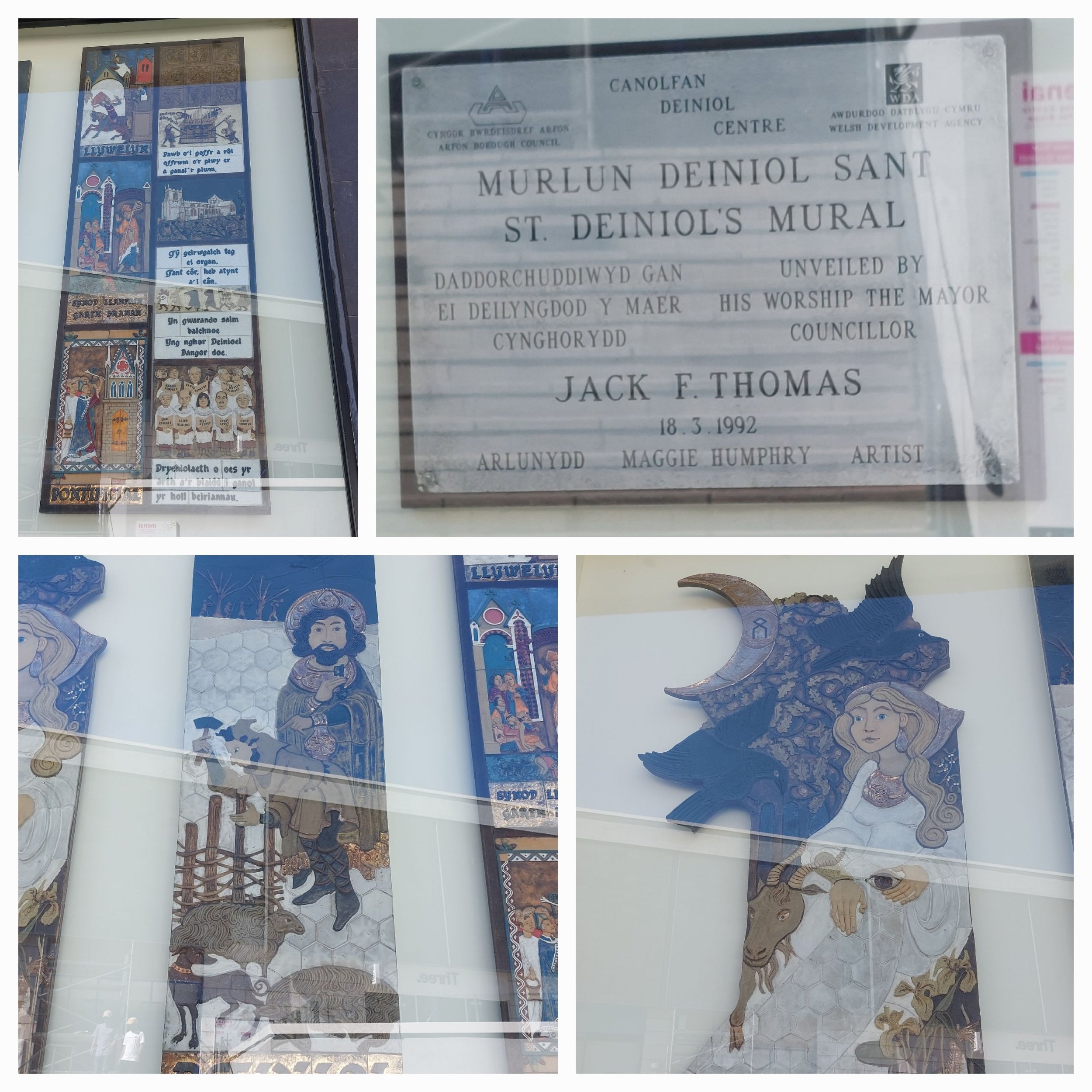
Mural celebrating St Deiniol (apologies for quality - it’s behind glass!)

I didn’t discover this board until afterwards!
The slate timeline runs the length of the high street and has some really lovely bronze illustrations which were designed by local schoolchildren and artist David Mackie then interpreted their designs and hand-carved all the moulds to be cast in bronze. I’d like to tell you more, but the advertised website for the timeline doesn’t exist anymore.
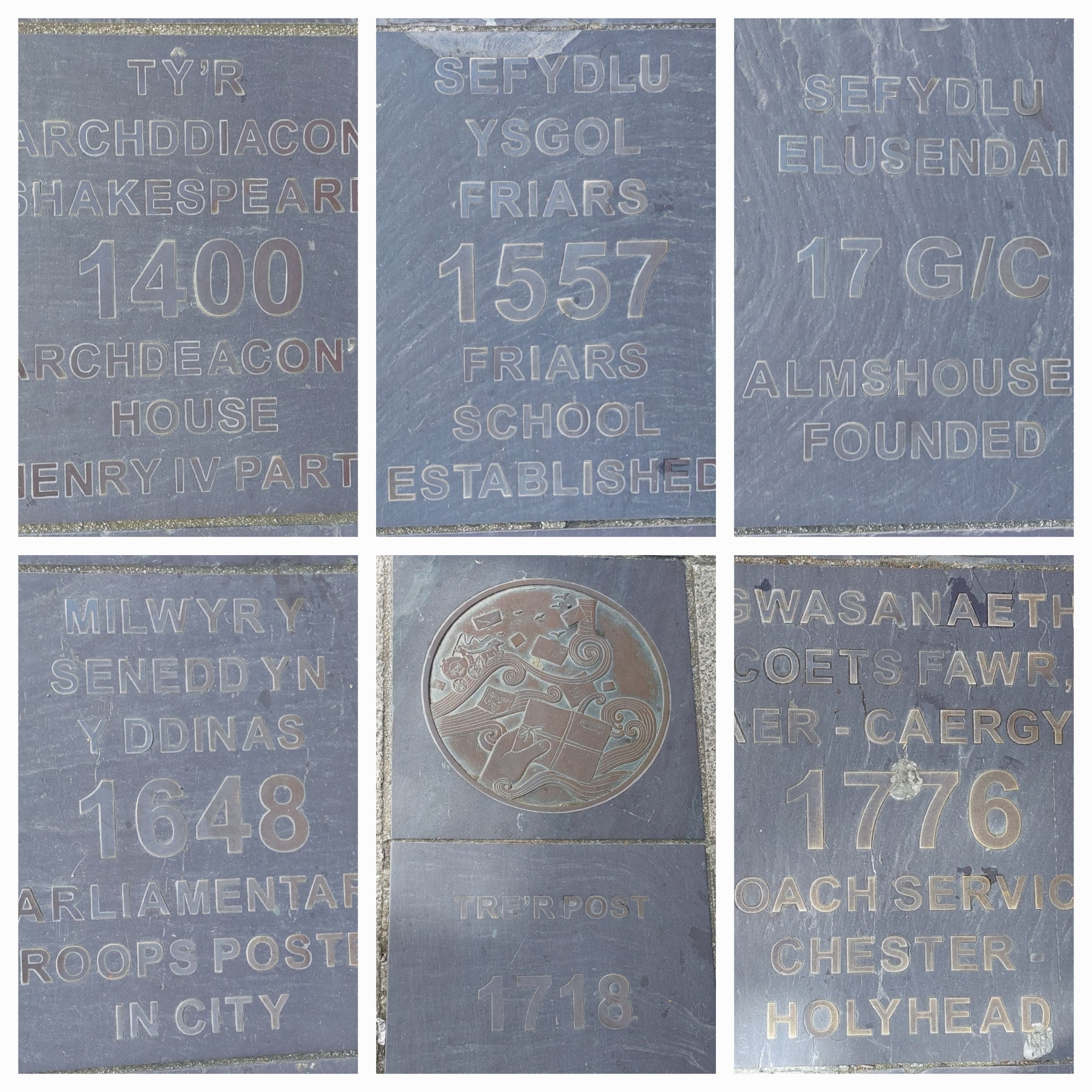

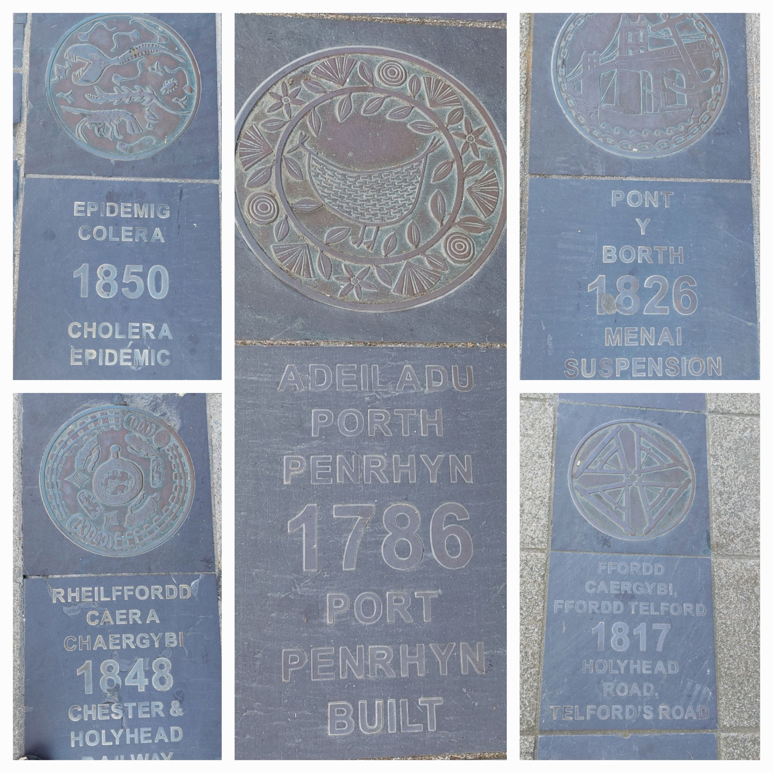
my favourite is the bird
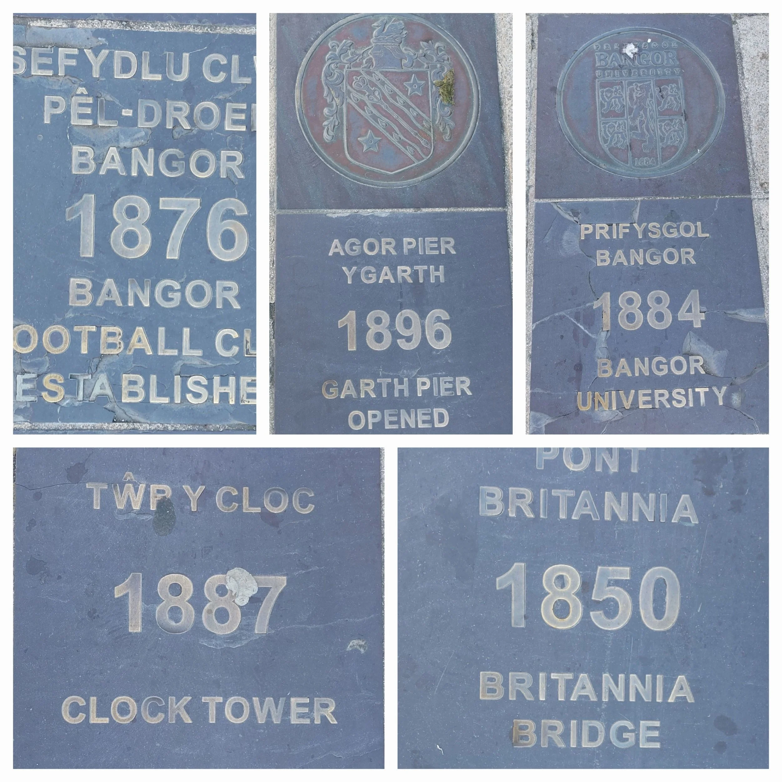
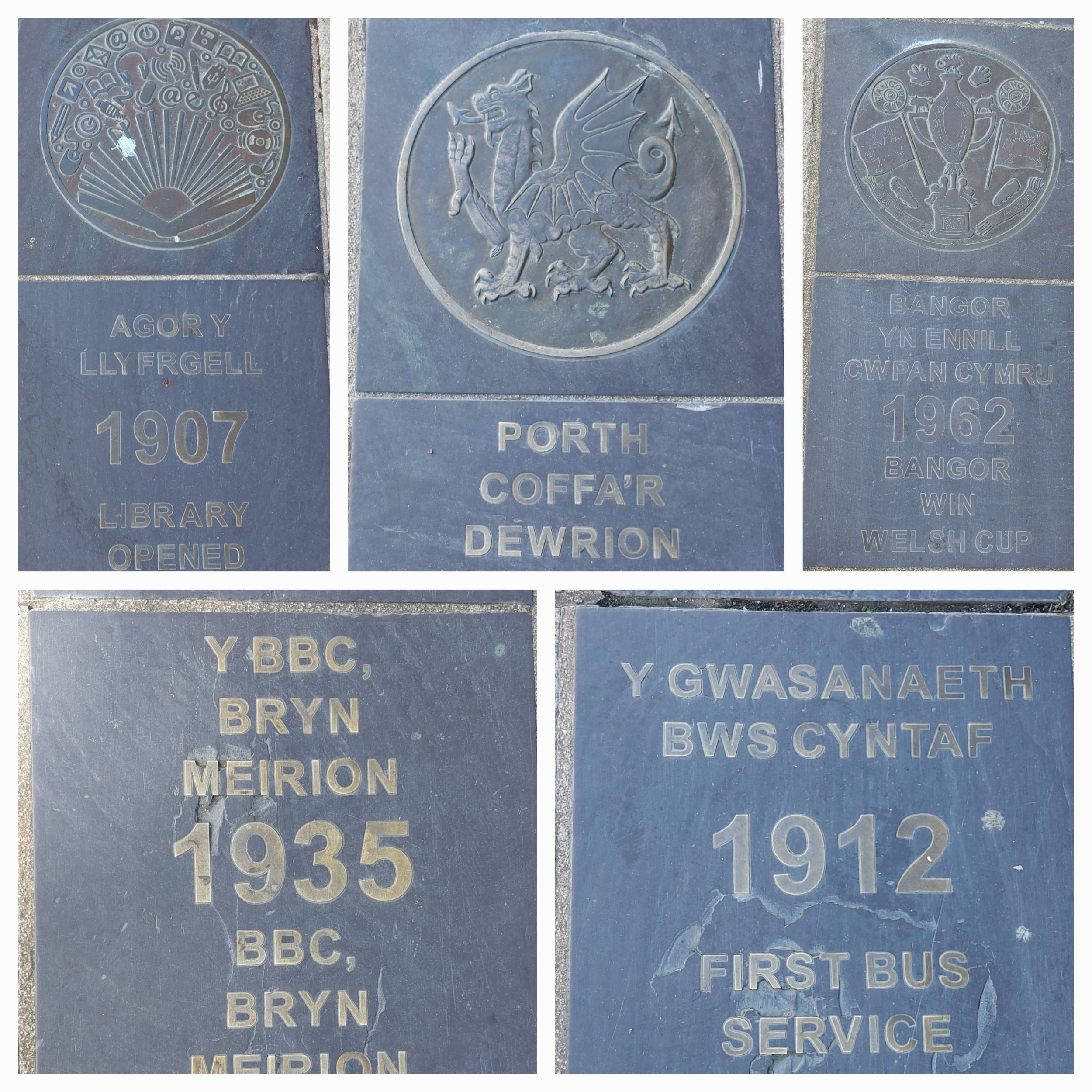
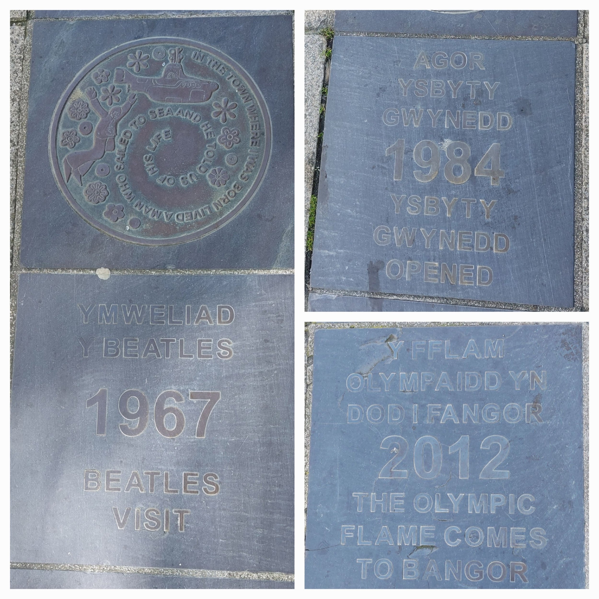
There are a few notable buildings (see pics) and the Victorian Clocktower is a central feature. So I follow the slate timeline from beginning to end, photographing most of it, getting some weird looks from passers-by as I go! When I come to the end I decide to carry on and walk the 15 minutes to visit Garth Pier as Steve won’t be finished in the Cathedral yet. Walking on through housing in the sunshine past an Ambulance Station, through a tiny green space with Standing Stones in, past an Army Centre, looking at doors (disappointing on that front) and finally reaching the pier.
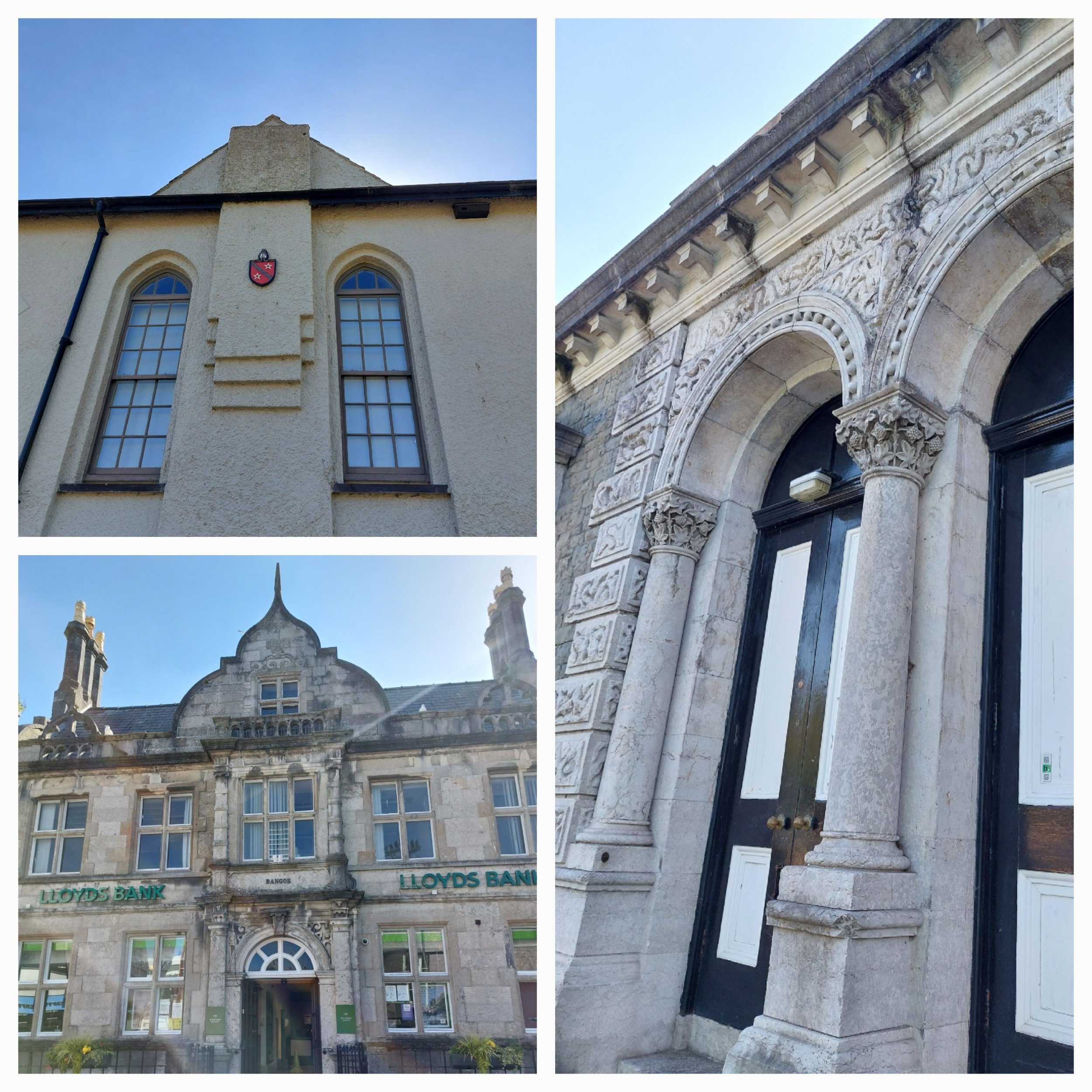
Beautiful Bangor architecture

around Bangor
Garth Pier is 470m long with really cute little pavilions all along its length. These house small cafes, gift shops, art galleries and a large café in the biggest pavilion at the end. The pier sits in the Menai Strait and you can just about see the Suspension bridge. It’s really windy today and I’m finding it difficult to control my Nordic Walking Poles! I duck into the café at the end, but it’s really busy so I head to the Whistlestop Café for a couple of slices of Bara Brith(not as good as yours Lorna Jones) and a drink, sitting to eat them in the sunshine. I then stop off at the little gift shop as I had spied something interesting on my way past. I had a chat with the lady running it and she was really disappointed to hear that Bangor Museum and Council Staff knew nothing about any of Bangor’s history trails, but it seems there’s a walk I could have done from Bangor to Betheseda following the history of the local slate industry following the Snowdonia Slate Trail. Another time maybe.

Garth Pier and views from it

Gate near the pier
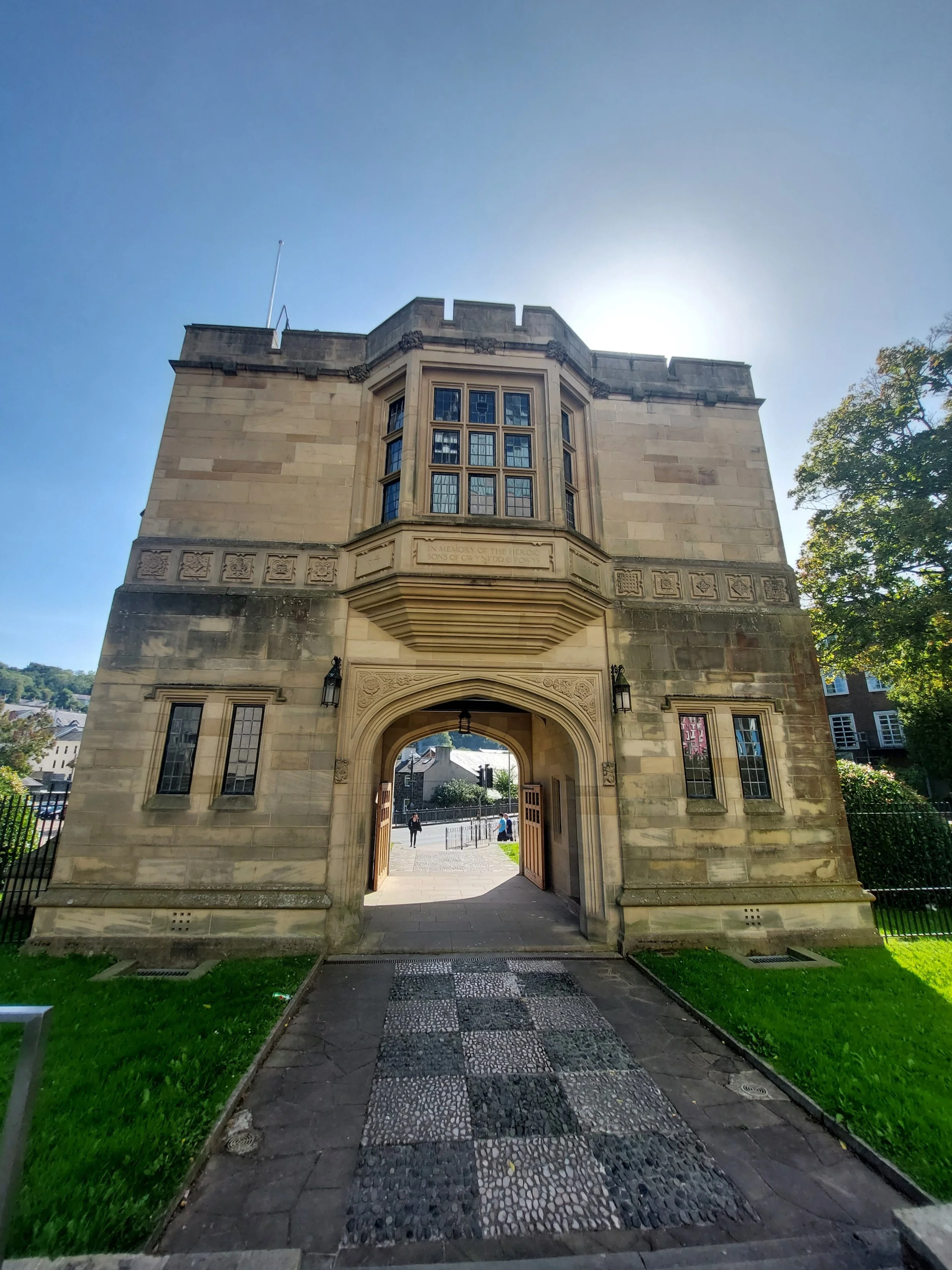
From the Pier I decide to start heading back to the Cathedral, but first I wanted to explore the ‘Castle’ I had seen on the way in…turns out there’s nothing listed about a castle as it’s actually a Bangor University Building!

views of Bangor University
Finally on my walk I come to the North Wales Heroes Memorial to all those men of North Wales who fell in the Great War. Behind it is a very modern building called Pontio, an Arts and Innovation Centre and Performing Arts Theatre.

I return to Clara and Steve and we head back into Bangor to find some lunch. I like to frequent smaller independent places to eat and we found a place called Bwyd Da Bangor, which combines a membership-based food share programme, re-distributing surplus supermarket stock with a high-quality training café. The café is run by staff who are coming though a local rehabilitation centre or currently living in supported accommodation. Receiving training through a local college staff get support and qualifications to gain access into long-term employment. It’s also an ethically, environmentally sustainable café! We both had delicious lunches and it was great to see a £2 option on the menu for those who just need a hot meal. Staff were friendly and attentive too!
So after lunch we had a trip to the local Morrisons for a restock and headed off to our next campsite.

Bangor Library near where we parked

Strolling in St Asaph
St Asaph
Sunday 3rd September 2023
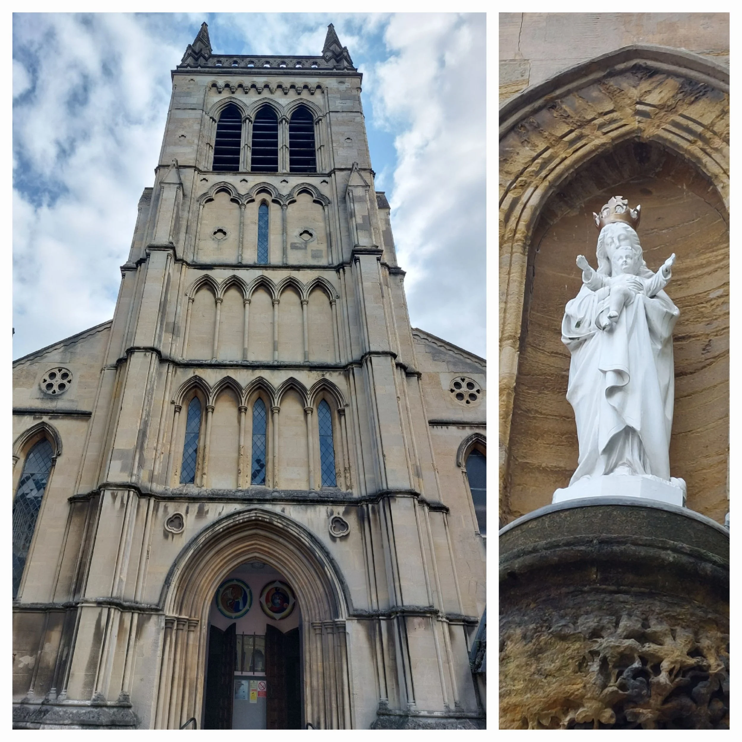
St Asaph is a city on the river Elwy in Denbigshire, North Wales. The city is believed to have developed around a sixth century monastery founded by Saint Kentigern, with the Cathedral being built on the same site in the twelfth century, in the thirteenth century it was almost burnt to the ground. Historically St Asaph was regarded as a city as it held the seat of a medieval cathedral and diocese, however actual city status was not granted until as late as 2012 despite several applications!

St Asaph Cathedral
Interesting facts I discovered are that St Asaph is the birthplace of both Greg Davies (comedian, writer and presenter of Taskmaster) and the composer Paul Mealor (famed for his 2011 hit ‘wherever you are’ performed by the original Military Wives Choir and many other choral pieces)
The city still has a thriving Cattle Market with livestock being sold twice a week.
I started the City trail at the Cathedral and Steve’s blog will give you a comprehensive view on that, so I just walked around the outside pausing occasionally to gawp at gargoyles! The trail then highlights the Translators’ Memorial in the Cathedral grounds. A splendid gothic tower installed by the Victorians it features eight statues of the scholars who translated the bible into Welsh. This includes Bishop William Morgan whose bible from 1588 helped save one of Europe’s oldest languages from oblivion. The Cathedral has an original copy of this bible on display and Bishop Morgan is buried underneath the high altar.

Boo!

Translators Memorial

A small, but well formed city trail!
Next on the trail just down the High Street is a house from 1745 adorned with a blue plaque which indicates that it was the birthplace of brothers George and Felix Powell whose song ‘pack up your troubles in your old kit-bag’ became hugely popular during the Great War. A little further down and I find the Barrow Almshouses built in 1680 for ‘eight poor widows of good character’.


Almshouses and other interesting building adornments down the High Street
Across the road I find the parish church of St Kentigern and St Asa (Asaph), but I’m unable to go inside as a Baptism family are gathering (not sure if it is before or after the event!) The current building was built on top of older foundations in 1524, soon after being extended into the typical double-naved Denbighshire style. Sir George Gilbert Scott (architect) added the porch, bellcote and vestry in 1872.
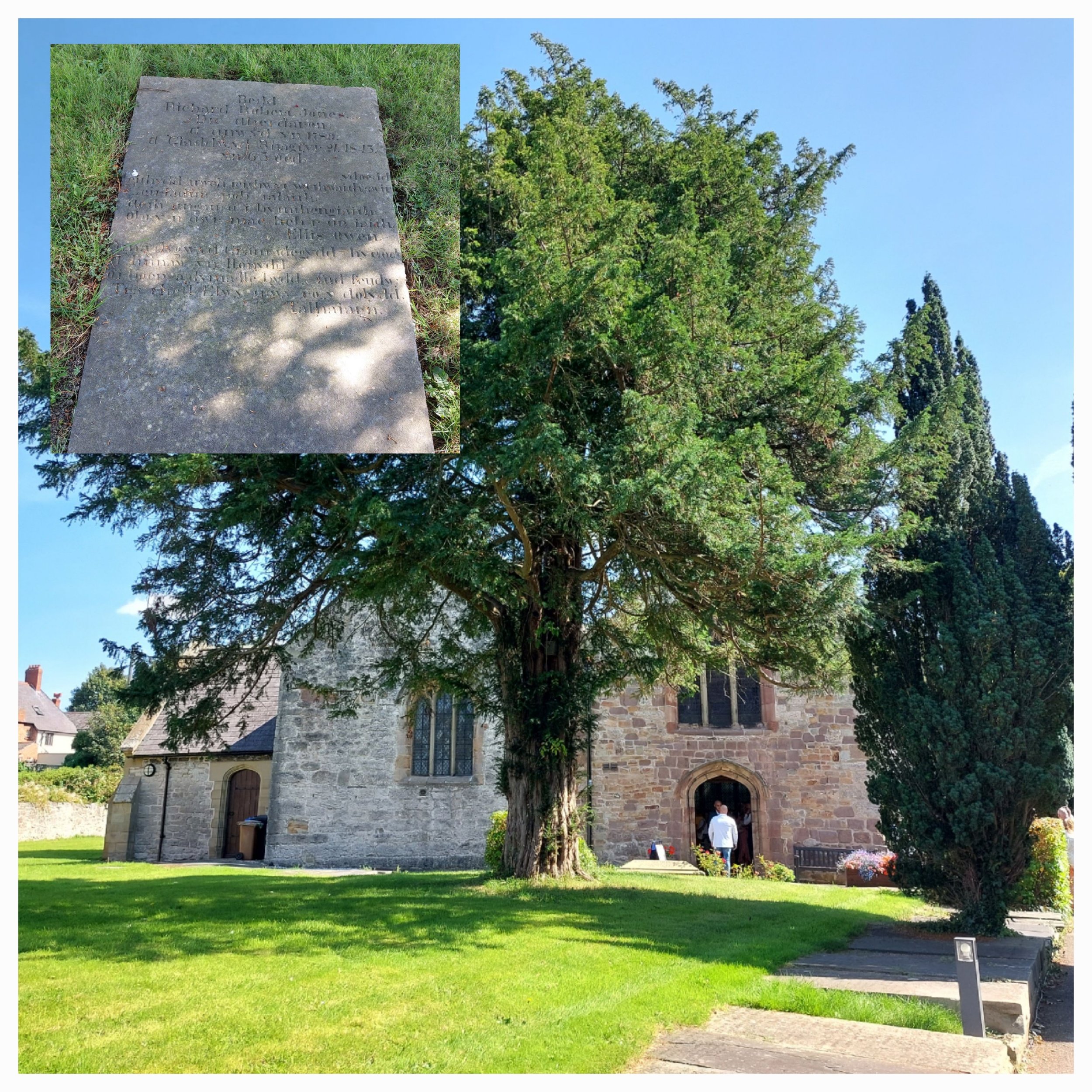
Standing in the church grounds looking for the next part on the trail a lady came to ask me if I was OK, so I told her I was looking for the gravestone of Dic Aberdaron (real name Richard Jones) the uneducated, nomadic, long haired son of a boat-builder died in St Asaph by chance. He spent his life wandering barefoot around England and Wales, carrying a harp, many books and his pet cat. He could speak 14 languages including ancient tongues of the Middle East and had spent years writing a Welsh-Hebrew-Greek dictionary only for it to remain unpublished. The National Library of Wales in Aberystwyth has the only copy. The kind lady said ‘Is that the linguist? I should probably know where that is’ By which time I had found it, on my return to the path she was keen to know where I was headed next and after that! She even popped up from the car park to share her wisdom!!
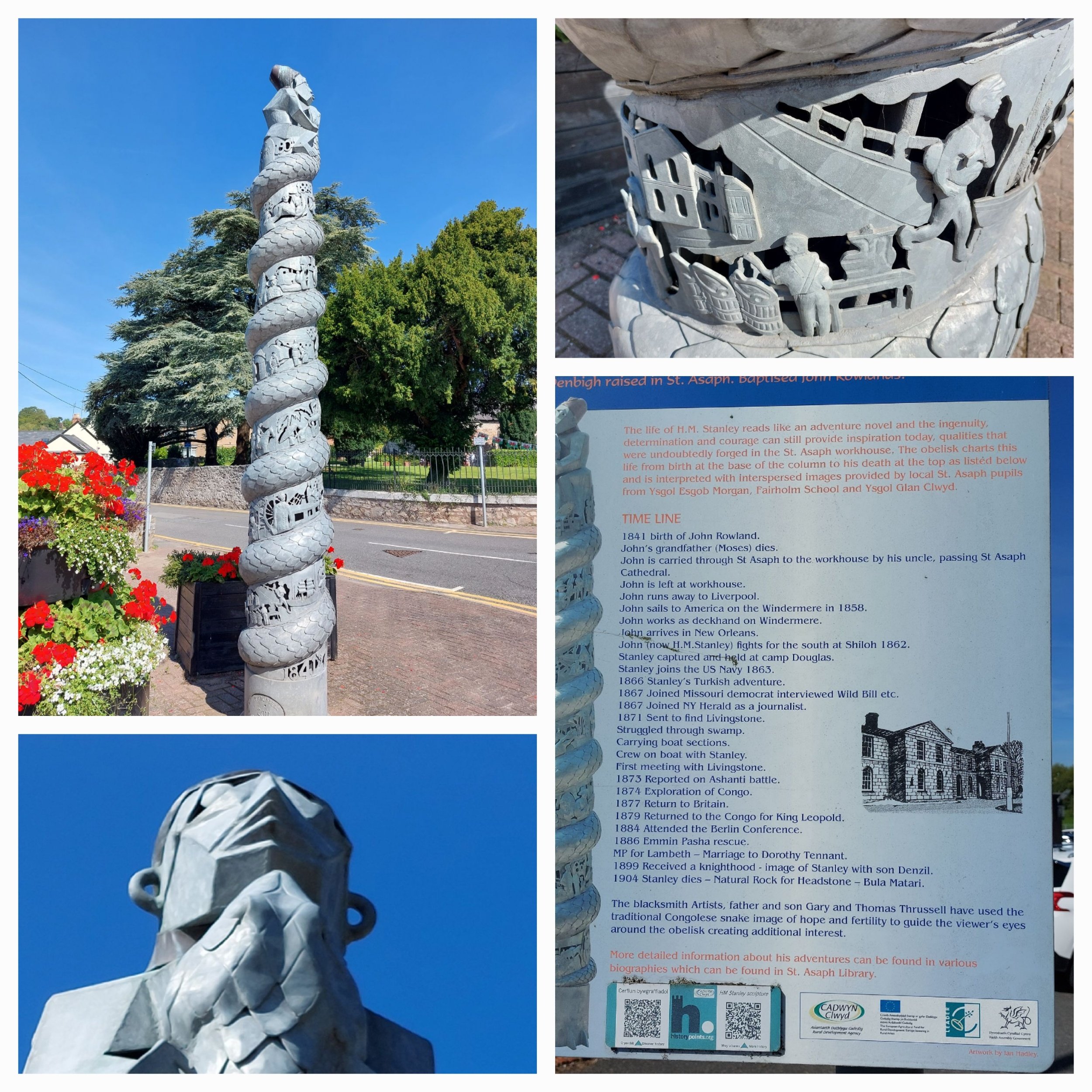
Next on the trail just across the road is an obelisk dedicated to the life of Henry Morton Stanley, he of ‘Dr Livingstone, I presume?’ fame. The Victorian explorer was born in Denbigh and raised in the St Asaph workhouse, he escaped by running away to sea and served on both sides in the American Civil War. He tracked down the Scottish missionary David Livingstone in deepest Central Africa whilst working as a journalist. He later planned to harvest the natural resources of the Congo with King Leopold ll of Belguim. Scenes from his controversial life spiral around the obelisk topped with a Congolese effigy. The kind lady popped up here to tell me the building of the obelisk was controversial! (She didn’t expand on why!)

I’m now heading towards the river Elwy which flows through St Asaph, the impressive 5-arch limestone and sandstone bridge here is a scheduled monument, built in 1770, it spans 65 metres – wide enough to cope when the river bursts its banks. In 2012 river rose to just 4 inches below the top of the arch where the path goes through (see photo) 1 life was lost, 322 houses and 32 businesses were flooded.
The last stop on the trail is Roe Plas, an area next to the river where lots of folk walk their dogs amongst the trees lining the river. Apparently the river Elwy is abundant in trout, salmon and bullhead attracting kingfishers, herons and otters, none of which I spied today. Also home to the rare species of timber – the Black Poplar (didn’t read that part until afterwards!)
Cattle Market- Top Left, Roe Plas- Top right
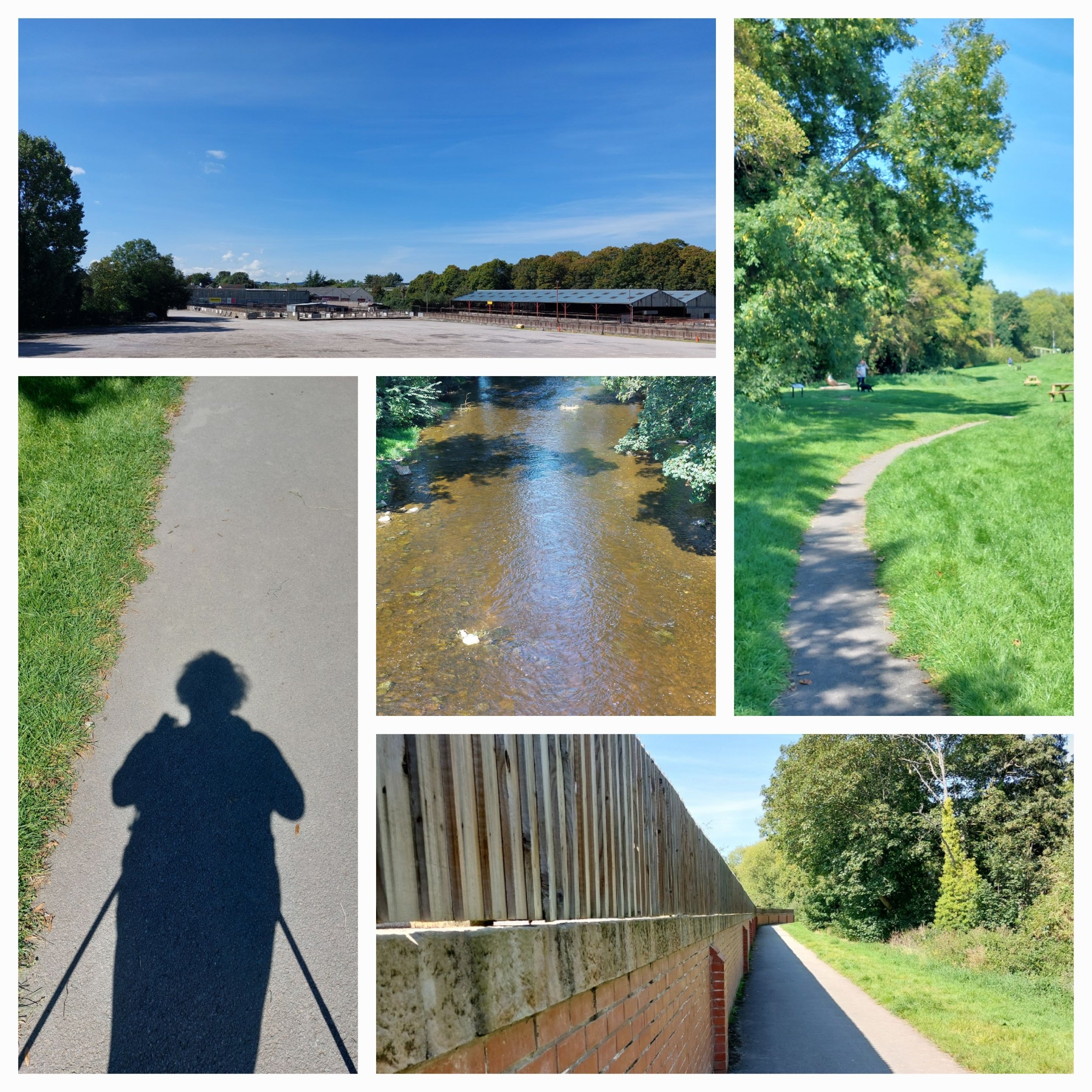
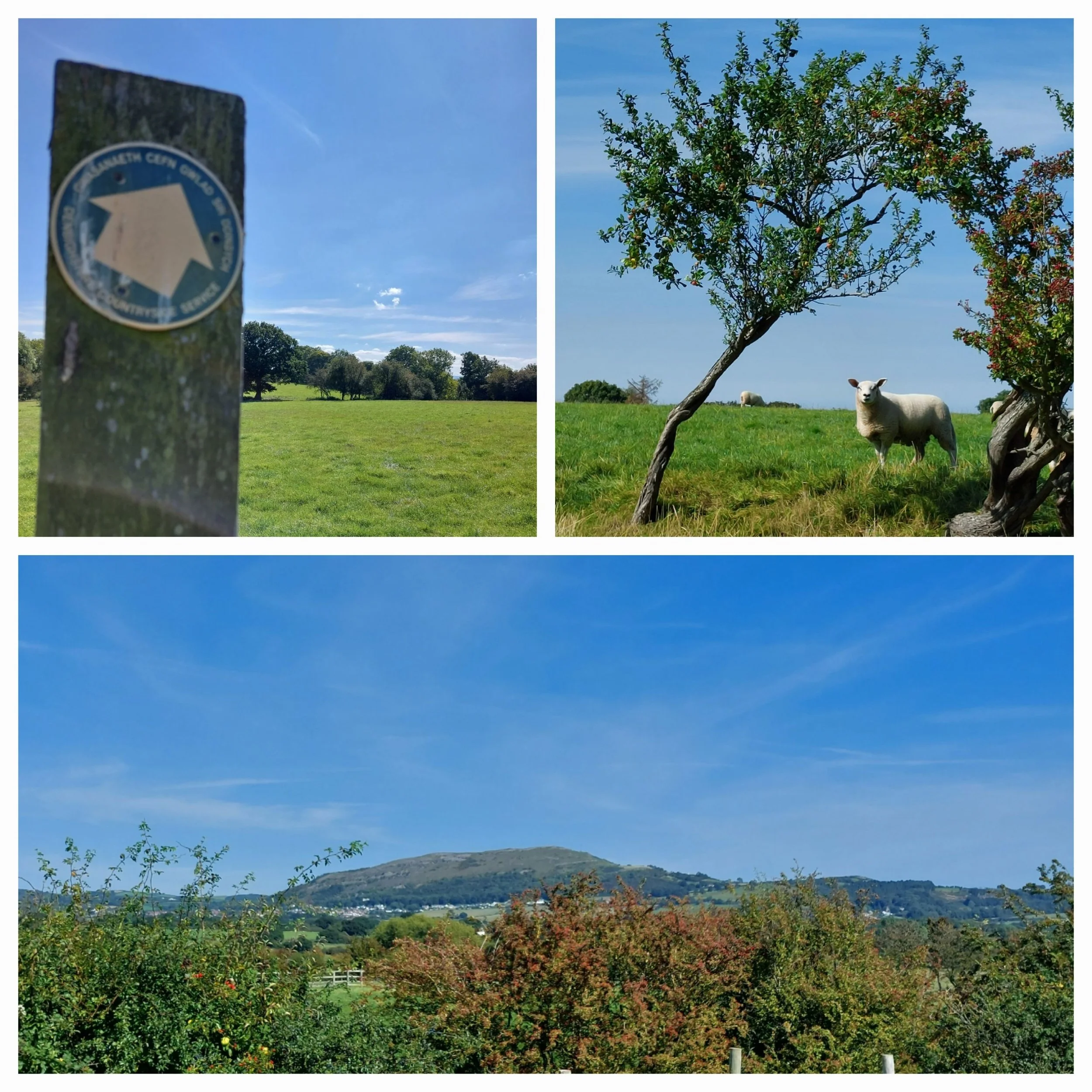
And that was the City Trail completed, so I decide to Nordic Walk the 5km loop I had plotted earlier, but backwards! I was near the end of the walk rather than the start! The first part of the route takes me alongside the river, but presumably due to flooding and access it is a tarmacked, raised path a little removed from the riverside edge, so you have to make forays to the little stony beaches that crop up from time to time. The route passes the extensive cattle market site and after crossing a road becomes a grassy, but still raised path. It’s a warm day and the sky is really blue with no clouds and so I seek shade down by the riverside and end up making a stone stack on the waters edge. I could literally spend hours making stacks, but I need to carry on! I eventually cross over the river via a footbridge to continue my journey back to St Asaph. On the other side of the river there’s some really hefty concrete blocks, barbed-wire fencing and ‘Private-Keep out’ signs that aren’t very picturesque or welcoming! I’m following a Public Footpath and ignore the ‘no through road’ sign and walk through a farm crossing a style into a field full of sheep. I continue through a couple more fields pausing under the shade of a massive oak tree to scoff my packed lunch (and chat to my son who has phoned). After the next style I come into a more open field from which are some fantastic views of the surrounding rolling hills! Then I’m onto a narrow lane which takes me all the way back into St Asaph finishing by the Cathedral.

Couldn’t resist stacking stones on a riverside beach!

Beyond the river
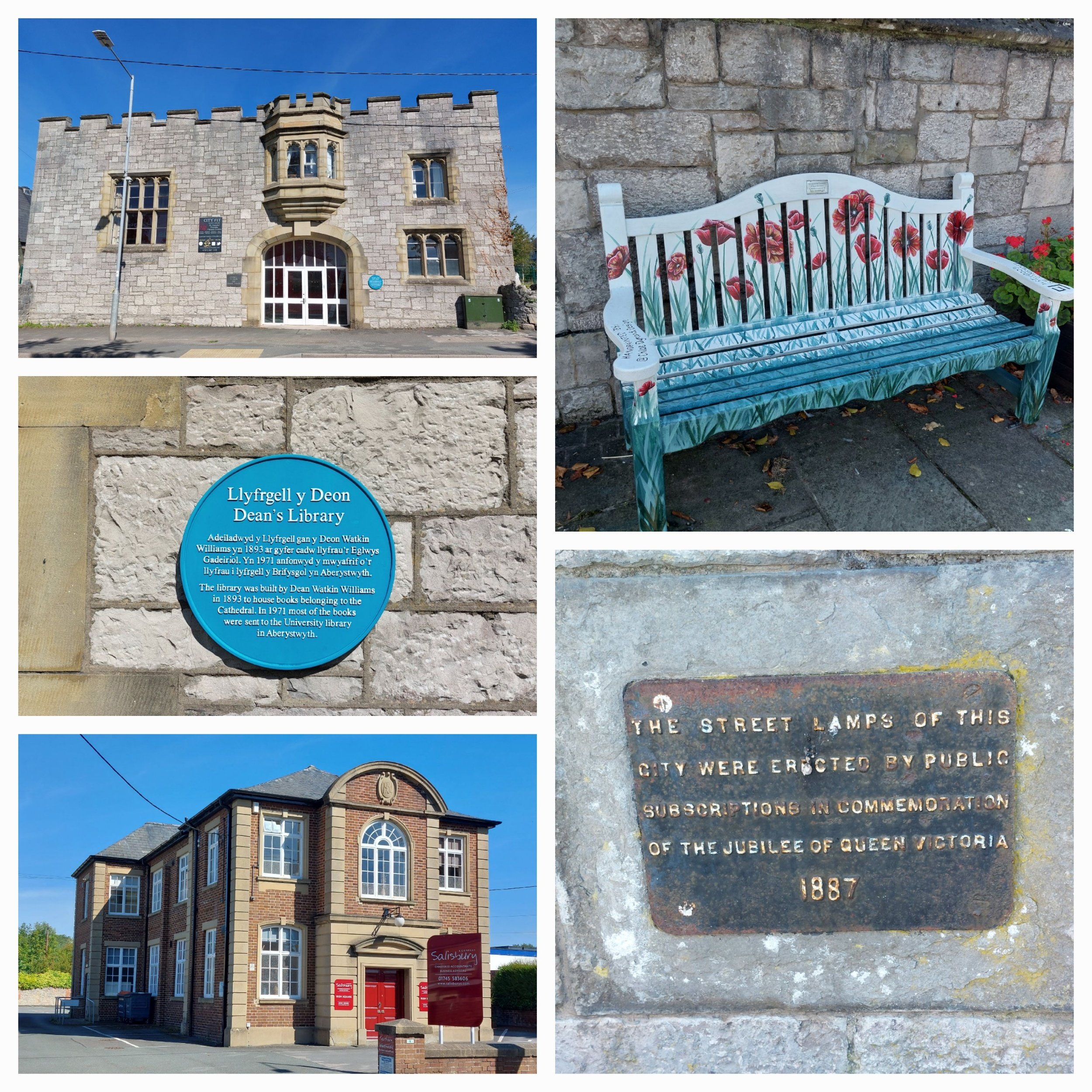
There are a couple of interesting buildings opposite the Cathedral, one is a building that looks like a castle which turns out to have been built in 1893 by Dean Watkin Williams to house the books belonging to the Cathedral. In 1971 most of these were sent to the University library in Aberystwyth. It’s now a fitness centre. The other building that caught my eye looked to have been a chapel or hall, but after a bit of research it turns out it was purpose built in 1934 as a flagship office for the St Asaph Rural District Council. The name of the building ‘Irish Square’ is a historical reference to the low-quality housing that had previously occupied the site where a large number of Irish labourers lived, who had come to work on road and rail construction in the late 1800’s.

The Blue Plaque says “The Canonry was built on a historic site, Owain Glyndwr burnt down a hostelry there in 1402 and an ecclesiastical residence was erected in its place.” I just liked the door!
I liked St Asaph, it’s views and surrounding countryside were excellent!
Clara, the Priest and the Nordic Nomad-The Welsh Odyssey
Nordic Walking in Newport
Wednesday 30th August 2023
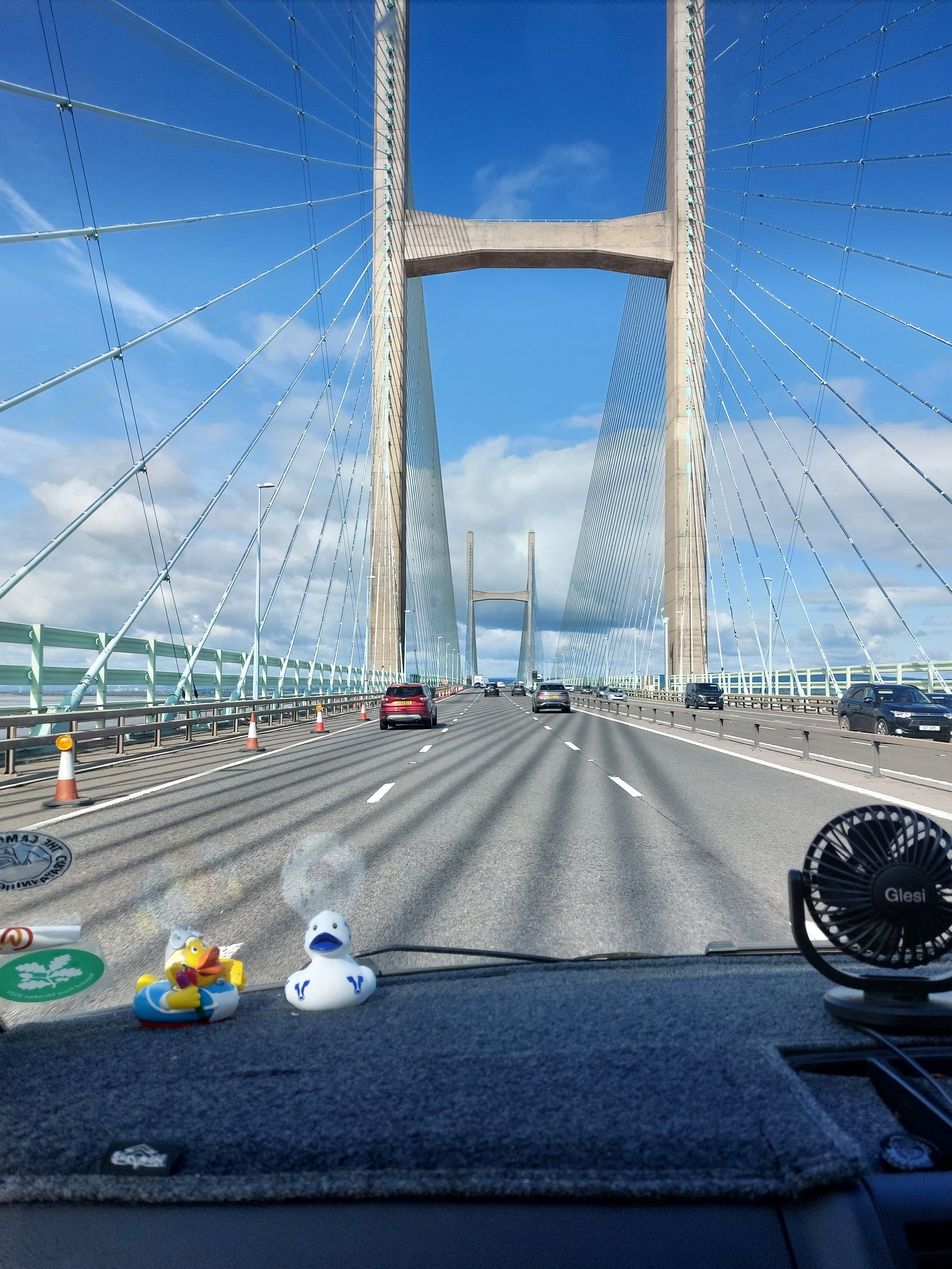
This is where Clara, the Priest and the Nordic Nomad – The Welsh Odyssey begins, now I’ll be honest I literally know nothing about Newport, I’ve driven past the signs for it on my way to Cardiff on the M4 numerous times, I’ve worked a couple of Events at The Celtic Manor Resort (the one on the right-hand side of the M4 up on a hill) I’ve even eaten at the local Toby Carvery (nearest to aforementioned Celtic Manor!) but I know nothing of it’s history, it’s importance or what happens there now. Wikipedia tells me that it is a city situated on the River Usk close to it’s confluence with the Severn Estuary, it had a population of nearly 160,000 in 2021, it is the third largest authority with city status in Wales and seventh most popular.
Newport has been a port since medieval times when the first Newport Castle was built by the Romans. Newport gained it’s first Charter in 1314 and was the largest coal exporter in Wales until the rise of Cardiff in the mid-1800’s. in the 20th century the docks declined, but Newport remained an important centre for manufacturing and engineering. Latterly its economy is bolstered as part of the M4 corridor high-technology cluster. It was granted city status in 2002. The original Welsh name was Casnewydd-ar-Wysg which translates as ‘new castle on the Usk’.
There’s plenty more history to discover online, but the trail I have found to follow today reveals the history and locations for the famous Newport Rising in 1839, which was the last large-scale armed rebellion against authority in mainland Britain. John Frost and 3000 other Chartists marched on Westgate Hotel at the centre of the town.
Now I know nothing about the Chartist movement so had to look it up! “Chartism was a working class movement which emerged in 1836 in London. The aim of the Chartists was to gain political rights and influence for the working classes”. The National Archives
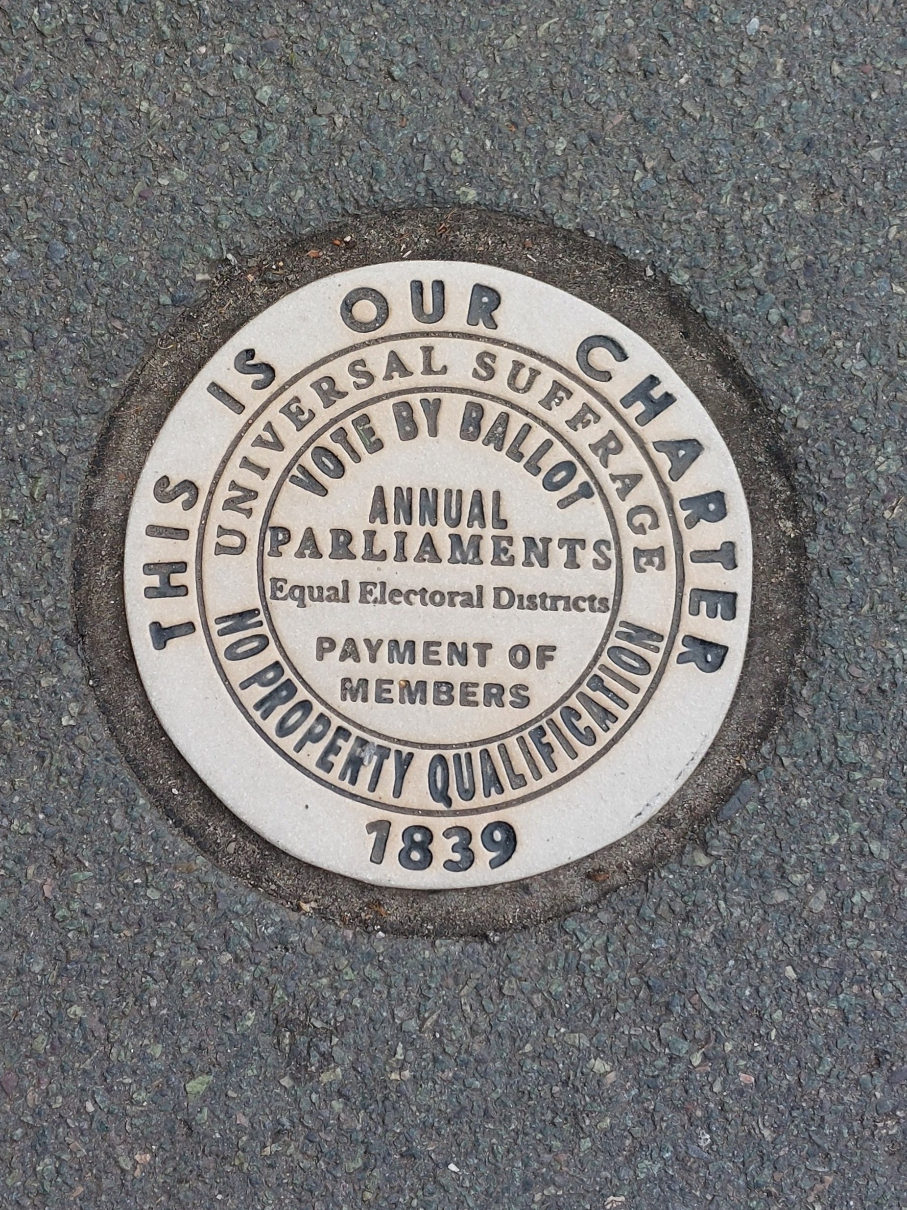
The six points of the People’s Charter set out the Chartists main demands:
1. A vote for every man over the age of 21
2. Secret ballots
3. No property qualification
4. Payment of MPs
5. Constituencies of equal size
6. Annual Parliaments
For more detailed info go to www.chartistancestors.co.uk
First things first, this trail was written in 2009 and as I found out some of it no longer exists as we’ll find out later! Also it’s very difficult to follow an online trail on your phone ( needed my glasses, which I didn’t have!) so I took several screen shots of the the trail so I could enlarge it enough to read it on screen in the glare of the sun!

The trail starts near the Cathedral, so I leave Steve and Clara there and head off to St Woolos Hospital. I’m looking for a red sandstone building according to the trail, but I’m not sure if I ever identified the correct building! The trail highlights that back in 1839 this building was the Union Workhouse and as there was no NHS and social security then, if you were injured at work this was likely the place you would end up! Sewing sacks, eating gruel and known as a pauper.
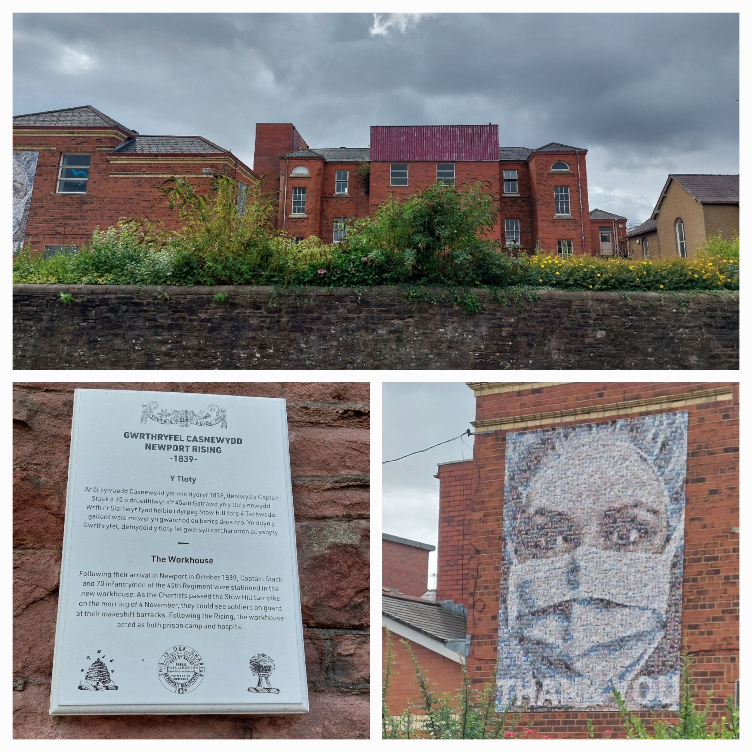
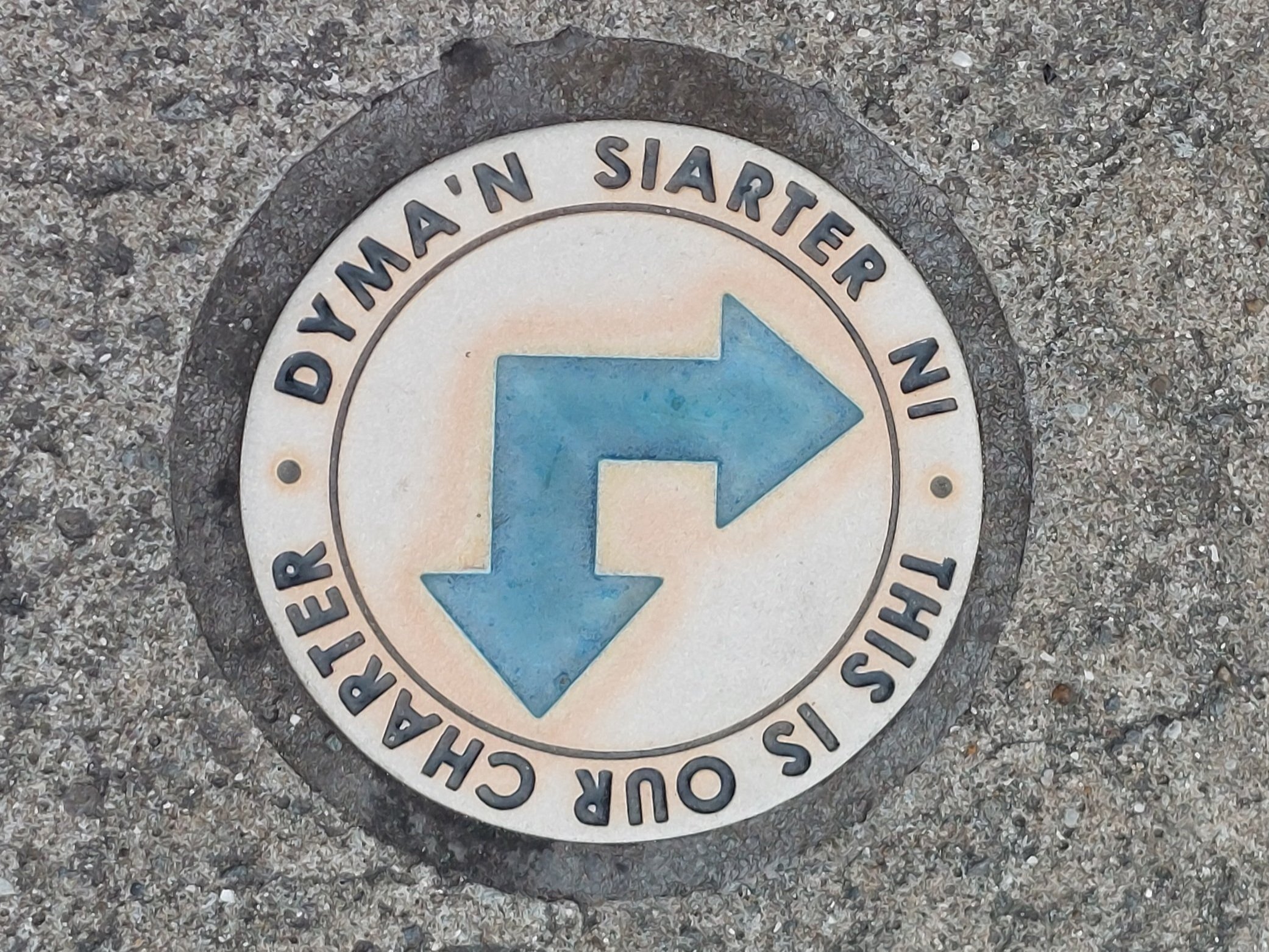
I found some plaques in the pavement commemorating the trail – which gave me hope that these would continue to guide me (no such luck!)
The trail takes me to a beautiful building called Friars House (now an NHS building) which at the time of the rising housed Thomas Prothero who managed land for Lord Tredegar. He made his fortune from coal was rich because he did not pay his workers a fair wage. He was also suspected of electoral corruption in the Monmouth elections of 1831. He feared the Chartists uprising and fled Newport during the march.

The trail leads me back up the hill to St Woolos Square which is just outside the Cathedral grounds, on the morning of the 4th November 1839 this was where 3000 Chartists lead by John Frost and Zephaniah Williams met before marching down into the town. The trail tells me that 10 of the 22 Chartists that died that day were buried here secretly in the dead of night by the military, their ancestors hold a twilight service on the 4th November each year to remember them each year. There is a memorial plaque in the Cathedral grounds.
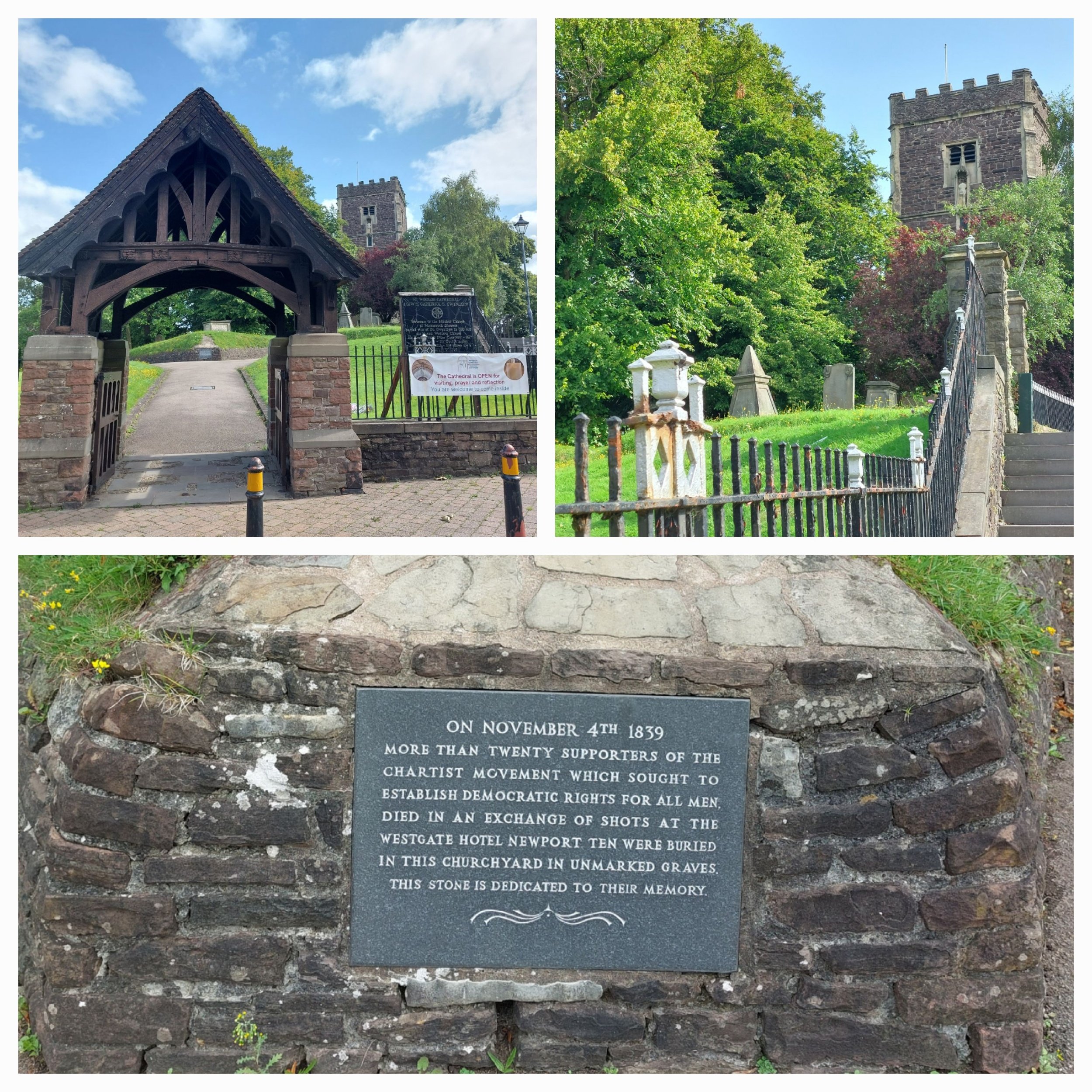
Some of the Chartists had previously been arrested during a peaceful protest and were being held in The Westgate Hotel in Newport and John Frost had organised this march to try and secure their release (some historians believe this was a trap to lure the Chartists into breaking the law)
The trail contradicts itself a few times, with different numbers of Chartists marching and locations of where they gathered differing, but it highlights The Six Bells pub (I completely missed it) as somewhere where school children now renact the march on the anniversary because they rallied here before marching on down Stow Hill. There is still a row of terraced cottages on the Southern side of Newport Cathedral that remain from that period.

When the Chartists marched past St Mary’s Church it was being built by Irish Immigrant workers who were called to join the march – there’s quite a bit of construction on another church opposite there now!
St Mary’s Church
Here the trail talks about the Mayor and how his house was opposite The Westgate Hotel, with memories of what happened to those in power during the French Revolution only a few years before he wanted to protect the town and garrisoned soldiers around it the day before. At 8.30am on the morning of the 4th November he had 30 soldiers join him at the Westgate Hotel stationed behind the closed shutters.

The Chartists reached The Westgate Hotel which was built in 1799 and sits at the junction of Stow Hill and the old High Street and they were shouting “give us up the prisoners!, give us up the prisoners!” There followed a scuffle between the 3000 (or 5000) Chartists and the special Constables, the shutters on the hotel flew open and the order to open fire was given. The soldiers fired volley after volley of shots into the crowd who panicked and fled screaming. 22 Chartists died that day and many more were injured in their fight for justice. Outside the Westgate Hotel today there stands three sculptures – Union, Prudence and Energy created by Christopher Kelly and erected in 1989 to commemorate the Chartist Uprising.

Top Right & Bottom Left- Union. Bottom Right-Energy

Prudence
The trail moves on to highlight various buildings around the city centre which were John Frosts birthplace, his draper’s shop and The Parrot Inn (former site of) where John Frost had his meeting to decide what ‘The People’s Charter’ should contain in 1938. Some of these buildings are beautiful and very grand indicating the importance of Newport at the time, As previous readers of my Nordic Walking blogs will know I love a bit of classic architecture and it’s such a shame that modern facades spoil these buildings now. Look up folk, always look up!


I spent more time than I care to admit looking for a mosaic mural designed by Kenneth Budd and installed in an underpass at John Frost Square in 1978 which illustrates the story of the Chartists march. I asked a lady part of a group protesting (how apt) in the town centre who replied “ Oh no love, we tore that down, it’s what the people of this city do best” However a bit of research online led me to discover that it was indeed taken down in 2013 to make way for a complete redevelopment of that area (the Friars walk shopping development) However in 2019 a new mosaic mural was created by Oliver Budd, son of Kenneth Budd. A smaller scale replica of the original, but it’s located in a different area. www.walesonline.co.uk/whats-on/arts-culture-news/newport-rising-chartist-mural-uprising-17196726?int_source=amp_continue_reading&int_medium=amp&int_campaign=continue_reading_button#amp-readmore-target
You can watch the original mosaic being ripped down and a picture of the new one here.


around Newport

After a quick wander around the centre of Newport (quite run down with the same shops as every other city centre) I headed back up towards the Cathedral to meet Steve and Clara. We then decide to find somewhere for a wild swim possibility and paused at a local supermarket for sandwiches to add to our lunch! Some of the trees here are over 200 years old and the paths down to the lake are steep and uneven as we discovered! The unusual shape of the punchbowl was formed by glacial erosion during the last Ice Age, the lake was added later by people and not a natural feature. The bowl-like depression left behind by the ice is called a cwm (Welsh for valley).

We ended up stopping off at a parking spot with a great view before driving on to The Punchbowl at Llanfoist, managed by the Woodland Trust.
As we entered the Punchbowl we were met with a the noise of group of lads who were camping, fishing and had lit a fire (why are groups of boys so loud!) Undeterred we walked around the lake, chose a suitable spot and enjoyed a lovely swim despite the shouting! One of the lads informed us there were sharks and crocodiles in the water! It was a chilly swim at times with weird cold spots, but the sun was shining which makes everything better!

The climb back to Clara soon warmed us up and we set off for Llanwrtyd to stay in the field of old friends from our Nijmegen days. We were treated to a lovely meal at The Castle Hotel Llandovery which made all the more special by the local Llandovery Male Voice Choir joining us after their practice and serenading us! Back to Llanwrtyd for the night by the river!