
Nordic Walking The Thames Path: The Last Leg - The Cutty Sark to Woolwich Foot Tunnel
The Cutty Sark to Woolwich Foot Tunnel

Leg Fifteen: The Cutty Sark to Woolwich Foot Tunnel
When: Saturday 20th September 2025
Miles Walked: 6.52
Steps Taken: 13,910
Moving Time: 2:05:38
Elevation Gain: 43 ft
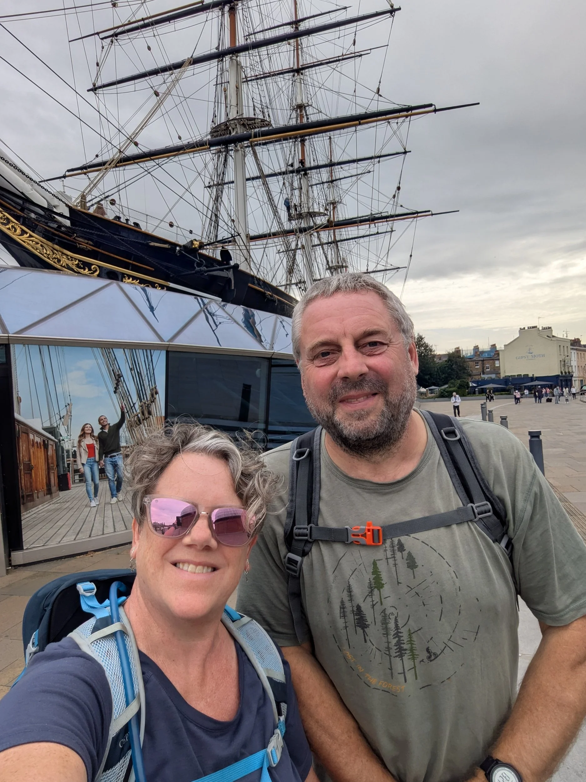
Today we have woken up to a dull, grey morning at the campsite and due to my extra long walk yesterday we have time to have a slower morning and properly pack up our camp (ready to go home later) before I start my last stretch of the walk today, I even have time to collect myself some sweet chestnuts from around our pitch - they’ve been dropping out of the trees around our pitch for the last few days. After we have packed up the van we head off to Woolwich station to park the van and get a train back to Greenwich. We arrive in Greenwich and decide to get lunch before setting off, we end up in Pizza Express and enjoy a delicious bowl of doughballs before our pizzas. With our bellies full and satiated we wander over to The Cutty Sark, Steve is going to walk part of the route with me today and my brother is going to appear on his bike to intercept me at some point.

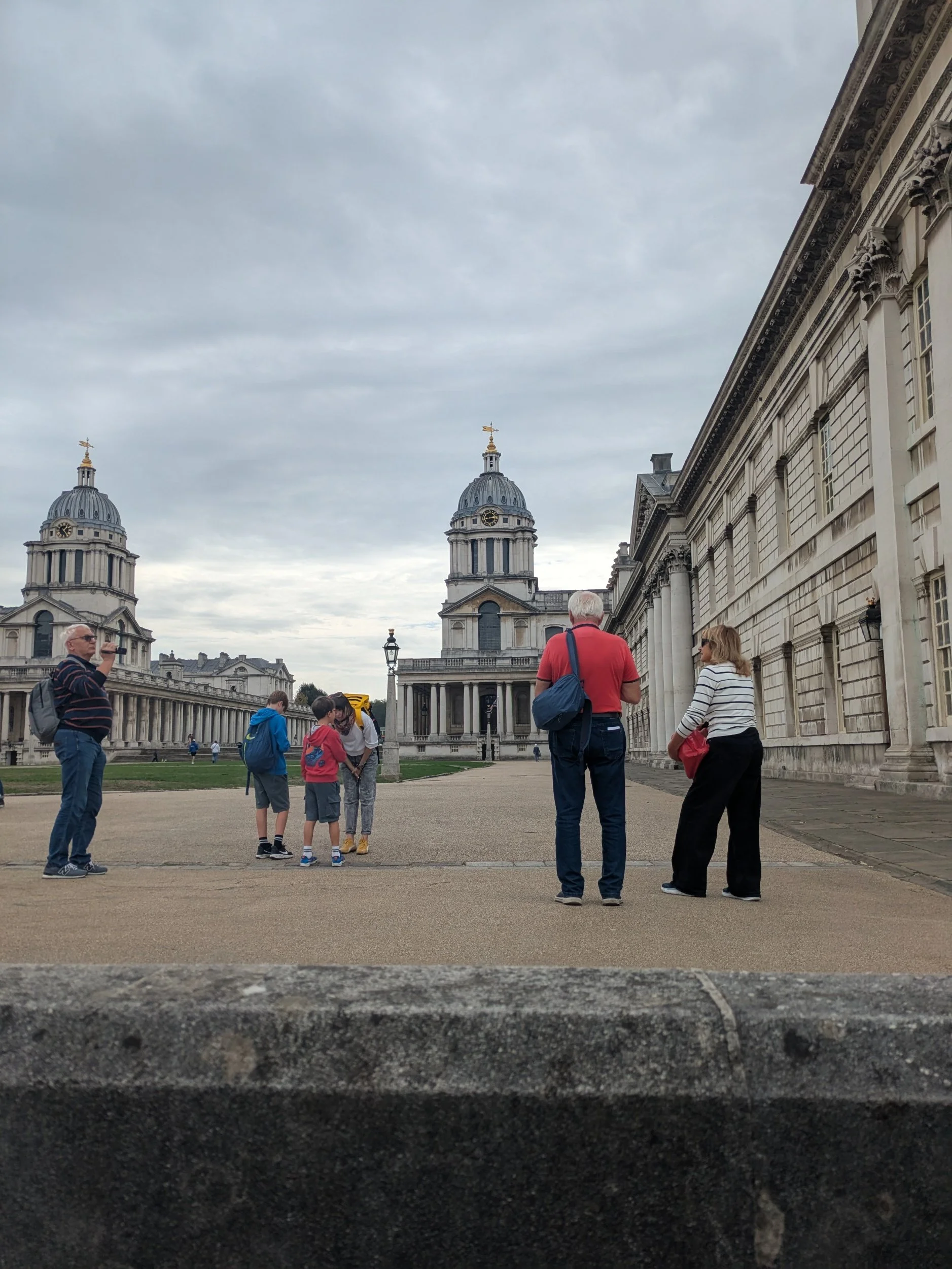
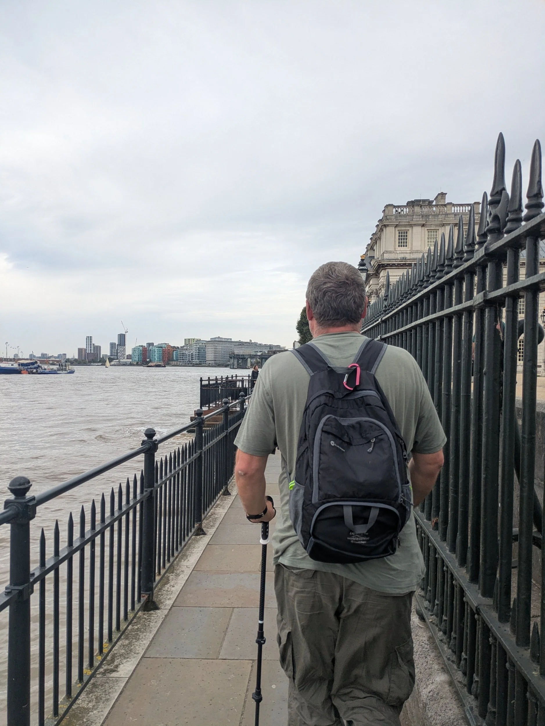
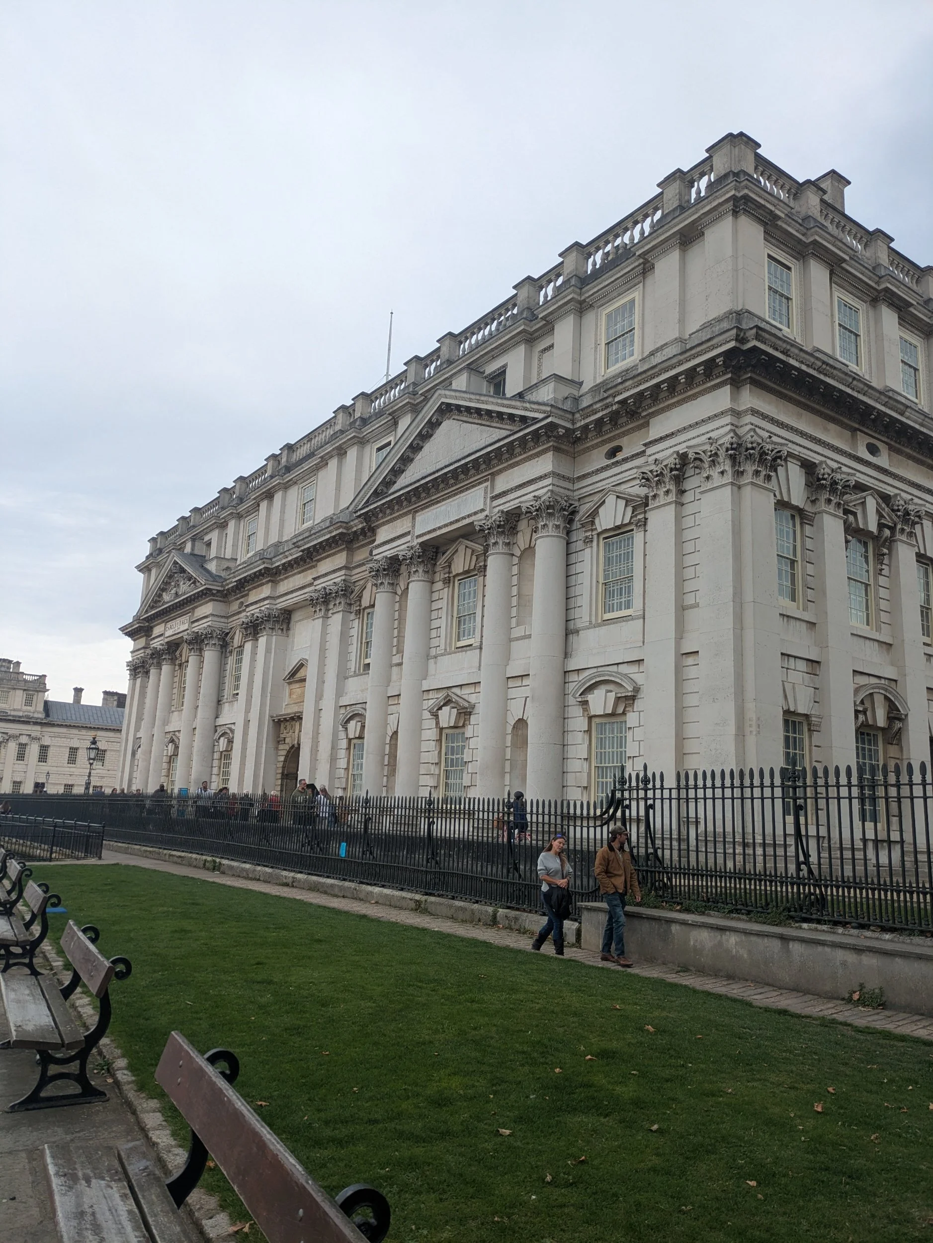
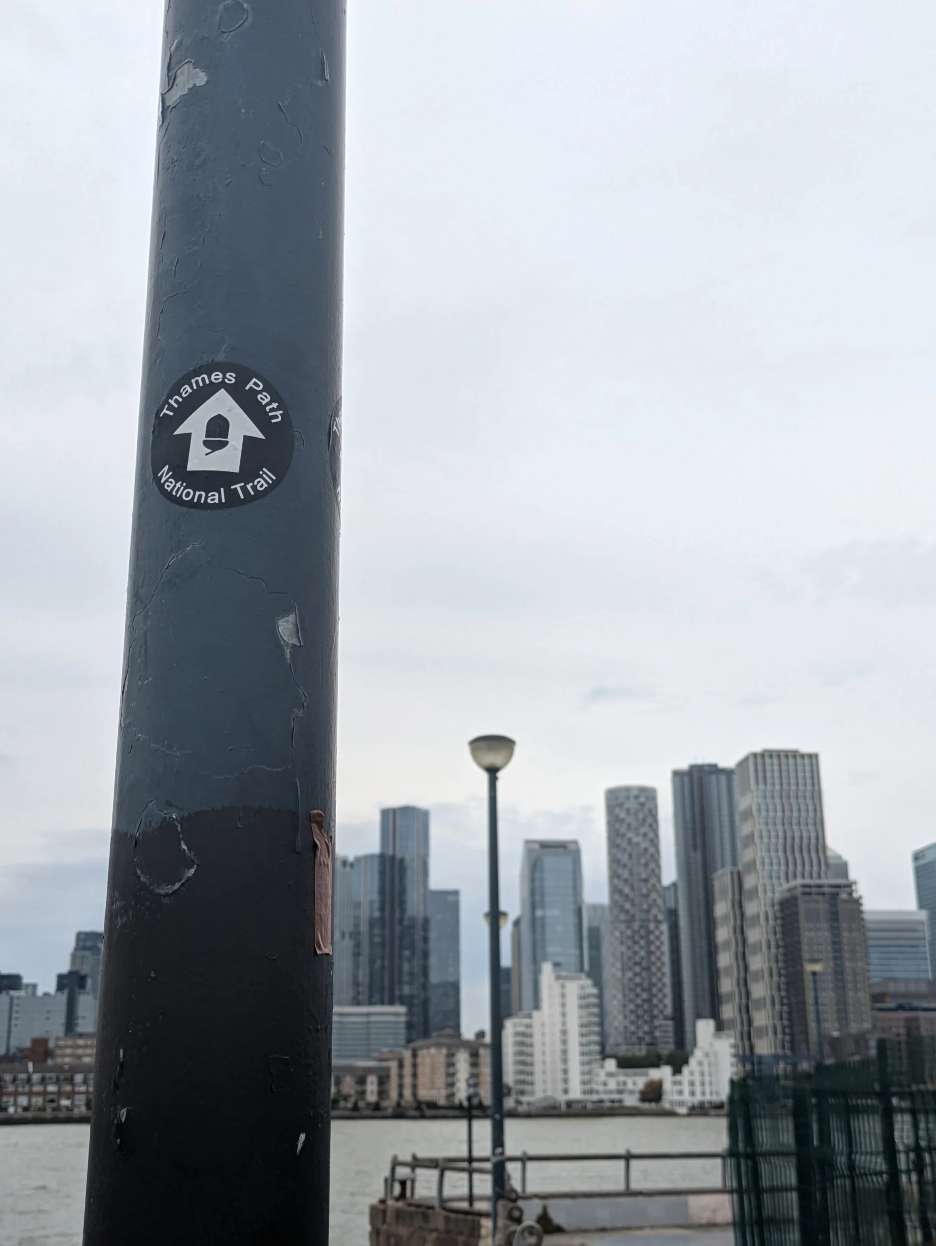
Greenwich is a UNESCO World heritage Site and has a rich history, it is the site of the 15th Century Palace of Placentia (now the Old Royal Naval College, those twin domes are a part of the masterpiece designed by Christopher Wren), there is also the National Maritime Museum and the Royal Observatory. The Thames Path keeps to the riverside giving a unique view of all the impressive buildings!
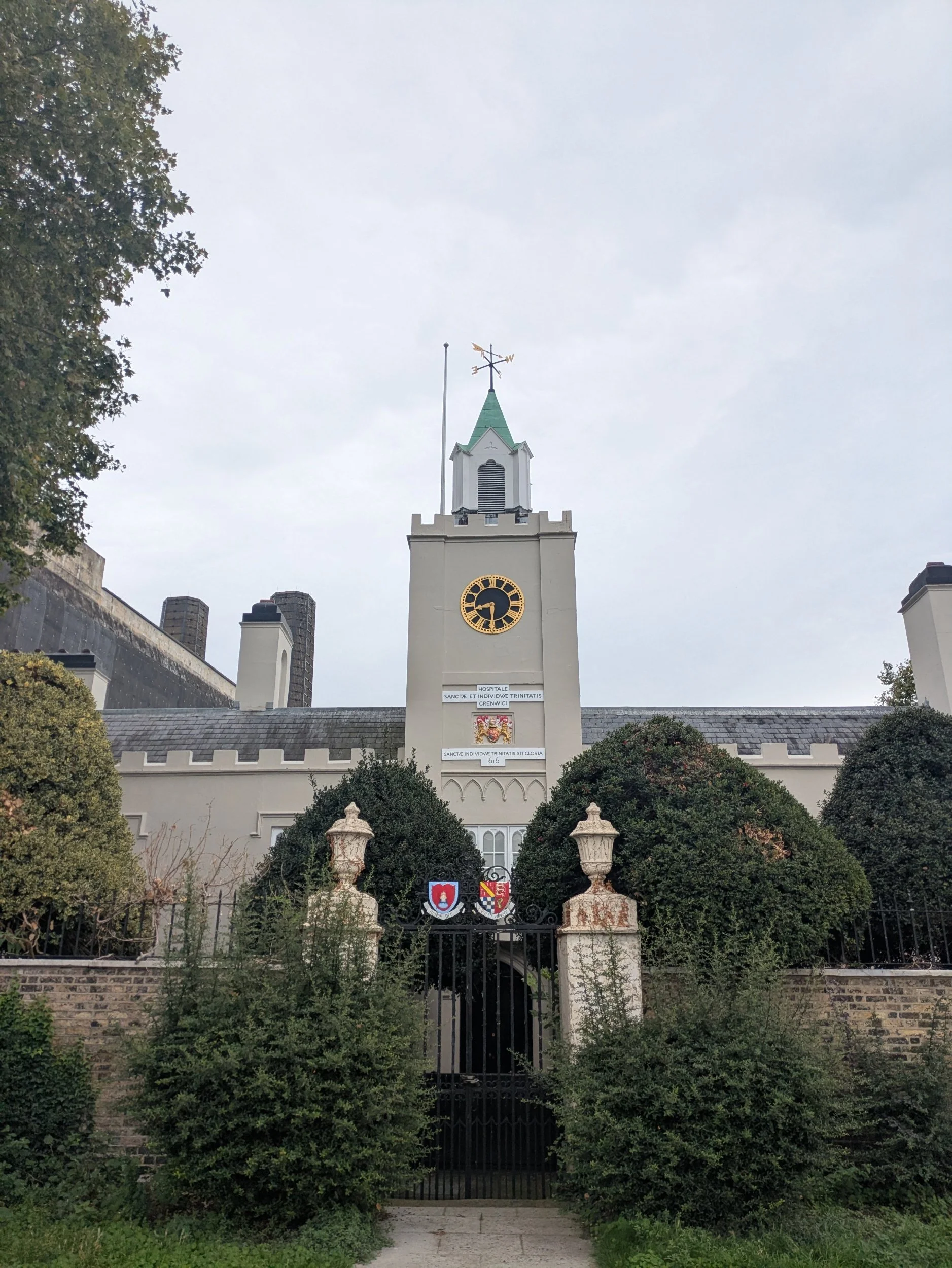
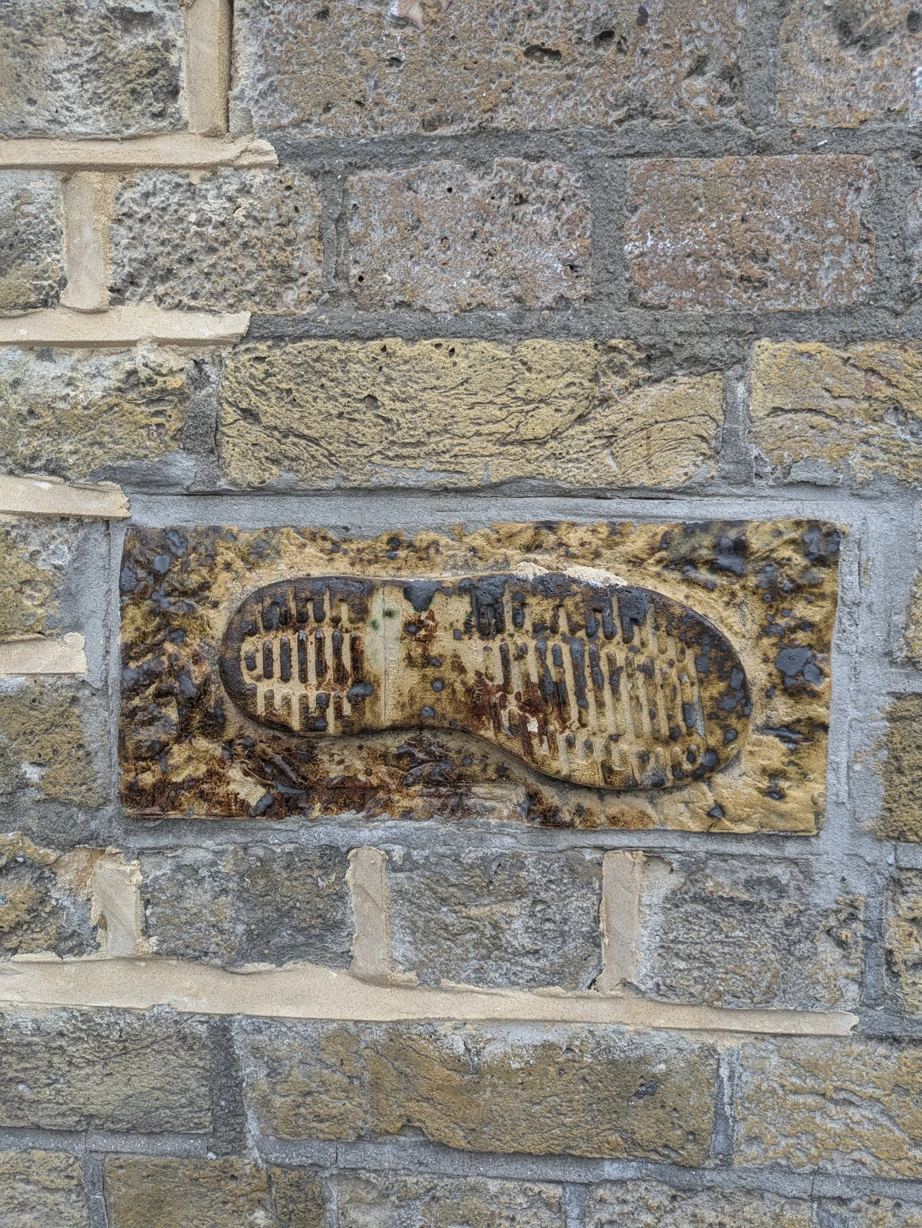
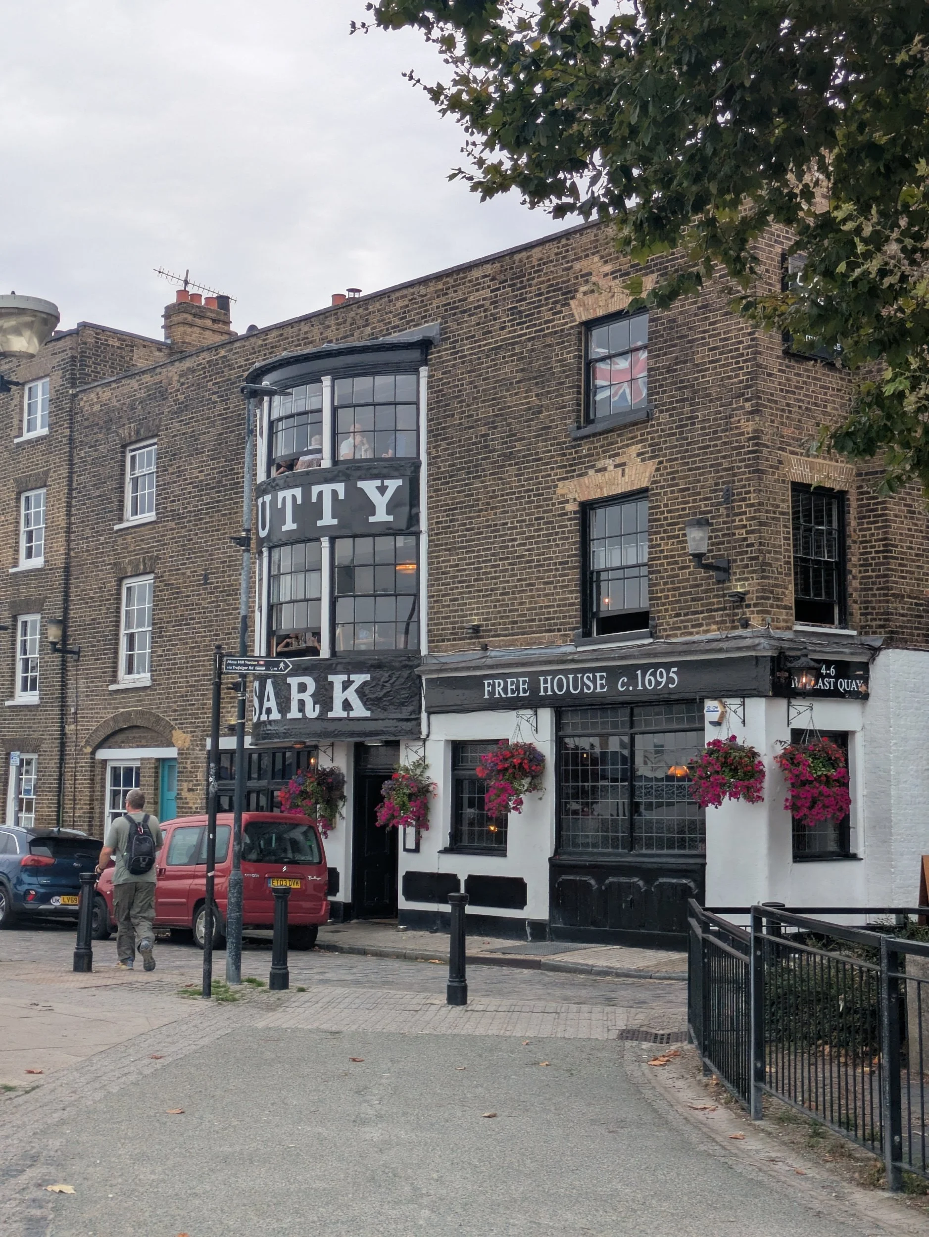
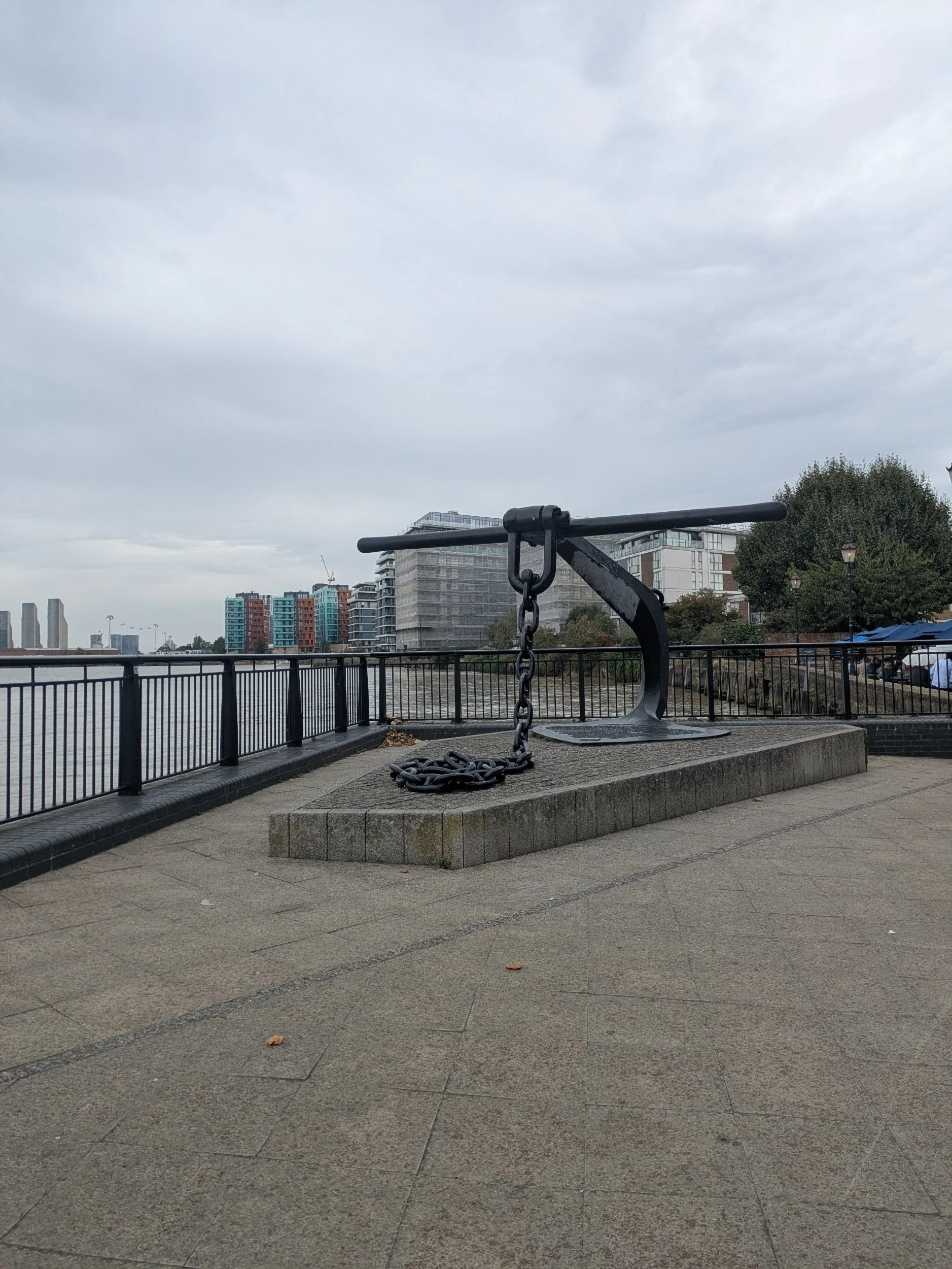
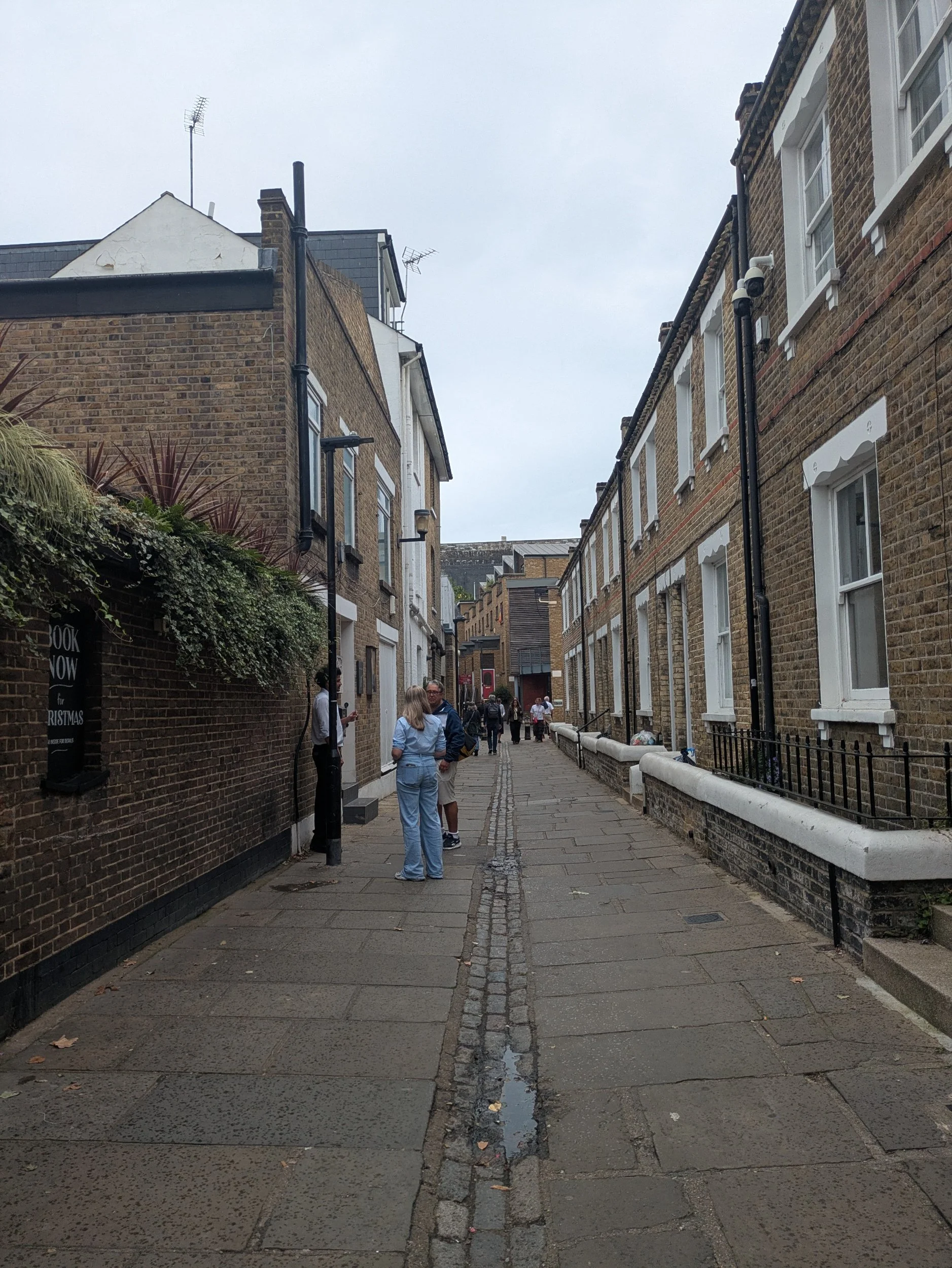
The route leaves the riverside and goes through some narrow streets passing Trinity Hospital, a group of Almshouses built in 1613 for the ‘poor men’ of Greenwich. I pass an interesting wall which has lots of ceramic plaques embedded in it, it’s an artwork entitled ‘The illustrated Thames tale’ by Amanda Hinge. The story begins with a message in a coke can which Stan sets out to interpret and follow, the footprint is part of it. We pass the Grade II listed Cutty Sark pub, this is it’s third name originally it was the Green Man and then the Union Tavern, it was only named the Cutty Sark after the Tea Clipper arrived in Greenwich in 1951. We pass a sculpture of an anchor which is a 2004 sculpture by Wendy Taylor called Anchor Iron, it has a plaque detailing the history of the local area.

Just around the corner someone hollers at me out of The River Gardens Café, it is my brother who is grabbing a coffee & pastry after his morning ride! After a little catch-up and a selfie we part ways and Steve heads back to Greenwich. So now it’s just me and the path once more.

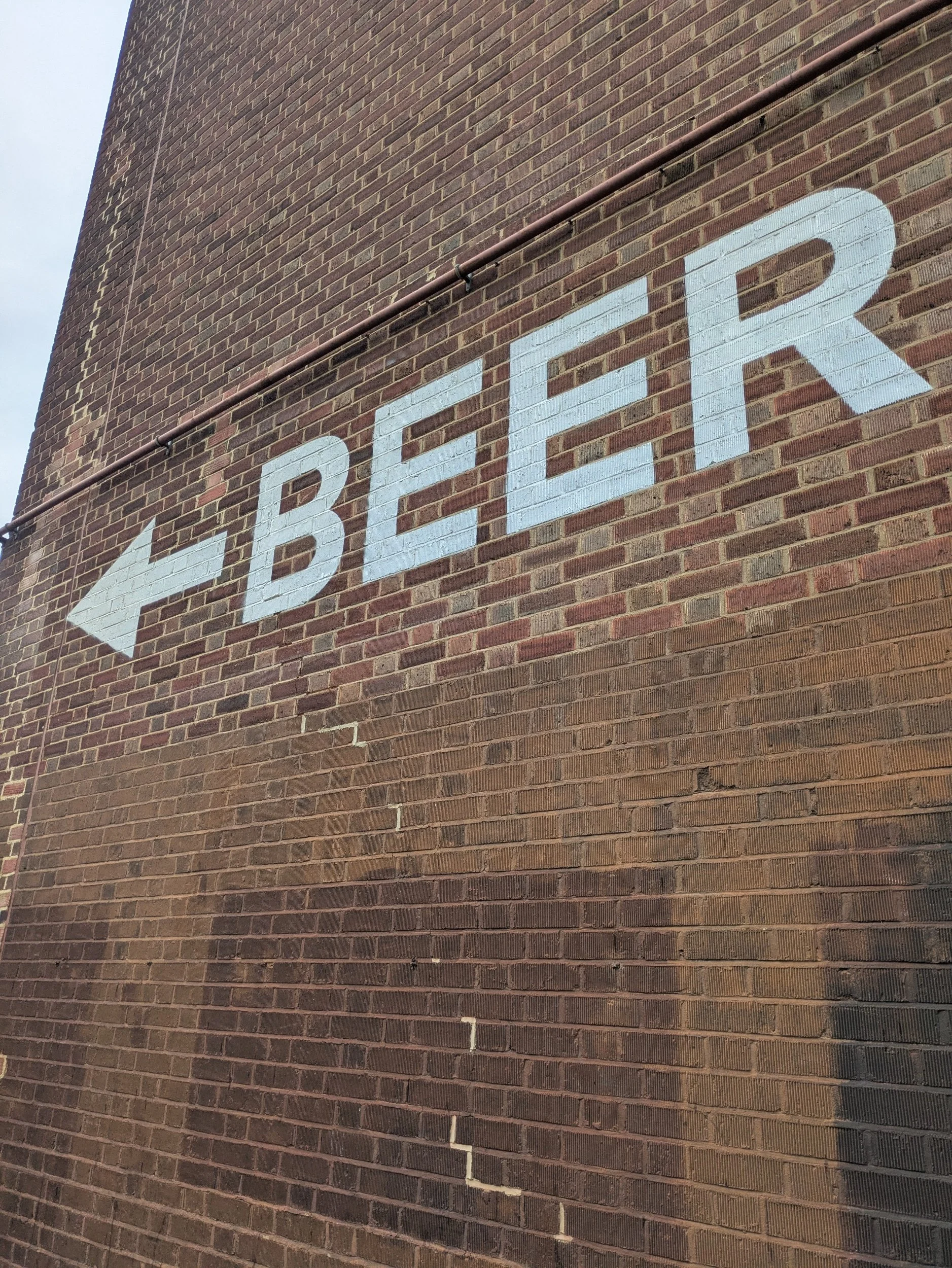


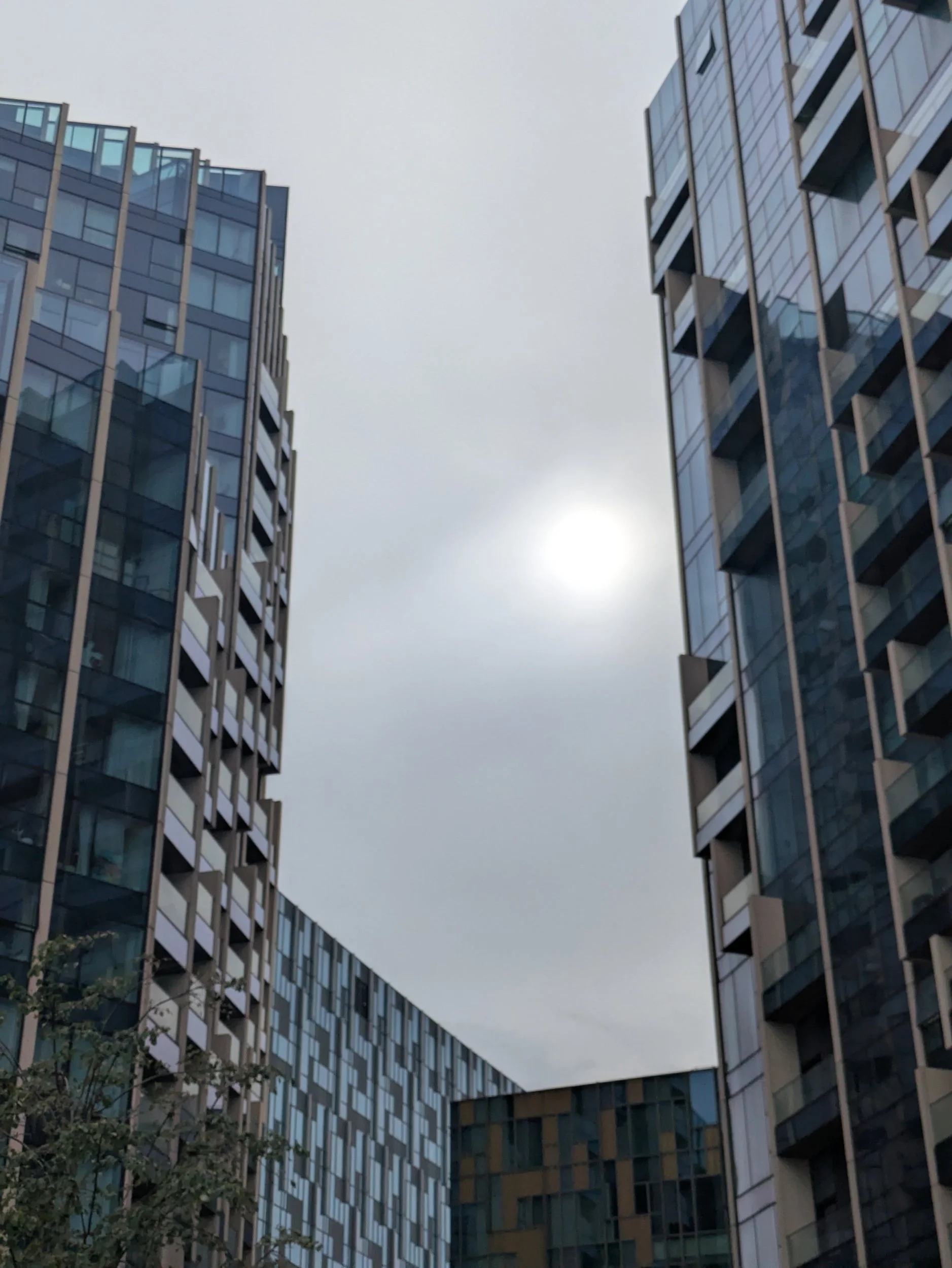
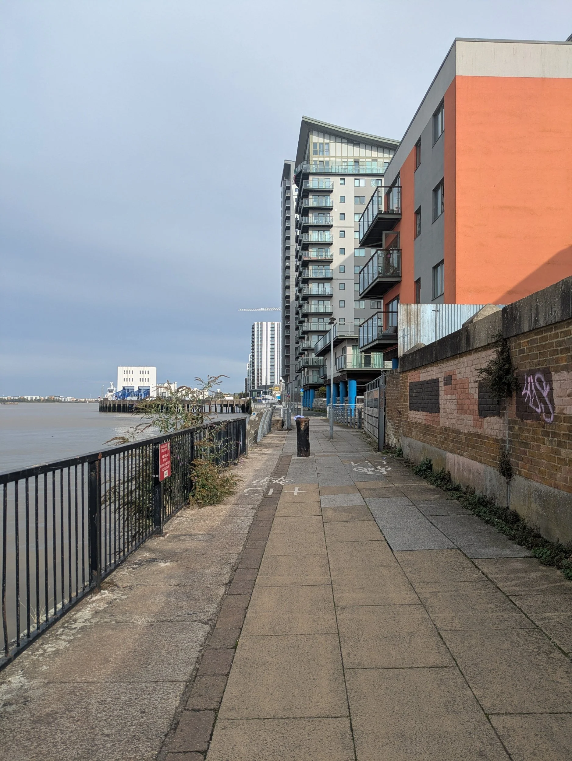
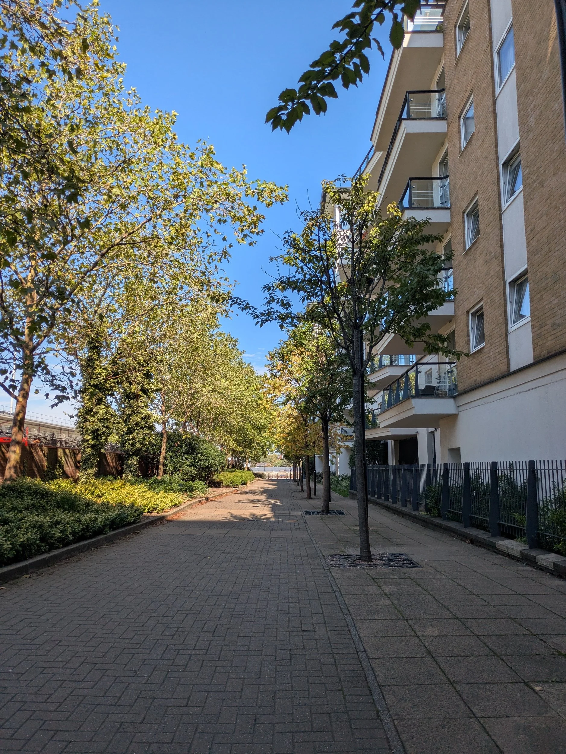
I pass some colourful apartment blocks as the path heads back closer to the riverside, it gets a bit industrial around Morden Wharf, a little run down and feels like it could do with a revamp! Morden Wharf was a 500 capacity pub with a terrace which sadly has closed.
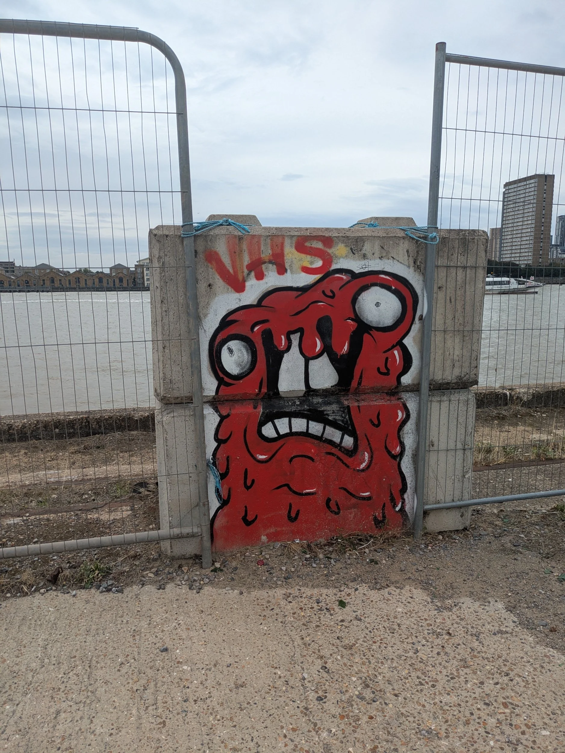

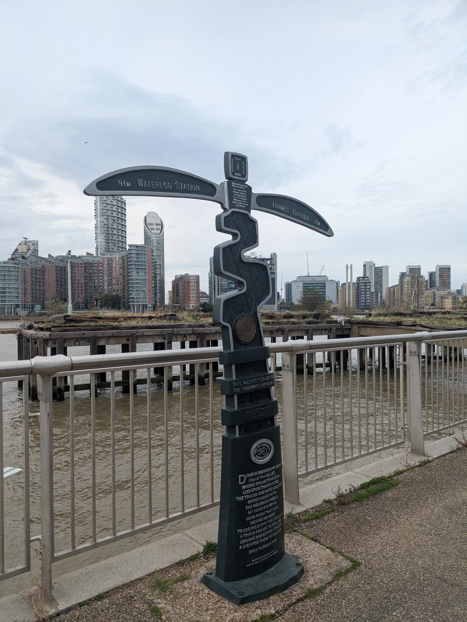
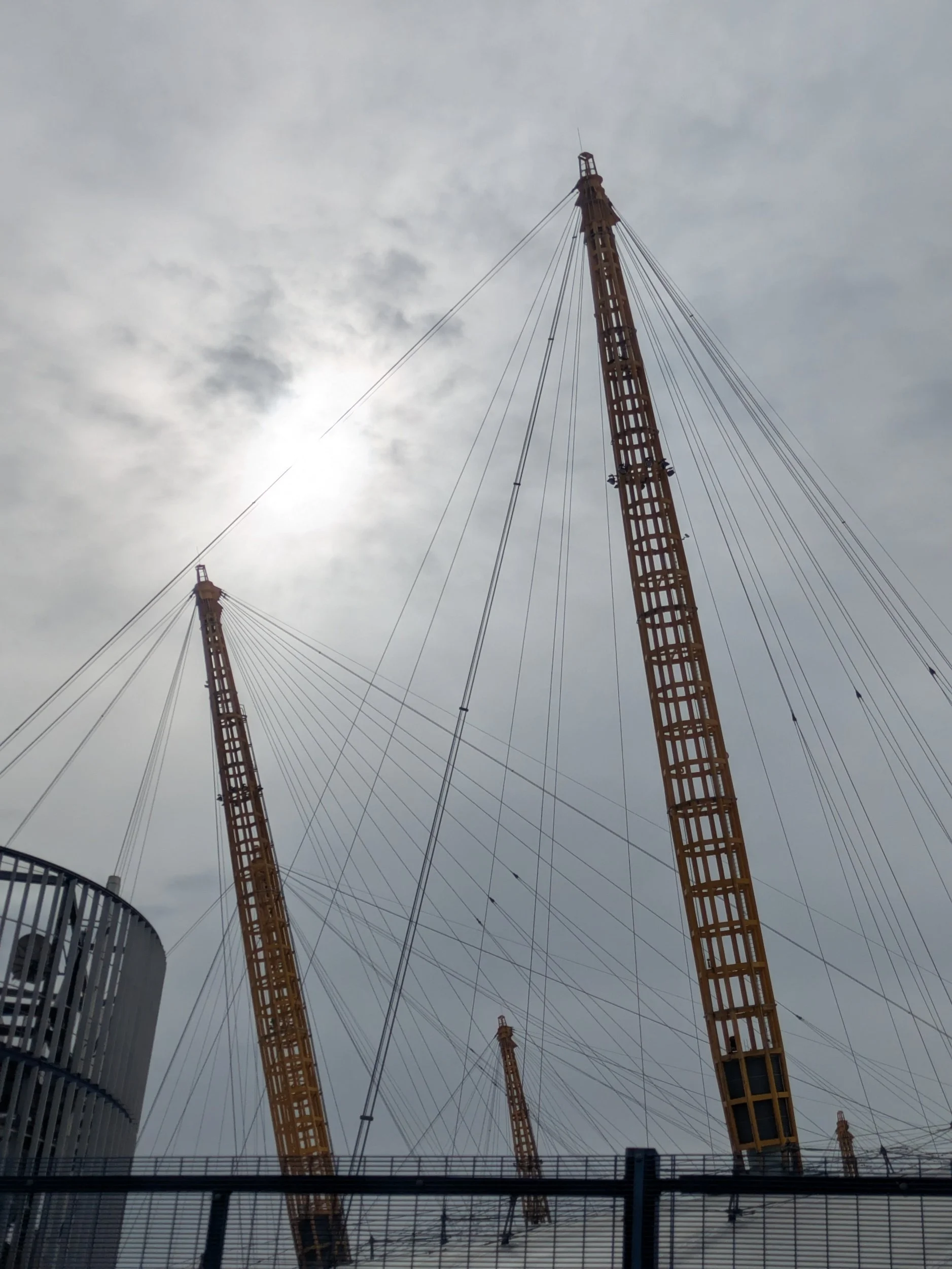
As I approach the O2 arena there’s some fun graffiti on some of the lego-esque concrete blocks, the area is so drab and grey they brighten it up! I pass a mile post marker which celebrates the Millennium and the creation of the National Cycle Network. As I round the O2 I start to encounter The Line, a public art trail that connects Queen Elizabeth Olympic Park and the O2, following the waterways and the line of the Greenwich Meridian. A slice of reality by Richard Wilson is a sculpture featuring a sliced vertical section of an ocean going sand dredger.


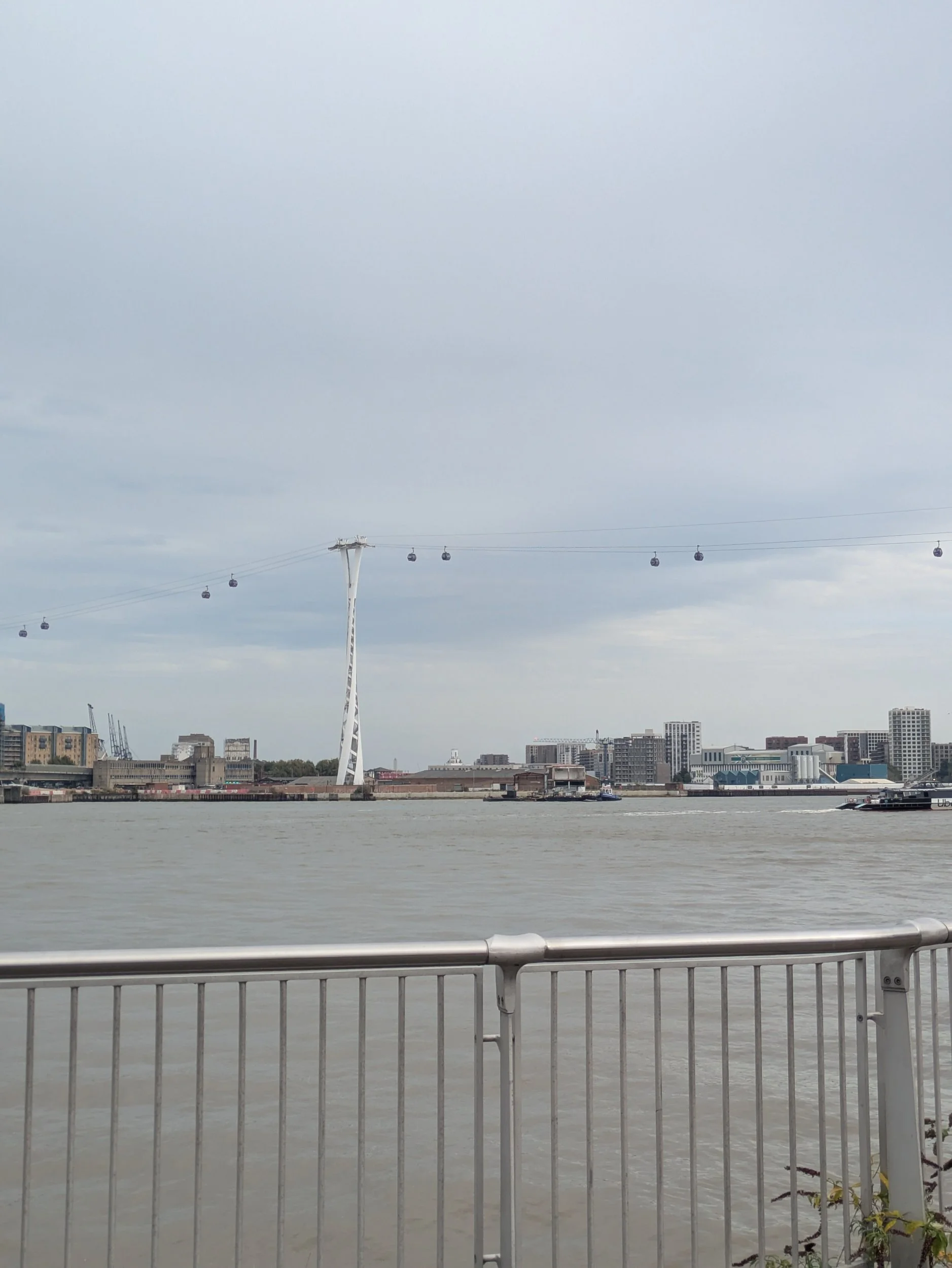
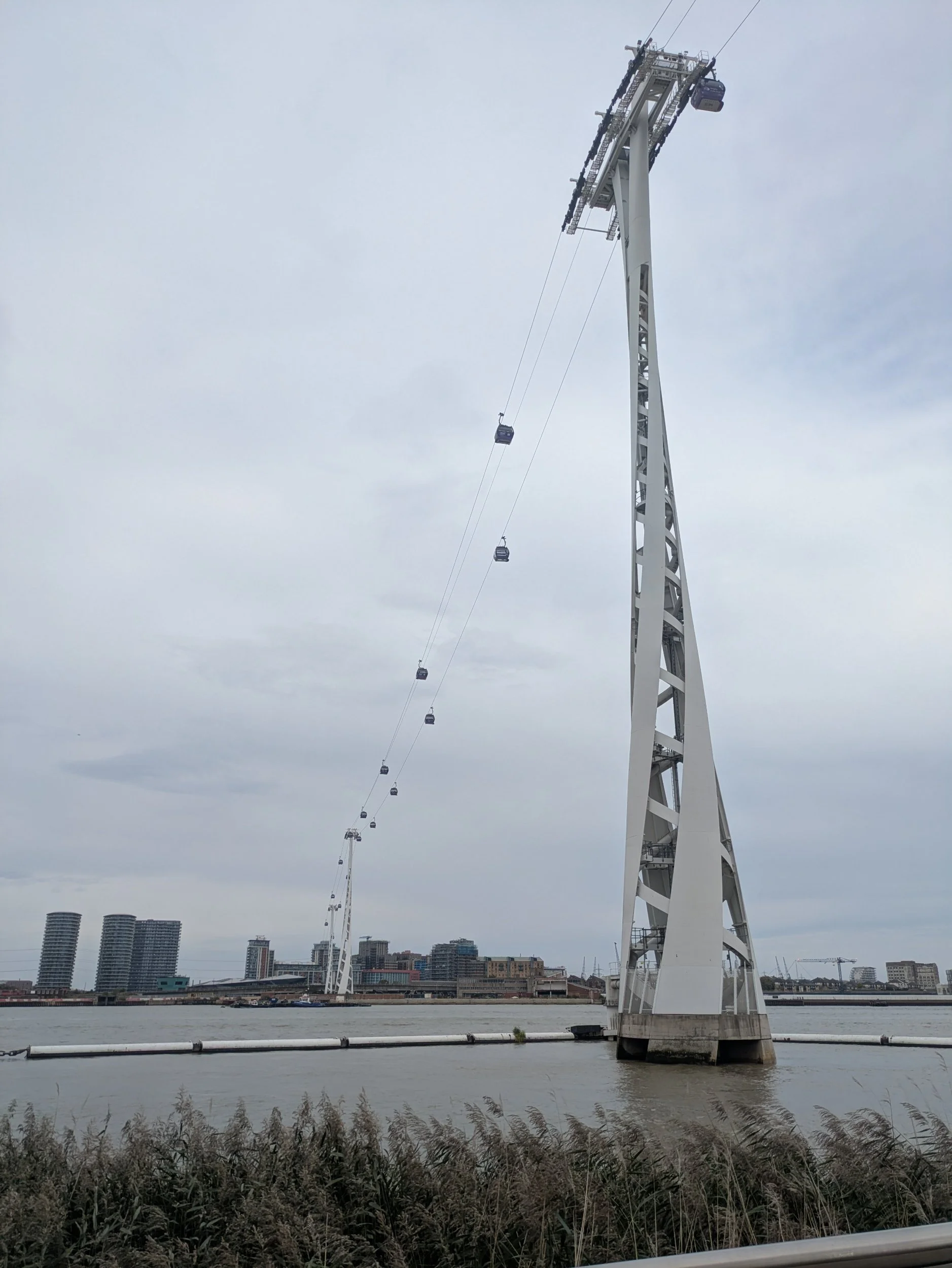
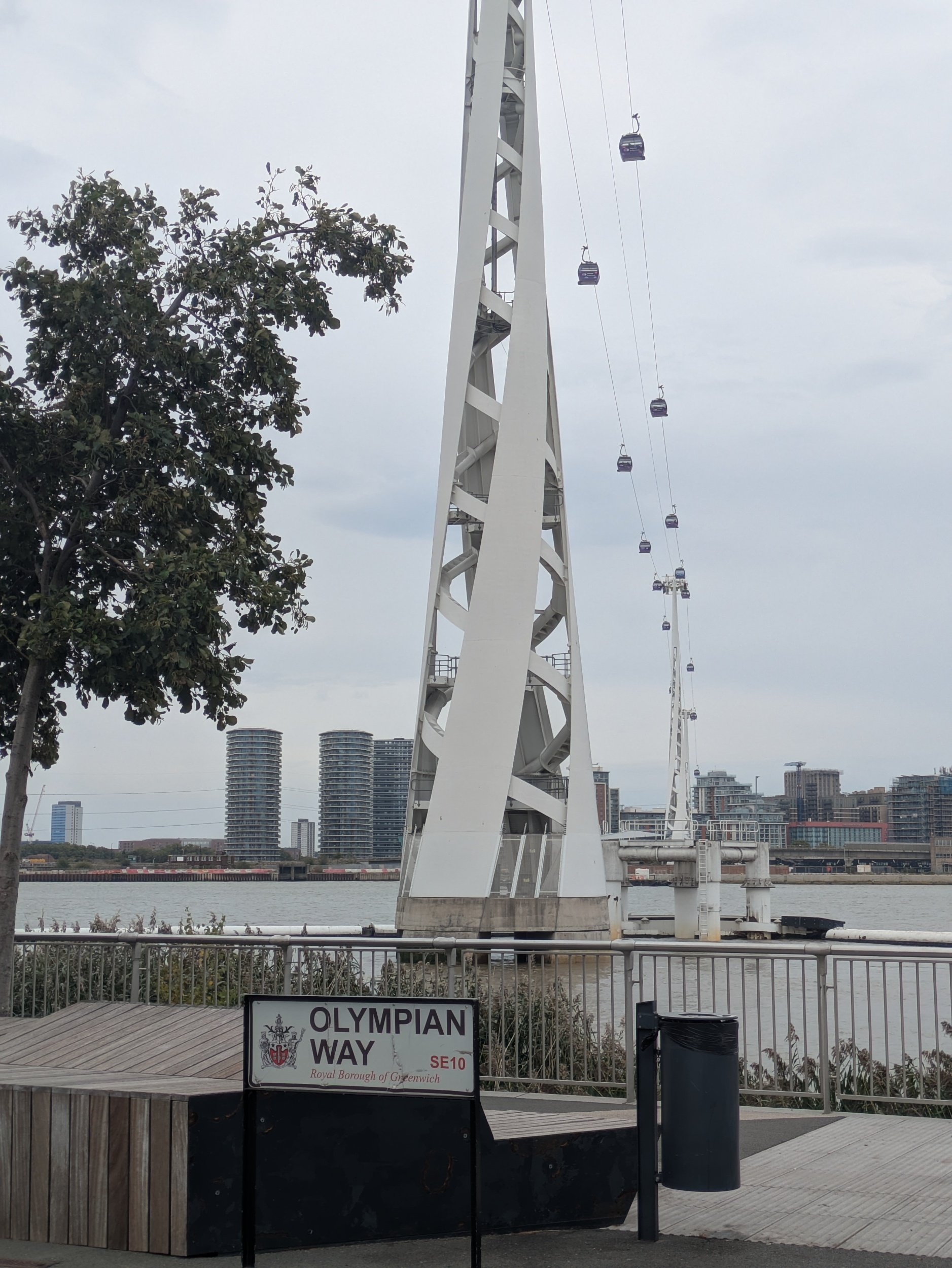
The 5 metre totemic sculpture is called Tribe and Tribulation by Serge Attukwei Clottey. The path is lovely and wide around here and a few people are milling around, but it is peaceful as I contemplate each sculpture as I pass. Liberty Grip by Gary Hume, a bronze based on the arm of a shop mannequin - it is huge! The Greenwich cloud cable car comes into view arcing across the river, as I walk along Olympian Way!

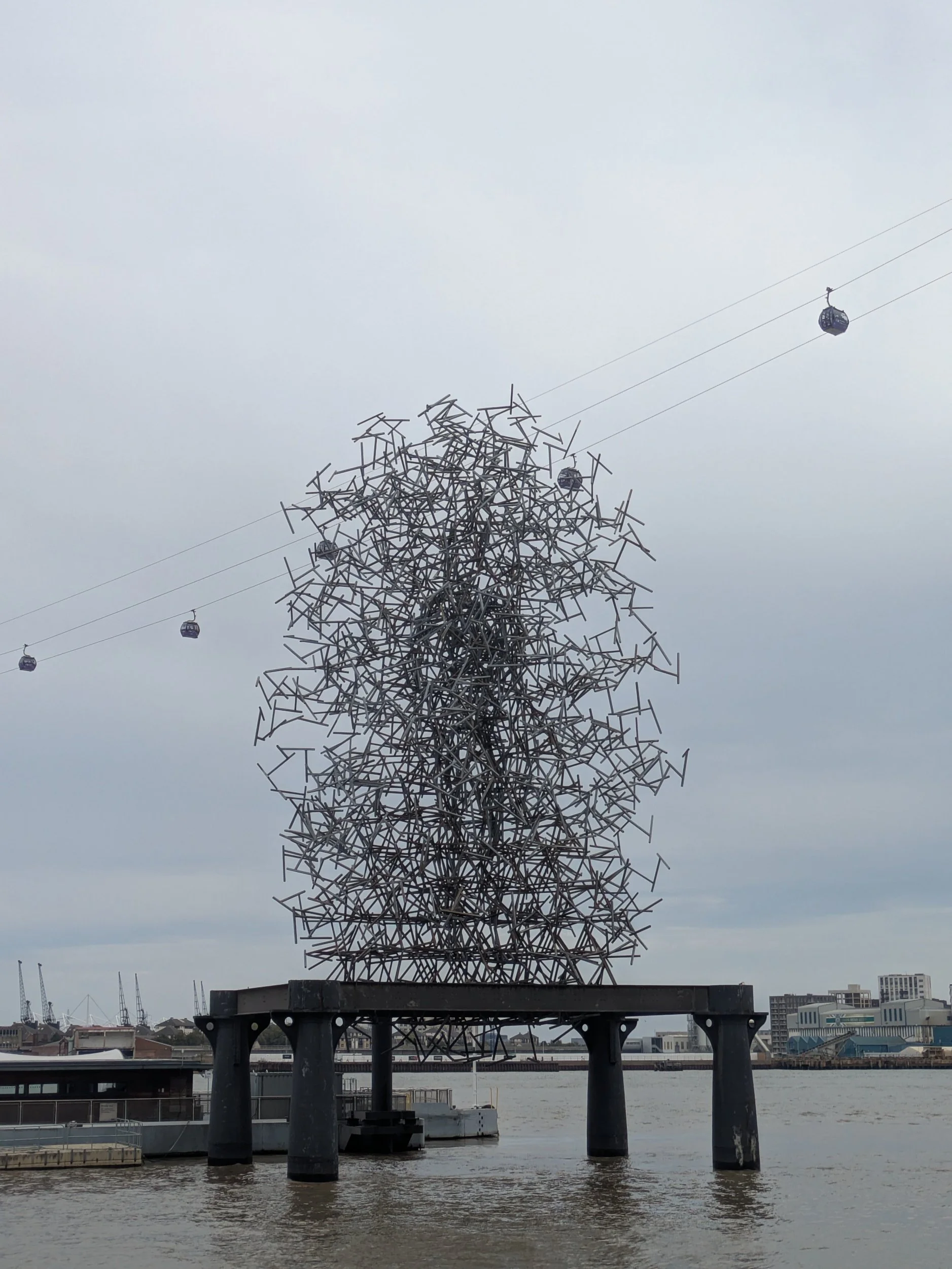
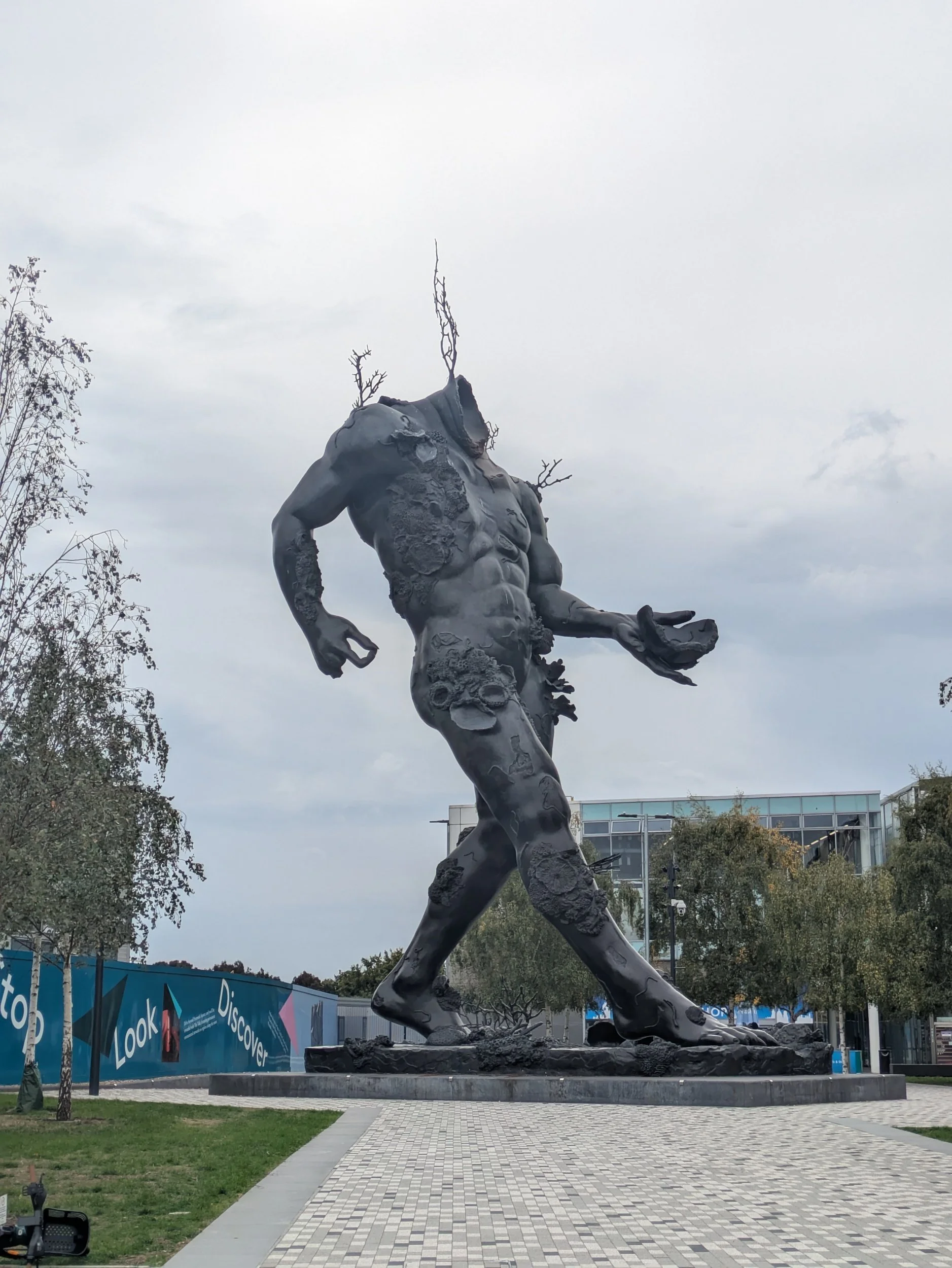
Located at the heart of The Tide overlooking the River Thames, The Mermaid (2014) is one of six public pieces from Damien Hirst at Greenwich Peninsula. Quantum Cloud is a galvanised steel sculpture by Antony Gormley. I’m enjoying the street furniture along here as well as the sculptures! This huge headless sculpture is another Damien Hirst, how do you even go about constructing something so vast?
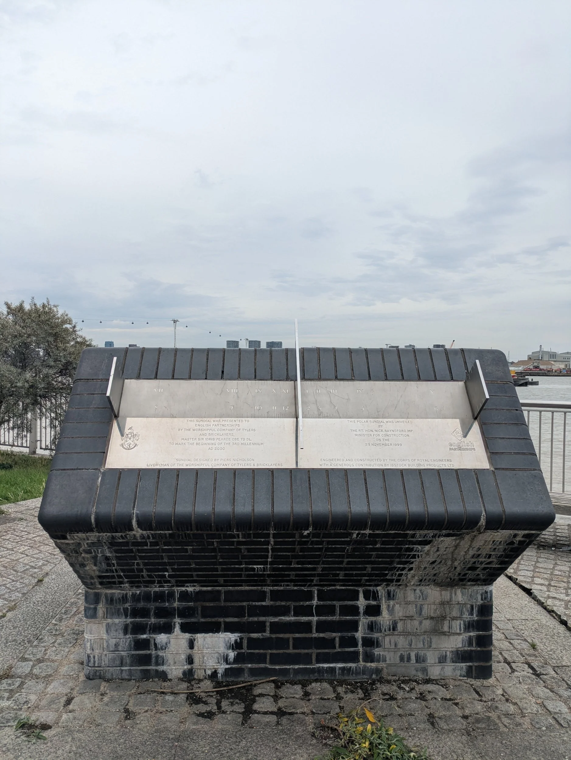
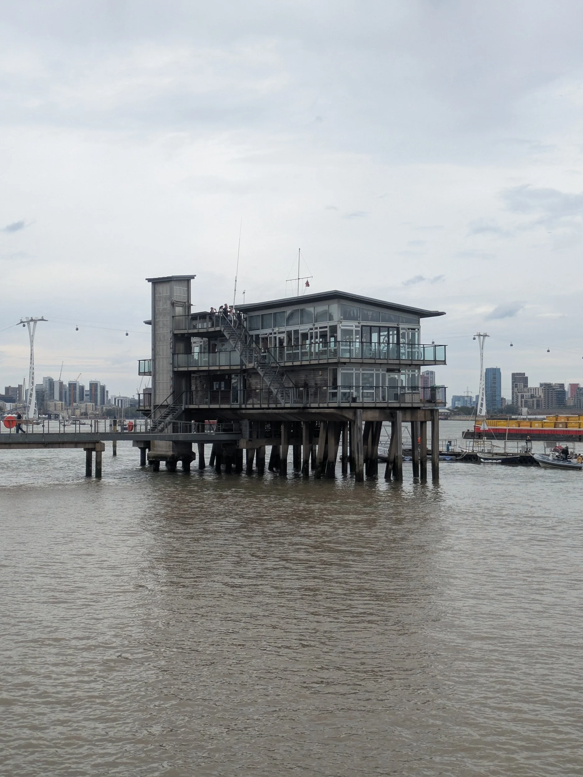

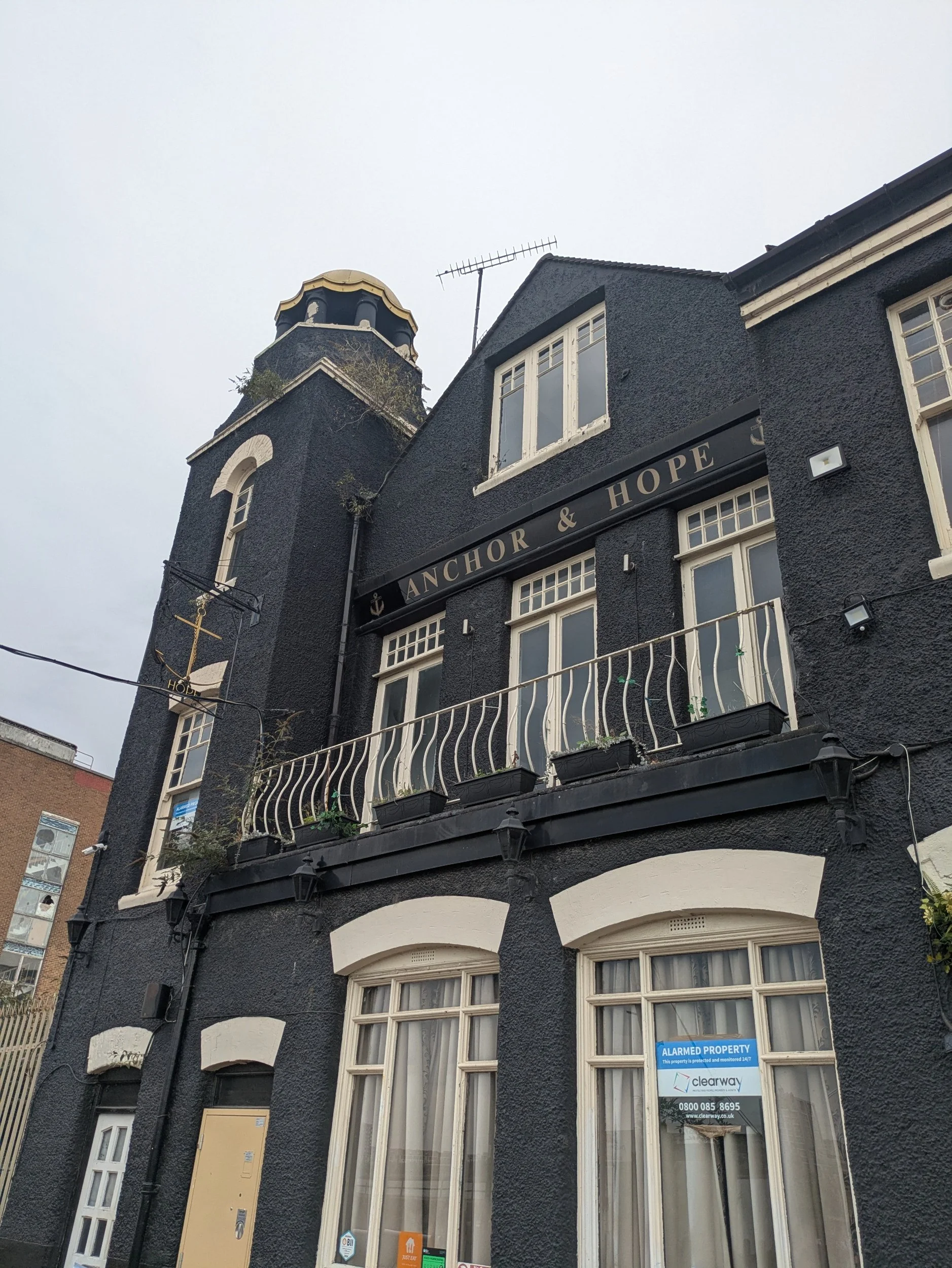
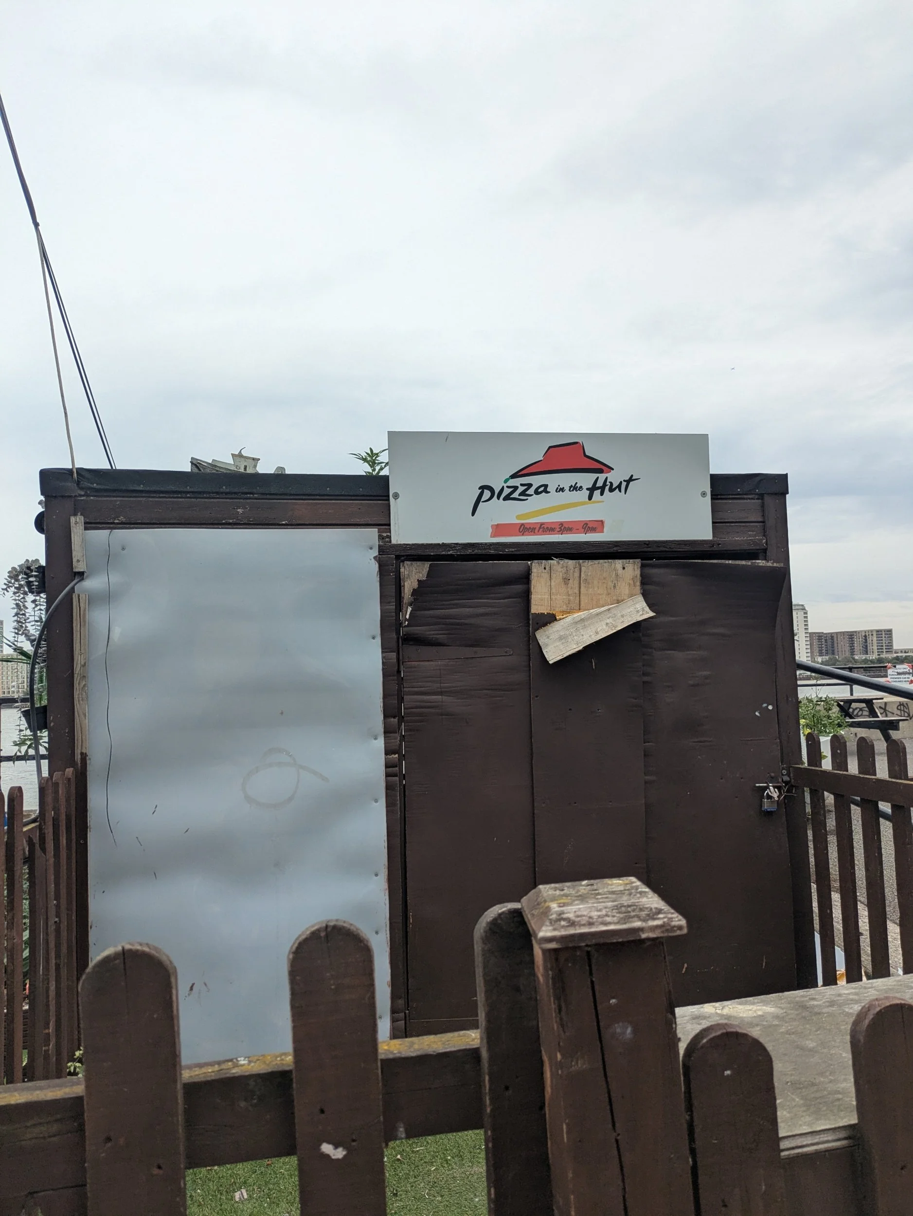
I pass a polar sundial which was created to mark the Millennium, it was designed by Piers Nicholson. Around the corner is Greenwich Yacht Club, I have actually visited this yacht club on a Team building event a few years back! Greenwich Yacht Club was founded by Thames watermen and river workers in 1908, this current clubhouse was built as a result of the construction of the Millennium Dome (O2) on the then redundant Peartree Wharf. I pass through an area that supplies aggregates to the building and construction industries - it’s quite sandy! Pizza in the hut made me laugh! it’s opposite the Anchor & Hope pub.
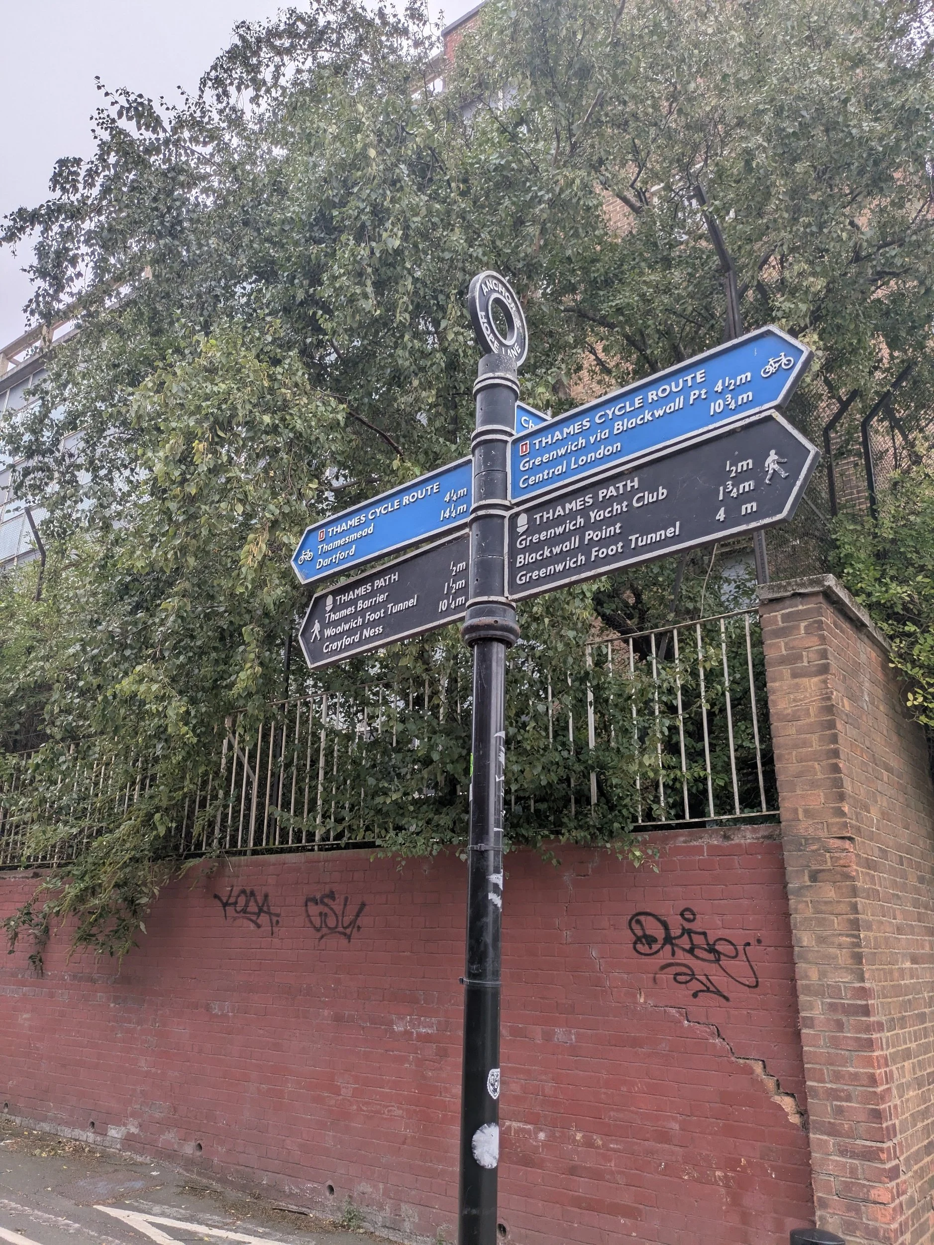
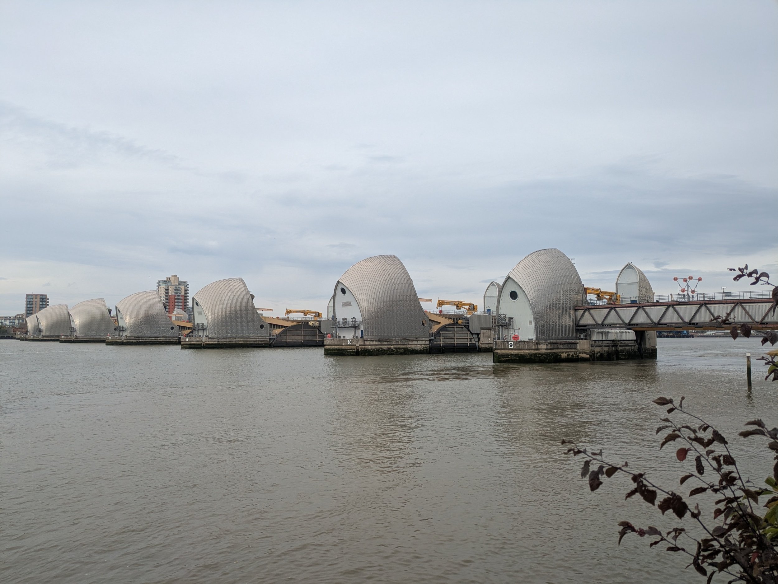
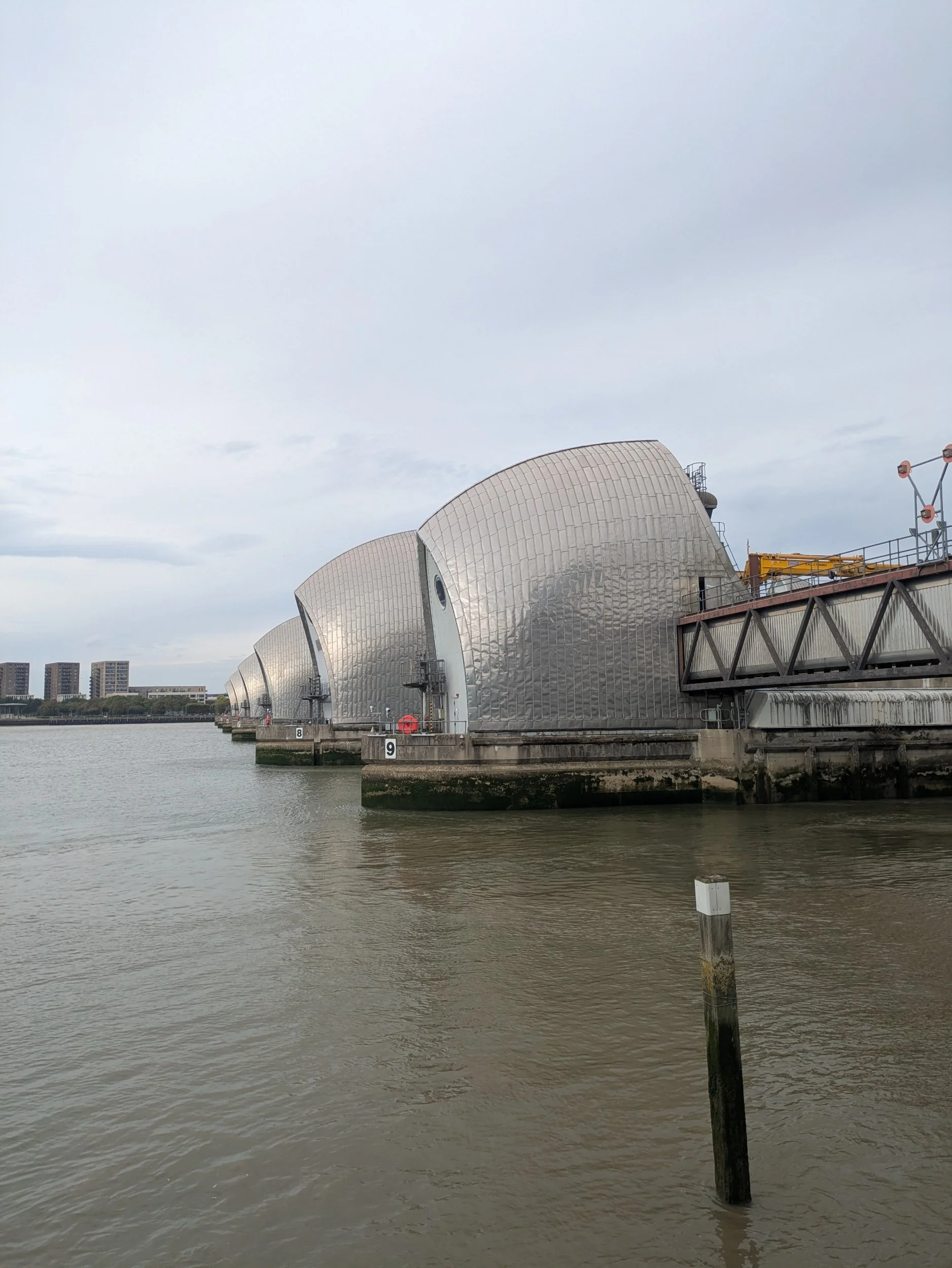
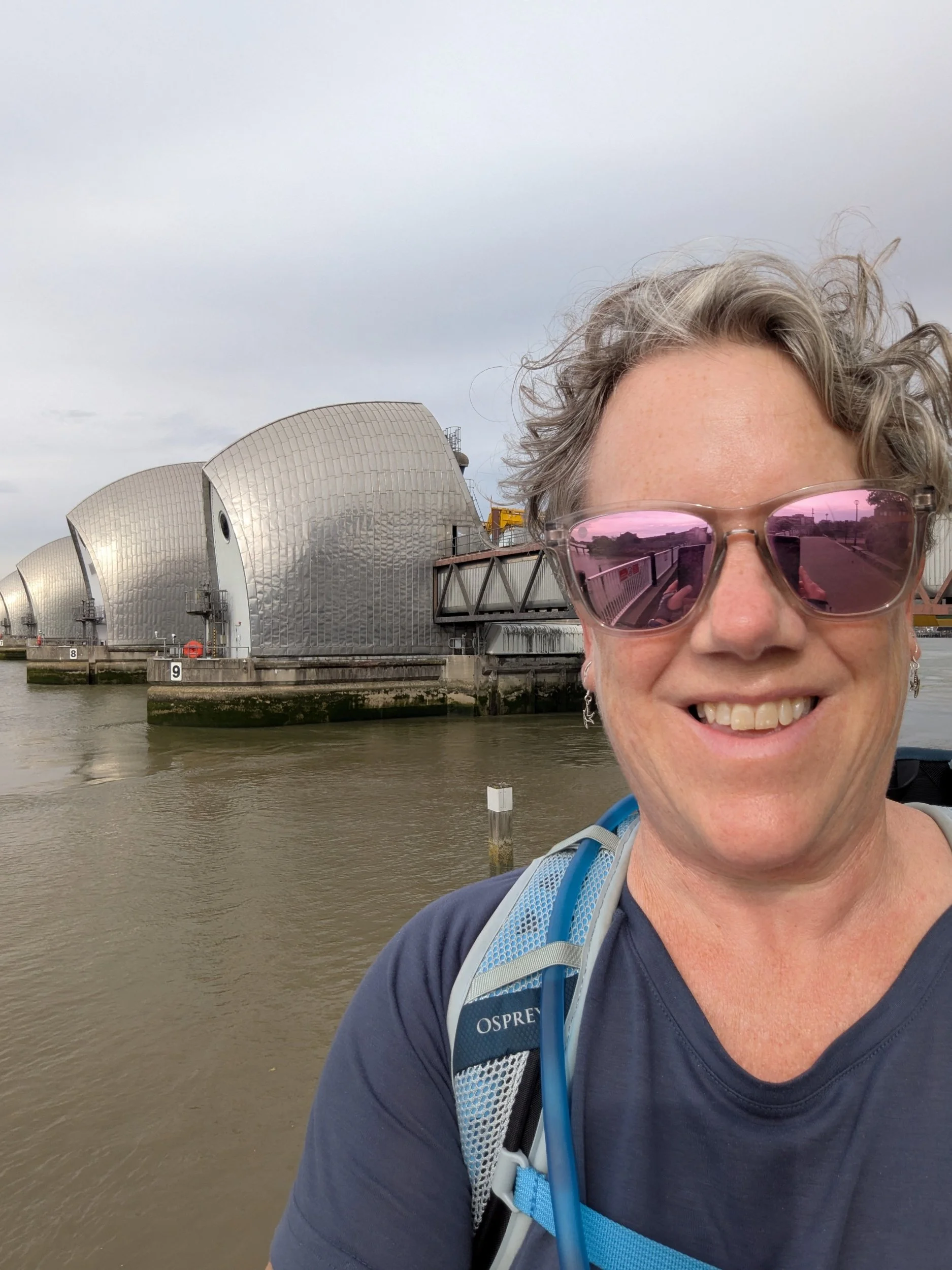
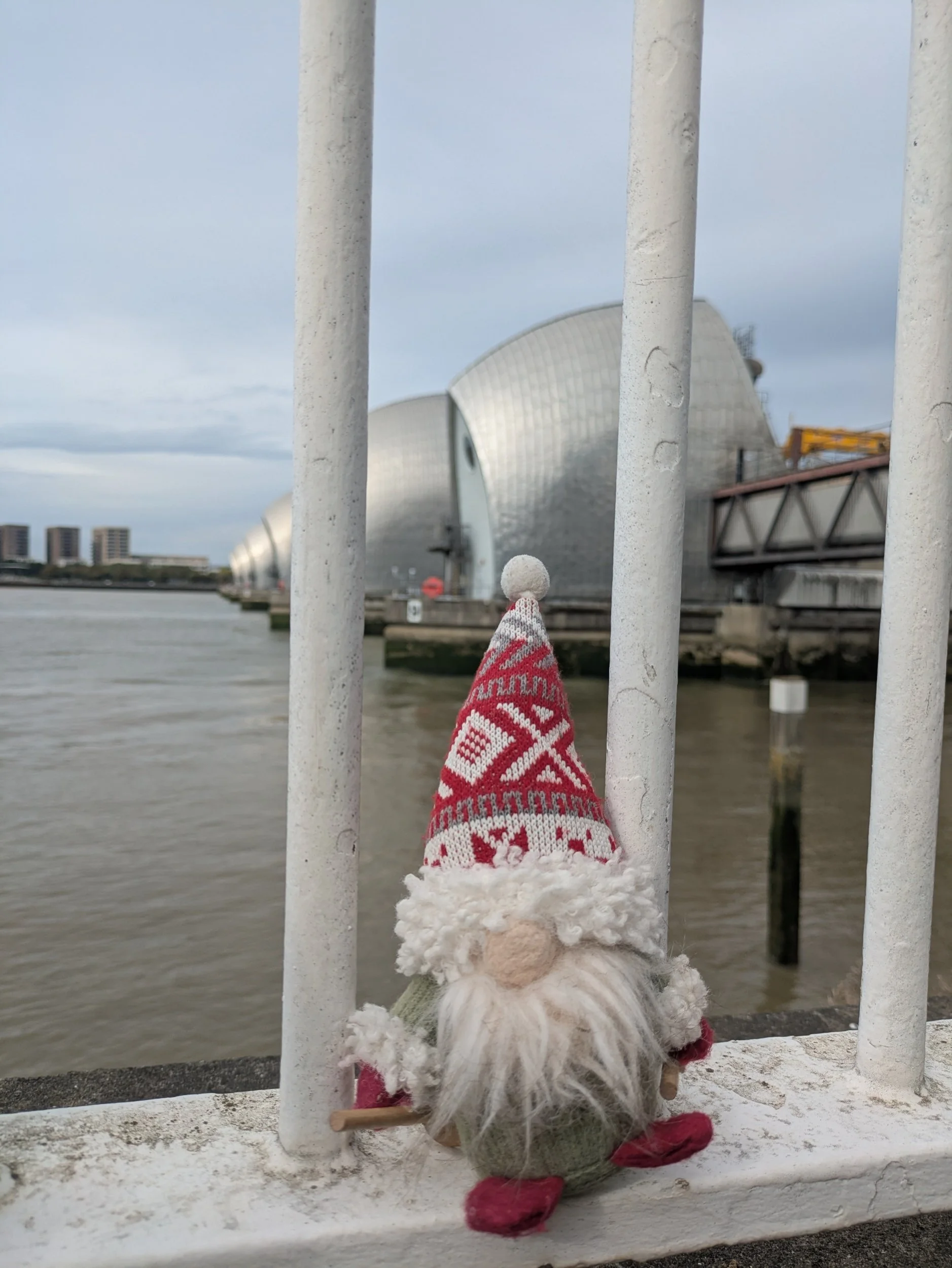
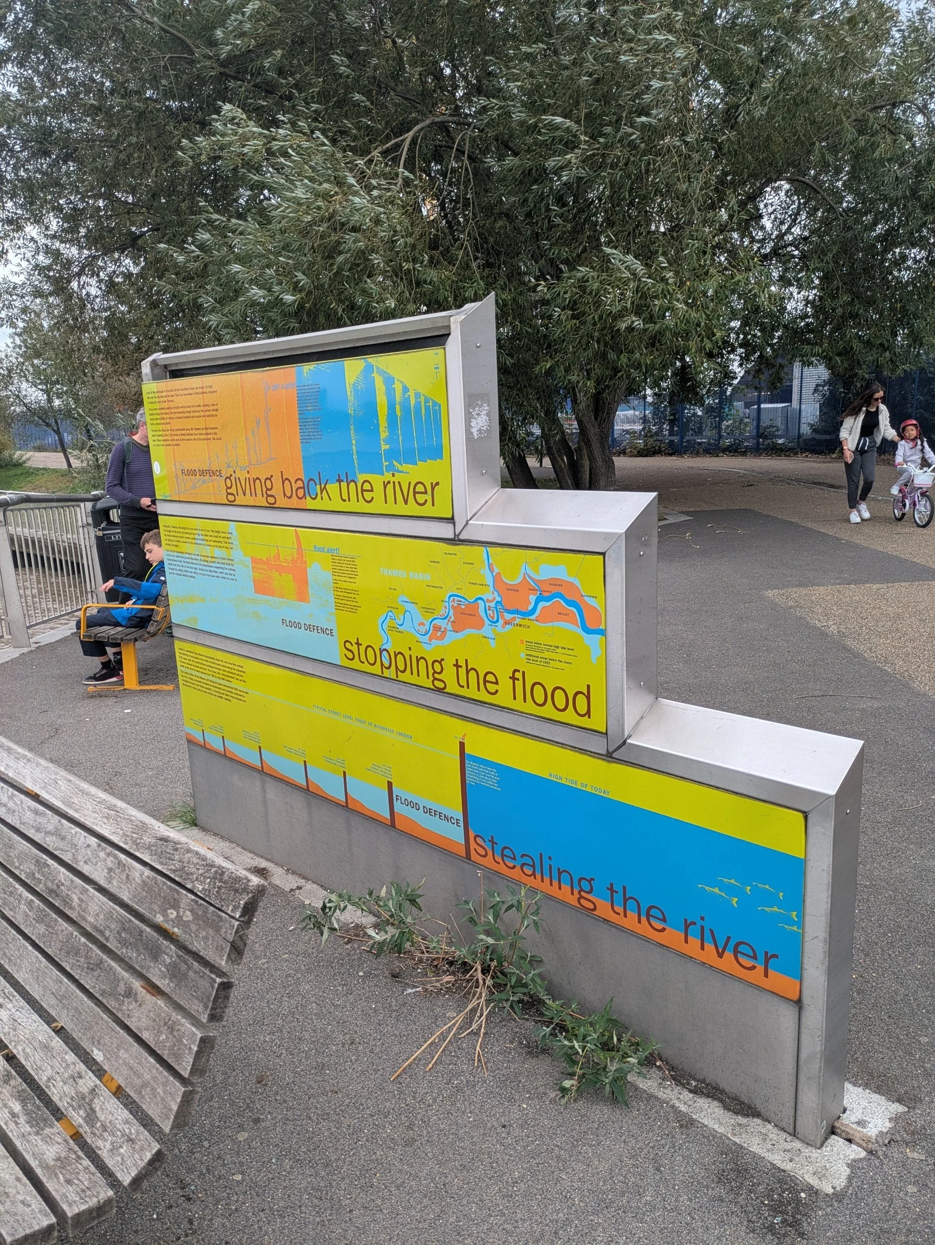
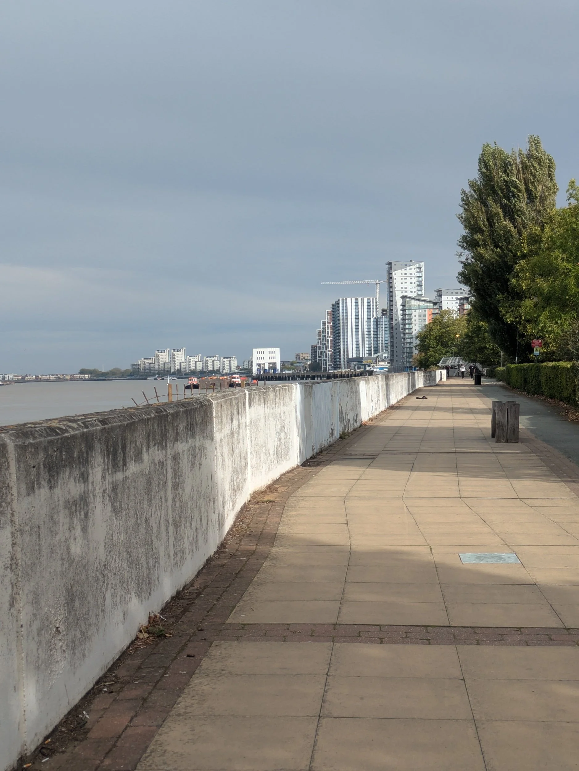
Only half a mile to go to The Thames Barrier, I can see it in the distance, The Thames Barrier, one of the largest movable flood barriers in the world, spans 520 metres across the Thames. Its ten, movable steel gates protect 125 square kilometres of central London from tidal-surge flooding. When raised, the 3300-tonne main gates stand as high as a five-storey building and as wide as the opening of Tower Bridge. It’s very impressive!
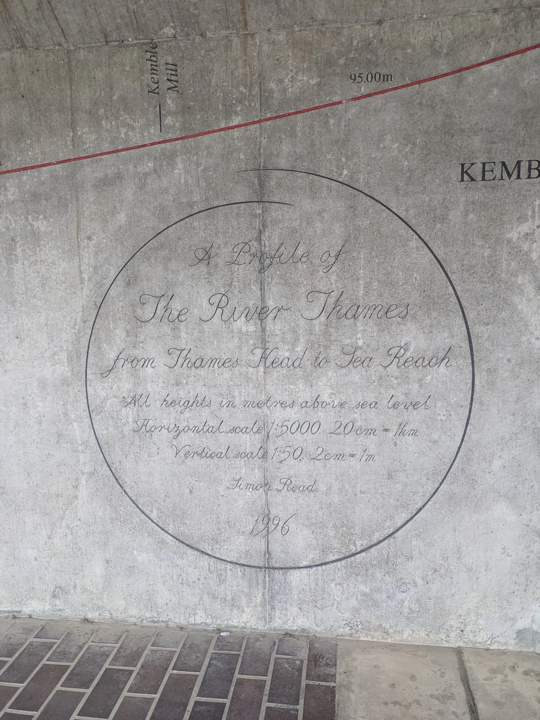
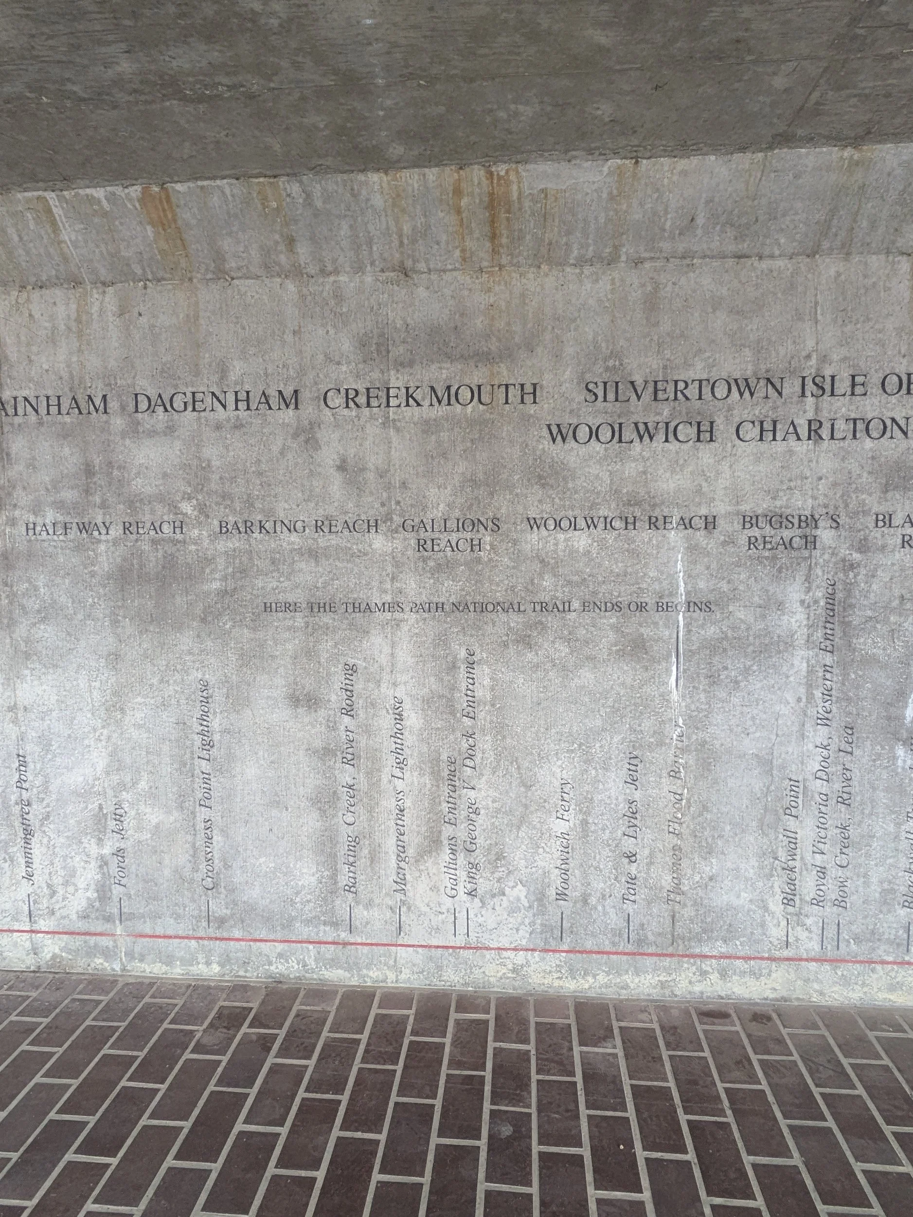
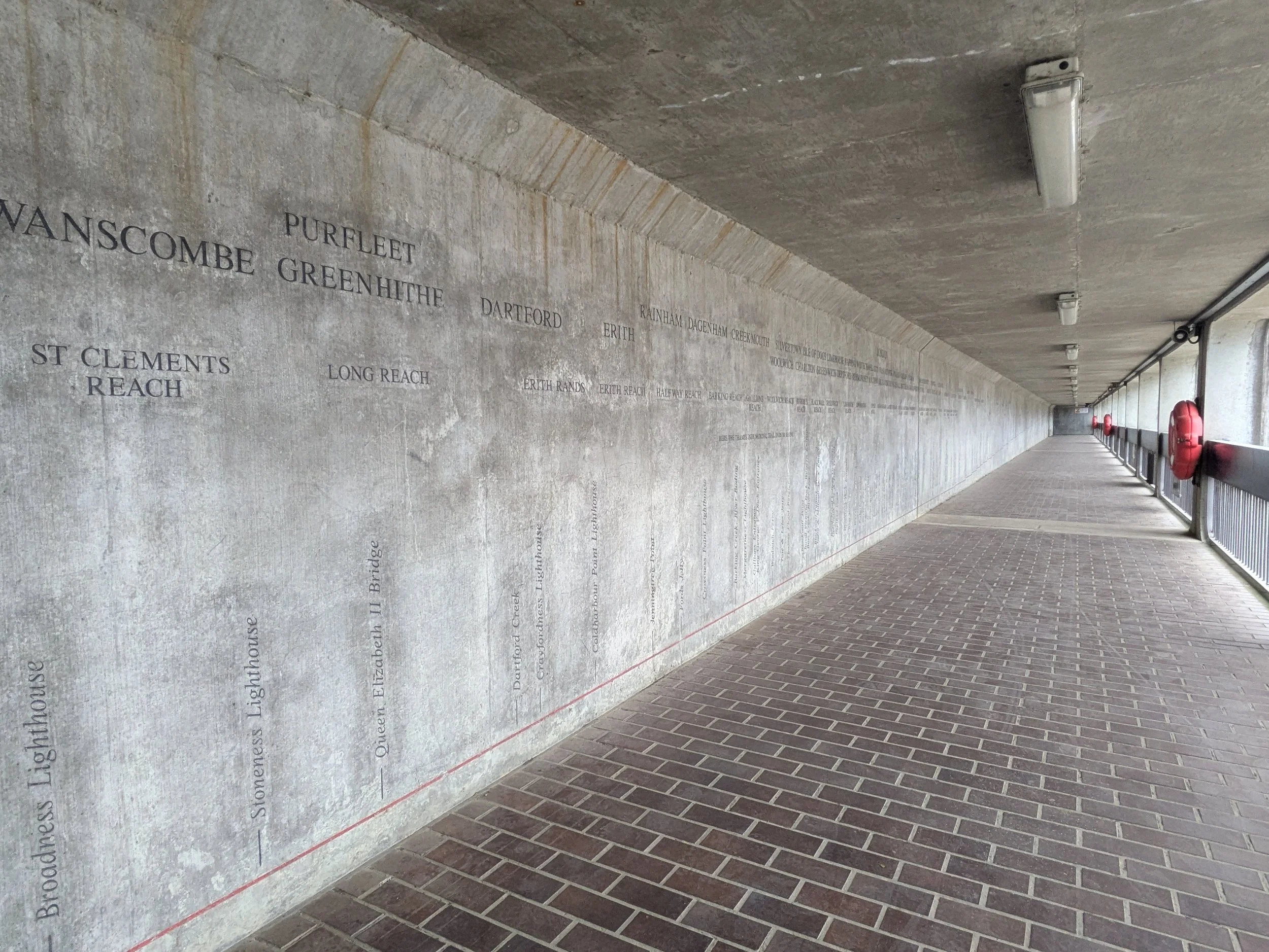


In a tunnel there is a linear map showing the elevation gain of the river Thames from sea level to Kemble, 0-105 metres over 180 miles. It’s quite mad to think I have walked all the way from Kemble to here! It is definitely more industrial out here! I can see the Tate & Lyle sugar refinery on the opposite bank.

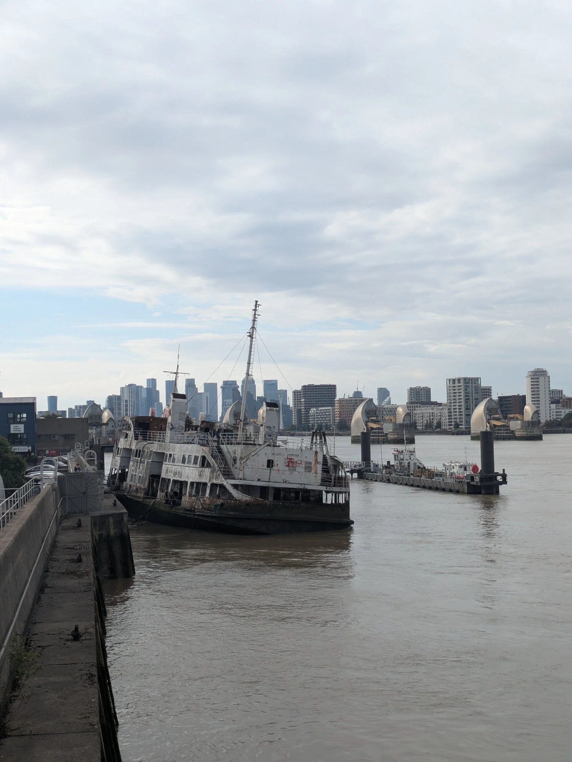
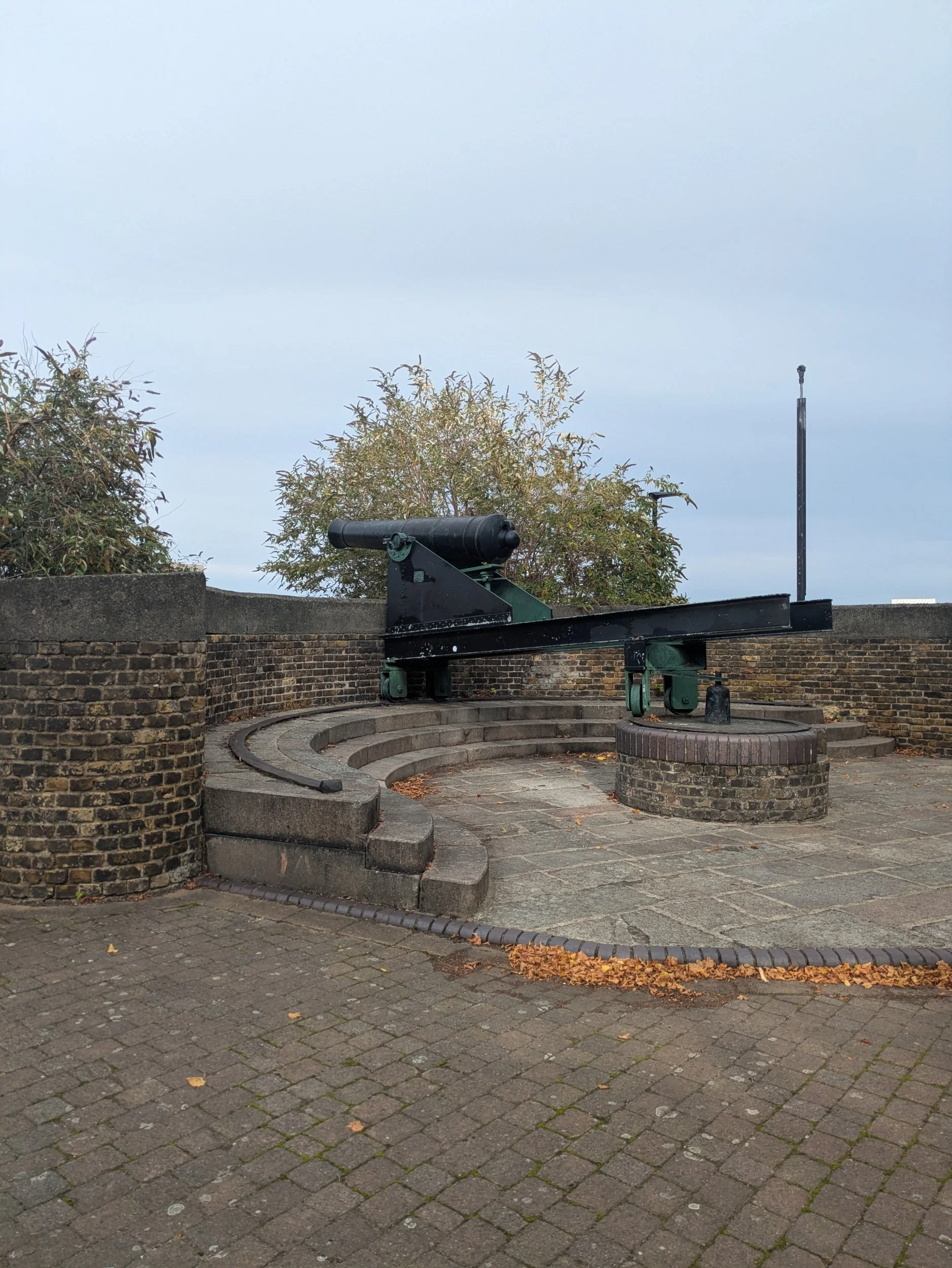

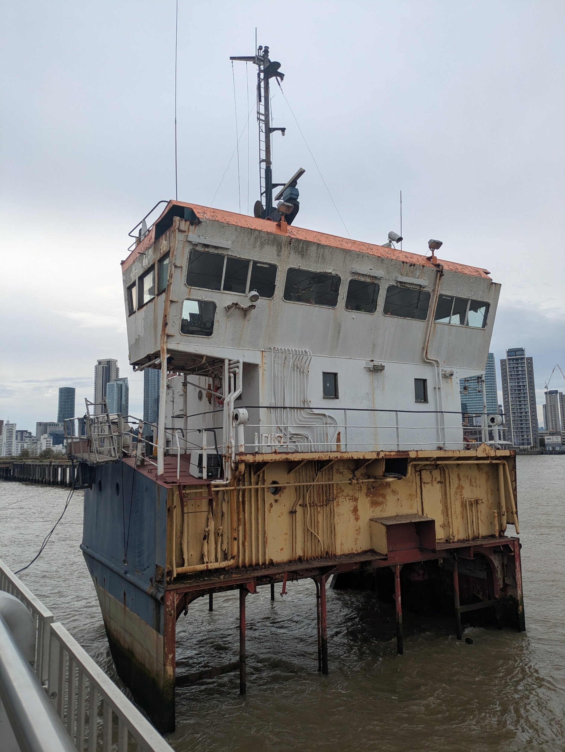
It’s a shame to see this old ship, the MV Royal Iris dumped and rotting. I continue on and pass gun emplacements, defence cannons at the former Woolwich Dockyard. I can see the Woolwich ferry in the distance, it’s not far now!
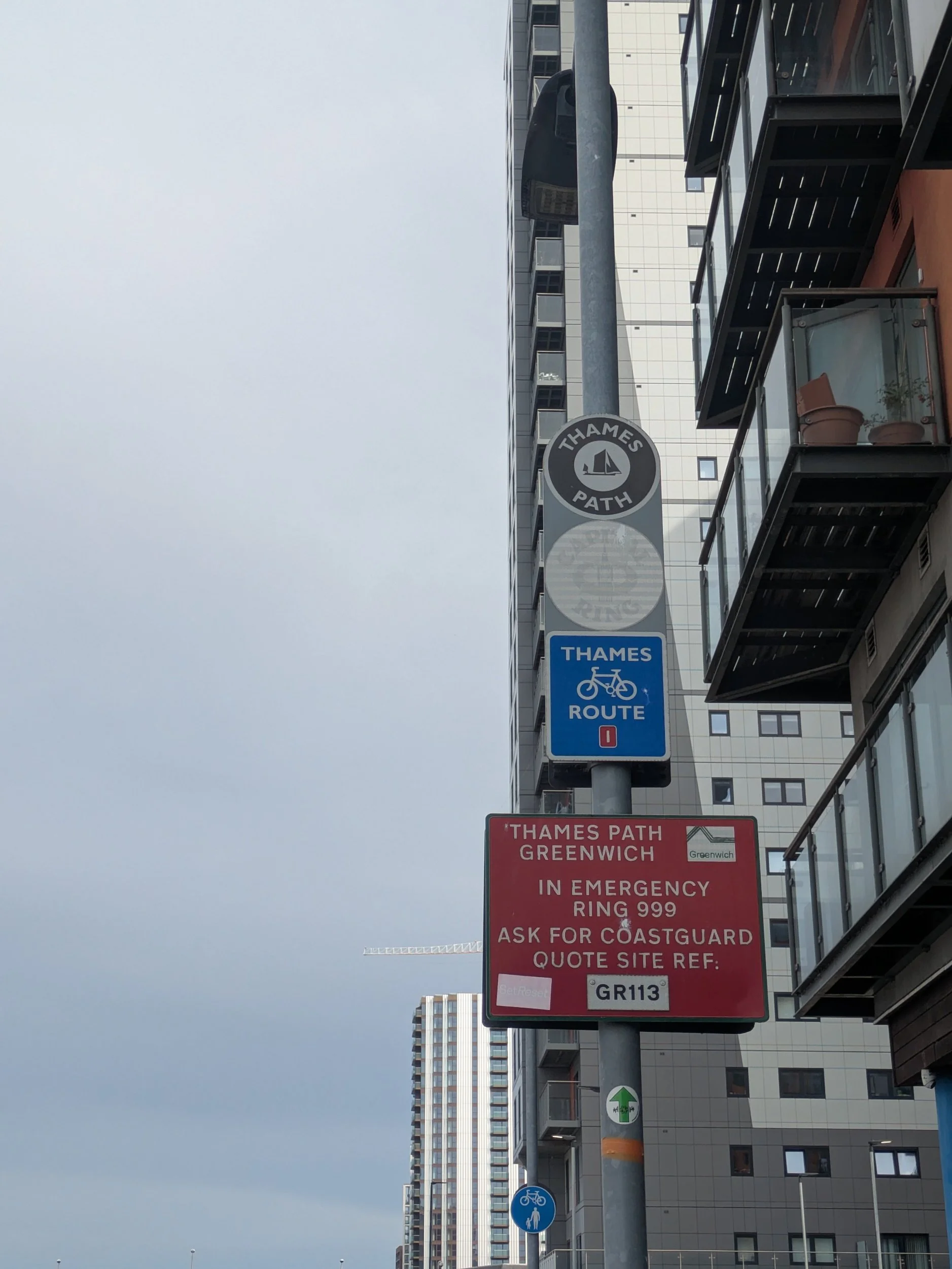

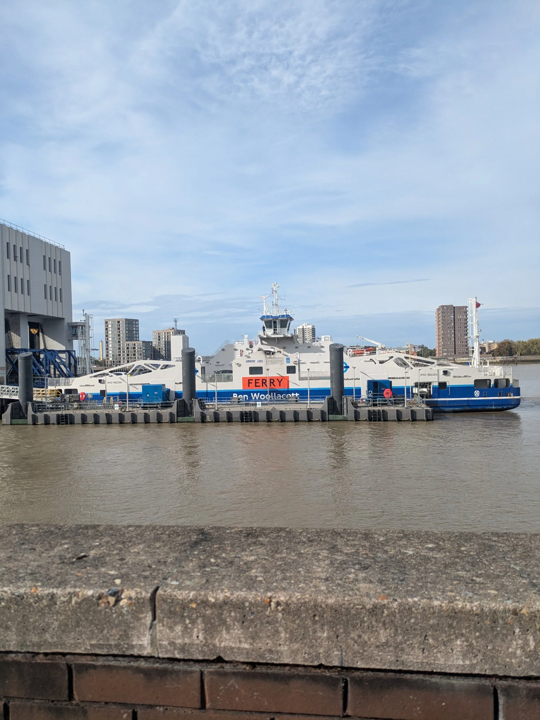

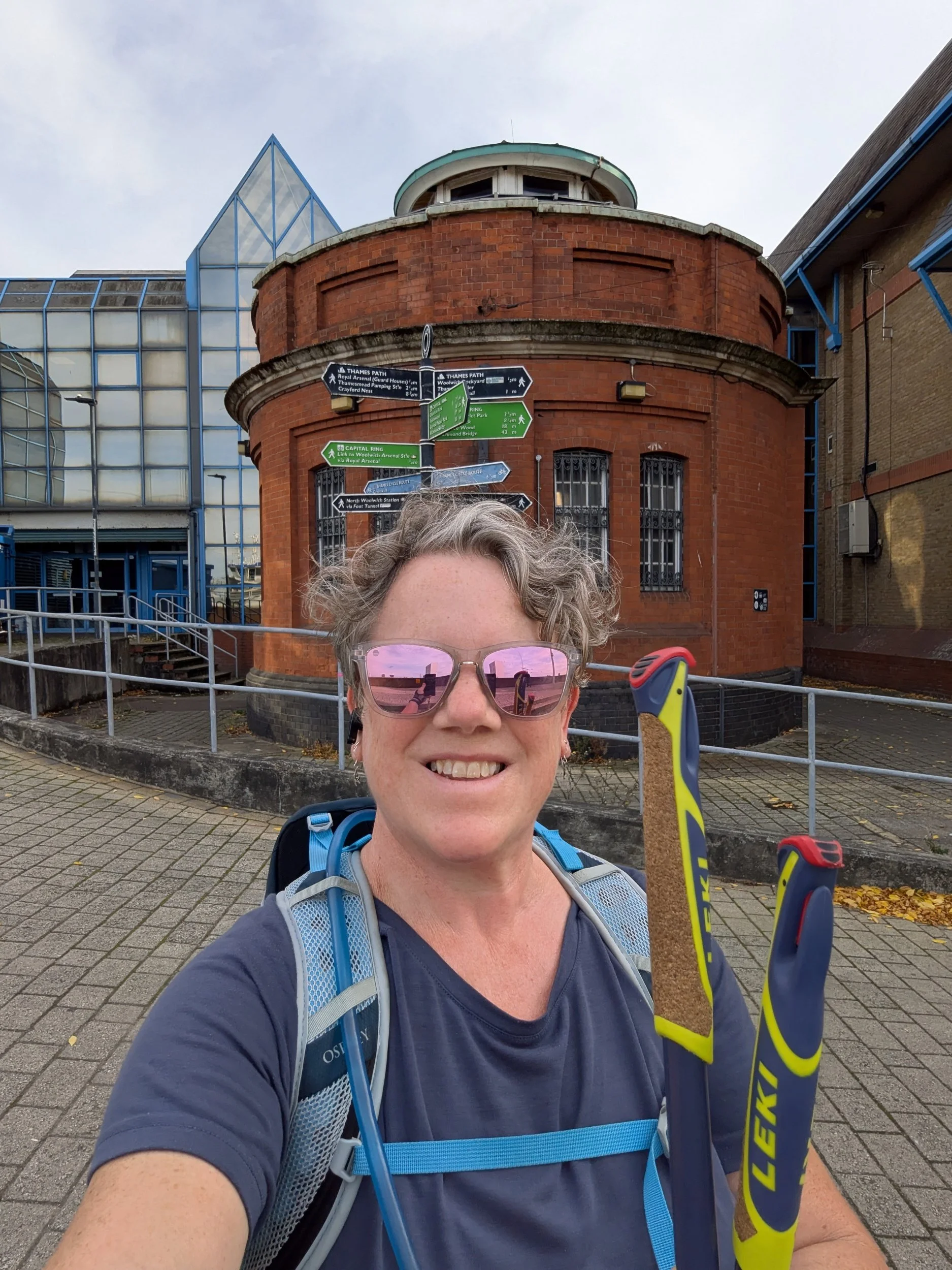
The Woolwich Ferry is a free service providing a link between Woolwich and North Woolwich run by TFL. Just before the ferry terminal here there is a great rapid charging forecourt, Glass Yard EV provides charging points for 8 vehicles. Around the corner is the official end of The Thames Path - The Woolwich Foot Tunnel was designed by Sir Maurice Fitzmaurice, who also designed the Rotherhithe Tunnel, and connects Woolwich with North Woolwich, it opened in 1912. The role of the tunnel was to provide easy access to the docks north of the river, for dockworkers who lived south of the river, it was created to operate alongside the Woolwich Ferry and is 1, 655 feet in length and 69 feet deep. The digging of the tunnel was achieved through the use of a tunnelling shield, however the excavation was done entirely by hand. The tunnelers worked day and night in eight hour shifts, managing to dig about 10 feet every 24 hours.
As I’m taking my selfie my phone starts to ring, it’s Steve. “where are you, you need to come I’m in the queue for the ferry, I texted you!” The original plan was for Steve to meet me here on foot, but he’s decided we should go on an adventure, so feeling a little bamboozled and rushed I depart for the ferry, missing jumping into the van as he has gone beyond the barrier! I embark as a foot passenger and leave the area for pedestrians to jump in the van and it’s a this point I remember I was supposed to walk 5 minutes further on to the Woolwich Works at Woolwich Arsenal to get the last stamp for my Thames Path Passport, but we are now on a ferry heading across the river, grrr, I’m not happy. To be honest it’s a bit of a rubbish end to my epic Thames Path Adventure and Norbert didn’t get a photo at the end either. But it is done, I have Nordic walked the length of the Thames Path from it’s source in Kemble to the original end at the Woolwich Foot tunnel.
According to Strava below are the totals for this entire adventure.
TOTAL MILES: 211
TOTAL STEPS: 437,592
TOTAL TIME: 68:57:59

Nordic Walking The Thames Path Leg 14: Putney Bridge to The Cutty Sark
Putney Bridge to The Cutty Sark

Leg Fourteen: Putney Bridge to The Cutty Sark
When: Friday 19th September 2025
Miles Walked: Strava says 18.37, but it was more like 16
Steps Taken: 32,786
Moving Time: 5:09:28
Elevation Gain: 108ft
Today’s planned walk was 9.25 miles from Putney Bridge to Tower Bridge and so I left the campsite with Steve (he’s going to be a tourist today) and walked to Abbey Wood Tube station, it should take just over an hour to get back to Putney Bridge Tube Station to pick up where I left off yesterday.


After a slight delay and ending up crossing over the pedestrian part of Fulham Bridge I have to double back to Putney Bridge and stop en route at The Dynamo (a cyclists café) for a comfort break, a cuppa and a croissant (toilet stops are expensive in London!) The sun is shining and the forecast is for a warm and sunny day, I’m in my shorts and vest! Once back at the bridge the path goes around St Mary the Virgin Church back towards the river, there’s a café here too, if only we had known yesterday! It’s a nicely developed area with lots of benches to enjoy the riverside view.


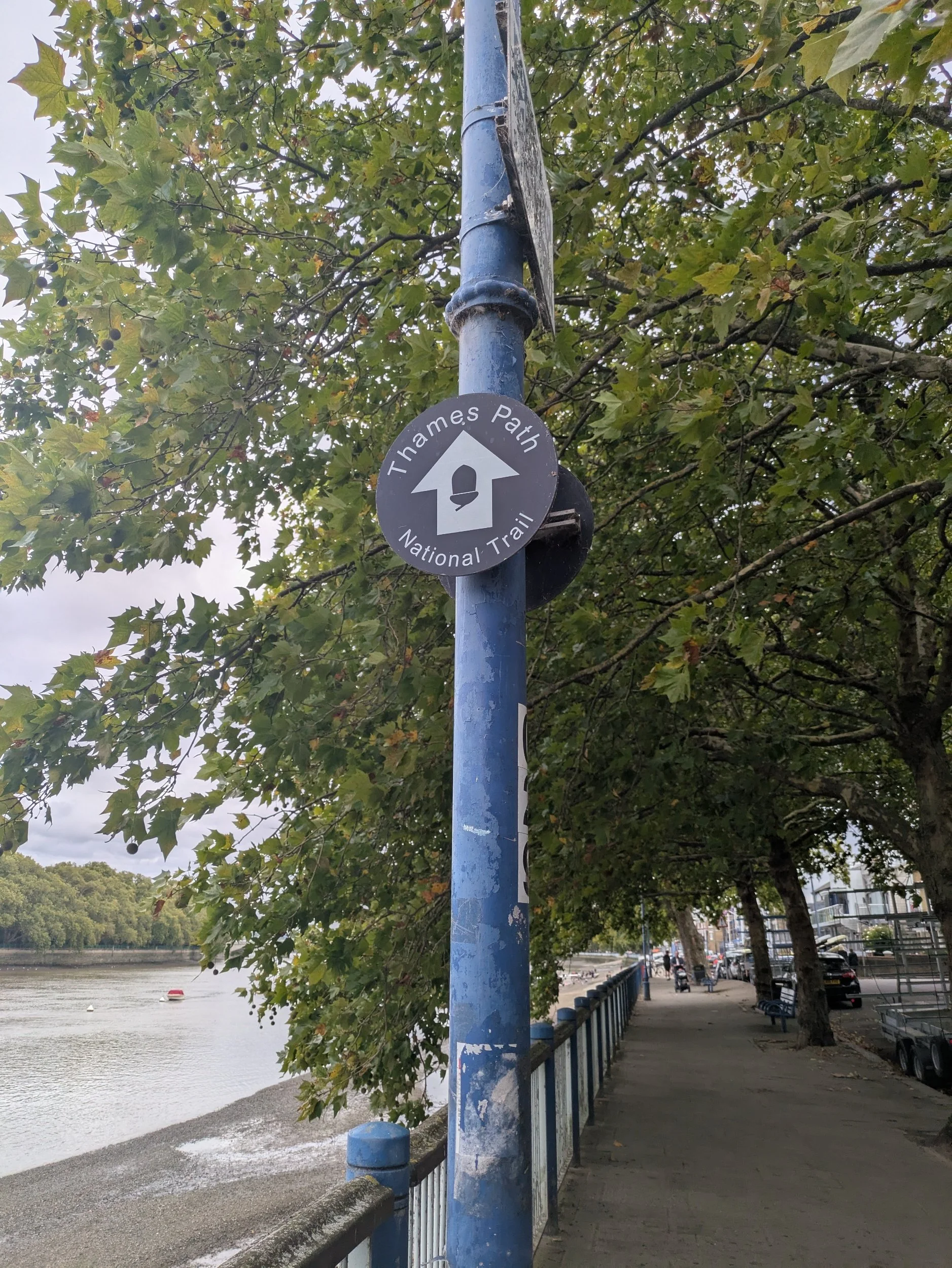
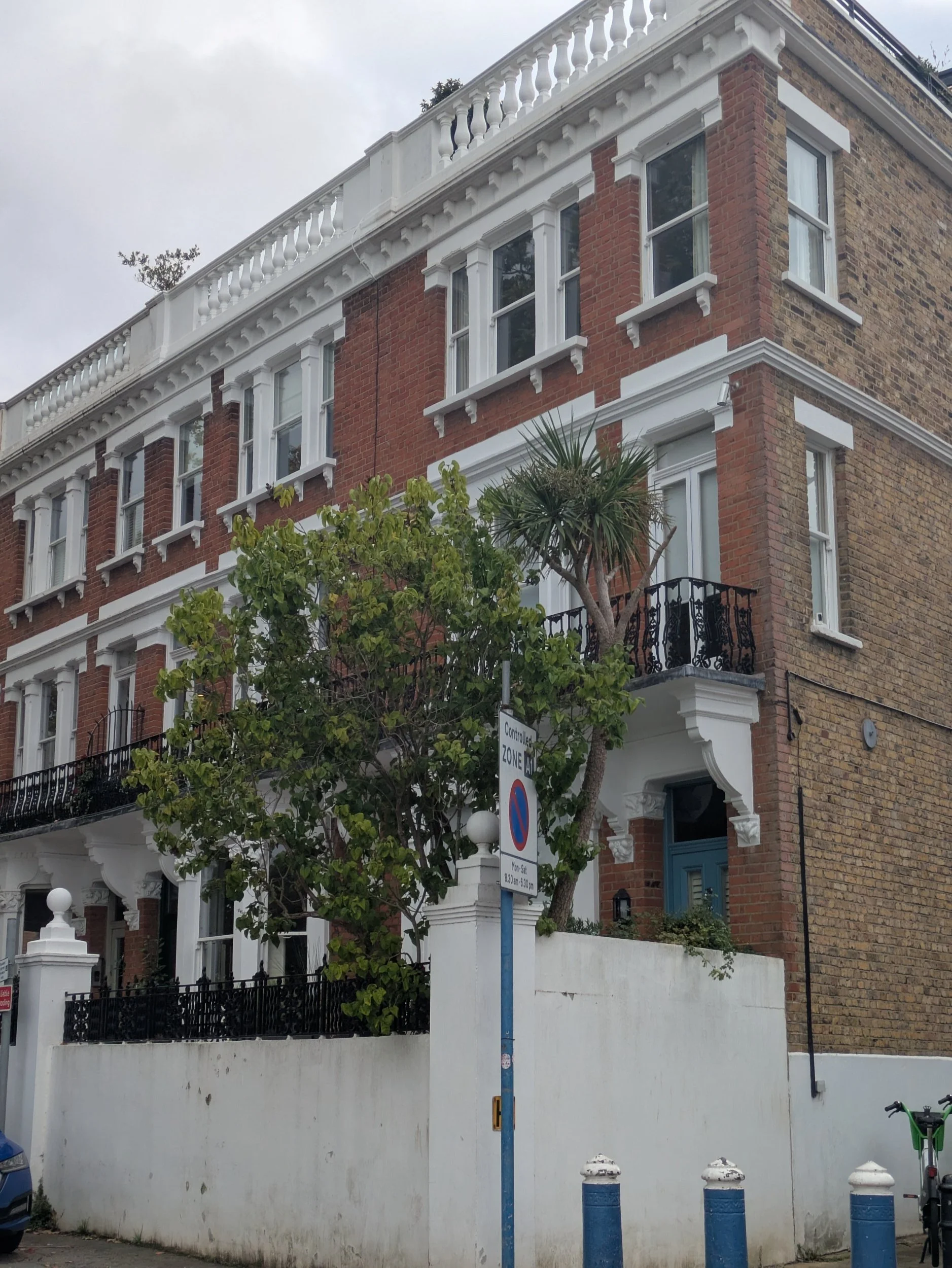
After a stretch on the riverside the path heads along a residential street where I spot this semi-detached/terraced property that looks a bit strange, I wonder did it used to continue left? I love these old Riverside Walk signs as I head through Blade Mews (someone is having a new kitchen fitted!)
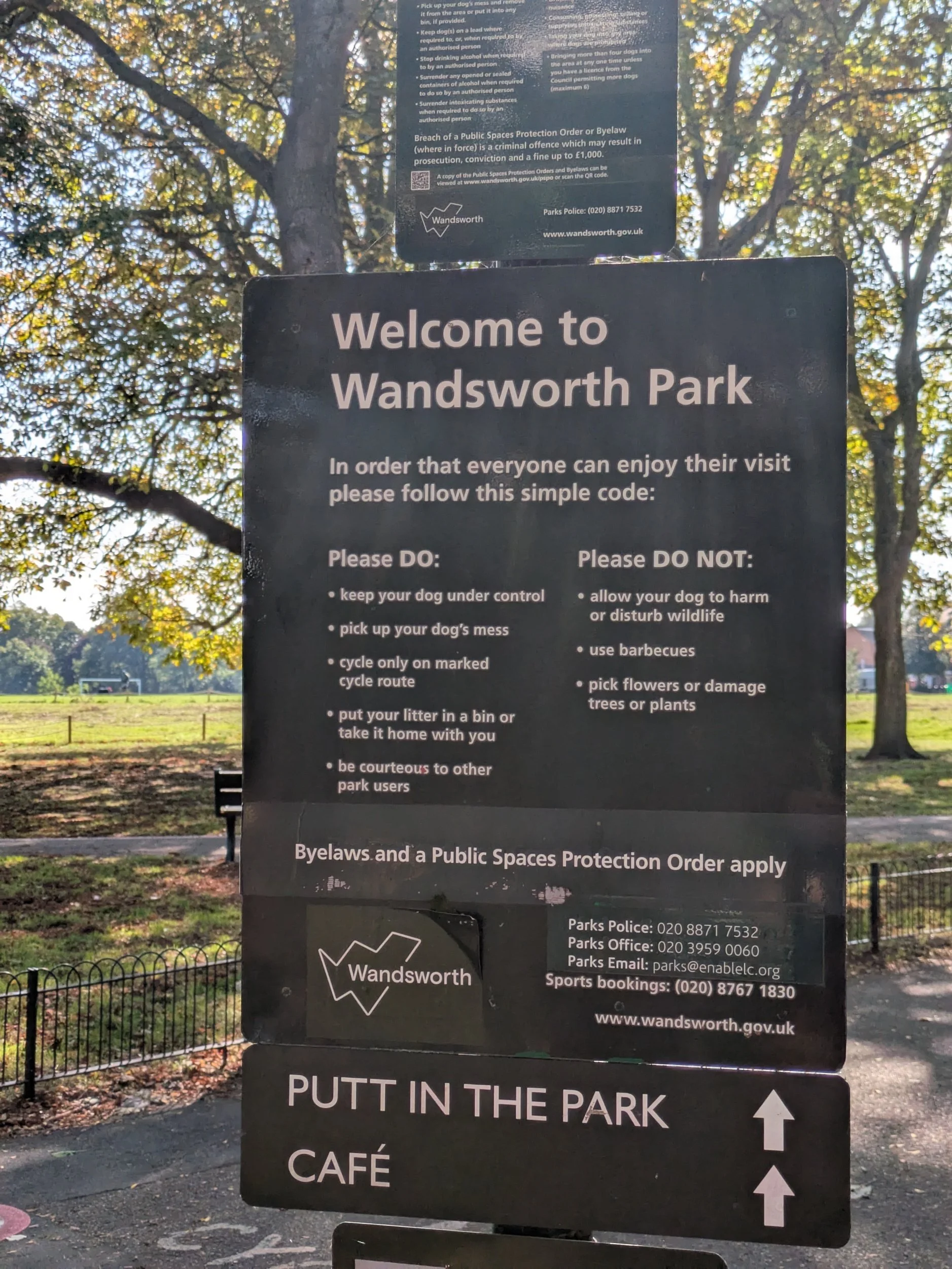

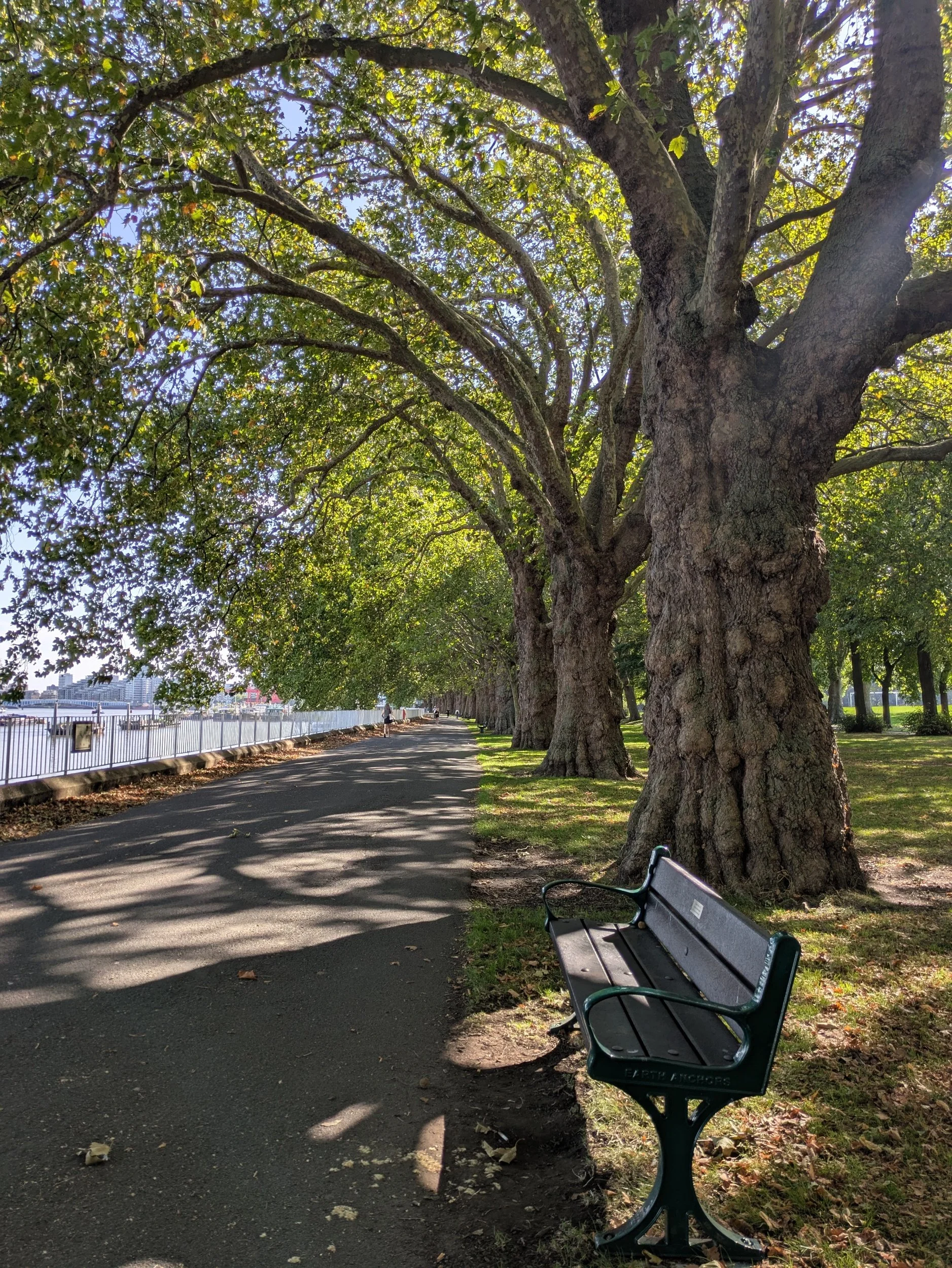
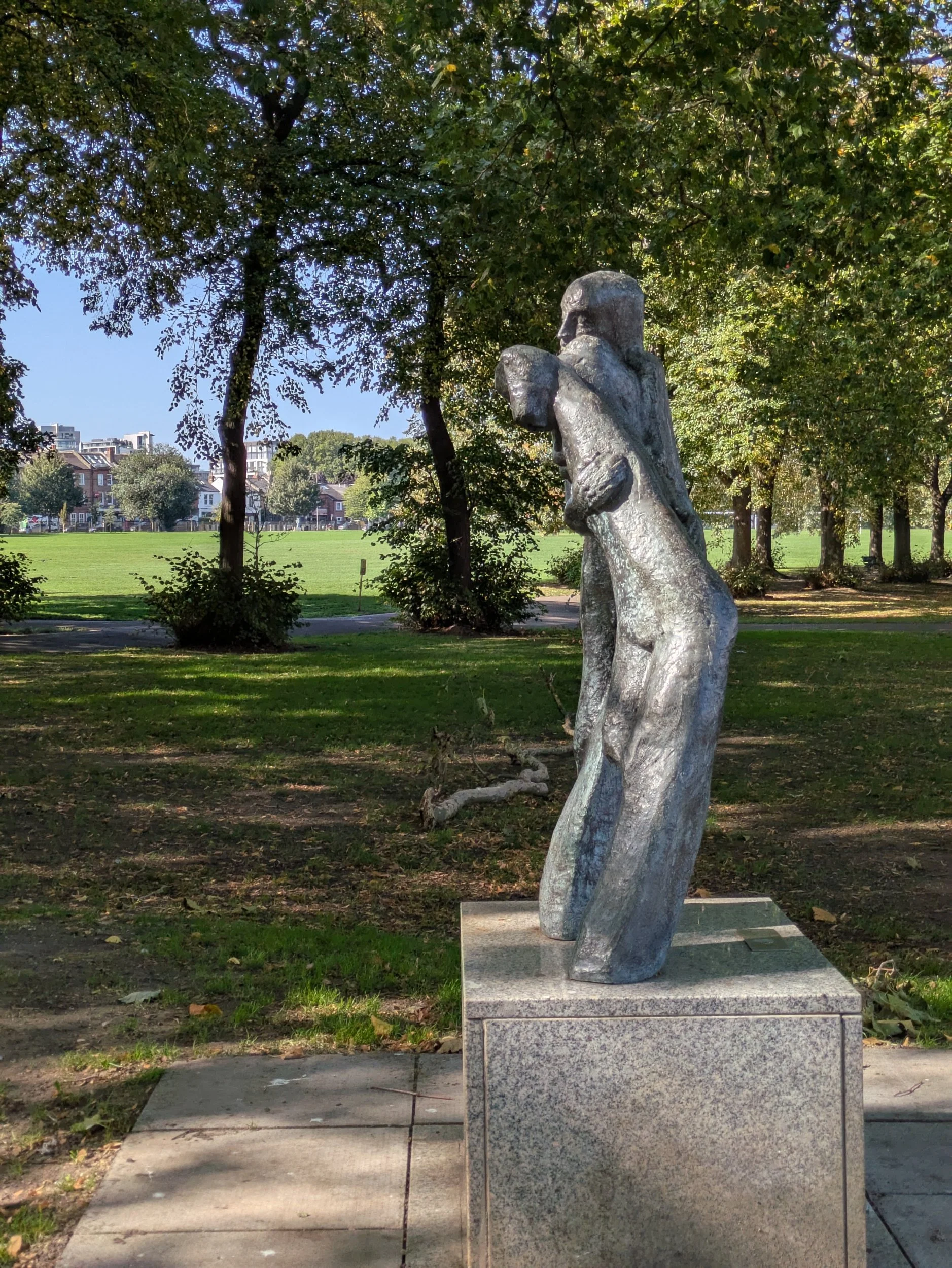

Beyond Blade Mews is Wandsworth Park, created in 1903 with its majestic avenue of over 120 year old London Plane trees which arch towards the river creating a green tunnel for me to walk through, pausing to look at various sculptures along the route. There’s also a double avenue of Lime Trees plenty of benches, mini golf, a bowling green and a café in the park and it is beautifully kept. This sculpture is entitled Pygmalion and is by Alan Thornhill.


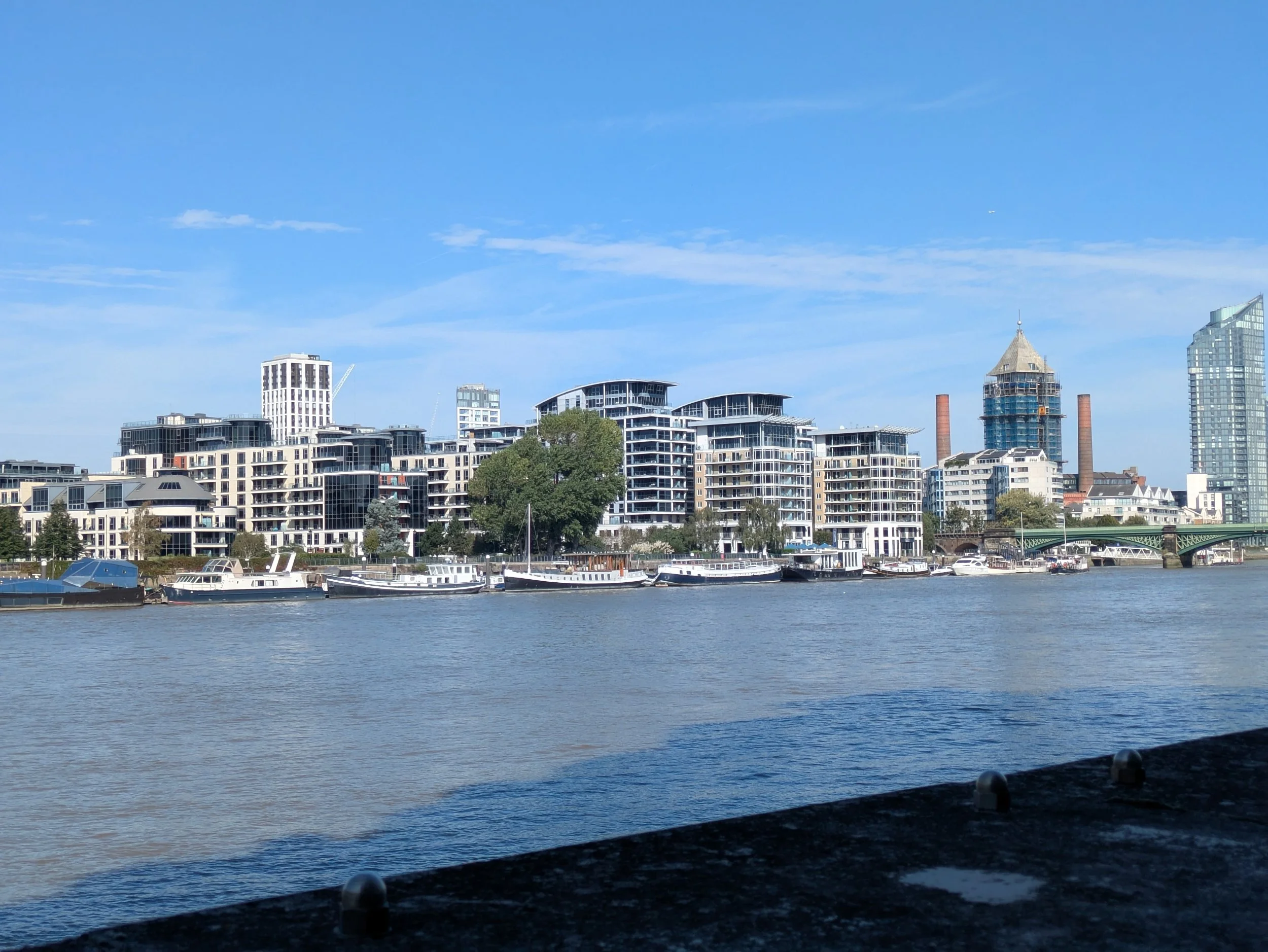
On this stretch I start passing little houseboat flotillas, some of them are huge boats! The path moves away from the riverside again through what feels like a recently renewed area , a mix of residential flats and offices. A footbridge then takes me over Bell Lane Creek, one branch of the River Wandle and the route now goes around the Western Riverside Refuse and Recycling Centre, where non-recyclable waste is compacted and carried away in barges to be burnt to generate electricity. I’m approaching Wandsworth bridge, there’s been a bridge here since 1873, the present bridge, an unadorned steel cantilever bridge designed by Sir Thomas Peirson Frank, was opened in 1940. At the time of its opening it was painted in dull shades of blue as camouflage against air raids, a colour scheme it retains. It reminds me of the blue panels they had on Gorsemoor Middle School in Ferndown back in the 1980’s! There is much more of a cityscape beyond this bridge. I’venow reached Battersea Reach an development of residential apartment buildings that all look like ships. Completed in 2019 with over half of the 13 acre site landscaped public open space and over 300 metres of new riverside walk, which I am enjoying!


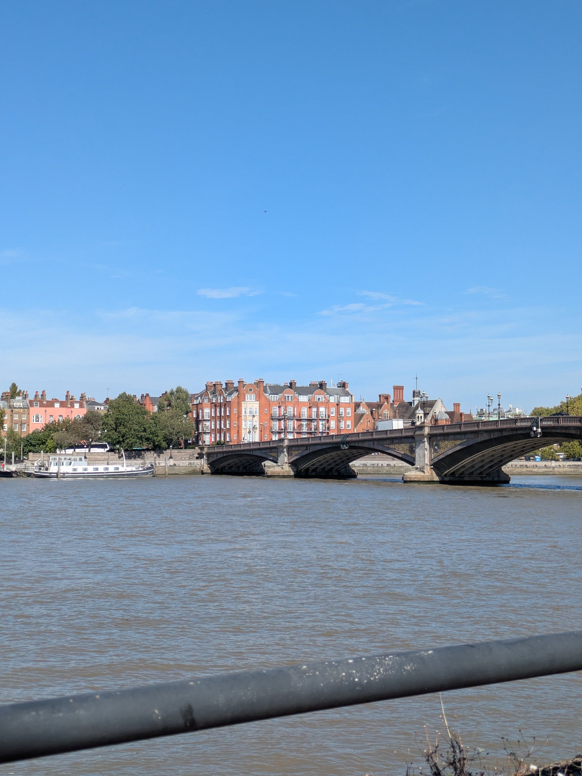
More houseboat communities on the river and more expensive looking apartment buildings across the river and I’m dodging cyclists in places! Battersea Railway bridge shades another few houseboats too. Completed in 1863 the bridge features five wrought iron arches, each spanning approximately 44 meters, and has a total length of approximately 387 meters. It is supported by brick piers faced with stone ashlar. The design includes riveted wrought iron segments, making it one of the earliest examples of a large railway bridge constructed primarily from wrought iron rather than cast iron A three-arch brick viaduct carries the line on the north side of the bridge, with one arch having been opened to provide a pedestrian route under the railway, as part of the Thames Path. On the south side are four arches, two of which are used as storage for the residents of a houseboat community moored immediately downstream, and another one of which was opened to Thames Path pedestrian traffic.
Across the river is a development known as Chelsea Harbour with it’s focal point being the 200ft Belvedere residential tower which acts as a sentinel for this 1980’s riverside village. It features a metallic pagoda-like roof and rows of metal balconies.


I’m in need of a comfort break and so am on the look-out for a café when I come across St Mary’s Church, a Georgian C of E Church open today as part of the Open House Festival. I pop in on the off-chance that they have a toilet, and they do! Once more in comfort I stop to chat to the two ladies welcoming visitors and tell them of my Thames Path Quest. This small church has a lot of history and is well worth a visit. You can have a look for yourself here. Our History - St Mary's Battersea and more about the building here Our Historic Building - St Mary's Battersea


I’m a big fan of sculpture and cities tend to have lots and London is no different, on Battersea Bridge Road I find this bronze of two parents holding their baby in the air, it’s missing a bird that originally was held by the child, but nonetheless still striking. Made by John Ravera in 1983 it is called In Town. Just a little further on is this swan, originally part of two, but I don’t remember there being another one. Another bronze from 1984 by Catharine Marr-Johnson, called Two Swans. Across the water is Crosby Moran Hall located next to the famous Cheyne Walk. Originally sited in Bishopsgate the hall was dismantled and rebuilt here in 1910, it’s a very fine example of Medieval architecture, but sadly is not open to the public.


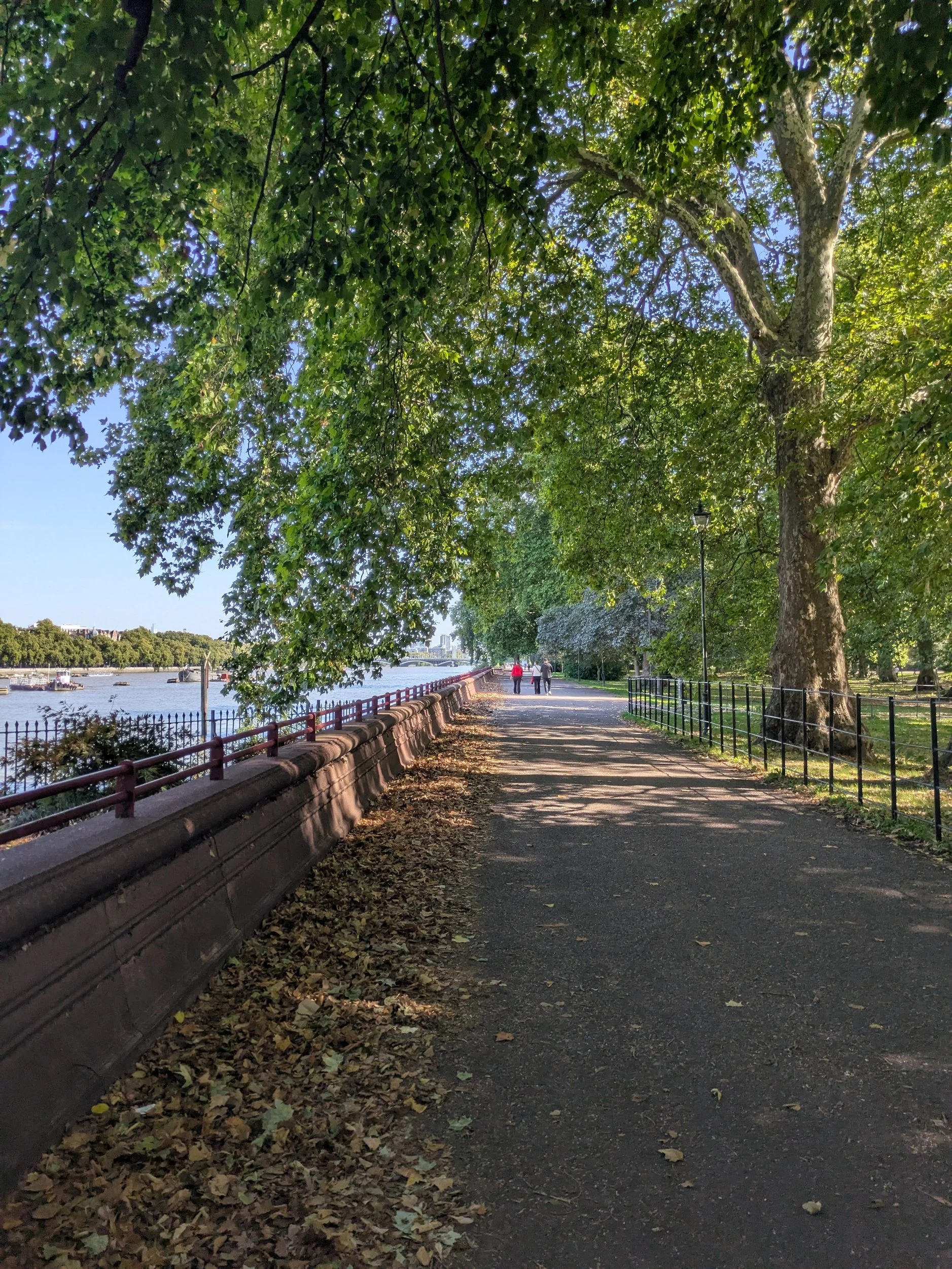


I’m approaching a very fine suspension bridge which is Albert Bridge, reputedly the prettiest bridge in London. The Albert bridge opened in 1873 to designs originally drawn up by engineer Rowland Mason Ordish, it was a combination of a suspension bridge and a cable-stayed bridge, however, this design needed strengthening in 1884 — just 11 years after it originally opened. This was overseen by Sir Joseph Bazalgette (once again), who replaced the steel cables with steel link chains. In 1973, the bridge was strengthened further, this was done through the addition of two concrete piers underneath — so it became a beam bridge too. The bridge is currently painted pink, blue and green, in an attempt to increase visibility in fog and murky light and is lit at night with halogen bulbs to stop boats colliding with it. It looks great against the bright blue sky backdrop we have today. I’ve now reached Battersea Park, a 200 acre green space originally opened in 1858 by Queen Victoria. The park is home to a small children's zoo, a boating lake, a bandstand, and all-weather outdoor sporting facilities including tennis courts, a running track and football pitches. Four West London hockey teams use the all-weather Astroturf pitches. In the centre of the park is Pump House Gallery, which is housed in a four-storey Grade II listed Victorian tower. On the western side there are two cricket pitches. The park is the site of the London Peace Pagoda, erected in 1985. A Buddhist monk looks after the pagoda on a daily basis. In 2002–4 the park underwent a £11 million refurbishment funded in part by the Heritage Lottery Fund and was re-opened on 2 June 2004 by Prince Philip. It’s obviously a popular space as it is teeming with people.
I go underneath Chelsea Bridge, officially opened in on 6 May 1937 by the Prime Minister of Canada. Chelsea Bridge is 213m long, and 20m wide. It has three spans. I think it might be one of the most decorated bridges in London with five sets of lampposts, each decorated with golden galleons; and four tall turrets at either end of the bridge. These turrets are decorated with heraldic designs: a golden galleon on top, and, on the outside, the LCC coat of arms of an English lion, St George's Cross, and wavy lines representing the Thames. On the inward south side, there's the Battersea dove of peace; on the northwest corner there's the winged bull, lion, boars' and stag of the borough of Chelsea; on the northeast corner, there's the portcullis and Tudor roses of the borough of Westminster and the whole thing is painted white with a red trim and greyish blue balustrades.


Beyond Chelsea Bridge is Grosvenor Rail Bridge with the pumping station chimney clearly in view on the opposite side of the river and now I have reached the site of the former Battersea Power Station, From the 1930s to 1980s, Battersea Power Station was a working Power Station. At its peak, it was producing a fifth of London’s power, supplying electricity to some of London’s most recognisable landmarks, such as the Houses of Parliament and Buckingham Palace. In 2007 The Power Station was upgraded to Grade II* listed status to protect it for the future. Work began in 2013 to redevelop the 42-acre site surrounding the Power Station to create a new community of homes, shops, cafes, restaurants, cultural venues and open space for London. Did you know you can visit the top of one of the 109 metre chimneys for a 360 degree view of London? This area is also buzzing with people enjoying the sunshine! Here the Thames Path leaves the river for a bit and I get a bit lost around the Rocket Padel during a charity tournament and ended up on a service road, hilariously a chap says he is following me because I look like I know where I am going, he is walking on the Thames Path to Vauxhall today. Eventually following my nose I end up back by the river on the Thames Path!
What looks like icing nozzles all lined up on a wall are apparently an example of hostile architecture, these are anti-sitting studs designed to stop homeless people sleeping here or people sitting on this ledge or even skateboarders.


I’m now approaching Vauxhall Bridge, a riveted steel deck arch bridge. Visually, this bridge stands out from other bridges of this type because of its large and very detailed statues on the piers, the work of Alfred Drury RA and Frederick Pomeroy RA. It also stands out for its vibrant, contrasted paint, the bridge's ornamental design is unique in that it is decorated with female bronze figures on either side representing the functions of local government. Looking downstream, Drury's figures represent Government, Education, Fine Art and Science/Astronomy and facing upstream Pomeroy's represent Agriculture (holding a shepherd's crook and a sheaf of corn), Architecture (holding a model of St Paul's Cathedral), Engineering (holding a very detailed steam engine and mallet) and Pottery (holding a vase/pot). It was the first bridge to carry trams across the Thames. It is thought that there has been a bridge on, or very near, this site for as long as 3500 years.
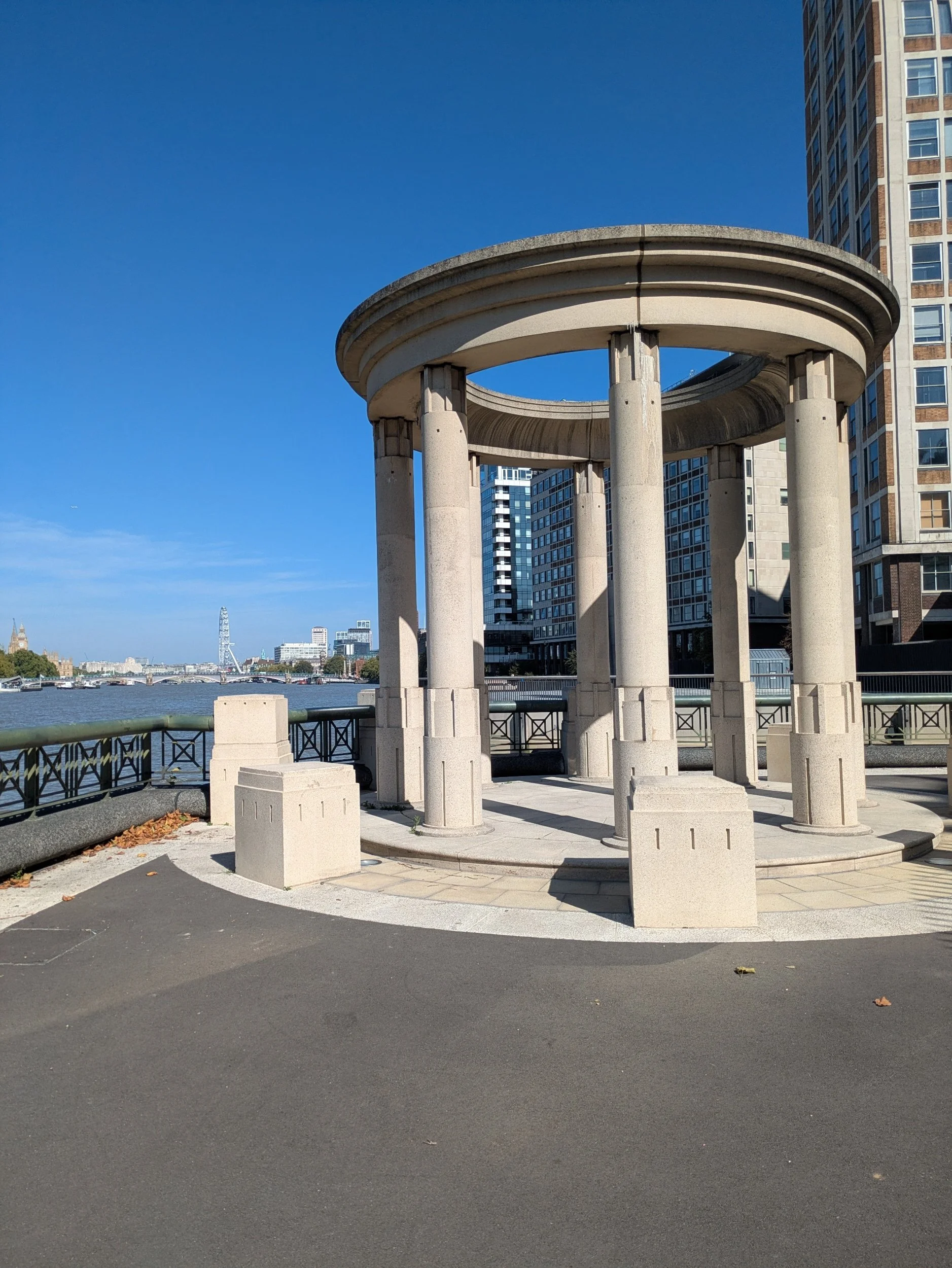
I pass the MI6 building at Vauxhall Cross where there is a small circular colonnade in the style of a classical temple this sits on a new riverside space created by the Tideway London project, Isle of Effra and Effra Quay .feature wide paved areas and seating with gorgeous ornate lamposts. In the Albert Embankment Gardens sits a sculpture to Basaveshwara, unveiled in 2015. Basaveshwara was a 12th Century Indian Philosopher, pioneer of democracy and social reformer. He spread social awareness through his poetry and rejected gender or social discrimination, superstitions and rituals, he fought for freedom of speech, respect and tolerance. Sadly his attempts to abolish the discriminatory Caste system in India has never happened.


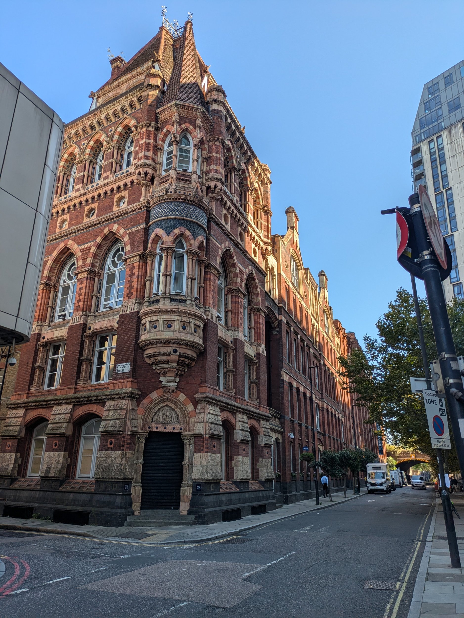

Across the road I spot some interesting benches and wooden arches. These were installed in 2009 to mark the location of the site of White Hart Dock, which can be traced back to the 14th century. The dock supplied nearby Doulton Pottery factories with clay right up until new clean air regulations came into force in 1956 and the pottery works transferred to Staffordshire. The beautifully ornate Southbank House, a 5-storey red brick building just down Black Prince Road is the former Royal Doulton offices, a listed building retaining many of its original features including decorative tiles and ornate finishes, it is the only remaining building from what was a huge site in the 1870’s.
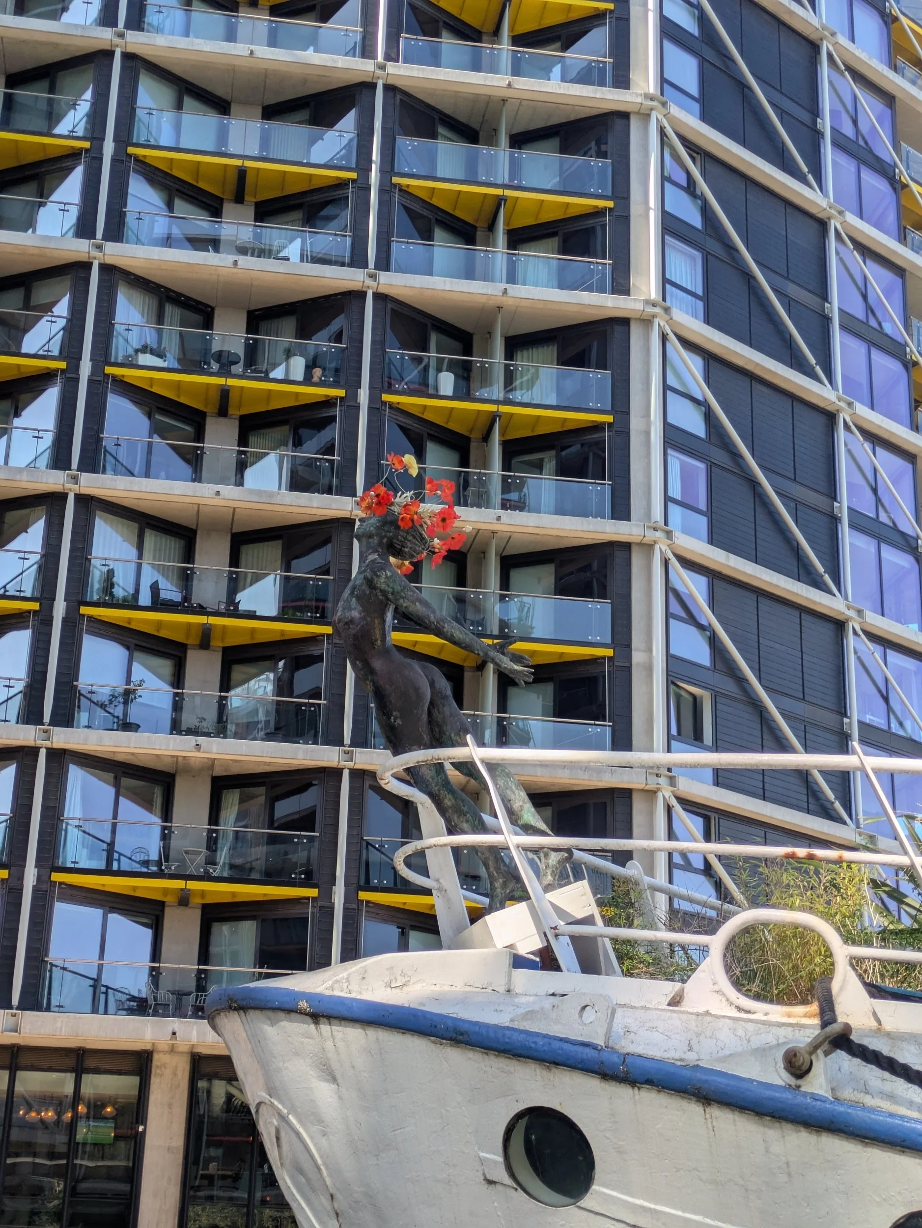
Further along the road I pass this building with a ship poking out of its frontage! The building belongs to the International Maritime Organization and the ship is a memorial to those who have died at sea. The ship wasn’t there when the building was constructed in the early 1980’s, but was installed in 2001 and represents the bow of a cargo ship with a lone seafarer standing up on the front of the deck.


I’m now approaching Lambeth Bridge, the present bridge, opened in 1932, has five spans and is of steel construction, but there has been a crossing point here since the 1500’s. The Horseferry was used up until 1750 when Westminster Bridge opened. Lambeth finally got it’s own suspension bridge in 1862, but its condition deteriorated quickly and it had to be closed to vehicular traffic in 1910. World War 1 delayed construction of a new bridge, but finally got underway in 1924.
On this side of the river is Lambeth Palace, which stands on the opposite bank of the River Thames from the Palace of Westminster, has been the London residence of the Archbishops of Canterbury for almost 800 years. It has evolved over that period, with styles of architecture that range from medieval to 21st century. The palace has been the scene of various political and religious events of national importance.
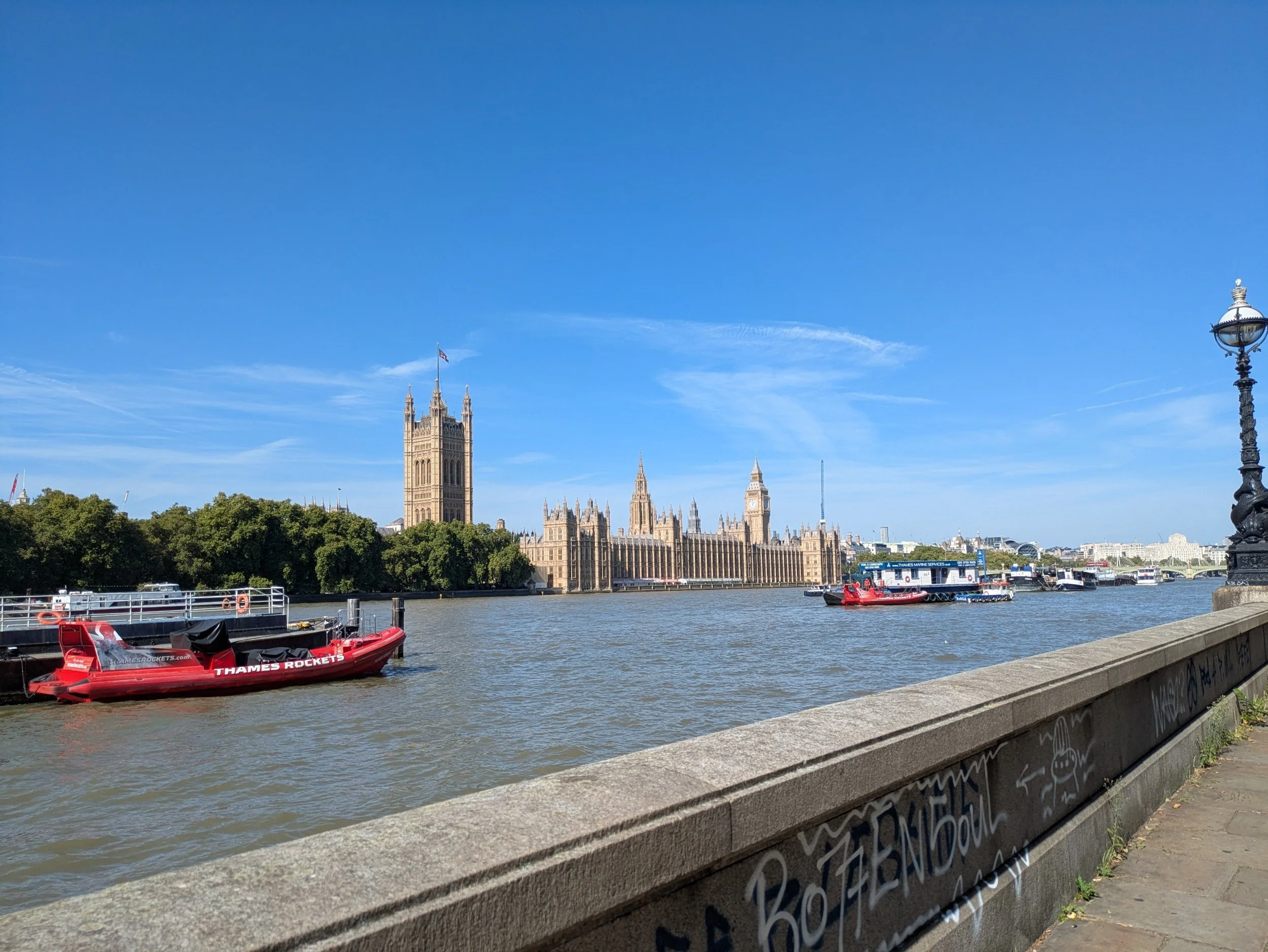
The Houses of Parliament are looking resplendent in the autumnal sunshine. The first royal palace at the site of Westminster was built in around 1045 by Edward the Confessor, at the same time as Westminster Abbey, and throughout the medieval period functioned as the principle residence of England’s monarchs. The various administrative bodies of the day also met at Westminster during this time, including the Anglo-Saxon Witenagemot and the medieval Curia Regis, however it was in the 16th century that it became their permanent home. Following a fire in 1512 that destroyed the royal apartments, Henry VIII moved the royal family out of the Palace of Westminster and into the newly-purchased Palace of Whitehall, leaving his old residence to Parliament and the royal law courts.
Infamously the Houses of Parliament were also almost blown up by Guy Fawkes during the failed Gunpowder Plot of 1605. They survived however, until in 1834 the entire complex went up in flames, with only Westminster Hall, the Jewel Tower, Cloisters, Undercroft Chapel, and Chapter House of St Stephens surviving. Following which the Houses of Parliament were rebuilt by Sir Charles Barry and Augustus Pugin in the magnificent form they remain today. The iconic clock tower largely known as ‘Big Ben‘ was built during this time, and has swiftly become one of London’s most recognisable symbols. Today the Houses of Parliament remain the seat of the UK Parliament who conduct regular sessions there.
I also walk past the sobering sight of the National Covid Memorial Wall, created in 2021 as a visual representation of the UK's catastrophic loss to Covid-19. The Wall stretches for 500 metres alongside the River Thames, directly opposite the Houses of Parliament. There are more than 240,000 individually hand-painted red hearts, each representing a person who died in the UK with Covid-19 as a direct cause of death. Many of the hearts on the Wall have been personalised with individual messages written either by the bereaved or by the volunteers who are there every week, maintaining this unique memorial. The original hearts were drawn with art pens, which have faded with the London weather, so each heart on the entire Wall has been repainted with long-lasting masonry paint by the Friends of the Wall team. They continue to add new hearts for those who are still dying from the Covid-19 virus.


The first Westminster Bridge was built between 1739-1750 by Swiss architect Charles Labelye, making it one of the oldest bridges across River Thames in central London. It was a much-needed connection point between Westminster on the west bank and Lambeth on the east bank. However, due to structural issues over time, it had to be replaced. The present-day stone bridge we see today was designed by Thomas Page and opened on May 24th 1862 – Queen Victoria’s birthday – symbolising yet another milestone in Victorian engineering prowess. With seven arches spanning over 250 meters, this Gothic-styled bridge quickly became an integral part of everyday life in London.
I meet Steve in a little cafe just off Westminster Bridge for an expensive sandwich, I’m pretty sure this used to be a Pret, annoyingly no toilet! After our lunch we carry on walking down the Queen’s Walk past the Paddington Bear experience and I leave him outside the Shrek’s Adventure and carry on towards the London Eye. At an overall height of 135 metres, the London Eye originated as an entry in 1993 to a competition for a new landmark to commemorate the millennium in London. Construction began in 1998, and the wheel was put together over the river, in a horizontal position, before being pulled upright. It was ceremonially opened by Prime Minister Tony Blair on December 31, 1999. Originally scheduled to be dismantled after five years, it was kept in place because of continued popularity. The wheel itself has a diameter of 120 metres and is connected to its hub by 64 cables that function much like the spokes of a bicycle wheel. Mounted on the wheel are 32 ovoid cabins that carry the passengers, their number corresponds to the 32 boroughs that constitute Greater London. Each capsule has a capacity of 25 passengers and rests on motorized mounts that function in such a way that the capsule remains upright as the wheel turns. The wheel moves so slowly—two revolutions per hour—that it need not stop for boarding or disembarkation of passengers.


It is busy on the South Bank on this warm September Friday, it’s almost impossible to Nordic walk through the crowds and I end up just carrying my poles on this stretch. Now on Jubilee Walk (1977) I pass the National Theatre with a statue commemorating the actor Laurence Olivier, the yellow steps of the Southbank Centre with a heavily graffitied skate park underneath, a living statue drawing a crowd, an old fashioned horse carousel in full swing and an area of huts (bit like a Christmas market) where I stop to look at earrings and buy myself a pair. The sculpture is called Jubilee Oracle by Alexander (1980), there’s a big crowd watching a man squeezing himself into an impossibly small box too, weird!


Outside the National Theatre there is another sculpture, originally created for the Festival of Britain in 1951, a bronze cast of the original plaster sculpture by Frank Dobson entitled ‘London Pride’ Placed here in 1987.
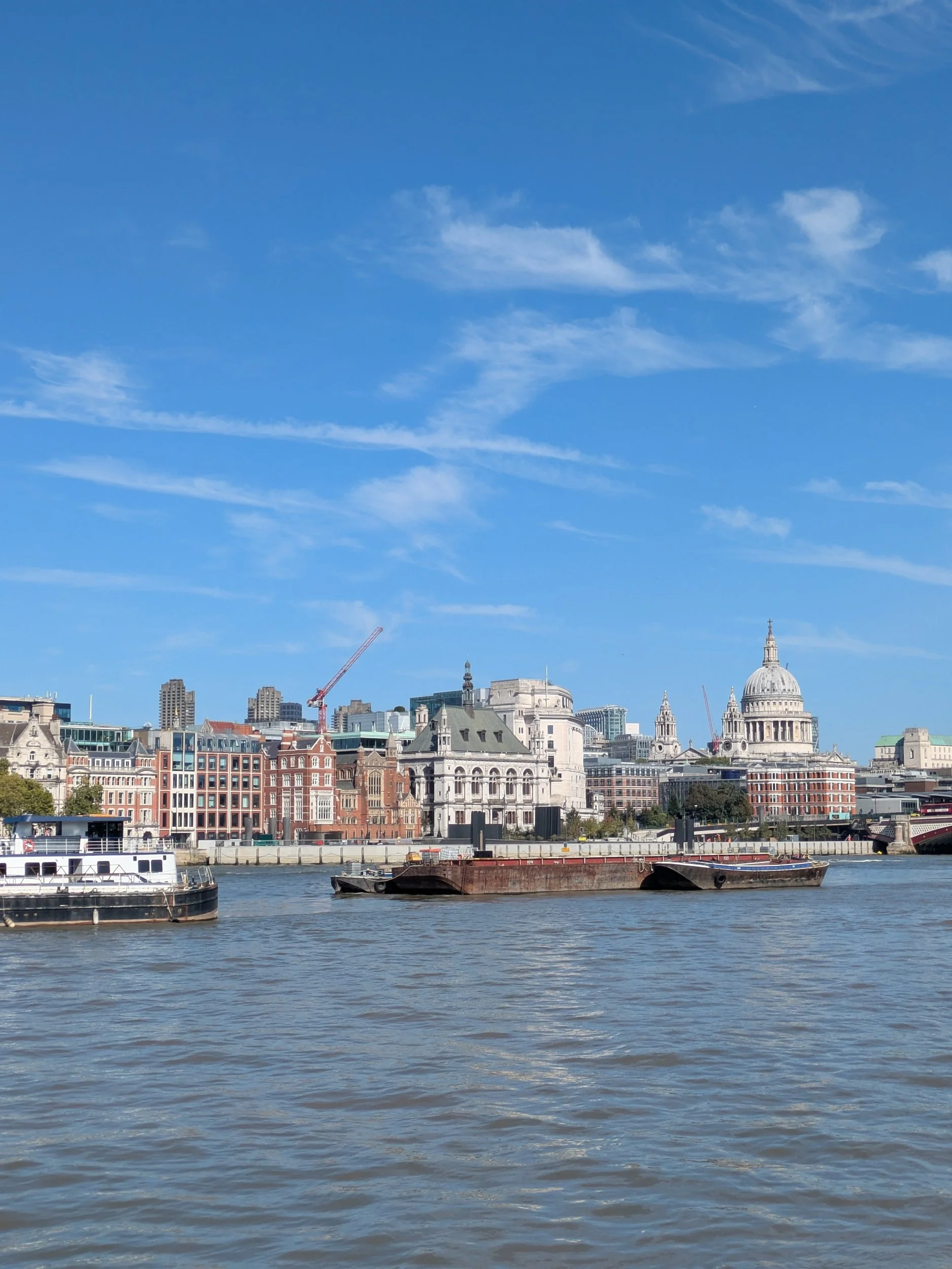
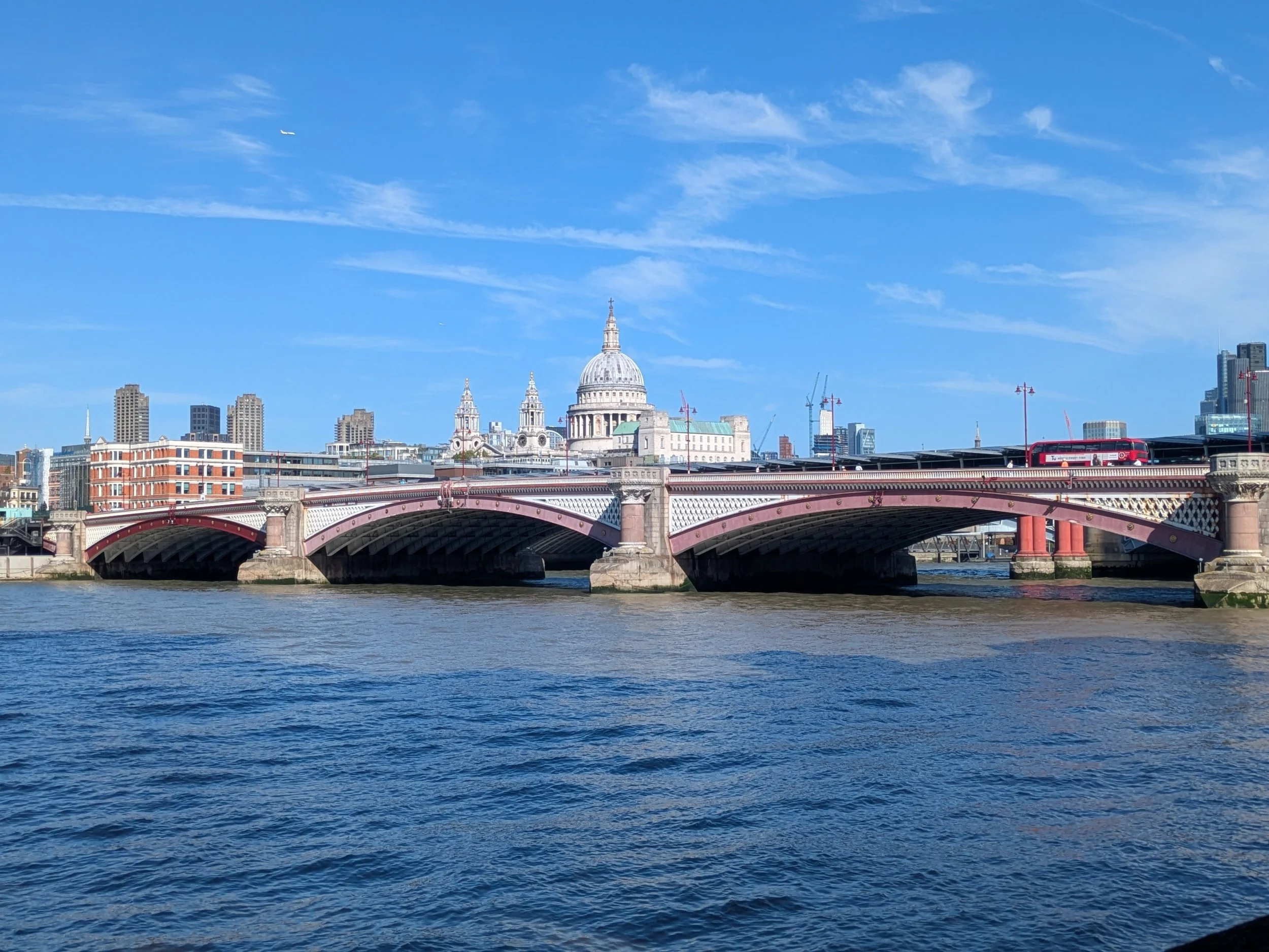
I can now see Blackfriars Bridge ahead. The present bridge which on 6 November 1869 was opened by Queen Victoria is 281 m long, consisting of five wrought iron arches built to a design by Joseph Cubitt. Cubitt also designed the adjacent rail bridge (now demolished) and it was a condition that the spans and piers of the two bridges be aligned. They have left the red pillars of the old rail bridge in the river as well as this highly decorative London, Chatham, and Dover Railway sign. Across the river I can see St Paul’s and lots of London’s landmark skyscrapers.


This is probably one of the most well-known stretches of the River Thames in London, I’m now passing Tate Modern, The Globe Theatre and The Millennium Bridge which is a steel suspension bridge for pedestrians crossing the River Thames. Construction began in 1998, and it initially opened on 10 June 2000. Londoners nicknamed it the "Wobbly Bridge" and even the "Wibbly Wobbly" after pedestrians experienced an alarming swaying motion on its opening day. The bridge was closed later that day and, after two days of limited access, it was closed again for almost two years so that modifications and repairs could be made to keep the bridge stable and stop the swaying motion. It reopened in February 2002,
I pass a harpist in a subway as the Thames Path passes the ruins of Winchester Palace, from the street you can see the remains of the great hall of Winchester Palace, built in the early 13th century as the London house of the Bishops of Winchester. The remains include the striking rose window which adorns the west gable. Most of the palace was destroyed by fire in 1814.


The Thames Path passes by The Golden Hinde, a full-size reconstruction of the famous Elizabethan galleon, captained by Sir Francis Drake, the first English ship to circumnavigate the globe. I pop into the shop at Southwark Cathedral to get a stamp for my Thames Path Passport and on my way to Queen’s Walk pass this interesting mosaic. a figure of ‘St Olave, King of Norway’ in black and gold, also by Frank Dobson, this art-deco building used by a hospital stands on the site of St Olave’s Church. Here the Thames Path follows The Queen’s Walk passing Hays Galleria, originally Hay’s Wharf, established in the 17th century. The site was originally purchased by Alexander Hay in 1651, who repurposed it from a brewhouse into a pipe-boring and shipping yard, it has transformed into a vibrant destination featuring retail shops, restaurants, public art, and offices, it has an impressive glass roof!


Passing HMS Belfast, now 9 floors of ship to visit and explore! In May 1971 after 32 years of service during which she had steamed over half a million miles she was destined for the scrap yard, but help was at hand, as the Imperial War Museum had been looking into preserving a second world war Cruise, a Trust was formed by one of HMS Belfast former Captains, now Rear Admiral Sir Morgan Morgan-Giles. who succeeded in bringing her to London where she opened up to visitors on Trafalgar Day 21st October 1971.
I can now clearly see Tower Bridge approaching, such a landmark on the River Thames, I ran over it when I ran The London Marathon in 2014! Tower Bridge was completed in 1894, it’s known for its unique bascule design and you can have a tour transporting you to Victorian London, telling the story of the city’s defining landmark from the very beginning. You can also watch city life unfold in panorama from its high-level Walkway and Glass Floor. There are lots of people stopping to take selfie’s with the bridge, myself included! On the opposite bank proudly stands the Tower of London, The Tower of London was built in the 1070s by William the Conqueror. As protector of the Crown Jewels, home of the Yeomen Warders and its legendary guardians, the ravens, the Tower now attracts over three million visitors a year. Throughout history, the Tower has also been a visible symbol of awe and fear. Kings and queens imprisoned their rivals and enemies within its walls. As the most secure castle in the land, the Tower guarded royal possessions and even the royal family in times of war and rebellion. But for 500 years monarchs also used the Tower as a surprisingly luxurious palace.


Beyond Tower Bridge the crowds dissipate and it feels much more peaceful beside the river. I pass through St Saviour’s Dock an area notorious for pirates in the 18th century. Stranded cargoes were vulnerable to attack and if caught the pirates were hung at the mouth of this dock. I cross over a hydraulic cable stay swing bridge installed in 1995 to connect up the Thames Path. There are some impressive apartment blocks along here including New Concordia Wharf, originally a cornmill and warehouse.


Around the corner I happen upon a group of sculptures known as ‘Dr Salter’s Daydream’. Ada and Alfred Salter were legendary and beloved in Bermondsey, their lives were marred by a great personal tragedy, in 1910 their only child, Joyce, aged 8, died from scarlet fever. This is the story the sculptor Diane Gorvin reflects on in this ensemble. In his old age Alfred sits imagining Ada, Joyce and her cat as they once were, in happier days long gone by. You can read more about their fascinating story here. Dr Salter's Daydream: A Moving Set Of Statues In Bermondsey - Living London History

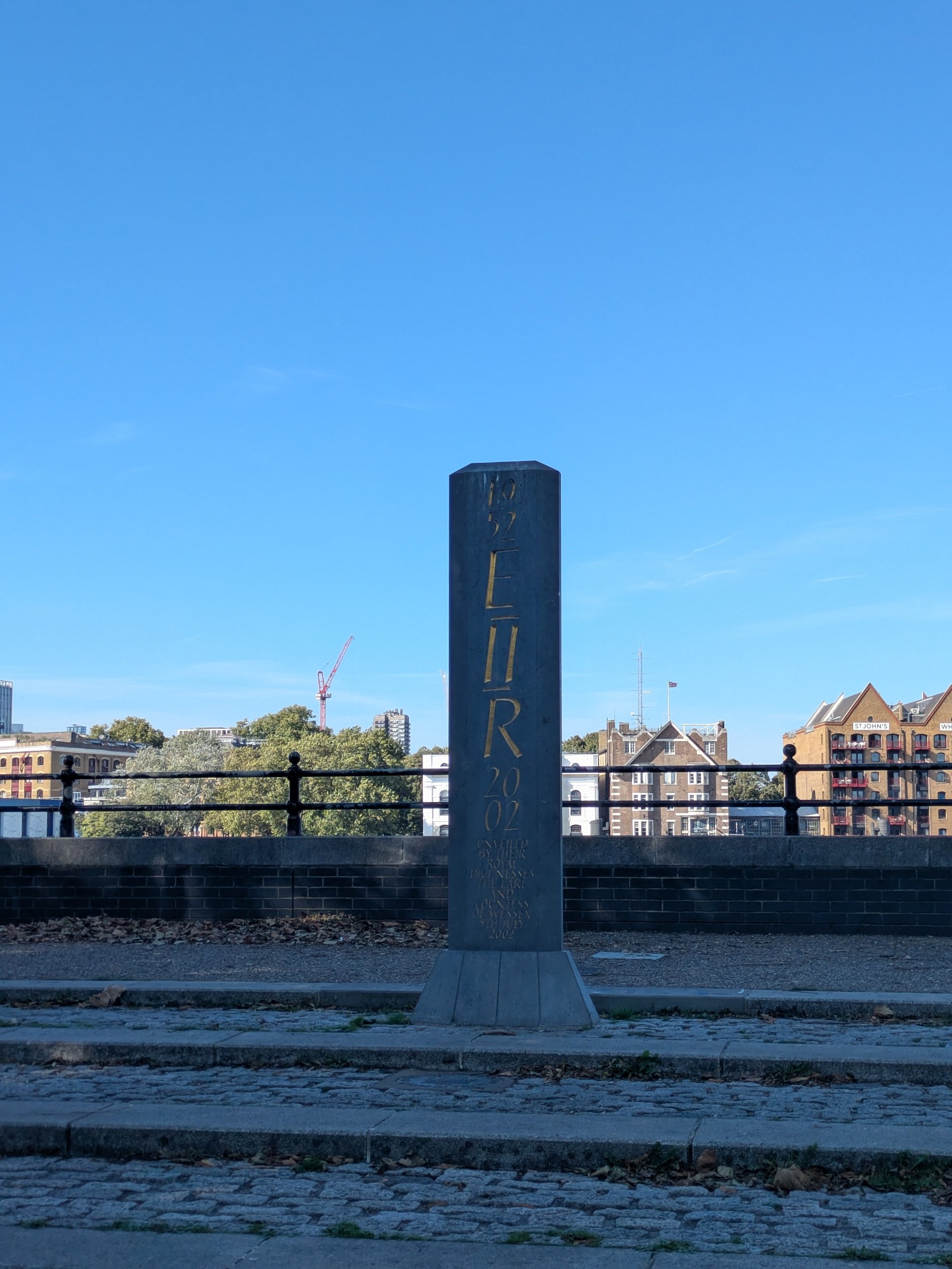


This next stretch is full of charm and interesting bits and bobs, starting with the Grade II listed The Angel Rotherhithe an early 19th century pub and round the corner in King’s Stair Gardens there’s a memorial celebrating Queen Elizabeth II’s Golden Jubilee, unveiled in 2002. Rotherhithe Street has balconies across the street and was once the thoroughfare of a centre of a major shipbuilding, apparently it’s the longest street in London.
There’s a beautiful church in Rotherhithe, St Mary’s Church. Christians have worshipped on this site for at least 1000 years. The present parish church, replacing a 12th century building, was completed in 1716. Designed by John James, an associate of Sir Christopher Wren, it has a homely grandeur with deep roots in the maritime history of Britain. The links with the ‘Mayflower’, with the Pilgrim Fathers, and with Prince Lee Boo of Pelau, are particularly treasured. I stop at The Mayflower Pub to get another stamp in my passport and use their facilities, it’s the oldest pub on the River Thames in London. It is a traditional English pub surrounded by cobbled streets, the outside decked jetty and cosy candlelit restaurant have stunning river views. At low tide you can spot the original 1620 mooring point of the Pilgrim Father’s Mayflower ship.

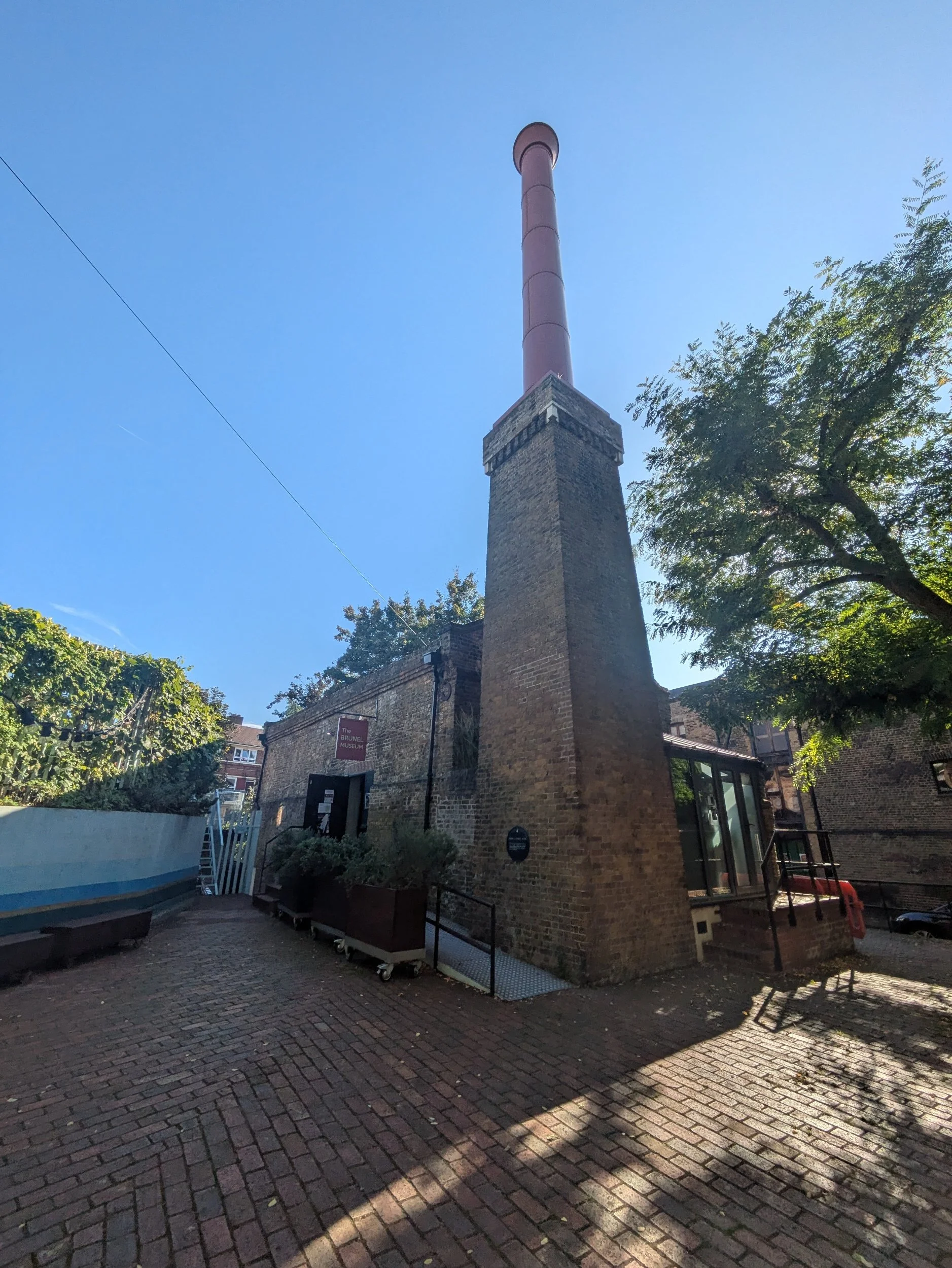


Across the way from The Mayflower Pub is The Brunel Museum, which is an educational charity and tells the story of one of the world’s great engineering dynasties. Brunel organised the world’s first underground concert party here in 1827, and the Museum celebrates and interprets music and theatre as well as engineering. I pop in to pick up another stamp and a cold drink as it’s still really warm! The Mayflower roots are strong here and around another corner there is Cumberland Wharf, a small park with circular seating areas and plenty of trees. Below is Rotherhithe Beach. In the corner is a statue of a boy dressed in 1930s attire, his dog and a pilgrim father. This makes sense, as it is close to this spot that the Mayflower set sail for Southampton, on September 16, 1620, before heading to the New World. The statue depicts the ghost of a Pilgrim Father, William Bradford, then Governor of the New Plymouth Colony, looking in horror over the boy's shoulder at what has happened within the New World, since his death. Peter McLean is a local artist who was commissioned to create the piece in 1991, by the London Dockland Development Corporation.
The shiny red bridge is a Scherzer bascule bridge, no longer operational and it is truly massive! As I am walking next to the river I can enjoy the river traffic as well as the street scenery. A Union Jack speedboat has just sped past! There was also a group of guys in sea kayaks out for a slightly more serene paddle!

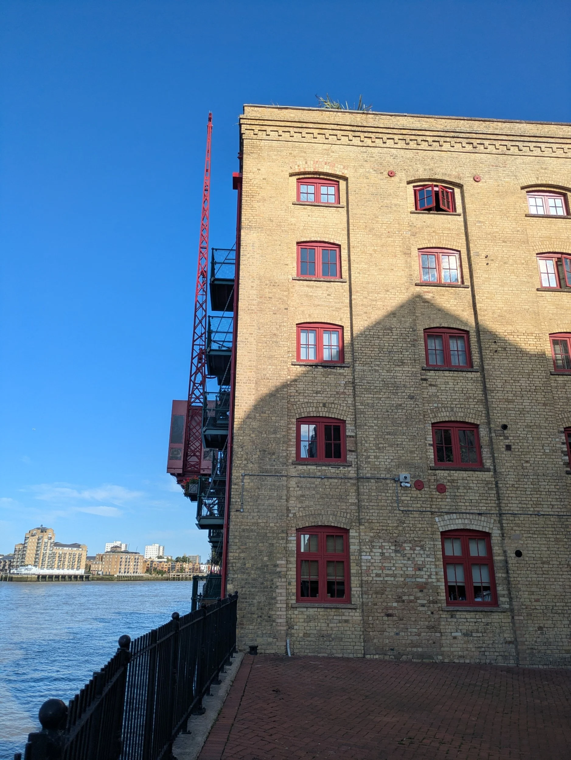


I’m enjoying this stretch of the Jubilee Greenway, a 60km long route linking all of the major London 2012 Olympic sites, and marking the Diamond Jubilee of Queen Elizabeth II. I love all the converted warehouses along here too. Globe Wharf (red windows) was once a rice warehouse and was built over 160 years ago. The Thames Path weaves in and around these old warehouses and where newer houses have been built there are gorgeous tree-lined streets for me to walk through. I can see Canary Wharf in the distance on the opposite bank.


I come across a large stone obelisk at Pageant’s Wharf. It is square and pointed at the top, standing in front of modern housing, there is no inscription on the obelisk and there is no explanatory plaque nearby. A mystery that needs further research! Unfortunately, the story isn’t particularly interesting. The master-plan for Canary Wharf Estate – on the Isle of Dogs – was laid out on a symmetrical axis, running through Canary Wharf Tower. If the line of that axis is extended westwards, across the Thames, it passes through the point where the stone obelisk stands. Pageant Stairs are modern concrete steps on the site of the old river stairs, named after a site on the east side with the name Pageant’s Wharf that was in use until the 1970s. Barratt Homes built the steps as part of their housing development Pageant Crescent in the 1990’s.


I have now reached Surrey Docks Farm, a working city farm and charity that enables the whole community to learn about farming, food production and the natural environment, they run a range of educational projects targeted to engage those who would benefit most. Here there is a café - The Barn and I pop my head around the half shut door to discover they have literally just closed, however the staff take pity on me and let me buy an ice-cream! I’ve never had a Black Coconut ice-cream before and wonder two things as I eat it, what makes it black and will it turn my mouth black? So I discover the black is added ash (weird) and I don’t think it did turn my mouth black. It was delicious by the way, I sat on a bench by the animal sculptures overlooking the Thames in the late afternoon sunshine! The animal sculptures commemorate the Farms relocation in 1986, when the animals were herded from the first site at Greenland Dock and led along the river to their new permeant home.
In Helsinki Square I pause to ponder this unusual sculpture, ‘Curlicue’ by William Pye. A steel tubular structure placed here in 1989.


The sun is shining over the moored boats in Greenland Dock, an eclectic mix of boats reside within the oldest wet dock in London. I pass this steel sculpture, mounted on a dolphin (the mooring structure underneath) on the end of some of the rods are red disks which form lines around the globular structure marking out the route of Sir Francis Drake’s circumnavigation voyage in 1577-1580. Stephen Lewis and Chris Marshall created this in 1998. Further on as I walk towards Deptford I pass several cannons and a National Cycle Network marker telling me it is 110 miles to Oxford and 115 miles to Dover. The Thames Path leaves the riverside for a bit now. I pass through a park where there is an energetic game of basketball on the multi-court and several dog walkers stretching their pooches legs.


Passing through the courtyard of the popular Dog & Bell Pub with this great Guinness mural painted on its side, it’s busy with punters enjoying the warm late afternoon sunshine. It is now just 3/4 of a mile to Greenwich which is coming as a relief to be honest! After walking through Twinkle Park with a lovely wildlife pond and leaving by the wrong exit, retracing my steps to find the correct one (not really sure if I was meant to walk through there at all). I pass by a very grand looking tableaux sculpture featuring Peter the Great, this was unveiled in 2001 and commemorates the Tsars visit to Deptford in 1698. Created by Mihail Chemiakin, it was gift from Russia. Back on the riverside once more I can now see The Cutty Sark in the distance, not far now!


It’s weird to think that the River Thames is tidal, I pass an area of the river that is clearly displaying currents and waves are lapping on the wall. I pass by another very ship like apartment block and turn the corner to see the Cutty Sark in all her glory, I am not unfamiliar with this area and have visited the Cutty Sark a few years ago now. I’m meeting Steve here somewhere hopefully. It is buzzing with people and there is a street food market and a street entertainer singing away. I spot Steve sitting on a wall. Phew that was a long, but very enjoyable day! There is just shy of 6 miles left to Nordic Walk tomorrow. Steve and I get a cheeky Chippy Tea from a chip shop in Greenwich before heading back to Abbey Wood to the campsite together.

Nordic Walking The Thames Path Leg Thirteen: Kingston-upon-Thames to Putney Bridge
Kingston-upon-Thames to Putney Bridge
Leg Thirteen: Kingston-upon-Thames to Putney Bridge
When: Thursday 18th September 2025
Miles Walked: 15.58
Steps Taken: 34,118
Moving Time: 5:13:22
Elevation Gain: 120 ft
Today I am walking from Kingston-upon-Thames to Putney Bridge and I am not alone! One of my best friends is joining me on this leg, Lorna and I have been friends since we were eleven years old, we’ve been through a lot of lifes ups and downs together and the last time she joined me on a leg of a walk in 2020 it absolutely poured with rain, so I am hoping for a better weather day today!


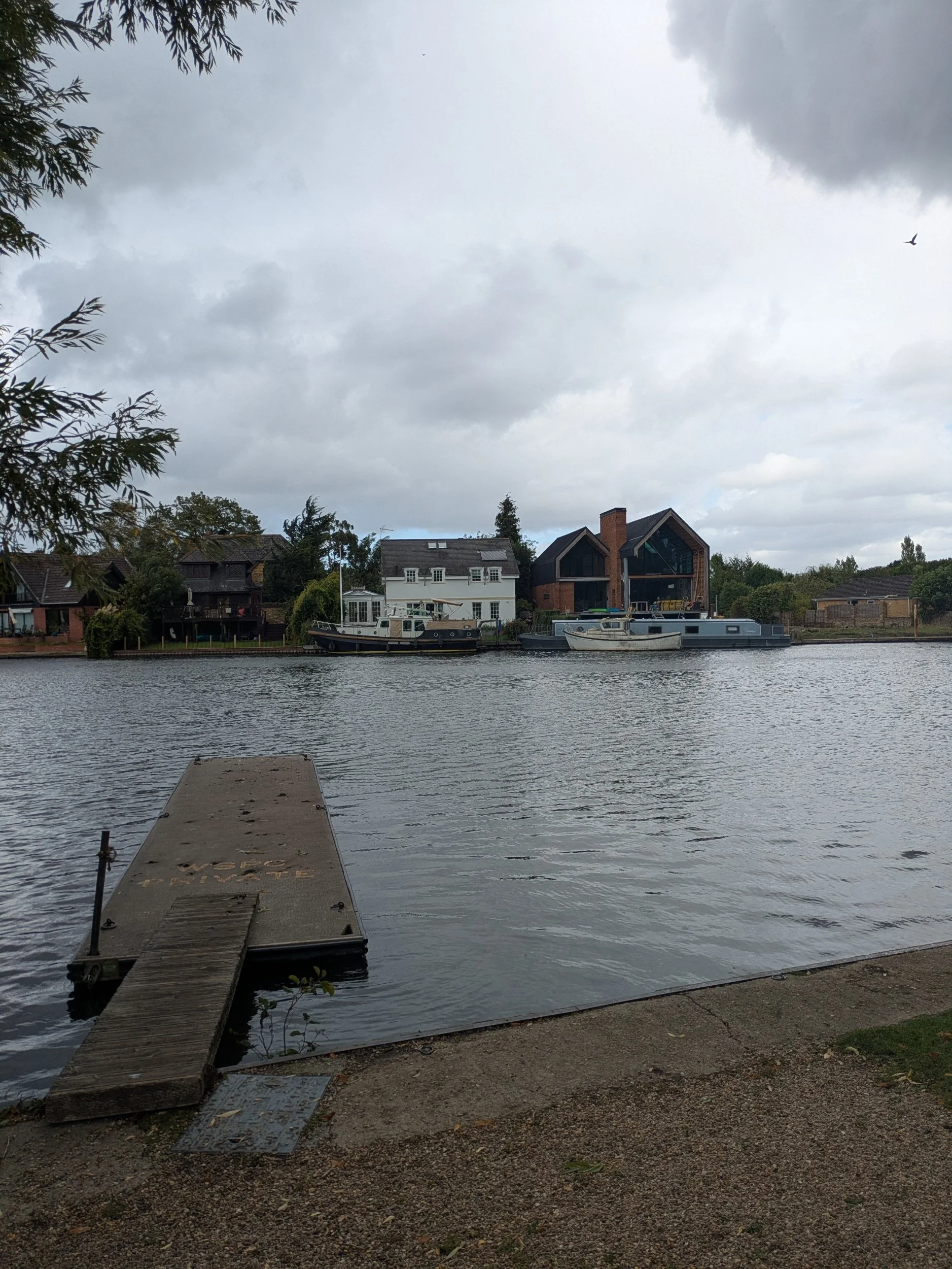
Steve dropped me off in Kingston-upon-Thames in the middle of stopped traffic and I leapt out having spotted Lorna on a bench, she crossed over and we shared a hug, it is so lovely to see her. She is one of those friends who you just pick up from where you left off even if months have passed since you last saw each other. We get onto the Thames Path away and I swear my mouth is moving faster than my feet! When you are chatting you forget to pay attention to the world around you and so I’ve probably missed loads on this leg. The first thing we spot is how like a ship this white block of flats looks like, I have spotted a few boat-like designs along the course of this journey, but it does really feel as if you are looking at the prow of a ship. The path is in quite a lovely park with lots of mature trees and benches to look out over the river and Lorna tries out a chair carved out of an old tree stump. We pass the former Albany Boathouse which has now been converted to offices and then pass this ultra modern property which after a bit of research it turns out to be an award-winning Architect (Fletcher Crane) designed one-off called Lower Ham, the glazed facade at the front is 9 metres tall, key living spaces frame the river aspect and the master bedroom suite benefits from panoramic views from Kingston to Teddington Lock. It also features a courtyard garden and reflecting pond. The unassuming front hides much more!


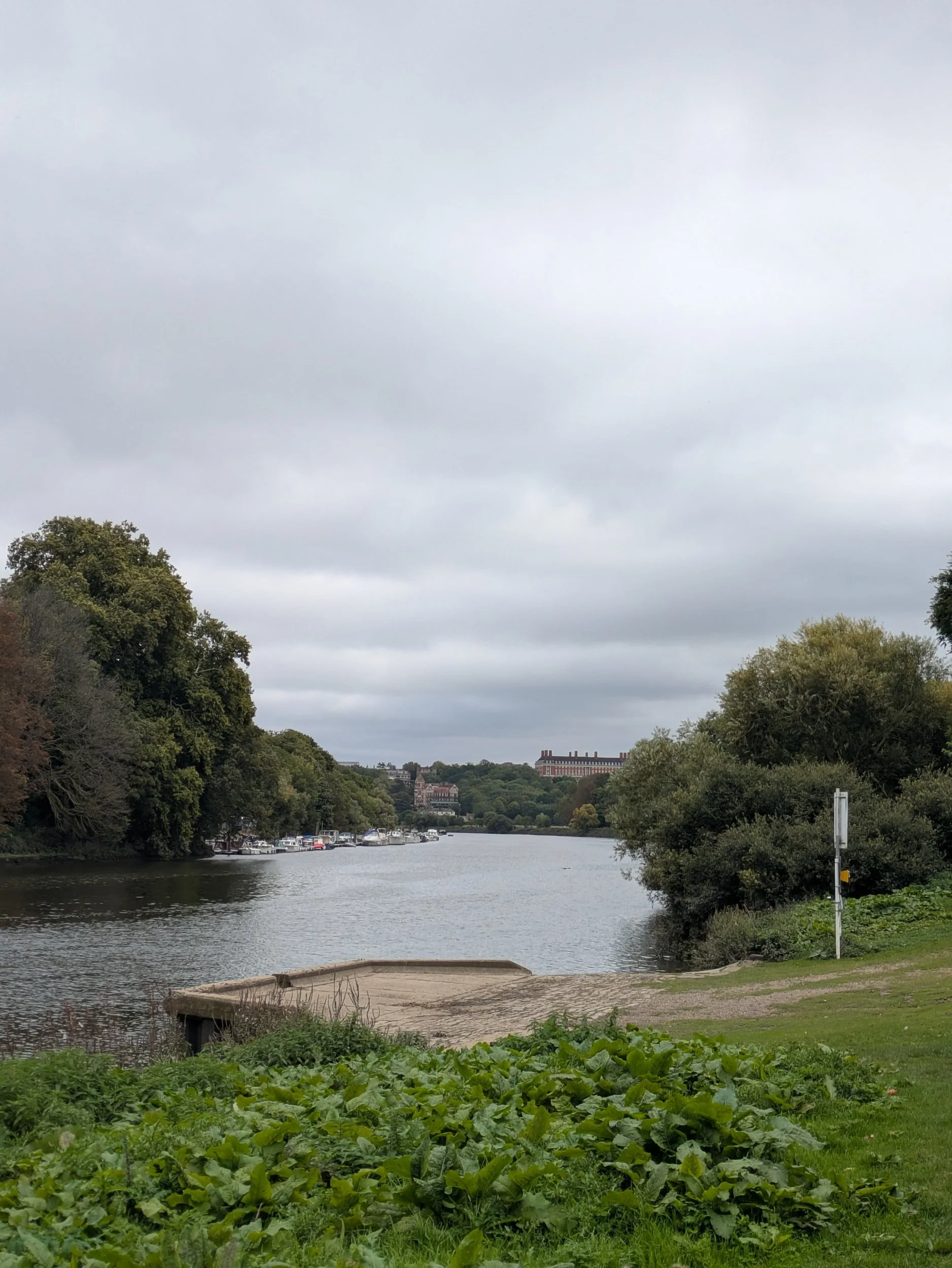
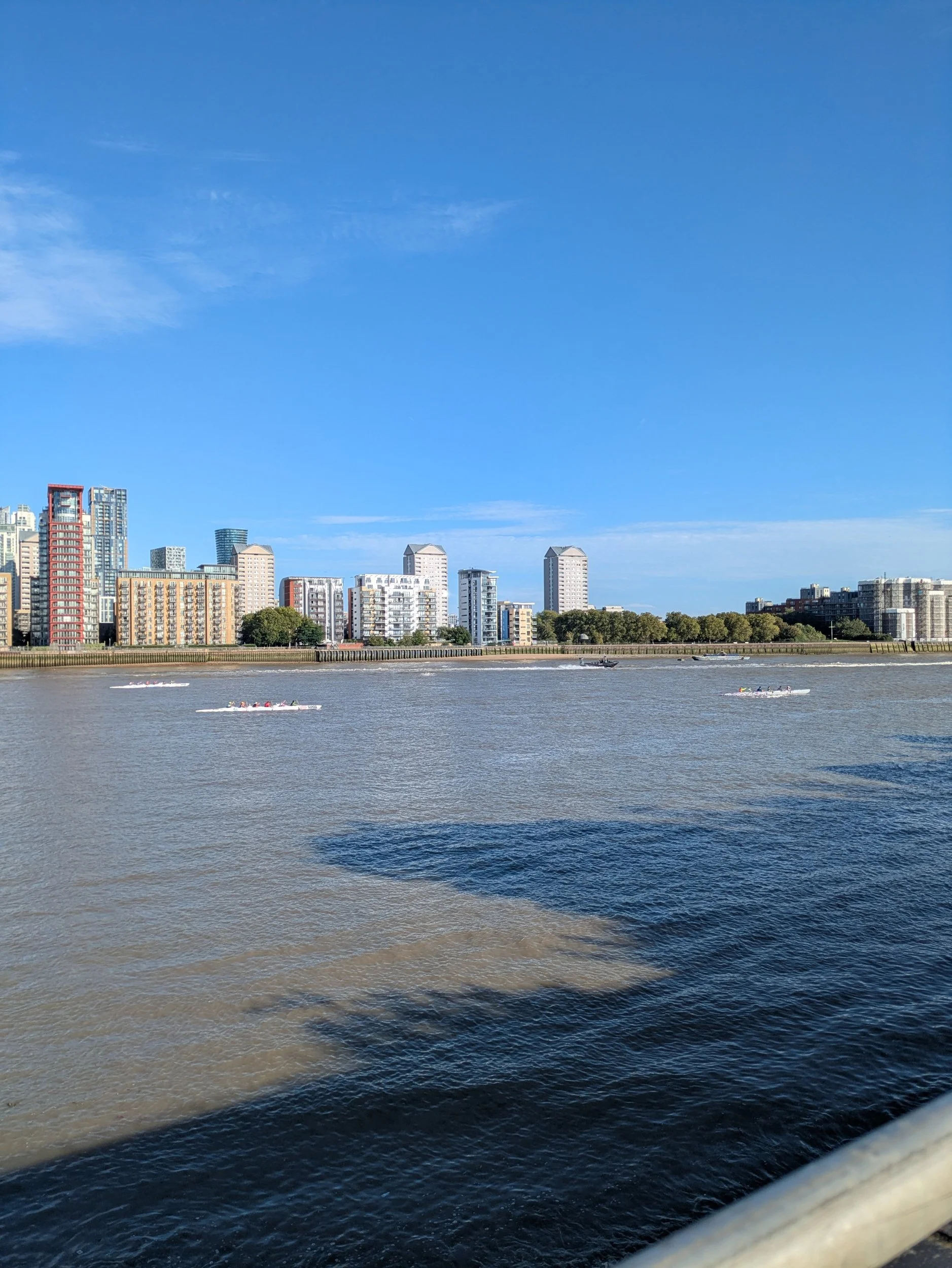
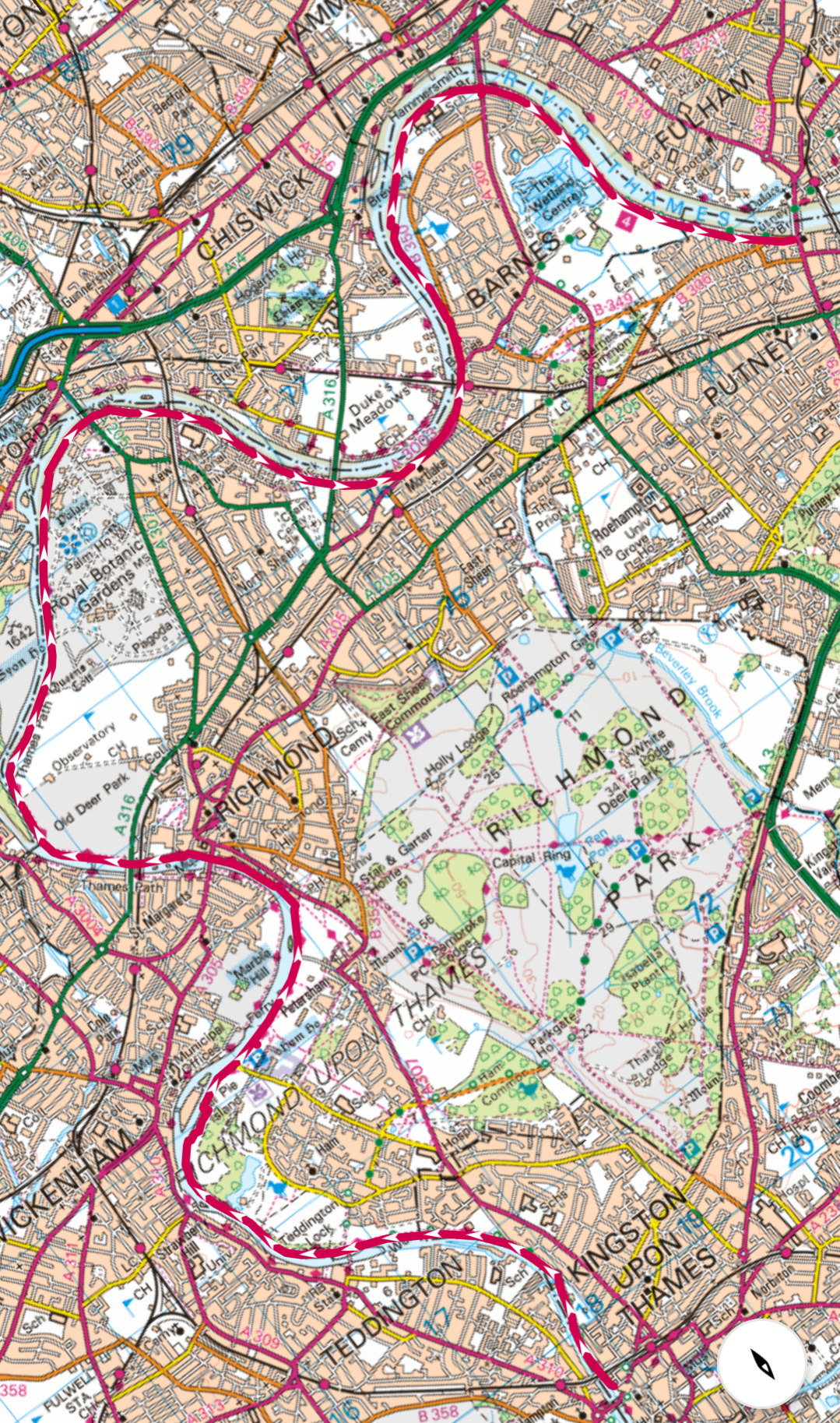
Once again there are rowers being coached in the river and a kayaker passes us by. We reach Teddington Lock where the Thames becomes tidal and this lock actually has three locks and a weir making it the biggest Lock system on the non-tidal Thames. We pass the 1909 Teddington Obelisk, a boundary marker marking the formal boundary between the upstream reaches which are governed by the Environment Agency and the downstream reaches governed by the Port of London Authority. We pass Eel Pie Island which is an 8.9-acre island (or ait) It is accessible by boat or from the north bank by a footbridge. The island had a club that was a major venue for jazz and blues in the 1960s. Its name may have come from Eel Pies that were served from the Inn on the island in the 19th Century. We are having a lovely time catching up and looking at all the boats and houses around including the magnificent Richmond Star and Garter Home on the hill, originally opened in 1916 by the British Red Cross Society to care for severely disabled young men returning from the battlegrounds of the First World War. It was sold in 2014 and is now private apartments. The path passes Hammerton’s Ferry where a cyclist is waiting to cross, it runs everyday from 10am-6pm, March to October.


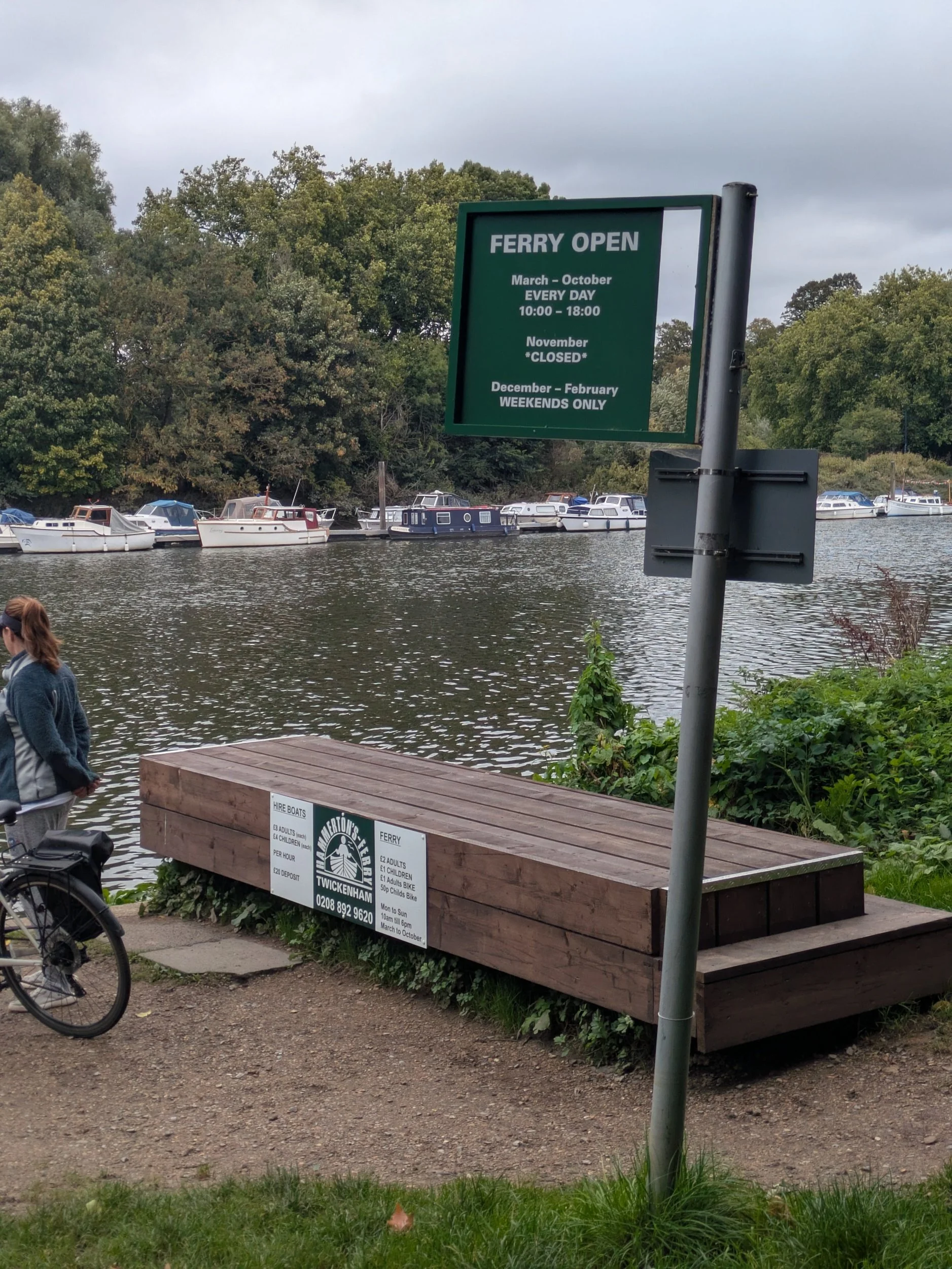
We can see in the distance the stunning Ham House to our right, this rare and atmospheric 17th-century house is the creation of the Duchess of Lauderdale and her husband, the Duke, who together transformed Ham into one of the grandest Stuart houses in England. Ham House is internationally recognised for its superb collection of paintings, furniture and textiles, largely brought together 400 years ago. Outside, the open and formal restored 17th-century gardens surround the house. We then pass Petersham Meadows, owned by the National Trust, a beautiful green space protected in 1902 by an Act of Parliament. 24 acres of water-meadow which famously formed part of the landscape from Richmond Hill depicted in the painting by JMW Turner. We arrive at Richmond Bridge a 1770’s stone arch bridge, the oldest across the Thames in London and the scene immediately before the bridge is giving me Cambridge and Oxford vibes with the long rowing boats all tied up together reminding me of punts.

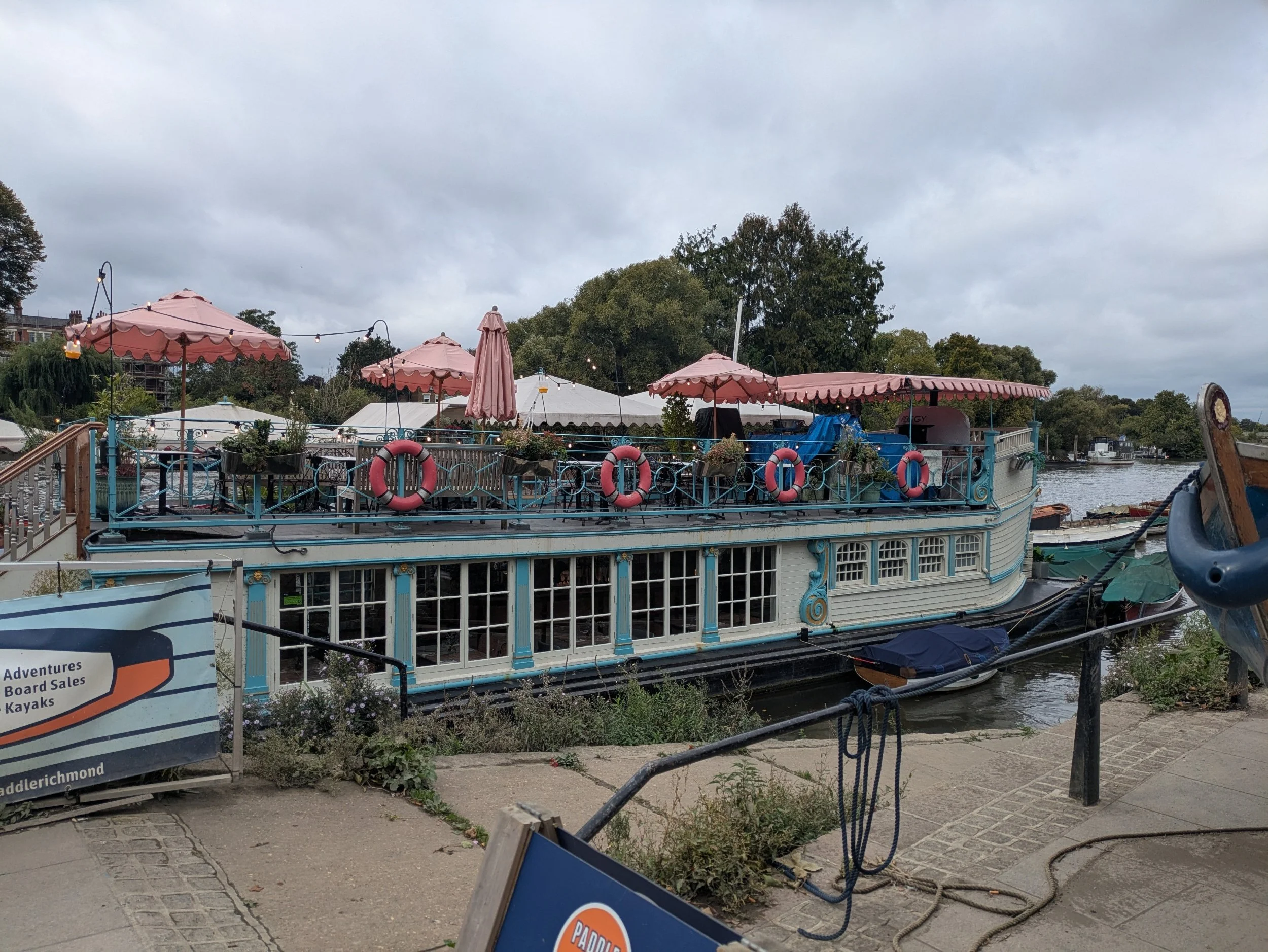
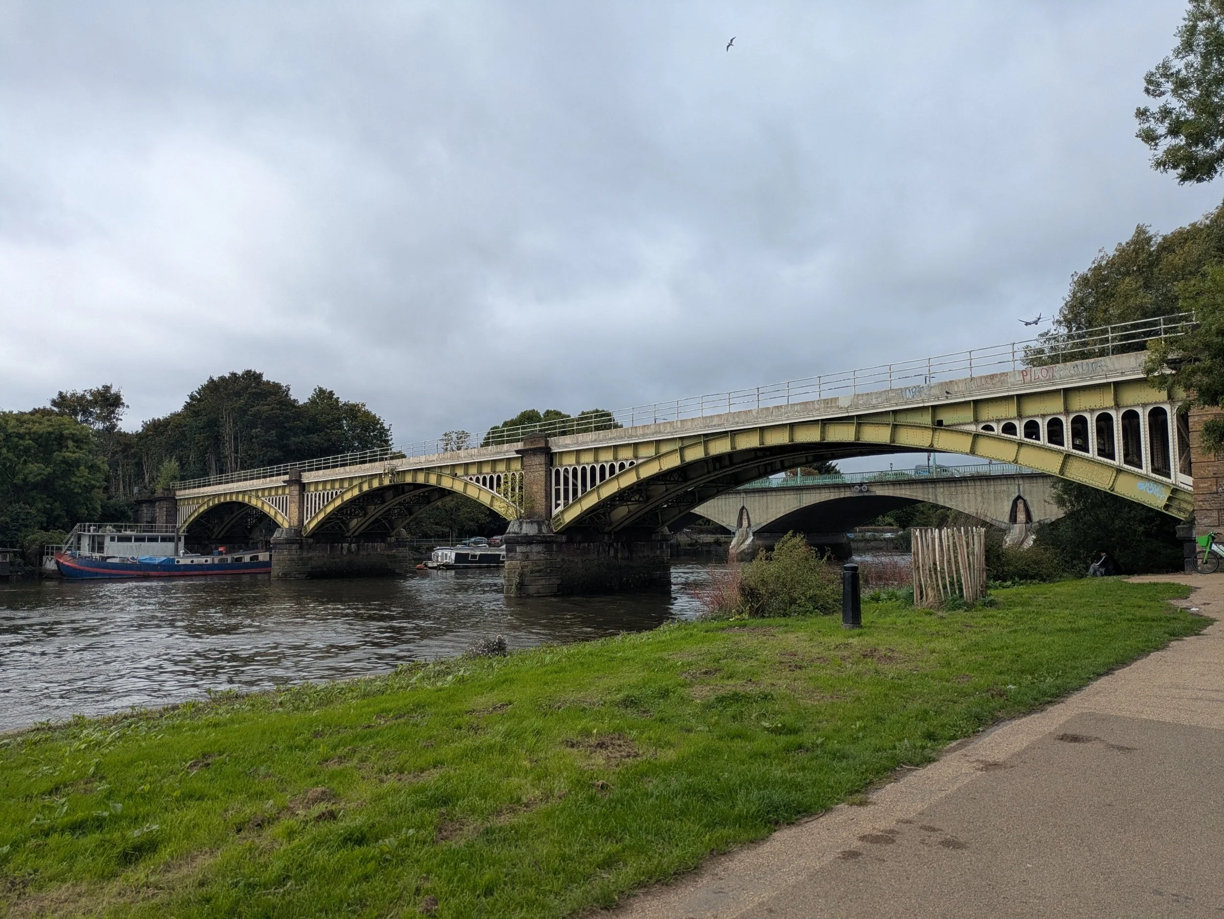


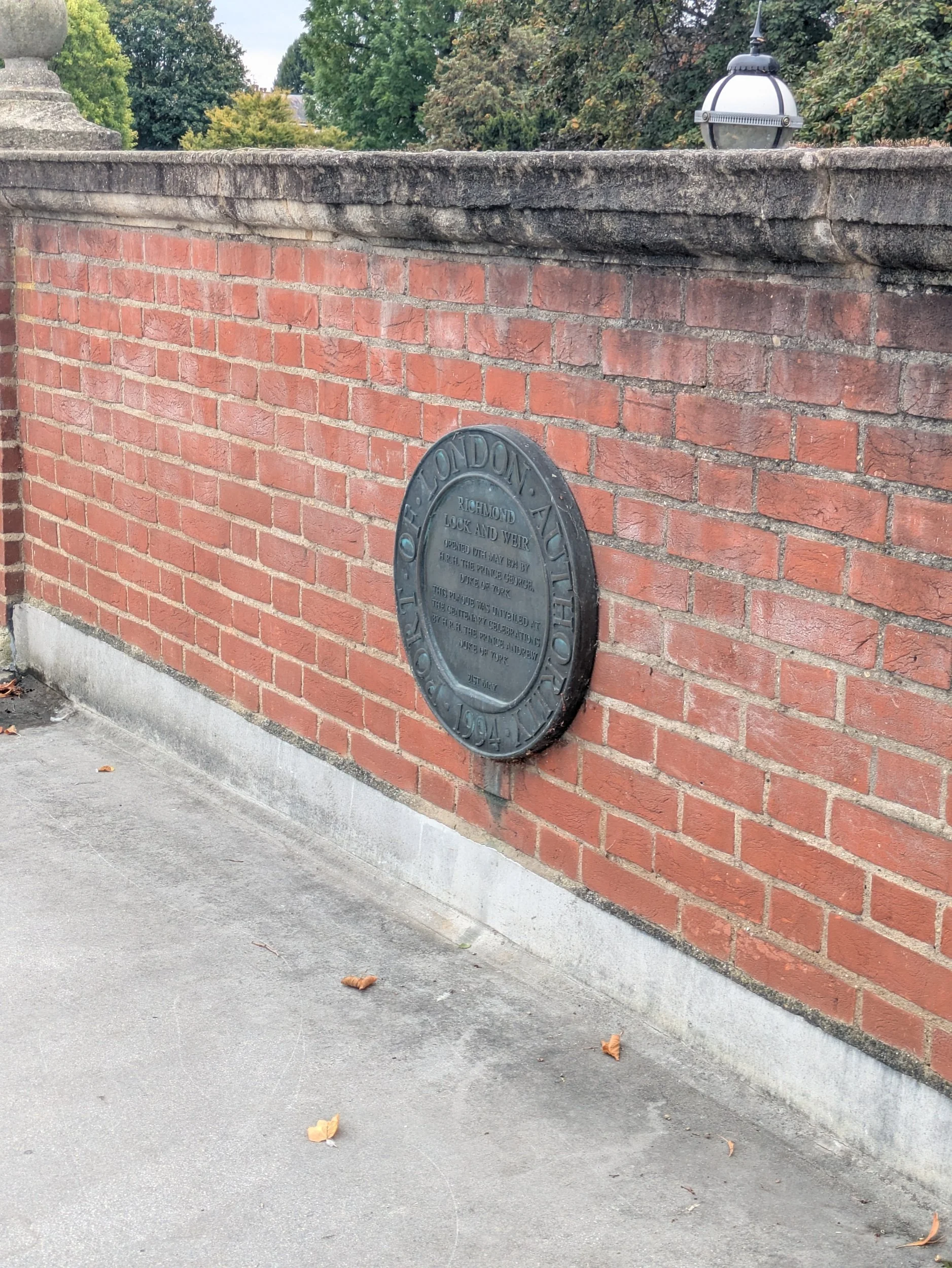
Beyond Richmond bridge there are more boathouses with businesses in and a floating restaurant moored up called Peggy Jean, an old Oxford barge from Jesus College, lovingly restored into this quirky restaurant. The menu is Aussie, with bottomless brunches, cocktails and more! The riverside buildings along here are very elegant, it must have been quite the place! We reach the Richmond Lock and Weir beyond the railway and road bridges and cross over it as there is a diversion further ahead around Kew due to a bank collapse, so for a while we’ll be walking along the North Bank and won’t be walking around the Old Deer Park - one of the most important spaces and landscape features in Richmond history for over 500 years apparently, it’s now playing fields and a golf course! Anyway back to The Richmond Lock and Weir which is a significant structure here, it consists of a half-tide lock and a rising low-tide barrage that allows for controlled navigation and water level maintenance. The lock and weir were officially opened in 1894 (by HRH Prince George, Duke of York), the weir features three vertical steel sluice gates that are raised during high tide to allow passage, while the gates are closed for the rest of the day. Lorna and I enjoyed its cream and pastel green colour pallete.


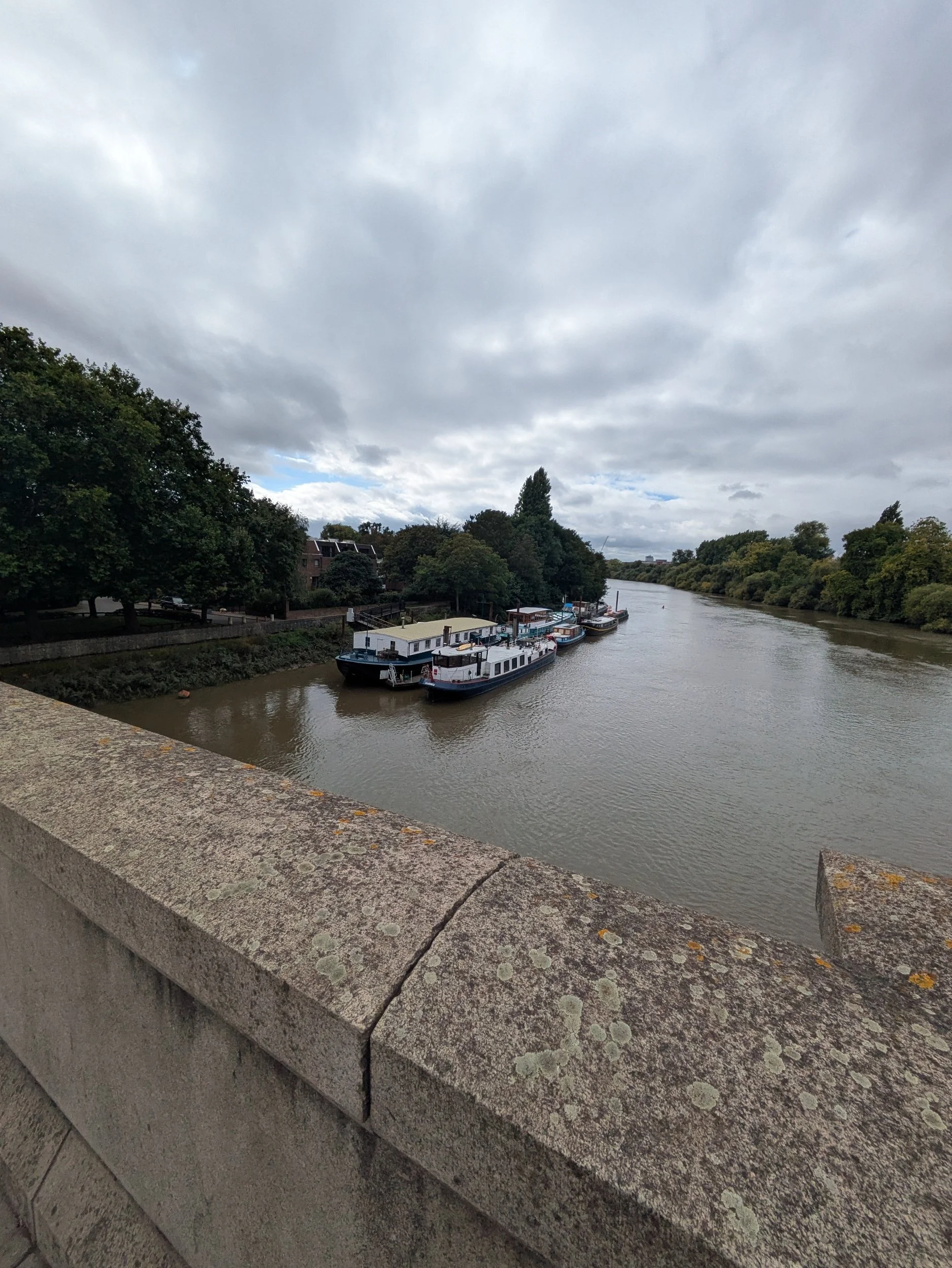
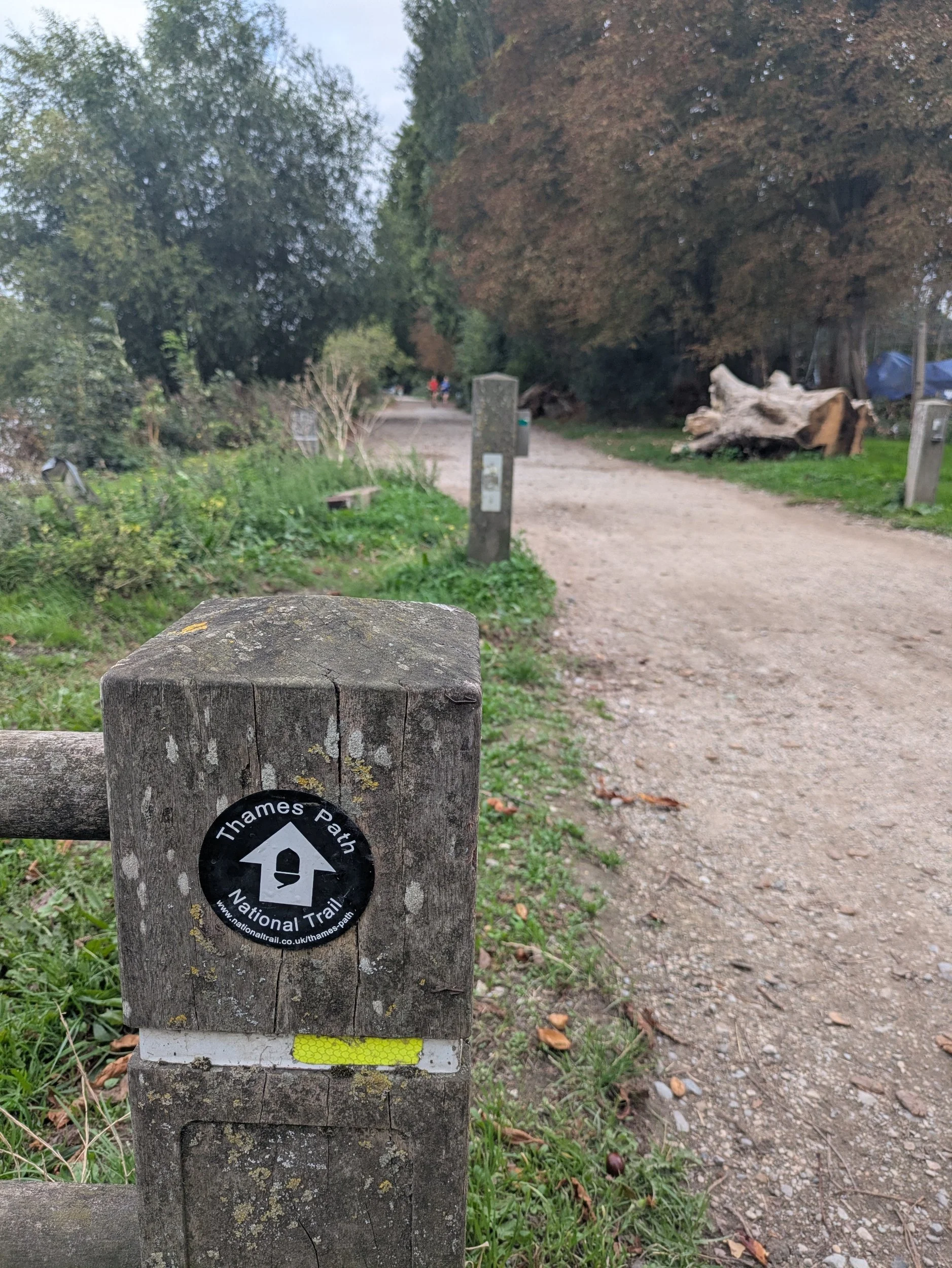
So we are now on the North Bank on the official diversion which looks complicated! We go through riverside paths to Isleworth keeping our eyes peeled for the little acorn signs! Passing through Lion Wharf where a chap looks to be fixing a wharfside crane, this wharf operated as a coal wharf. The wharf buildings that remain are now apartments with riverside views.


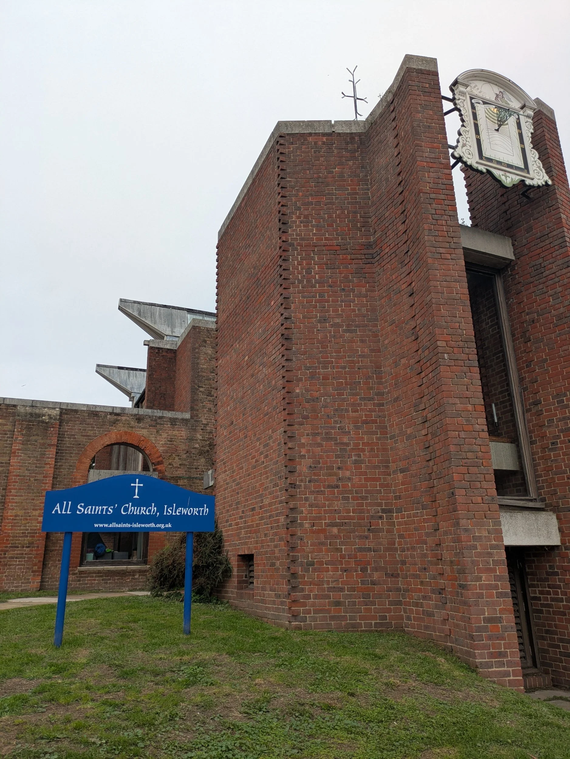

The old vicarage looks very grand and has interesting shaped railings. I haven’t taken many pictures of doors on this trip, but here are a pair that are very pleasing to my eye, no interesting door knockers, but the hint of the top of a column and the gothic arches (very church-like) made them stand out. Then we came to a very interesting sight…An old church tower with a very modern rest of the building. All Saints’ Church, Isleworth has fascinating history. In 1943, the whole church, save the 14th century Kentish ragstone tower and parts of the stonework, was burned to the ground. Not by WWII bombs (Isleworth was heavily bombarded during the war), but by two teenage boys. You can find out more here https://www.allsaints-isleworth.org/history and see an aerial shot.


We are now entering Syon Park, which features Syon House the London home of the Duke of Northumberland.
The house was built in the sixteenth century on the site of the Medieval Syon Abbey, by Edward Seymour, 1st Duke of Somerset and came to the family of the present owners in 1594. It stands in 200 acres of grounds designed by Capability Brown. The house has also been the site for many historical events including the imprisonment of Queen Katherine Howard before her execution in 1542, Lady Jane Grey (the 9 day Queen) was offered the crown here in 1553. The house was extensively refurbished in the 18th century using designs by Robert Adam, the most famous architect of the day. We decide to stop here for a bite of lunch in the Clocktower Café within the Hillier Garden Centre. A slightly disappointing lunch menu of cold, refrigerated, insipid looking tuna baguette, a shared pack of crisps and a cuppa later and we are off again continuing along the diversion through Brentford and passing the Thames Lock.


This area has a very industrial past with The Red Lion Brewery, a distillery, a windmill and a hotel all being taken over eventually by The Gas Works (closed in 1963) some light industry remains, but most of the area deemed too polluted for housing is now Watermans Park. The Gas Works were cleared and capped to make way for the park and Arts Centre which opened in 1983. Brentford street lights were lit by gas until 1960! We also pass by the London Museum of Water & Steam where you can find out about the story of London’s water supply, a hands-on experience which also has a narrow-gauge railway!


We cross over Kew Bridge and continue along the footpath towards Mortlake, back on a nice wide leafy path! More rowers pass us and we pass the Putney Town Rowing Club, are we venturing into Boat Race territory? The Boat Race between Cambridge and Oxford Universities has been held on this stretch of water every Easter since 1845. It’s a four mile, 374-yard course between Putney Bridge and Mortlake (just shy of Chiswick Bridge) which we are fast approaching. Chiswick Bridge is a reinforced concrete deck arch bridge, it is one of three bridges opened in 1933 as part of an ambitious scheme to relieve traffic congestion west of London. The bridge is built on the site of a former ferry. It is 606 feet long and faced with 3,400 tons of Portland stone. When the 150-foot central span opened it was the longest concrete span over the Thames.


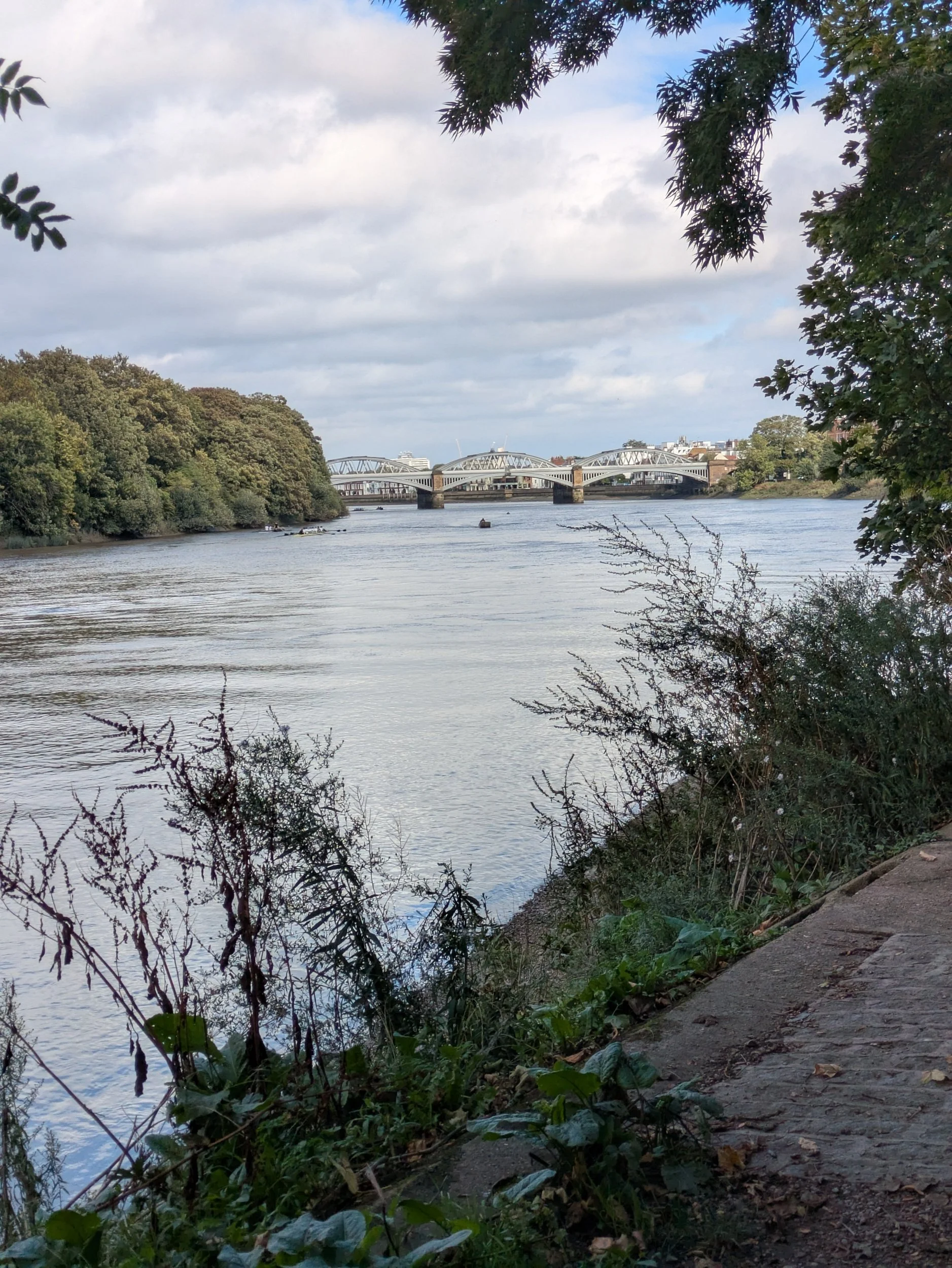


We pass under Chiswick Bridge and pass what looks like a former mill, but turns out to be a former brewery. The Stag Brewery Regeneration project has received planning permission to redevelop the former Stag Brewery site with planning for 1.075 new homes, a secondary school and improved public spaces in Mortlake. We also pass this interesting Victorian Villa, known locally as The Tower, which sold for over £6.4 million last year! Barnes Bridge is a railway bridge constructed in 1849.


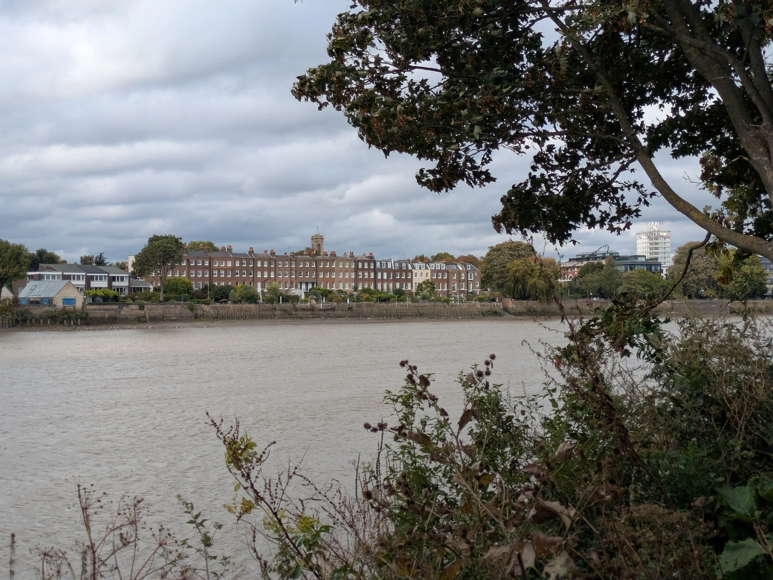
Beyond Barnes Bridge we pop into The Bull’s Head pub to get another Thames Path stamp for my passport and then we are back to spotting unusual items on balconies… this time it is a colourfully painted cow sculpture and a Storm Trooper from the Star Wars films just casually keeping watch over the passers-by. Over the river I spot this magnificent row of terraced houses, Hammersmith Terrace is a street of brick-built houses in Hammersmith, most of the seventeen houses in the terrace are Grade II listed. The street was built in about 1770 and has been home to several notable artists. The 70 foot gardens reach right down to the Thames, giving the owners riparian rights.

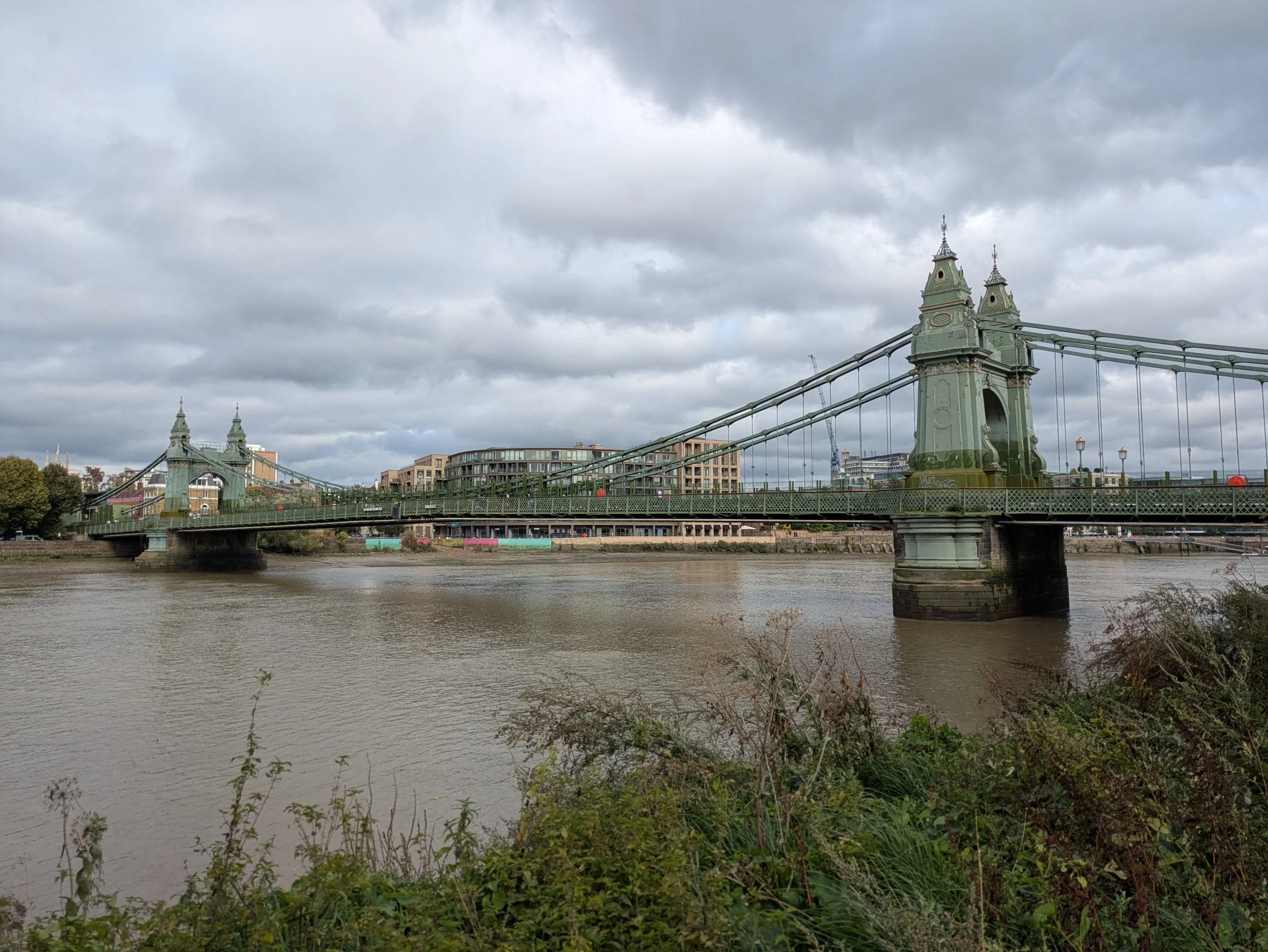


I have also been spotting a few fungi this afternoon! Hammersmith Bridge now comes into view, Hammersmith Bridge was designed by Sir Joseph Bazalgette and opened in 1887, using the same foundations that were built for an earlier bridge, which had to be replaced because it couldn't cope with the weight of the traffic. The bridge is 210m long and 13m wide and consists of a central roadway with a walkway on either side. It is a suspension bridge, with large chains. It is painted green and gold. It's London's weakest bridge, the bridge was closed to motorised traffic on April 10th 2019. After a lot of repair work the bridge reopened in April this year with new bicycle and pedestrian lanes on the "roadway" part of the bridge. The stone obelisk is a memorial to rowing coach Steve Fairbairn and marks one mile from the finish of the Head of The River Race- an annual against-the-clock rowing race for Eights which sees hundreds of boats competing in different categories.
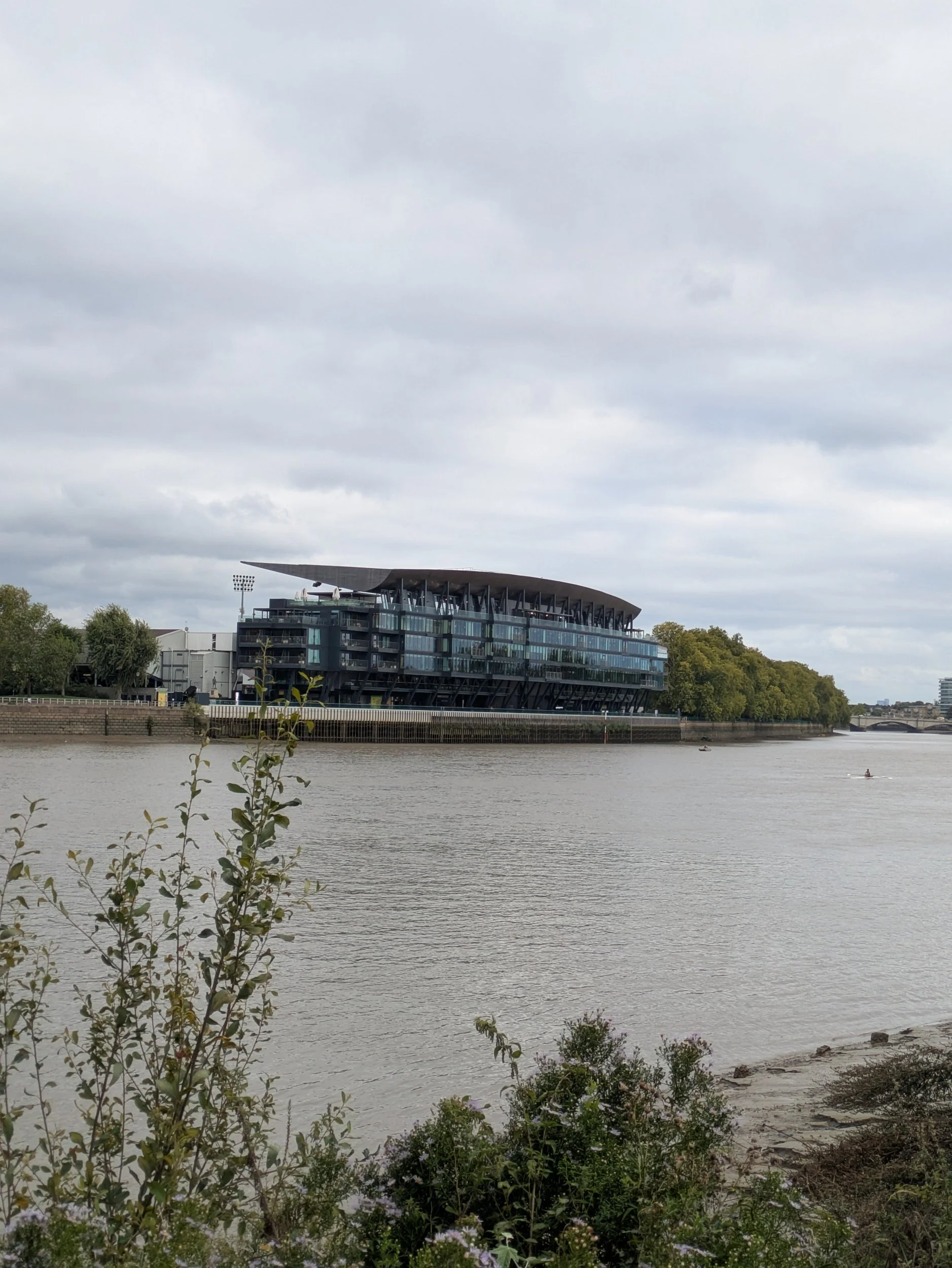
On the other side of the river is an impressive looking building which turns out to be the new Riverside Stand of Craven Cottage, home to Fulham Football Club since 1894. This redevelopment was started in 2019 and consists of 5 levels of restaurants, bars, premium hospitality lounges on matchdays and a 3-level skydeck with views across London!


The footpath now goes through a leafy area, with very autumnal looking Horse Chestnut trees and the sun keeps teasing us by briefly peeking out from behind the clouds. The frequency of boathouses along this stretch is becoming ridiculous and we pass many young people launching boats, bringing boats out of the water, cleaning boats after a rowing session and lots of boat trailers parked alongside the public slipway just before Putney Bridge. Pink seems to be the in colour for the male rowers!


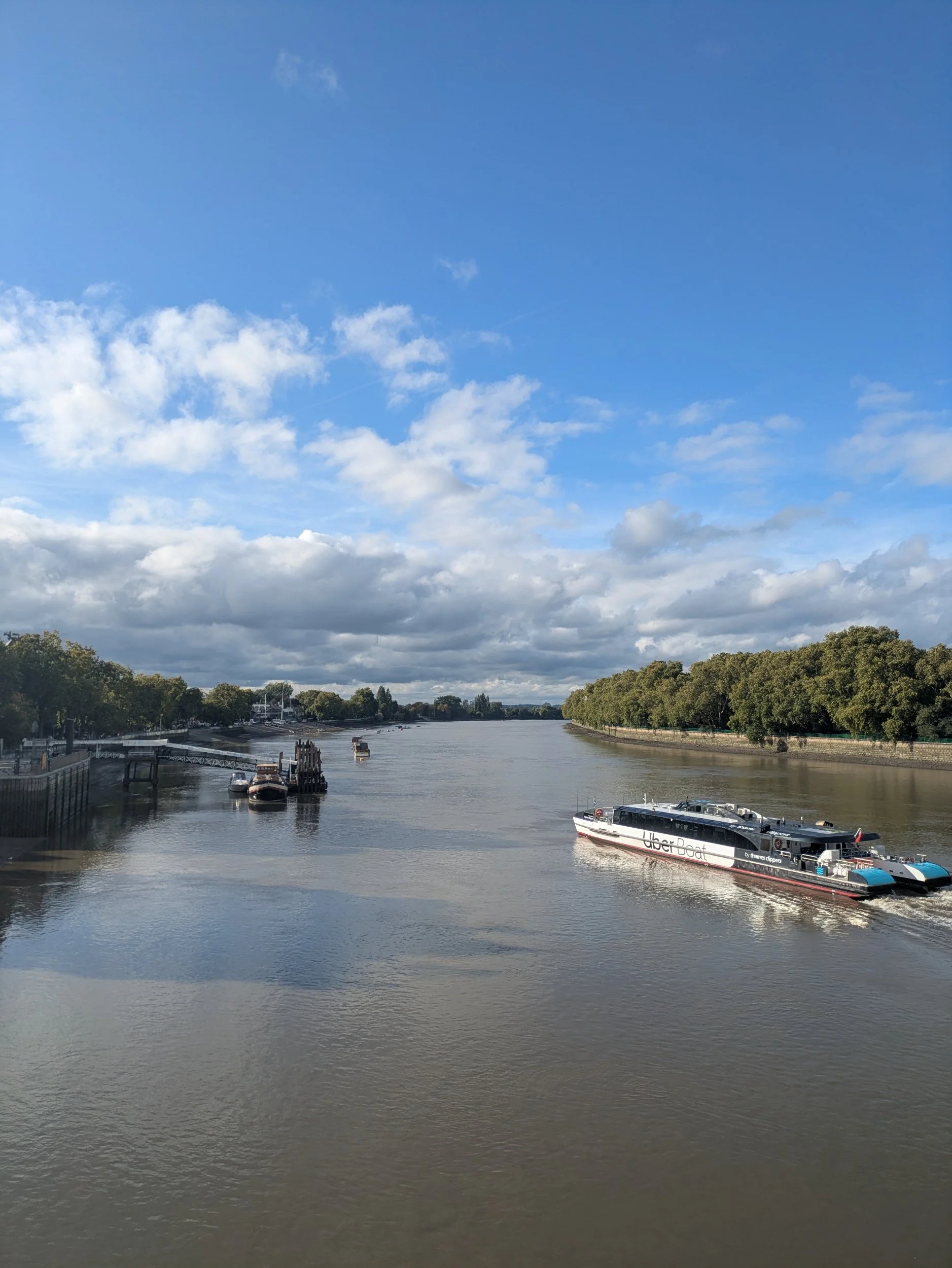
The London Rowing Club (blue balcony) was established here in 1856 and there are other good looking buildings on the Putney Embankment including Ruvigny Mansions, a Victorian mansion block. At Putney Pier you can pick up an Uber boat and it is where the University Boat Race starts! We soon reach Putney Bridge-an important river crossing spot since Roman times. A wooden toll bridge was erected in 1729, this bridge was designed by renowned architect Sir Jacob Acworth, officially known as the Fulham Bridge, it was the only bridge between the central London Bridge and Kingston Bridge at the time. The original wooden bridge was badly damaged following a collision with a river barge in 1870. The current stone bridge was designed by Sir Joseph Bazalgette (we’ve heard that name before) and was opened by the Prince and Princess of Wales in 1886. The bridge was later widened in 1933 and remains one of the busiest of all the Thames crossings. Upon reaching the bridge we decide to cross the busy bridge in search of the Tube station and try and find a café with a toilet, but alas the ones near the Tube station were sadly lacking. The sun did finally came out as we crossed the bridge!
The end of this day was a long one, we reached Putney bridge at 4.30pm and due to delays on some of the Tube lines, including no trains running on the Elizabeth Line at all (my route to Abbey Wood, where we are camping tonight) and us trying to find a café with a loo (we ended up in Pret at South Kensington, literally such a relief) we eventually went our separate ways and I misread the Tube map (should’ve gone to Specsavers) I ended up at Stratford (don’t ask). I finally reached Abbey Wood at 8pm, Steve met me as it was dark and a ten minute walk to the campsite. I clocked up 40,000 steps today. #exhausted

Nordic Walking The Thames Path Leg Twelve: Chertsey Bridge to Kingston-upon-Thames
Chertsey Bridge to Kingston-upon-Thames

Leg Twelve: Chertsey to Kingston-Upon-Thames
When: Tuesday 16th September, 10am
Miles walked: 12.72 miles
Steps taken: 25,974
Moving time: 3:52:50
Elevation gain: 62 ft


Oh what a beautiful morning! We have woken up to blue skies and sunshine this morning. I leave the campsite around 10am and set off for Kingston-upon-Thames. Crossing back over the bridge at Chertsey and walking into Dumsey Meadow an SSI, the only remaining grazed unimproved Thames-side meadow in Surry. The grass is cut for hay in August and then grazed by a herd of Belted Galloway. I am already in a much better mood than yesterday! Everything always looks better when the sun is shining.


It’s a great stretch of walking on strips of grass alongside the river with plenty of housing and bungalows to look at, there’s even a bell for visitors to ring for houses across the water on Pharoah’s Island! I’m listening to the new terms songs for Show Choir as I’m missing the first rehearsal tonight! Did you spot another pair of balcony dwellers? I pass the Thames Court Pub on my way to Shepperton Lock.


Shepperton Lock is very well tended with shortly mown grass and borders of flowers alongside the lock, I make use of the facilities and head down to the Ferry Coffee Shop to buy my ticket for the Ferry which costs £3.50 for a single very short journey! The Coffee Shop is worth stopping at with a selection of sweet and savoury food, hot and cold beverages and a small gift shop, as well as my ticket I buy a drink and some crisps and go and wait for the ferry. It soon comes and the journey is less than 5 minutes to the other side of the river where I begin a very pleasant walk on a wide path.


Just beyond a footbridge to the privately owned D’Oyly Carte Island where there’s a large café in Spring/Summer, events and Weddings held, I stop to drink my cup of tea and eat my crisps at a picnic table (bliss) in the sunshine.


After my brief pause in the sunshine I continue along the path enjoying the diverse transport options, watch a couple in a dinghy try to remove a willow tree that has fallen in the river - precarious! There be Pirates!! I scuttle past a boat flying the Jolly Roger! I’m heading towards Walton-on-Thames and pass a car park with a nice and easy slipway into the Thames, no-one using it today though! I’m approaching a rather splendid looking bridge ahead and after some delving I discover this award-winning bridge was only completed in 2013! Its slender yet dramatic hexagonal curved ivory coloured steel arches are rather eye-catching! This is the sixth bridge to be built in this location, the earliest back in the mid-1700s. Now if you want nerdy technical details this is a thrust arch bridge! It has two parallel steel arches spanning between the banks of the river and the deck is supported by 20 steel hangers suspended from the arches. In the consultation process they sought advice from a local swan sanctuary on the colour of the bridge as apparently swans can’t see very well and aren’t good at spotting contrasts, who knew?


The area around the bridge was re-landscaped and there is a unusual round building with a café and a shopping plaza a bit further up the road not far from the Walton Marina which I pass through next. The marina has a high footbridge over the channel allowing the boats into the marina and so I get a good view of the marina as I walk over it (trying not to drop my phone!)


Walton, which is mentioned in the Domesday Book, has existed since Anglo-Saxon times. Walton’s wharf was built in the 17th century to accommodate the steady flow of barges towed along the Thames by gangs of men and horses and is still used by the Hampton Court ferry.
One of the pubs (The Anglers of Walton) here was built in 1870 and was originally known as The Angler’s Cottage, after the innkeeper’s listed profession – fisherman.
Check out the name of the little cruiser…a message?


It’s a leafy corridor up to a pub called The Weir (guess what it is located by?) Lack of water depth to tow the laden barges became a problem in the early 19th Century and in 1812 Sunbury Lock was constructed, one of a serious of pound locks along the Thames. I like the logo of the St George’s College, Weybridge, Boat Club!
I haven’t really talked about the Thames Conservancy in any of my blogs yet, but the name keeps appearing on lockkeepers cottages so here’s what Wikipedia has to say about them:
The Thames Conservancy (formally the Conservators of the River Thames) was a body responsible for the management of that river in England. It was founded in 1857 to replace the jurisdiction of the City of London up to Staines. Nine years later it took on the whole river from Cricklade in Wiltshire to the sea at Yantlet Creek on the Isle of Grain. Its territory was reduced when the Tideway (upper and lower estuary) was transferred to the Port of London Authority in 1909. In 1974 the conservancy was taken into the Thames Water Authority, later to devolve to the Environment Agency in almost all respects.


A community run Ferry operates here enabling folk to travel between Walton and Sunbury more easily, it is run by volunteers on demand at weekends and on public holidays from Easter to September, what a great initiative. The path continues through a green corridor with brief glimpses of the river and I spot a coupe of lovely looking fungi on the side. I have also been passing a number of reservoirs, not that you can see them!
This stone is apparently a coal duty boundary marker, it marks a point where duty on coal was due to the Corporation of London. Coal imported into the City of London had been taxed since medieval times and, as it was originally all brought by sea to riverside wharfs, the collection of the duties was relatively easy. The City was a small (one square mile) but influential and rich part of London. The Port of London, within which the duties were payable, stretched far beyond the boundaries of the City, all the way along the Thames from Yantlet Creek to Staines. By the 19th century, however, there was increasing trade by canal and rail, and various acts of Parliament extended the catchment area to include these new modes of transport. The Coal Duty, London Act 1845 set the boundary at a radius of 20 miles from the General Post Office, London and permitted the erection of boundary markers to indicate where this boundary lay; and about fifty markers, inscribed with a reference to the act, were erected in the 1860’s.


Once the reservoirs end, the path widens and I start to pass a housing estate which runs along Hurst Park, on the opposite bank is Hampton. Hampton has a rich and varied history that dates back to the Saxon period. The area was originally a small village, but it gradually developed into a residential district in the 20th century. During the 18th century, Hampton became a popular destination for wealthy Londoners, who built grand houses and gardens in the area. Today, Hampton is a thriving and vibrant area, with a mix of historic landmarks and modern amenities, it certainly looks pretty from across the river!


Up until 1962 there had been a racecourse here on the banks of the river Thames, built during the Victorian ‘leisure revolution’, along with nearby Sandown Park, which opened in 1875, and Kempton Park, which opened three years later, Hurst Park was initially a National Hunt venue. However, the layout of the racecourse was soon modified to accommodate Flat racing. Hurst Park was still a popular venue at the time of its closure but, despite significant opposition, its owners opted for property development, rather than horse racing, on the site. Only a couple of gate pillars remain from the racecourse!
I pause to look at the Heritage Marker in Hurst Park, at Sadler's Ride, it tells the history of the area and includes an interactive sundial, which allows visitors to tell the time using their own shadow. I meet Steve and Clara in the car park here for a spot of lunch and a rest, there is a public toilet in the car park too! Across the river is Tagg’s Island a 400 metre long river island that is home to 62 houseboats, one of the biggest houseboat communities in the UK, they look like quite extensive dwellings!


After I have passed Molesey Lock I reach Hampton Court Bridge, climb up onto it and cross over the bridge, there is a family coat of arms on the bridge of Thomas Newland Allen who paid for the bridge to be built in 1866. This bridge is the fourth on the site. The bridge has three wide arches, is designed to be able to carry quite heavy traffic and is constructed of reinforced concrete, faced with red bricks and white Portland stone on its pontoons, dressings, and balustrades. The bridge was one of three authorised by Parliament in 1928. It was designed by the Surrey county engineer W. P. Robinson and the architect Sir Edwin Lutyens to reflect the style of the portions of Hampton Court Palace. I pass Hampton Court Palace, the original Tudor Hampton Court Palace was begun by Cardinal Thomas Wolsey in the early 16th century. But it soon attracted the attention of Henry VIII, who brought all his six wives here.
When William III and Mary II (1689-1702) took the throne in 1689, they commissioned Sir Christopher Wren to build an elegant new baroque palace. Later, Georgian kings and princes occupied the splendid interiors. When the royals left in 1737, impoverished 'grace and favour' aristocrats moved in. Queen Victoria opened the palace to the public in 1838, it has remained a magnet for millions of visitors.


I pass a set of magnificent gates and railings designed by Jean Tijou around the Privy garden and glimpses of the palace behind. Then I am onto Barge Walk, which runs for 5 km alongside the River Thames from Hampton Court Bridge to Kingston Bridge. This historic towpath has been part of the Hampton Court estate for 500 years. There are quite a few benches with dedications along here and it is a very pleasant walk along to Kingston-upon-Thames from here.


Along Barge Walk I spot a Old Dutch cargo barge, made from iron with a flat bottom, probably converted to a houseboat. There have been a lot of rowers passing by in the river too. On the opposite side of the river there is a beautiful church St Raphael, a building designed by architect Charles Parker in Italianate style, built in 1846 as a family chapel.


Ahead of me is the Kingston Bridge across the river Thames, the bridge, about 100 feet upstream from its predecessor, was built of Portland stone: comprising five elliptical arches. The abutments were finished with towers or bastions, and the whole bridge finished with a balustrade, with galleries projecting over. The length of the bridge is 382 feet by 27 feet in width.


Steve meets me on the bridge and we head to All Saints Church to see the newly unveiled Seven Saxon King Embroidery Project. Over a millennium ago, Kingston was an important ceremonial site where seven Saxon kings, including the esteemed first ‘Kings of England,’ are traditionally thought to have been crowned. All Saints Church, a Grade I listed building, had an important role in Kingston’s Saxon history. Before All Saints Church was built, the site was an important estate of the West Saxon Kings and host to Royal coronations. Well worth a visit! After a cuppa in the café we also go and find the Coronation stone. The Coronation Stone is an ancient sarsen stone block which is believed to have been the site of the coronation of seven Anglo-Saxon kings and as part of the team who created The Athelstan Pilgrim Way and with Athelstan’s connection to Malmesbury, we couldn’t visit Kingston-upon-Thames without seeing it.

Nordic Walking The Thames Path Leg Eleven: Windsor to Chertsey
Windsor to Chertsey Bridge

Leg Eleven: Windsor to Chertsey
When: Monday 15th September, 11am
Miles walked: 16.39 miles
Steps taken: 31,946
Moving time: 4:51:48
Elevation gain: 164 ft
Today I will be Nordic walking from Windsor to Chertsey Bridge and the days hasn’t started off well. We are much later starting than usual because we needed to do some washing (limited storage in Clara) and the campsite laundry room doesn’t open until 9am, which in reality is actually sometime after 9am when one of the wardens gets round to it. I eventually got my wash on at 9.15am. The weather forecast is mixed today and still very windy so I don’t trust leaving my washing outside the awning whilst we are out all day. So I hang it inside the awning hoping it will warm up enough to dry it! We get to Windsor around 11am and park in the station car park.


I head down to Eton to get a stamp for my passport from the information centre and the very friendly lady tells me where the one in Windsor is now located as they don’t have a Tourist Information Centre anymore. Windsor is bedecked in American and Union Jack flags ahead of the state visit by President Trump, I’m glad I won’t be here when he is as they are closing the section of Thames Path for two days because of it. There is already quite a police presence. Having walked all the way uphill into Windsor and found the giftshop that has the stamp I am told the Information point is not open today and so I cannot get a stamp…I’m fuming. I’m also desperate for the loo and so say goodbye to Steve and nip into Mcdonald’s whose main toilets are out of order, but the guy behind the counter takes pity on me and let’s me use the disabled/baby change loo, he probably picked up on my increasingly fuming vibe! Finally I make it back down to Windsor Town Bridge and take a left turn down the steps back onto the Thames Path, I now need a good Nordic Walk to bring calm to my being! Walking past an entrance to the Station car park (where Clara is parked) directly onto the path doesn’t help my rage!


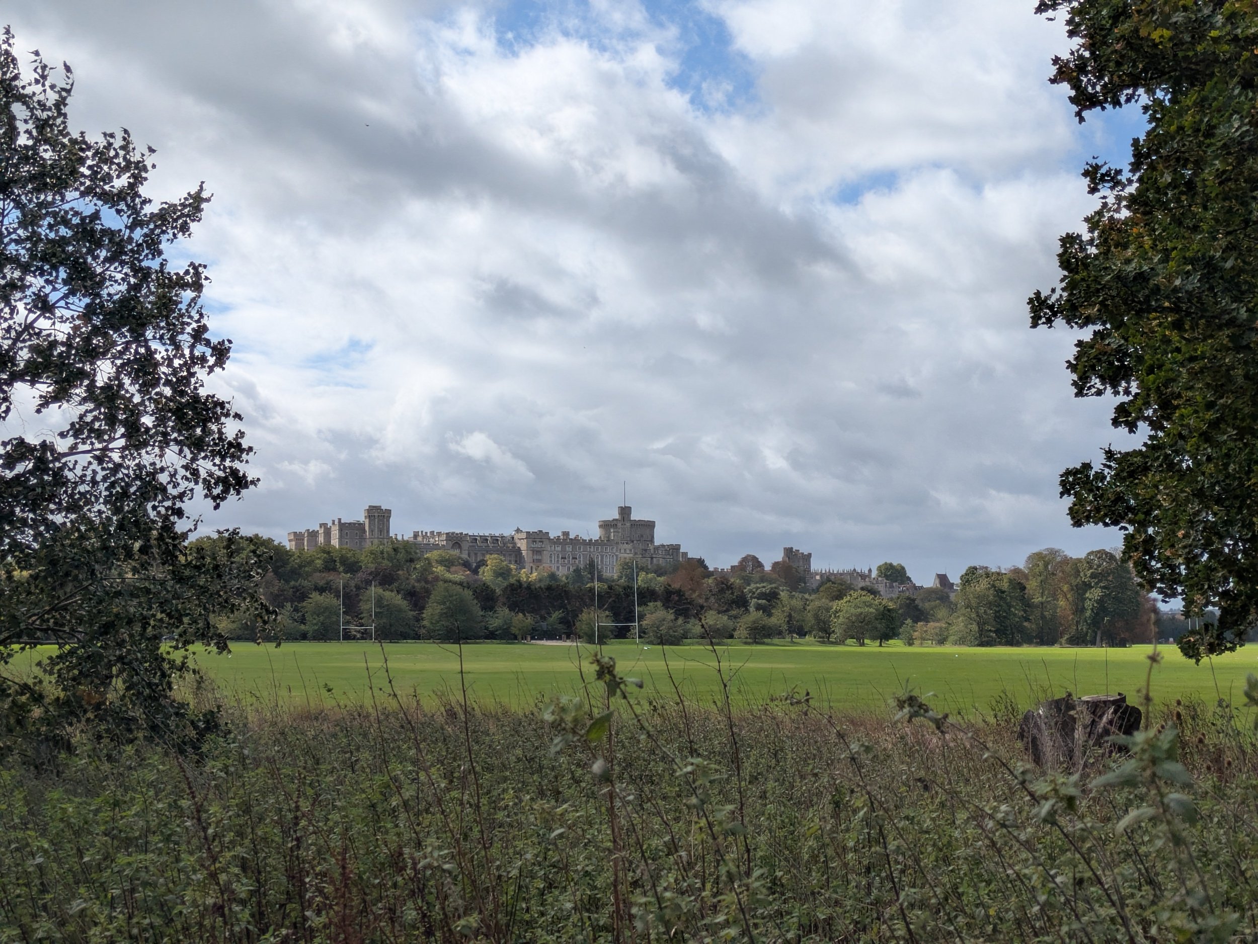

The path goes through Tom Jones boatyard and out onto a meadow which is part of The Home Park where I can get a view of Windsor Castle, then I go under the railway bridge and follow the river around the park. There are Police boats in the river!


The path goes up to a road and crosses Victoria Bridge which had it’s central crossing rebuilt in 1966 due to Tank damage from the Second World War weakening it. Once across the bridge I take the footpath on the other side of the river and continue to follow the Thames towards Datchet, coming out onto the main road.


The path follows the main road for a bit then takes me down onto a path the other side of a hedge from the still away from the river and passing fields full of geese and a heron! Then I’m alongside the river again until I reach the Albert Bridge which was rebuilt in brick in 1927. Opposite is Albert Bridge Lodge, a mini castle used as a private retreat by members of the Royal Family and a residence for the Rangers of Windsor Great Park. It was built around the same time as the original Victoria Bridge and Albert Bridge 1850-51. Crossing the bridge I see the police rib again, they seem to be paying close attention to the bridges.


I’m now on my way to Old Windsor Lock with a path between vegetation I don’t see much of the river itself, however I am please to find a yellow Mirabelle plum tree with fruit I can actually reach growing in the hedgerow! Snack time- these are my favourites!


The Thames Path continues through to Runnymede with boathouses and dwellings either side of the river, I need to leave the path to visit the Magna Carta Tea Room to get a stamp for my passport, but guess what…IT IS CLOSED on Mondays. Hmmmph. The boat-like carved bench is designed to be sat and climbed on and was created by master carver Hugh Wedderburn with sculptor Isabel Coulton. It is carved form a fallen oak from the ancient woods at Runnymede.
I re-join the path and continue around the river passing the location where it is believed the Magna Carta was signed and find Steve and Clara in the car park, it is time for lunch.


Haymaking is a 16-piece willow sculpture in Runnymede meadow depicting a pre-industrial scene made by Willow Twisters and community groups from in and around Runnymede and sits in the meadow outside the Magna Carta Tearoom. Across the river, the white walls of St. Mary Magdalene’s Priory stand out against the trees, Nuns worshipped here for nearly 400 years before it was closed in 1536. In 1551 Sir Thomas Smith built himself a fine Courtier’s mansion with a small section of the priory surviving within its walls. In 1805 having pulled down Smith’s house, John Blagrove left the remains of the priory as a garden feature. Blagrove’s house burned doen in the 1960’s and was demolished in 1992, the chalk walls of the priory still stand!


On 14th June this statue of HM Queen Elizabeth II was unveiled in the Runnymede Pleasure grounds to celebrate the 800th commemoration of Magna Carta. A timeline in the stone slabs links the freedoms gained, many set out in Magna Carta, with the reigns of our sovereigns from the time of Edward the Confessor to our late Queen. On the way out of the park, I pass the Wraysbury Skiff, Punting, Dragons and Waka Am club. I reach Bell Weir Lock and painted on the side of the lock house are murals celebrating the 800th commemorations of Magna Carta. There is a lot of history in and around Runnymede! Apparently during the construction of the M25 in 1975 fragments of pottery dating back to c.750BC were found leading to the site of Runnymede Bridge being protected as a Scheduled Monument. The finds from the excavations can be found in the British Museum and a Bronze Age Runnymede mini-documentary was created by Egham Museum in 2016 and can be found at www.eghammuseum.org


There is now yet another diversion, a really boring alongside the road diversion, however it passes The Range and I have a little retail therapy (can’t carry much anyway) before continuing. I do pass a very grand Georgian entranceway which is a bit neglected and then I’m soon back on the trail.


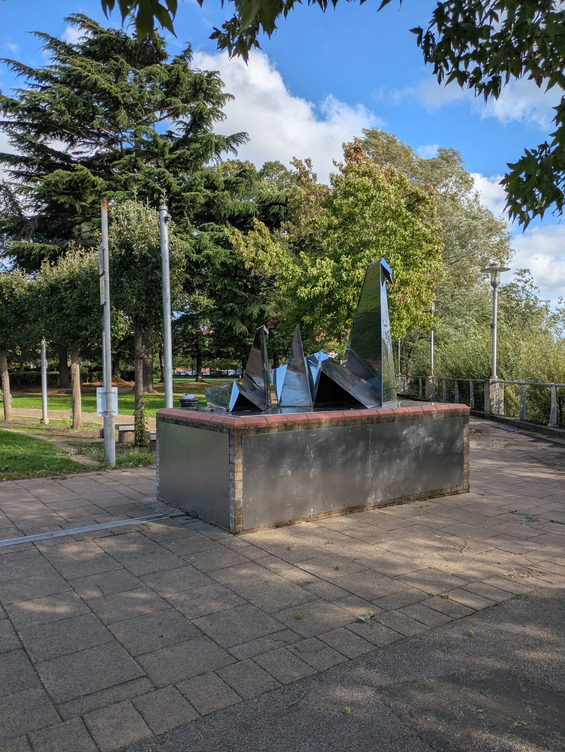
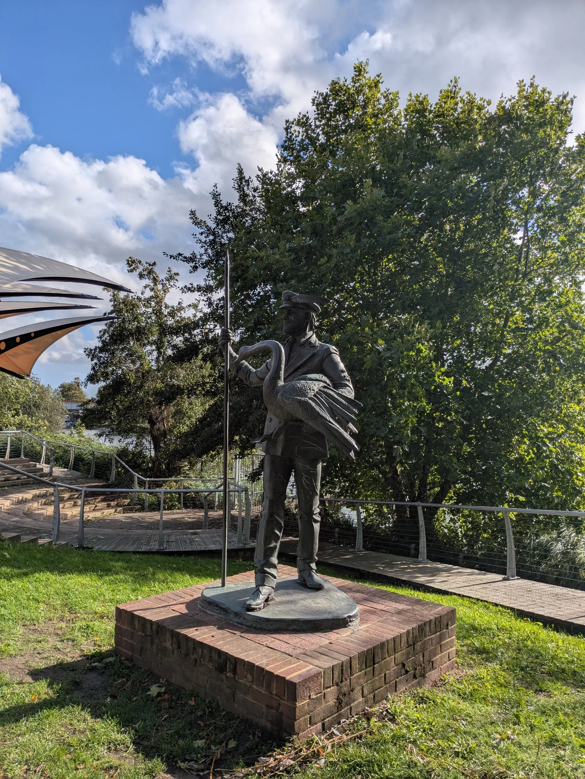

Over bridges and through tunnels the trail takes me into Spelthorne Borough and Staines-upon-Thames. I pass a replica of The London Stone, a boundary stone marking the extended jurisdiction in 1285 after King Richard I sold the rights over the River Thames between the estuary and Staines to the corporation of the City of London to pay for his Crusades! Here in Riverside Gardens there are also sculptures, The Origami Swans by Tom Brown and The Swan Master by Diane Thomson, swans feature heavily in Staines obviously!


Walking along the Thames Path under another railway bridge and the sun is shining beautifully, there are a lot of residential flats and houses, but I pass this striking church, built between 1892 and 1894, a rich red brick with stone dressings and a copper-clad spire with a beautiful lych-gate opening onto the towpath. St Peter’s Parish Church was used as a film location for the 1976 horror film The Omen. This flagpole in a front garden made me smile, the owner has put a whiteboard inside a waterproof pouch and attached it to the flagpole which reads: TODAY’S FLAG IS BELIZE, educational!


On the opposite bank there are some pretty snazzy properties, very sleek and modern. I pass through Penton Hook Lock, opposite is Penton Hook Island where the river Thames forms a big, almost complete loop here, the island was formed when Penton Hook Lock was built in 1815. It is a protected nature reserve, unfortunately it is currently closed to the public due to ash dieback. Have you spotted the Arctic visitor standing guard on a balcony? The path moves onto a quiet road and I pass a couple of Boathouses and Laleham Camping Club and pass underneath the M3 motorway bridge.


Way back in the 16th and 17th centuries there was a ford across the Thames here at Chertsey, later upgraded to a ferry. This part of the river was known as Laleham Gulls an area notorious for causing all sorts of difficulties in the shallows for river traffic. Eventually the Corporation of the City of London realised the need to improve navigation here and between 1811 and 1815 they built a series of large locks along the Thames, Chertsey being one of them. Behind the lock here is the campsite where we are staying and where I am walking to today, but I cannot access it from this side of the river and so on to Chertsey Bridge I go!
Chertsey Bridge is a Grade II listed structure dating from 1785, it has five round arches over the water, the central one being the biggest and one more on either side. Just before the bridge is a semi-detached pair of houses with a round window painted with a old scene of the Bridge painted onto it, which house does it belong to I wonder? I finally reach the bridge, climb up the steps to reach the road and walk over to the other side to find the campsite down the road.

Nordic Walking The Thames Path Leg Ten: Marlow to Windsor
Marlow to Windsor

Leg Ten: Marlow to Windsor
When: Sunday 14th September, 10am
Miles walked: 14.98 miles
Steps taken: 30,712
Moving time: 4:25:22
Elevation gain: 741 ft
Today is Sunday and Steve drops me off at the (much busier today) same car park as yesterday, where the green space is full of footballers! I’m heading towards Bourne End, but my end destination today is Windsor.


There’s a lovely wide gravelled path and it’s not long before I’m being passed by tired Ultra Challenge participants! On the opposite bank there is a fantastic castellated house and boatyards, on this side of the river is a wide expanse of grass between the river and a railway, which I hadn’t spotted until a small train passes by!


I’m passing some really interesting dwellings, most of which seem to be upside down in terms of living room and bedrooms all for better views of the river! Along here are sailing clubs and marinas and the river is busy with craft and more rowers!


At Bourne End the Thames Path crosses the river by the railway bridge and continues on the opposite bank onto the National Trust managed Cock Marsh and then Marsh Meadow, common land since 1272. I can see Cookham in the distance, there’s quite a few people out and about and I have to nip off the path to find a secluded spot for a comfort break.


I reach Cookham through the churchyard and visit Bel & the Dragon to get another stamp for my passport, I’ve stayed in Cookham and remember it being very nice, here the Thames Path takes you past the Stanley Spencer Gallery, an old Wesleyan Chapel reopened in 1962 as a memorial gallery to the work of local artist Stanley Spencer, most famous for his painting The Resurrection, Cookham which now hangs in Tate Britain.
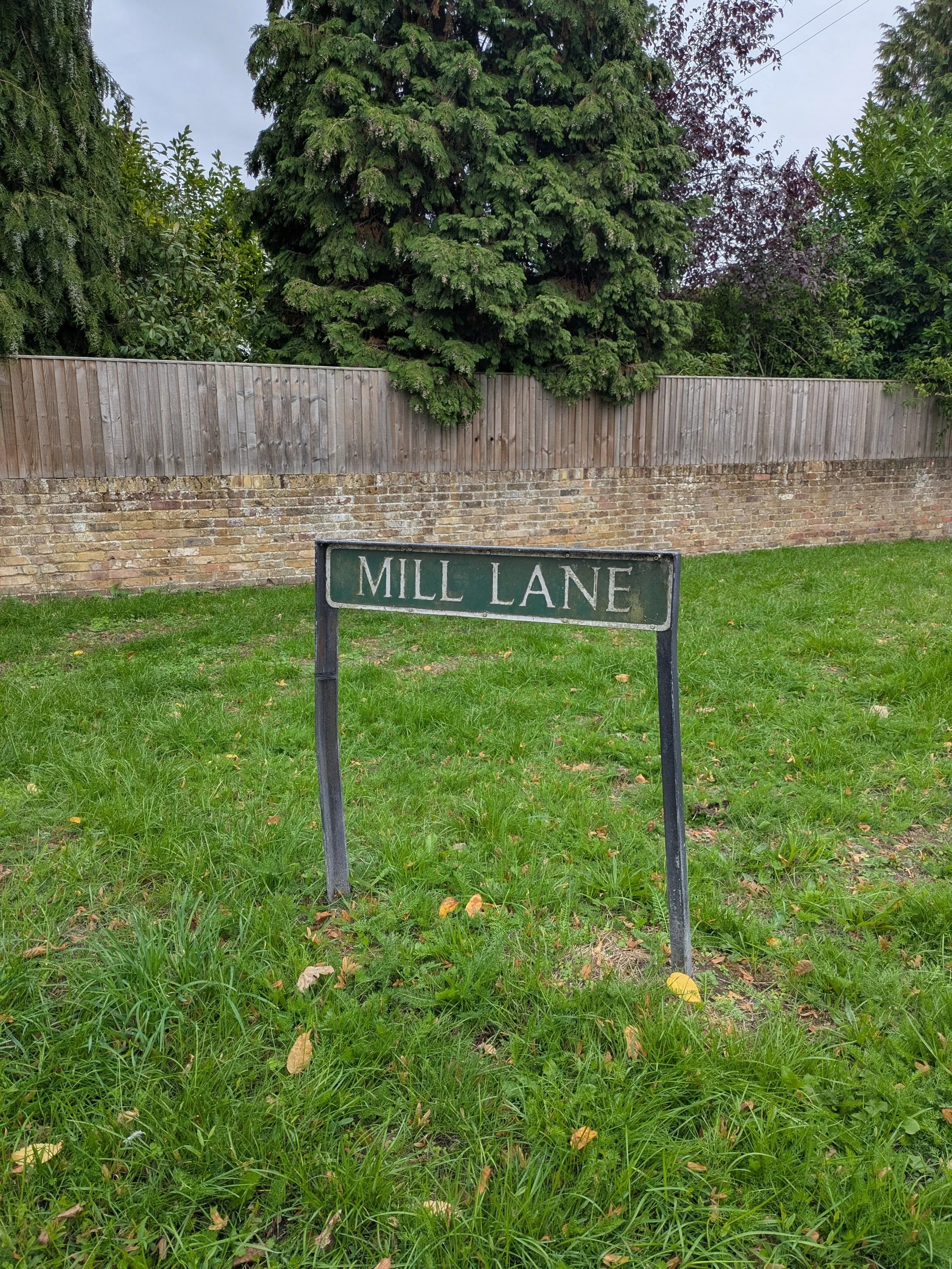


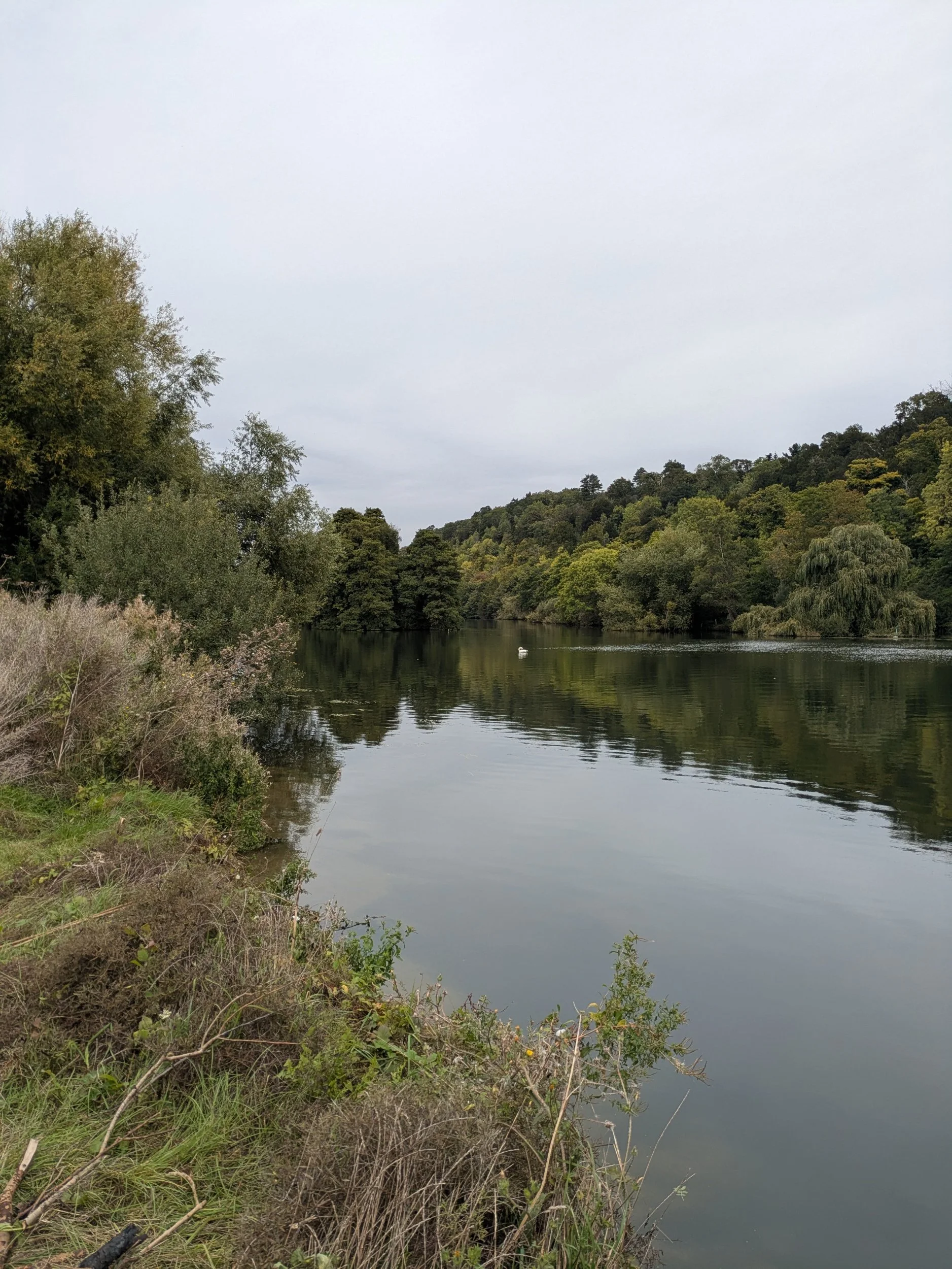


The Thames Path now takes me down yet another Mill Lane across country to the riverside once more. Across the river is Cliveden Hotel and this stretch is beautifully quiet with open wide expanses of river.


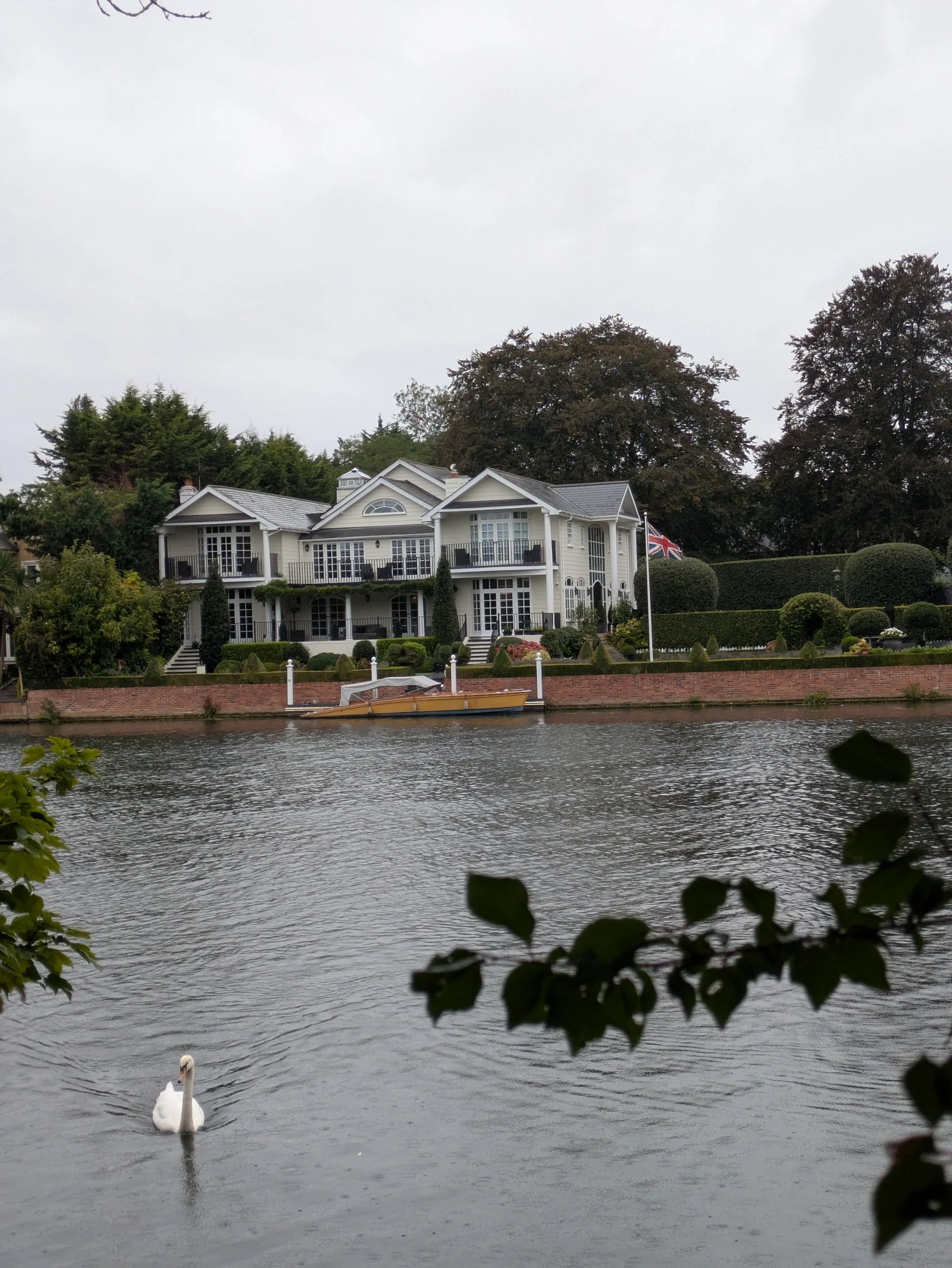
I pass through the edge of Battlemead- meadows, wetlands and woodland rich in wildlife and important habitat. There are some huge houses beyond here as we approach Maidenhead, plenty for me to admire the architecture, fences and flora! I really like this Blue Globe Thistle - might have to see if I can find some for my own garden!


I generally photograph things that interest me, things that raise a smile as I pass by or things I want to remember and look up more about. As I approach the weir before Boulters Lock and there is a residence with a dinghy moored up outside with a statue of an elderly man in a top hat sat snoozing, it raised a grin from me! Boulters Lock is associated with the Victorian boating craze so vividly portrayed in Jerome K Jerome’s ‘Three men in a boat’ published in 1889, but it has a history stretching back to the middle ages! Boulters Lock was part of the fashionable Ascot Week race meeting in Victorian and Edwardian times. It became the custom on Ascot Sunday for fashionable race-goers to promenade or go on the river. On Ascot Sunday 1888 more than 800 boats and 72 steam launches passed through the lock! Just beyond here I am meeting Steve for lunch at Riverside Park.


After lunch I continue on my way and head towards Maidenhead Bridge passing through Bridge Gardens where the impressive Ada Lewis Trough Memorial was erected in 1908. It has started to rain. There’s been a bridge here since 1280 when Maidenhead was the hamlet of South Ellington, the current Portland Stone and brick bridge was built between 1772 and 1777. I cross the bridge and continue down the path onto the opposite bank and head down a residential street towards the railway bridge. More lovely houses adorn both banks and private moorings with private bankside gardens, some of which feature beautiful flowers like this scented rose!


I spot a survey marker, a bronze disc placed on the ground to denote a fixed point for surveying property boundaries, I’ve never seen one of those before! The Thames Path goes through Bray Lock before heading underneath the M4 and through the end of some gardens before reaching a patch of woodland, it’s really raining now.


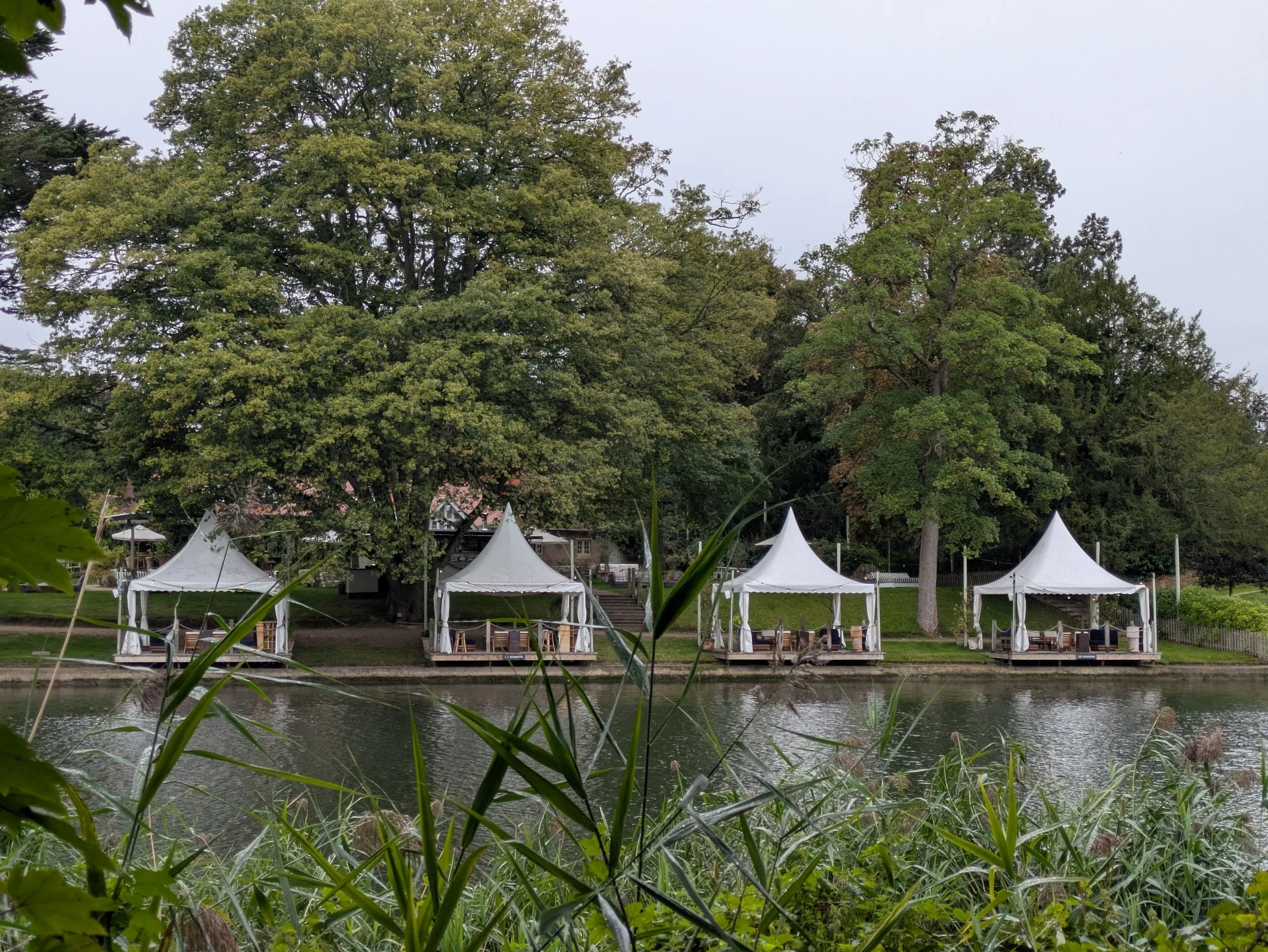
I can’t feel the rain so much in amongst the trees! On the opposite bank I spot these outdoor dining marquees -not sure which hotel they belong to, but what a great place to eat!


Bray Marina is on the opposite side of the river and to my left is Dorney Lake, Eton Colleges Rowing Lake which is set in Dorney Lakes Country Park at a boathouse near the end of the lake Steve appears to hand me motivational Lindor through a locked gate, bless him. He’d been visiting the Rowing Lake. Pocketing one of them I carry on and pass a church that has both doors open and so I go to have a look. There really isn’t any information about it, but it is good to be out of the rain. It is a redundant Anglican Church since 1975, under the care of the Friends of Friendless Churches, it is still consecrated and used for occasional services. It’s a shame there is no information board and the visitor book needs replacing as the current one is full! Back out into the rain and gloom and I pass through Boveney Lock. On the opposite bank is Windsor Racecourse.
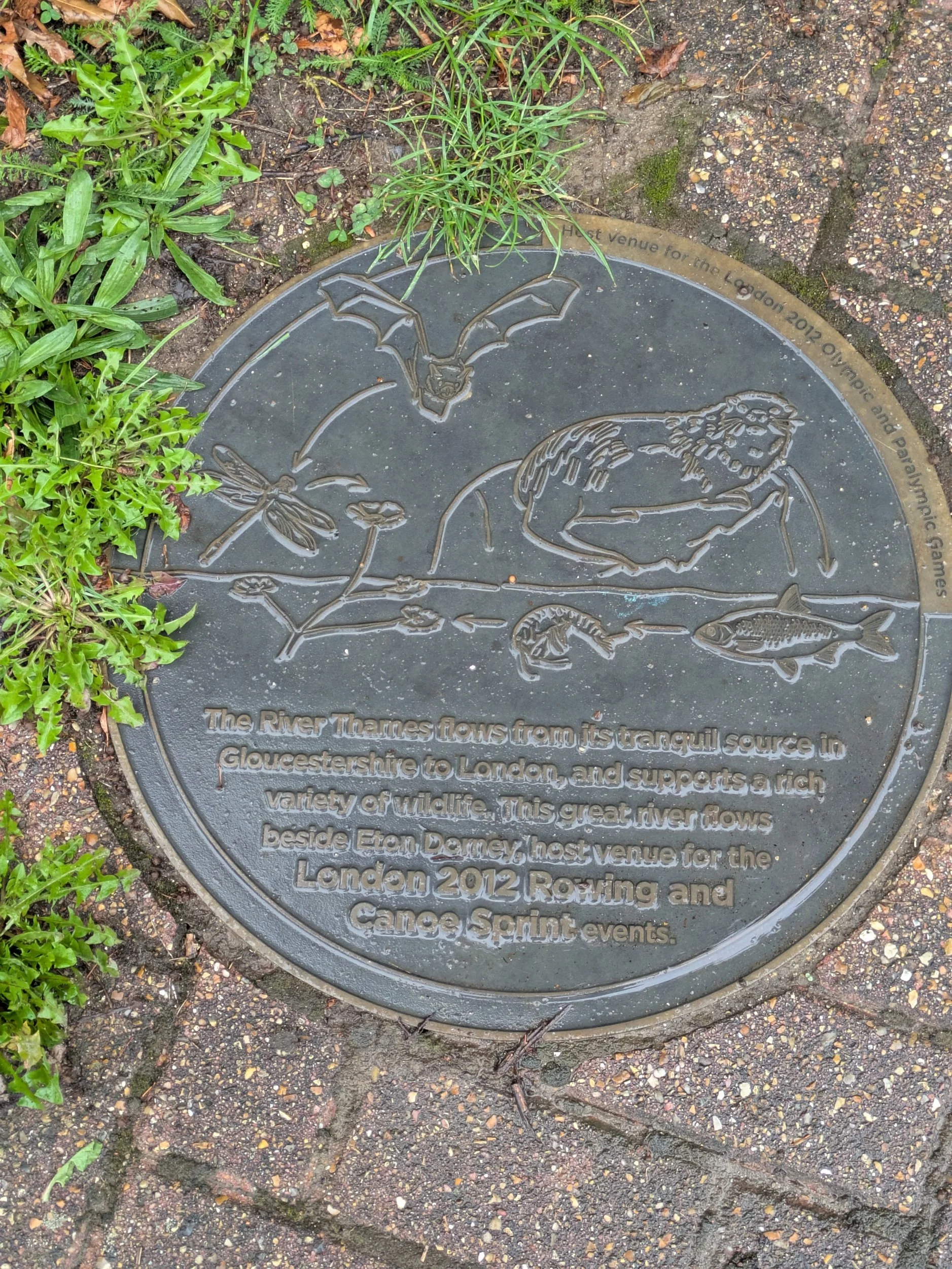


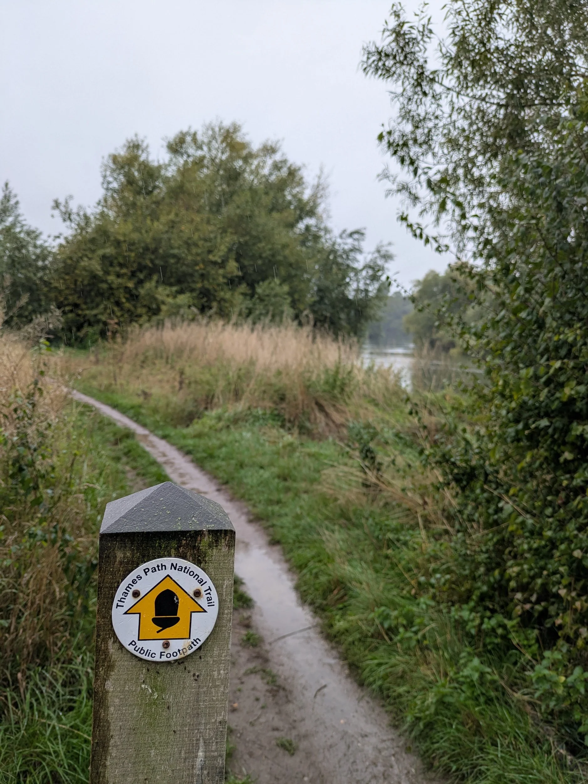

There’s a plaque in the ground commemorating Dorney Lake as a host venue for the 2012 Olympic games. The next stretch goes through meadows where I am exposed to the rain and there’s a information board about ‘Athens’ the original site of a bathing spot in the River Thames used by boys from Eton College. The path goes under the A332 road.


Another piece of public art by Florosepoet (last one we saw was in Oxford) I’ve now reached The Brocas, a meadow owned by Eton College, public access is allowed subject to 5 rules: No fishing, no fires or BBQ’s, clear up after your dog, take all rubbish away with you and respect the privacy of local residents. Shouldn’t we all be doing those things in all public spaces anyway? I can now see Winsdor Castle in the gloom in the distance and I am nearly finished for today.
Underneath the bridge is this amazing mural painted by Cosmo Sarson in 2012, look him up he’s done some amazing stuff elsewhere too!


Through a couple of back streets into Eton, up over the pedestrian/cycle (iron and granite) Windsor Town Bridge that connects Eton and Windsor, I’m on my way to find Steve and Clara in a car park. I spot this unusual black swan, apparently native to Australia, but there is a small established breeding population here in Norfolk, they have been spotted this year in Windsor!
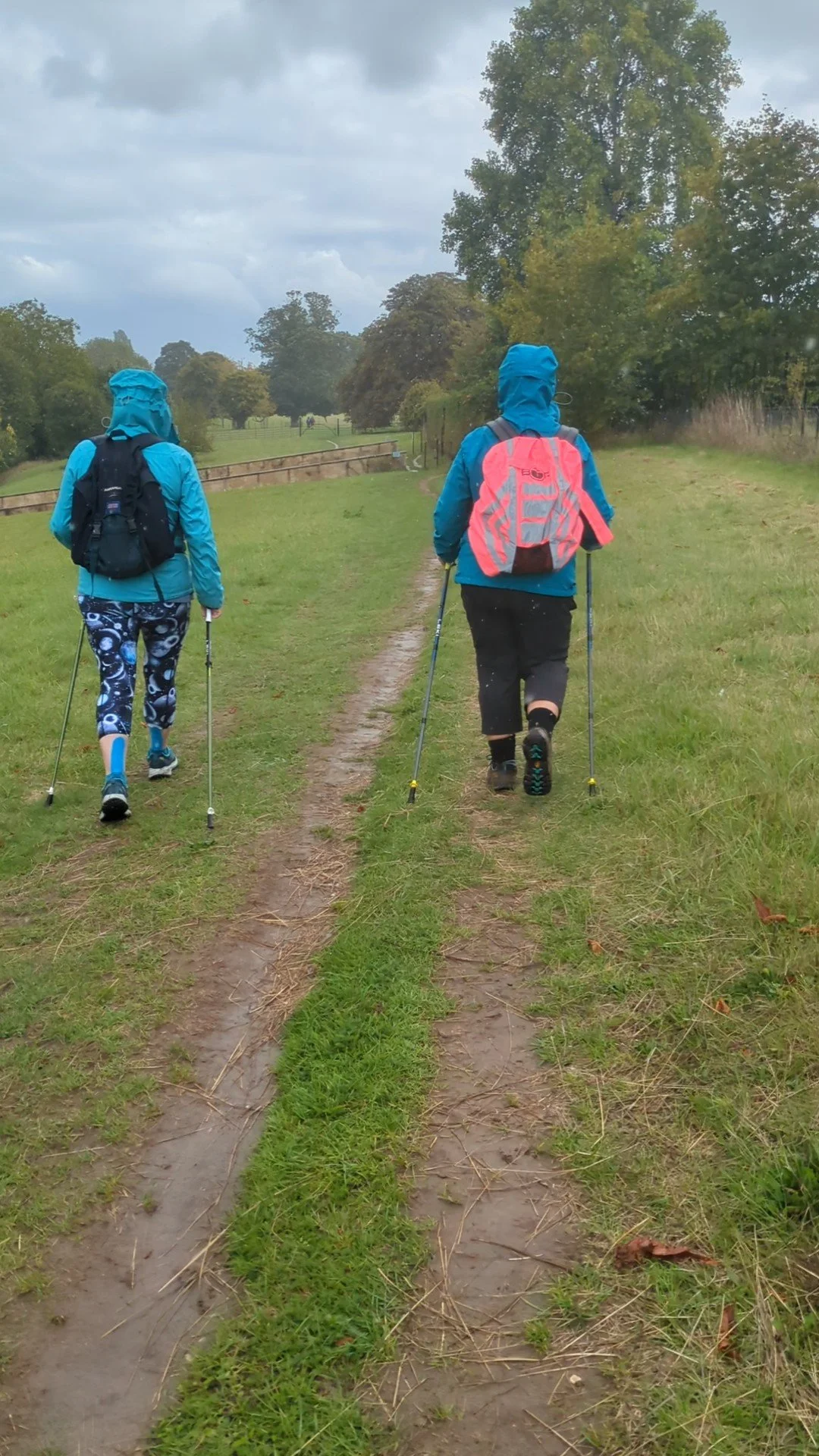
Nordic Walking The Thames Path Leg Nine: Henley to Marlow
Lower Shiplake to Marlow

Leg Nine: Henley-on-Thames to Marlow
When: Saturday 13th September 2025
Miles Walked: 12.55
Steps Taken: 27,046
Moving Time: 3:58:02
Elevation Gain: 93 ft
Avoiding the lengthy diversion at Shiplake we are starting this leg beyond the diversion, I found a car park near the Thames just before Henley-on-Thames which turns out to be just where the closure is.


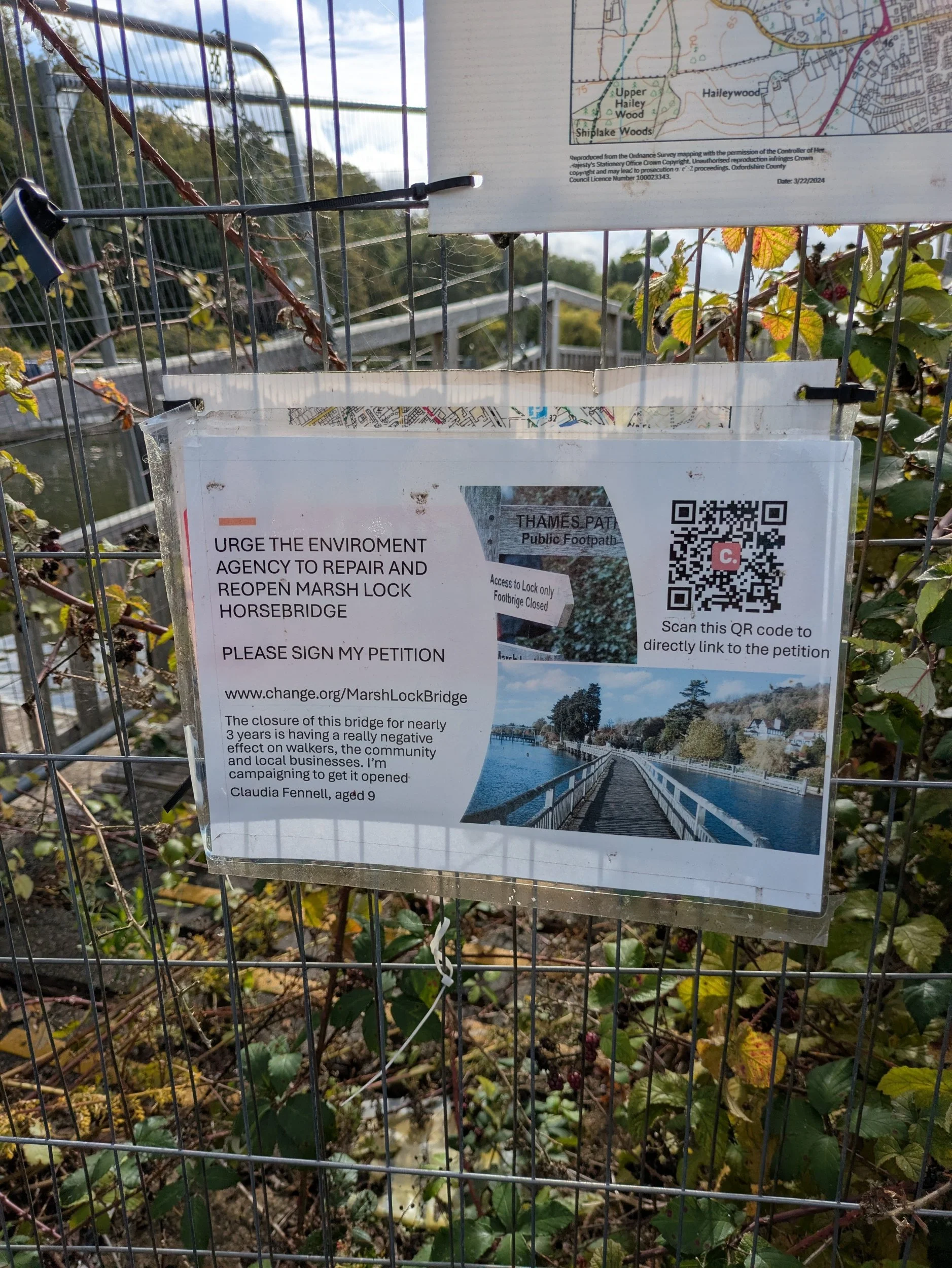
Karen and Sarah are joining me on this Leg and have driven up from home this morning, we meet at the car park in Marlow and Steve drops us all to the car park at the bottom of Mill Lane. We set off in the sunshine and are contemplating the closure when a couple appear on the bridge, apparently not the whole bridge is closed! They suggest it’s worth a walk across and so we do. Honestly the small amount of bridge that has been closed for nearly three years must be such a nightmare for local residents, let alone Thames Path walkers. The Environment Agency need to really get on with repairing it, there’s a petition by a 9 year old local girl attached to the fence (www.change.org/MarshLockBridge) the couple told us the structure of the bridge is sound, there’s some slats that need repairing, but it has taken this long for them to find that much out!


After our bridge expedition we head out along the towpath towards Henley-on-Thames, it’s a busy Saturday on the river and on the path! We stop at the River & Rowing Museum so I can get a stamp for my passport and avail ourselves of their facilities. Sadly this museum is closing for good next weekend as they just can’t afford to keep it open. We pop into the shop and I purchase a small Toad of Toad Hall plushy to keep Norbert company. Back on the path we pass the Ultra Challenge finish line area being set-up, folk are walking/running between 25km and 100km this weekend from Putney Bridge or Runnymeade for charity. Soon we can see Henley-on-Thames town appearing. I love some of the boat names!


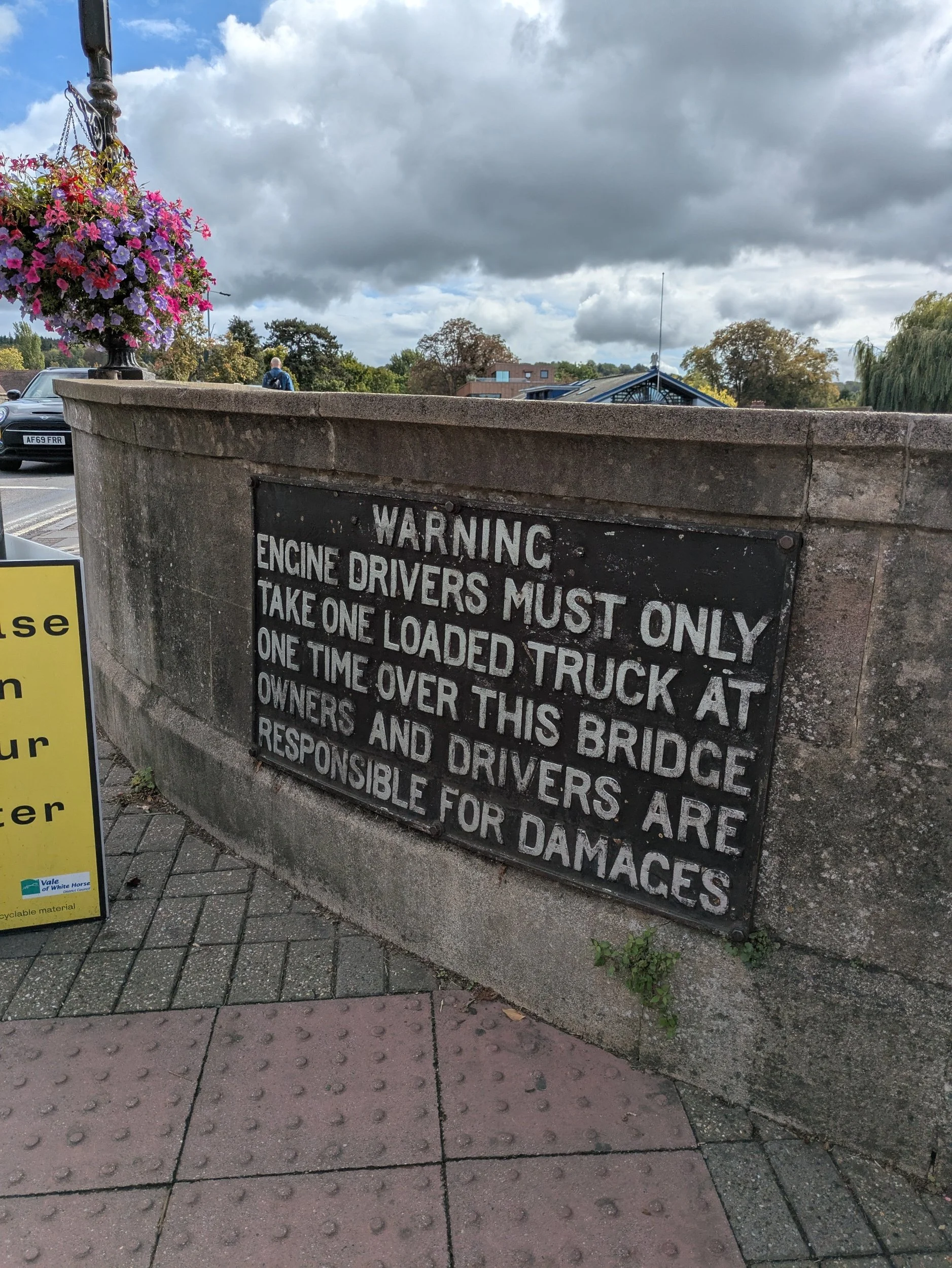
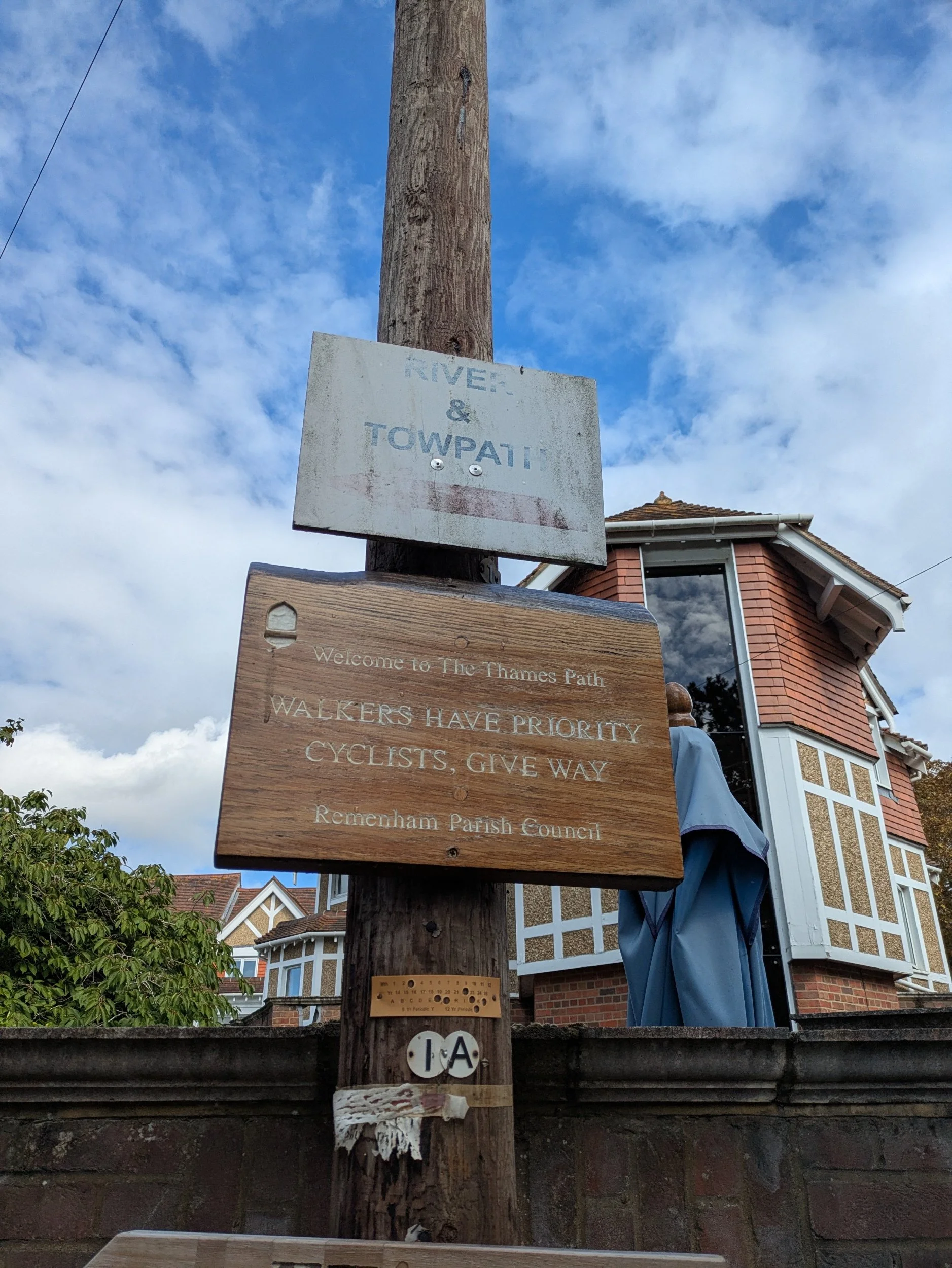

When we reach Henley-on-Thames we have a wander up and down it’s High Street and admire some of the impressive buildings. The Grade II listed Town Hall in the Market Place built between 1899 and 1901 to commemorate Queen Victoria’s Diamond Jubilee, the Greville Phillimore (a local Rector) memorial Fountain (1885) and the Golden Post Box celebrating the medal winning rowers at London’s 2012 Olympics. Henley Bridge was built in 1786, a five-span stone bridge designed by William Hayward which replaced an earlier medieval wooden bridge. Henley Bridge was also the finishing line for the first Oxford and Cambridge University Boat Race in 1829! We cross over the bridge and pick up the path on the other side of the river.


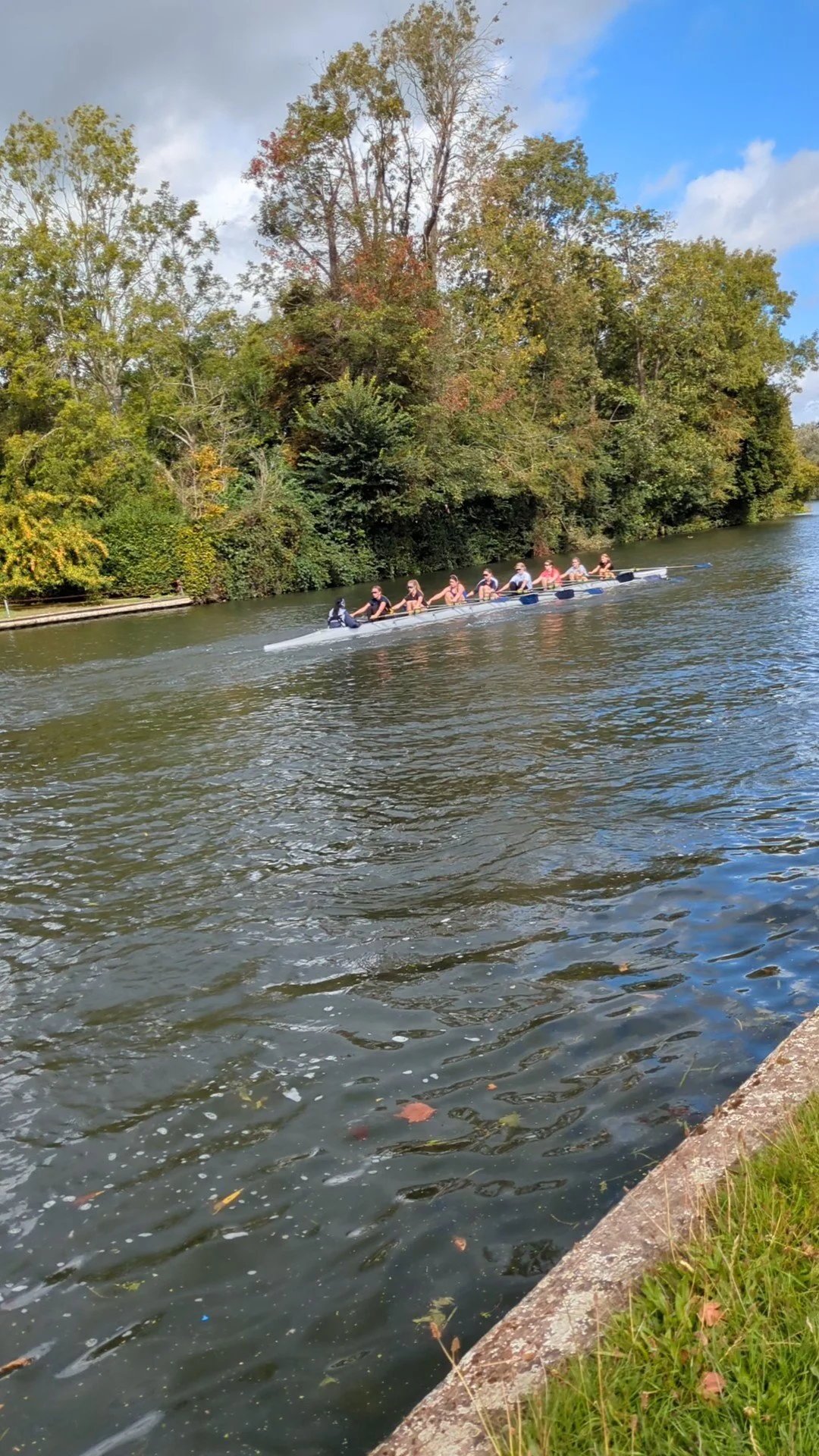

This stretch of The Thames Path is extremely busy on this sunny September Saturday! Dog walkers, families out walking, rowing coaches on bikes shouting through loud halers, we battle our way on through enjoying the rowers, boats and kayakers gracing the waterway. We initially pass many boathouses on the opposite bank and the Grade II listed Phyllis Court Grandstand which overlooks the finish line of the Henley Regatta, in 1912 King George V and Queen Mary made a visit here to watch the Regatta! In the middle of the river is Temple Island which has this folly in the form of an elegant ornamental temple built in 1771, it was designed as a fishing lodge for nearby Fawley Court. It is now owned by Henley Royal Regatta and the course starts here. We outwalk most of the groups of walkers ambling along the path and reach Hambleden Lock, there’s been a lock here since 1773.


Beyond the marina we see the first KM marker for the Thames Path Ultra Challenge, 95km! We’re now heading away from the river on a small lane towards the hamlet of Aston and our lunch booking at the Flowerpot Hotel.

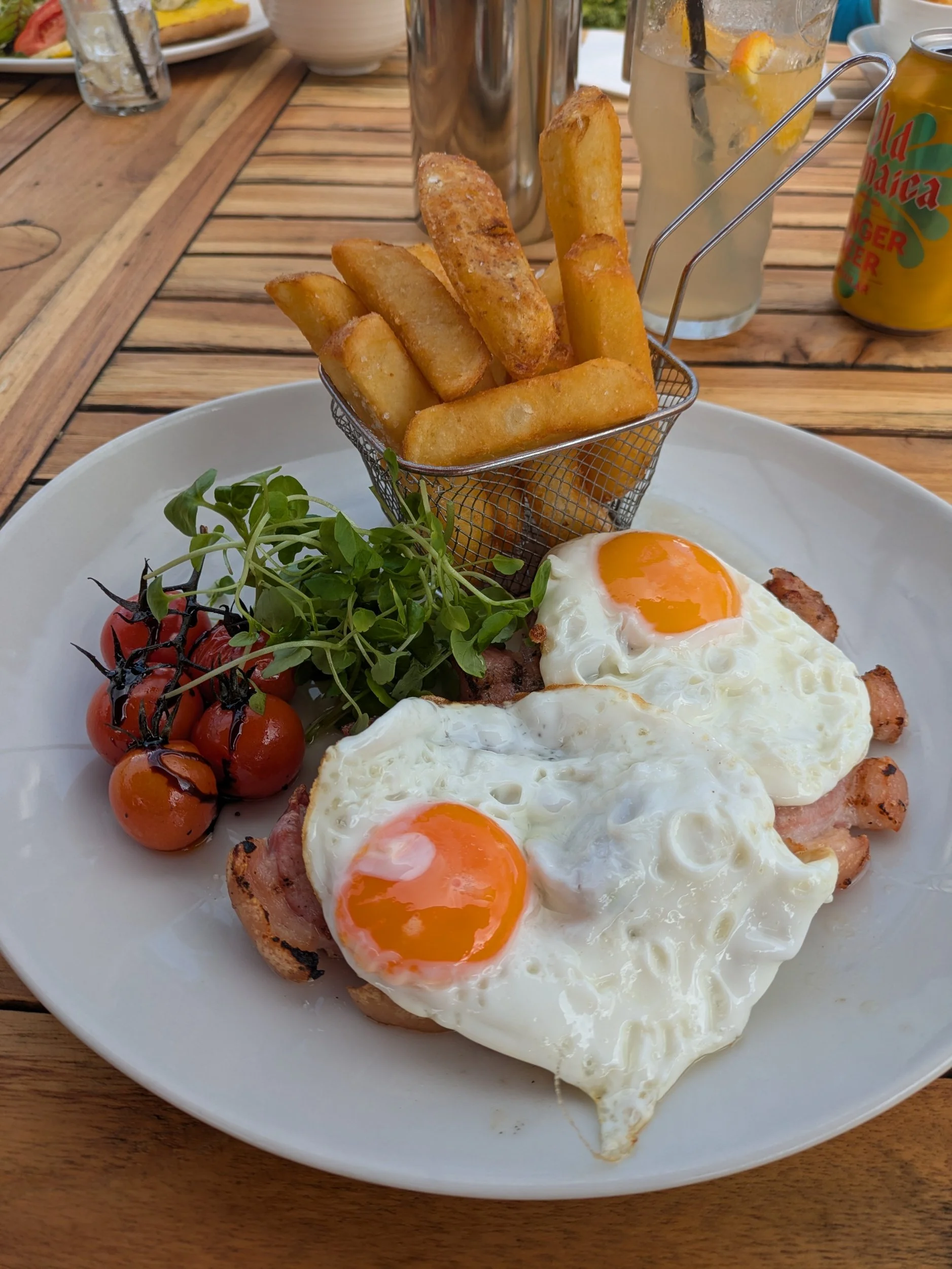


We met Steve here and decided to sit outside and enjoyed our lunches in the sunshine, the triple cooked chips were amazing! Once we had settled our bill, used the facilities and hoisted our rucksack back on our shoulders, we grabbed our poles and set off up the lane for our afternoon walk, passing Clara in the car park. The path now takes us on higher ground above the river through the grounds of Culham Court, where we hear a clap of thunder and the rain begins to pour from nowhere! Waterproofs hastily donned we walk past a couple of sculptures in the grounds, one by Chrisitian Andersson, looks like something from Stonehenge, but in fact says To R.M for EVER. We then pass another sculpture which is harder to see in the rain, but I believe it is by the Spanish artist Jaume Plensa, a 7 foot bronze head of a girl entitled ‘Wilsis’ The owner of Culham Court is a big art collector.


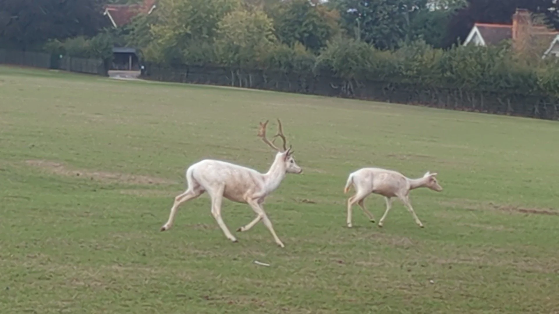
As we walk on into the Deer Park there is a stark white building on the hill, it turns out this is Culham Court Chapel, Chapel of Christ the Redeemer (a Roman Catholic chapel with services held on the last Sunday of the month), which was built in the footprint of a demolished 18th century building. It won the Murdoch Award in 2017 and has been described as a masterpiece of architecture, apparently the simple outside belies the magnificence inside! The rain has thankfully stopped and we are treated to the wonderful sight of herds of White Fallow and Fallow deer grazing around us! I’ve never seen white deer before and am momentarily captivated! I though it to be a very rare sight indeed with a white stag in folklore and legend symbolising purity, mystery and messengers from other worlds!


We reach the riverside again and pass through fields of sheep and take the alternative path that hugs the riverside, spotting St Mary’s Abbey at Medmenham on the other side of the river from us. Better known as Medmenham Abbey, the current building is partly 16th and partly 18th century Gothic and was the home to Sir Francis Dashwood, founder of the infamous Hellfire Club, but is located on the site of the medieval Cistercian Abbey founded in 1204. Shortly after this we think the first participant in the Ultra Challenge Thames Path event passes us! We are approaching Hurley Riverside (where we are camped) and in the distance we can see a grand house high up on the hillside - this is Danesfield House Hotel and Spa, built between 1899 and 1901 in the Neo-Tudor style , designed by architect WH Romaine-Walker (also involved in designing Medmenham Abbey) it has a varied history as a private home and used as temporary home for 80 evacuee boys during the war and being requisitioned by the RAF in the Second World War and as the headquarters for Carnation in the 1970’s and a hotel since 1991. It was located on the site of a large multivallate hillfort known as Danesfield Camp.
The walk along Hurley Riverside with its wide green picnic meadow is very well kept, clean and tidy, Hurley village is mostly built on the site of a Benedictine Priory. We pass through Hurley Lock and continue on to pick up an alternative diversion route as Temple Bridge is closed ahead.


The diversion takes us away from the river and along footpaths to start with.


The diversion route takes us along Temple Lane and around Bisham Abbey National Sports Centre, I keep myself occupied spotting unusual door knockers and house adornments! This road must have originally been on the route of the Reading & Hatfield Turnpike Road as this milestone marker shows Hatfield at the top. This was a toll road designed to avoid going into Central London established in the 1760’s.
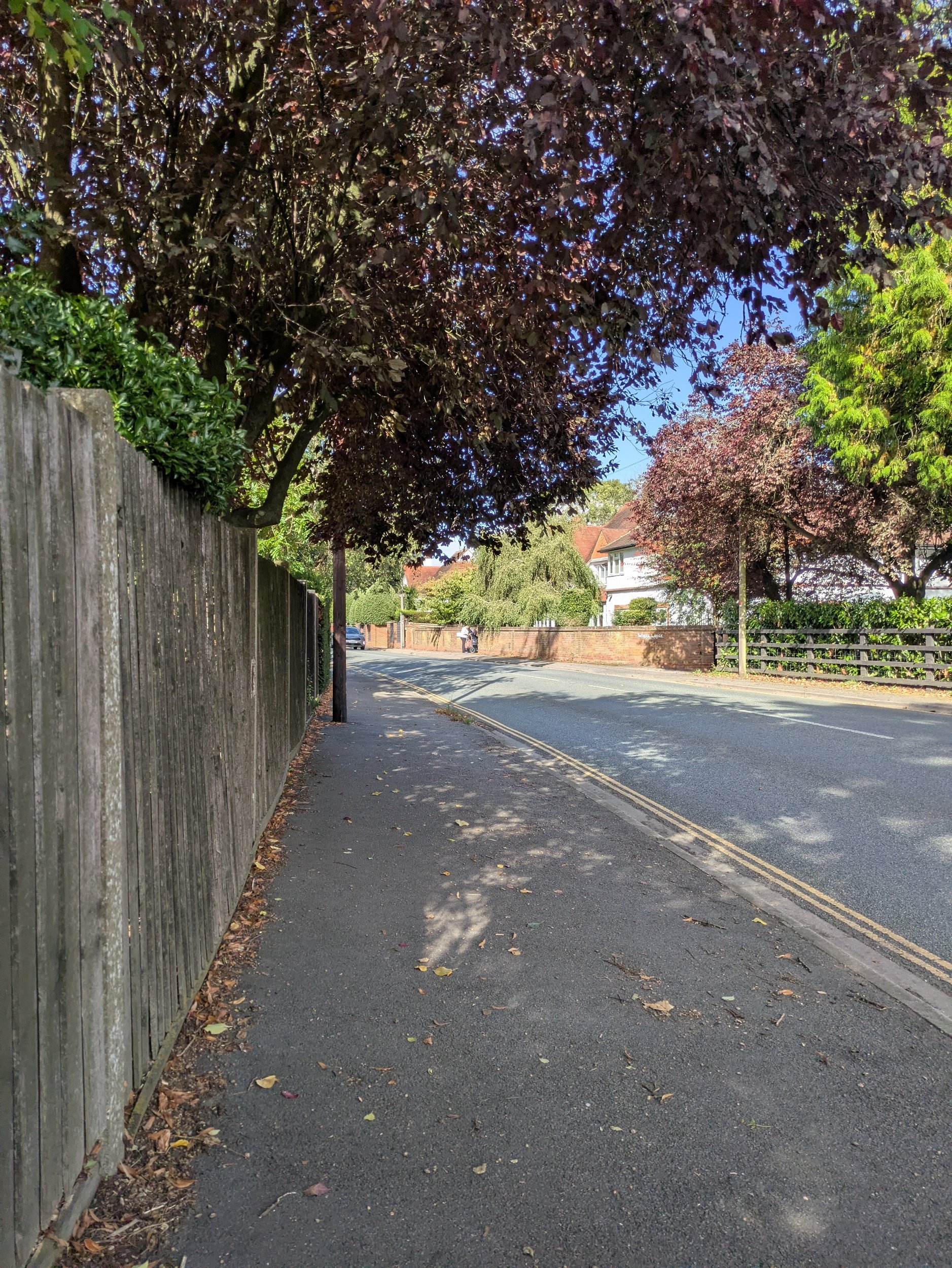

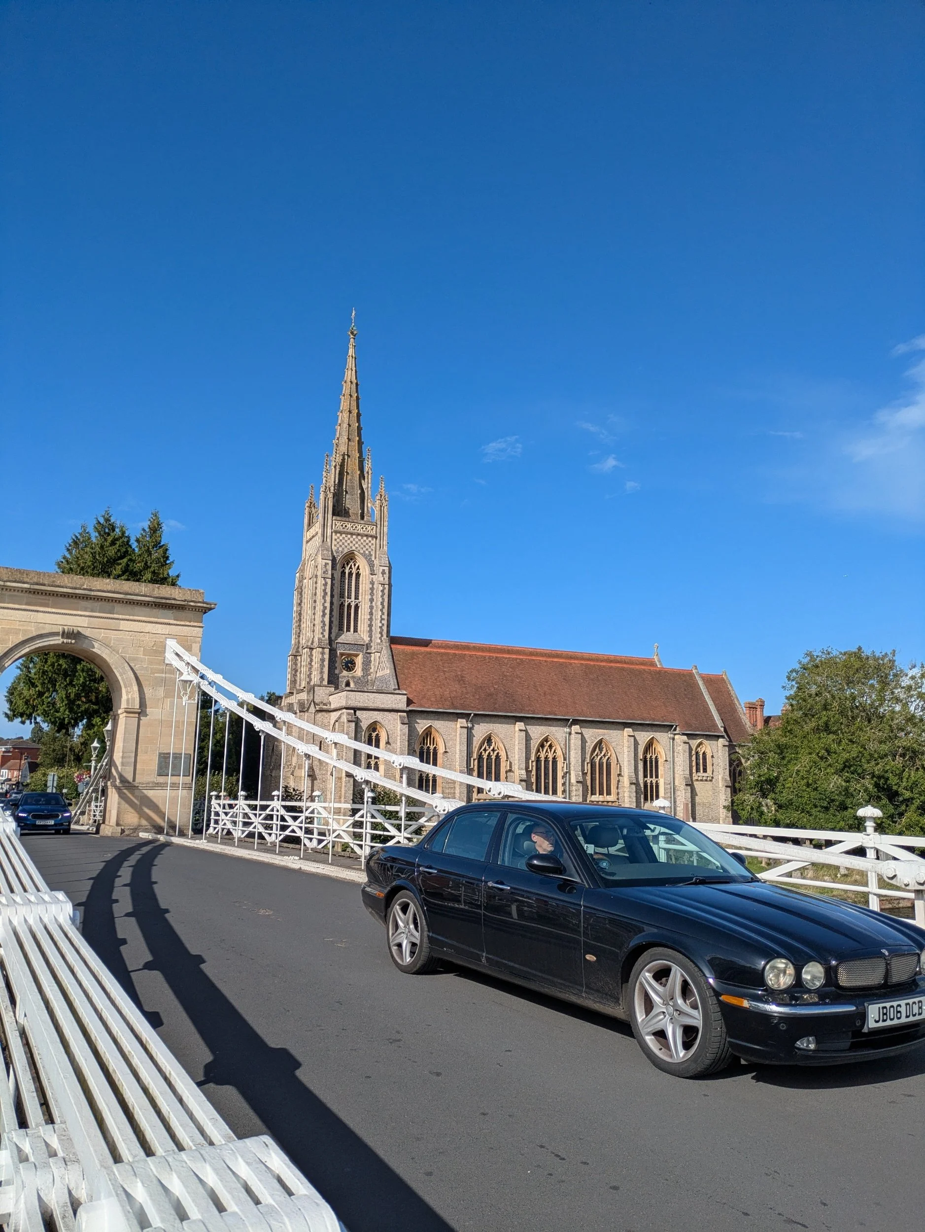
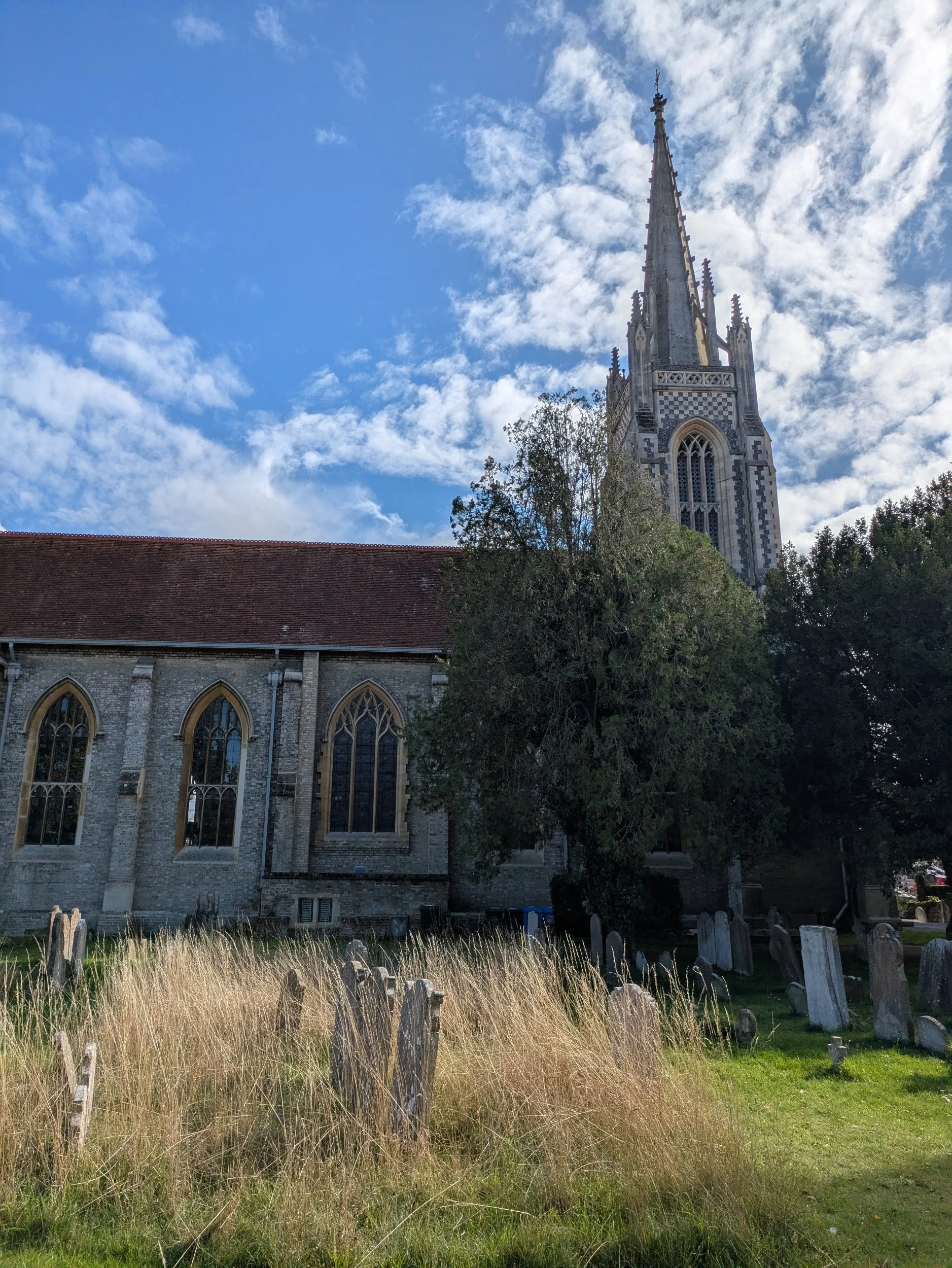

We finally reach Marlow and cross over the river using the impressive looking metal suspension bridge was completed in 1832 and was an experimental design at the time. I nip off to collect a stamp for my passport from a café and Sarah stops to buy an ice-cream. We then head through the churchyard to a lovely wide path beyond.


Here the Thames Path weaves on and off the riverside and eventually we see the car park Sarah and Karen parked in this morning. Steve is waiting for me in Clara having passed us on the bridge in Marlow and turned round (originally Sarah was going to drop me back) and we complete our stretches with the heavy scent of weed coming from one of the parked cars nearby!

Nordic Walking The Thames Leg Eight: Pangbourne to Lower Shiplake
Pangbourne to Lower Shiplake

Pangbourne to Lower Shiplake
(map part one)

Map Part Two
Leg Eight: Pangbourne to Lower Shiplake
When: Thursday 11th September 2025
Miles Walked: 16.09
Steps Taken: 30,184
Moving Time: 4:32:48
Elevation Gain: 163 ft


Steve dropped me off in the centre of Pangbourne opposite The Elephant Hotel, as I had spotted a shop yesterday that I wanted to visit, Garlands Organic is a health shop much like The Wild Food Co. in Malmesbury and it was good to stock up on some snacks and check out their range, they sell the same organic eggs! I wandered back to the river via a couple of charity shops (you never know what you might find) and beyond the bridge is a wide open space, Pangbourne meadow, owned by The National Trust, with benches along the river, there’s a few dog walkers about too. The path continues along a boardwalk and into another meadow before leading over more boardwalk (obviously gets wet in the winter months) onto a narrower strip of land alongside the river. Boats and kayaks appeared out of nowhere when I was trying to record a little video on this stretch!


Meadows give way to Mapledurham Lock and beyond the lock the path leaves the riverside and heads up past some paddocks and uphill through housing estates bringing you out in a small woodland in Purley-on-Thames coming out on the A329 briefly (welcome to Reading). Around 600BC Saxon invaders sailed up the Thames and settled beside the Kennet. These were the Readingas named after their leader Reada (The Red) who gave the town their name.


Now heading down the side of a red-brick building and across the railway bridge, down steep steps back to the riverside, it’s a bit of an uninteresting schlep to be honest. The path now runs alongside the river and in between the river and the railway line, at least the Horse Chestnut trees have decorated the ground in orange leaves. The path finally opens up to go through a boatyard and past some static caravans.

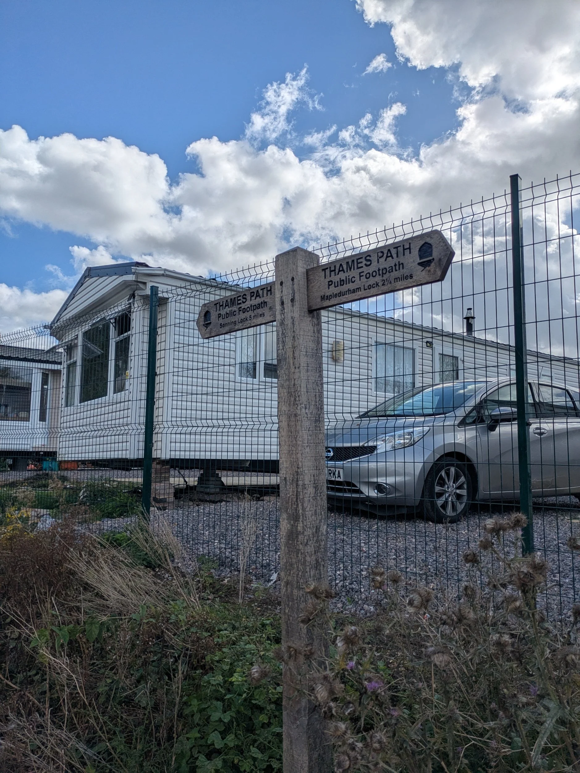


We are now on Reading Thames-side Promenade, a wide expanse of grass and tarmac path dotted with blue painted benches and willow trees, there are lots of folk using the path, cyclists, runners, parents pushing prams. It’s along here that I decide to race and beat the Wessex Hotel Boat!. I leave the promenade to meet Steve in the car park of the Rivermead Leisure Centre for lunch leaving the path in bright sunshine. During the course of lunch the heavens open and chuck bucketful’s of rain down! So it’s a bit greyer when I set off for the afternoon walk returning to the promenade, passing Reading rowing club.


I walk through the tunnel under Caversham Bridge and when I get to the other side it has started to rain again, so I pause and put my full set of waterproofs on as it feels like this is set in for the afternoon! Caversham Boat Services across the water caught my eye with their two stone lions flanking their path…rahhh! Christchurch footbridge comes into view and there’s a group of people ducked under the other side taking shelter. Reading Bridge (imaginatively named) has another pedestrian tunnel for me to walk through bringing me to Caversham Lock.


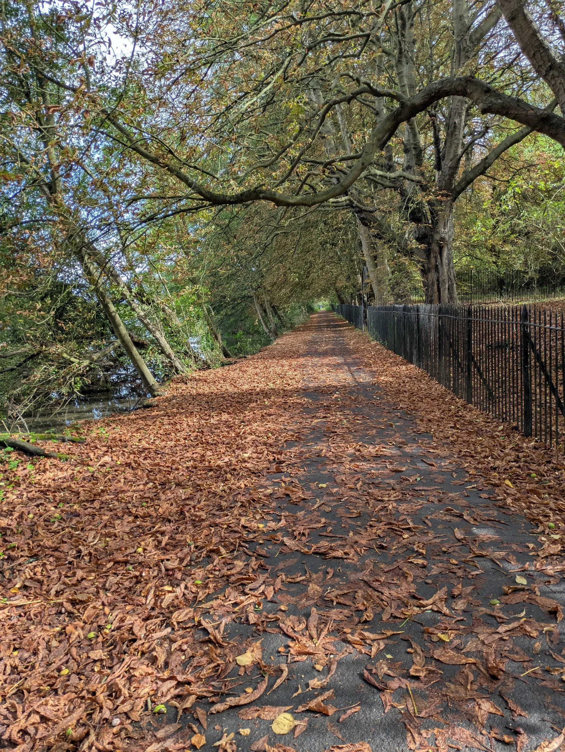

There’s a beautiful narrowboat moored up her called Sunshine on Leith with a Nessie painted on her bow! ( I see this particular narrowboat a few times in the days to come) Beyond Caversham Lock is King’s Meadow where I encounter strange looking geese. These are Egyptian Geese which were brought to Great Britain in the 1700’s, now common in the South of England. They have been around since the ancient Egyptians who considered them sacred birds. This stretch of riverside passes a Tesco supermarket and quite a few permanent looking moorings, it has stopped raining!


The Thames Path National Trail now goes through the Thames Valley Nature Reserve where I pass some young people getting some kayaking lessons at Wokingham Waterside Centre. In the nature reserve they have been coppicing the willow trees and laying mulch, so it looks a bit bare on the riverside . There are benches dotted all along the waterfront and one has a quote from Kenneth Grahame’s Wind in the Willows: “The mole never heard a word Rat was saying. Absorbed in the new life he was entering upon, intoxicated with the sparkle, the ripple, the scents and the sound and the sunlight, he trailed a paw in the water and dreamed long waking dreams…”
Author Kenneth Grahame has a long association with this area and the river Thames, he spent much time in Cookham as a boy, boating and exploring the countryside of the upper reaches of the Thames. He originally created the riverside adventures of Mole, Ratty, Badger and the troublesome Mr Toad as bedtime stories for his disabled son and they were collectively published in1908 as The wind in the willows. Grahame spent his latter years at a cottage in Pangbourne until his death in 1932.


Tree-lined paths lead me past Reading Blue Coat School’s grounds and down to Sonning Lock, there is a memorial gate to an old master from the Blue Coat School, simple with it’s gold crossed oars, but effective. I then reach Sonning Bridge, a Grade II listed brick and stone arch bridge which replaced (built 1175-1790) an earlier wooden bridge that had stood at the site since Saxon times. It is the only crossing point over the Thames between Henley-on-Thames and Reading which can lead to significant congestion at peak times! I cross over the bridge and pick up the path on the opposite side of the river.


The path winds it’s way along the meandering river with fields on one side and flanked by trees interspersed with moored boats. There’s quite a few rowers out on the water with their distinctive swish of the oar blades cutting the water and the shhh of the wheels of the sliding seats moving forward and back, a consistent rhythm sometimes accompanied by shouts from coach or cox of “every stroke counts” I reach the boathouse for Shiplake College, where there is a pontoon full of shoes waiting their owners return.


Beyond the Shiplake College Boathouse the path continues on to Shiplake Lock passing some stunning riverside residencies on the opposite bank. Shiplake Lock is quite pretty in itself! The path reaches a cobble and brick wall and turns left alongside it away from the river eventually reaching a lane which takes you towards Shiplake Station. Here due to a bridge closure at Marsh Lock, South of Henley-on-Thames, there is a 3 mile route diversion and I have opted to skip the diversion and meet Steve here. I stop at the Baskerville Arms to get my passport stamped and pop into The Corner Shop for goodies to go with my cuppa when we get back to our campsite!

Nordic Walking The Thames Path Leg Seven: Wallingford to Pangbourne
Wallingford to Pangbourne

The Thames Path: Leg Seven
Wallingford to Pangbourne
When: Wednesday 10th September 2025
Miles Walked: 14.36
Steps Taken: 28,572
Moving Time: 4:51:27
Elevation Gain: 329 ft


Today is our 31st Wedding Anniversary, so we begin the day by walking across the bridge into Wallingford in search of a cooked breakfast! We end up at Mollie’s Café and have arrived just before they open, so take shelter from the rain whilst they put out the furniture! We eat a delicious breakfast (highly recommended!) and cuppa before heading out into the now dry weather, it’s still a bit gloomy. Leaving Steve to his morning I set off to find the Thames Path again.


The Thames Path leads me down the imaginatively named Thames Street passing St Peter’s Church whose spire I had spotted as we crossed the bridge. The original medieval church had been destroyed during the Civil War and so a new church was completed in 1769, the unusual spire was added in 1775, designed by famous architect Robert Taylor. It was the stained glass window that caught my eye as I passed! At the end of the street is another church, St Leonards the oldest of the three remaining churches in Wallingford, it is believed to be of Saxon origin. Turning left at the church the path leads down a narrow path.


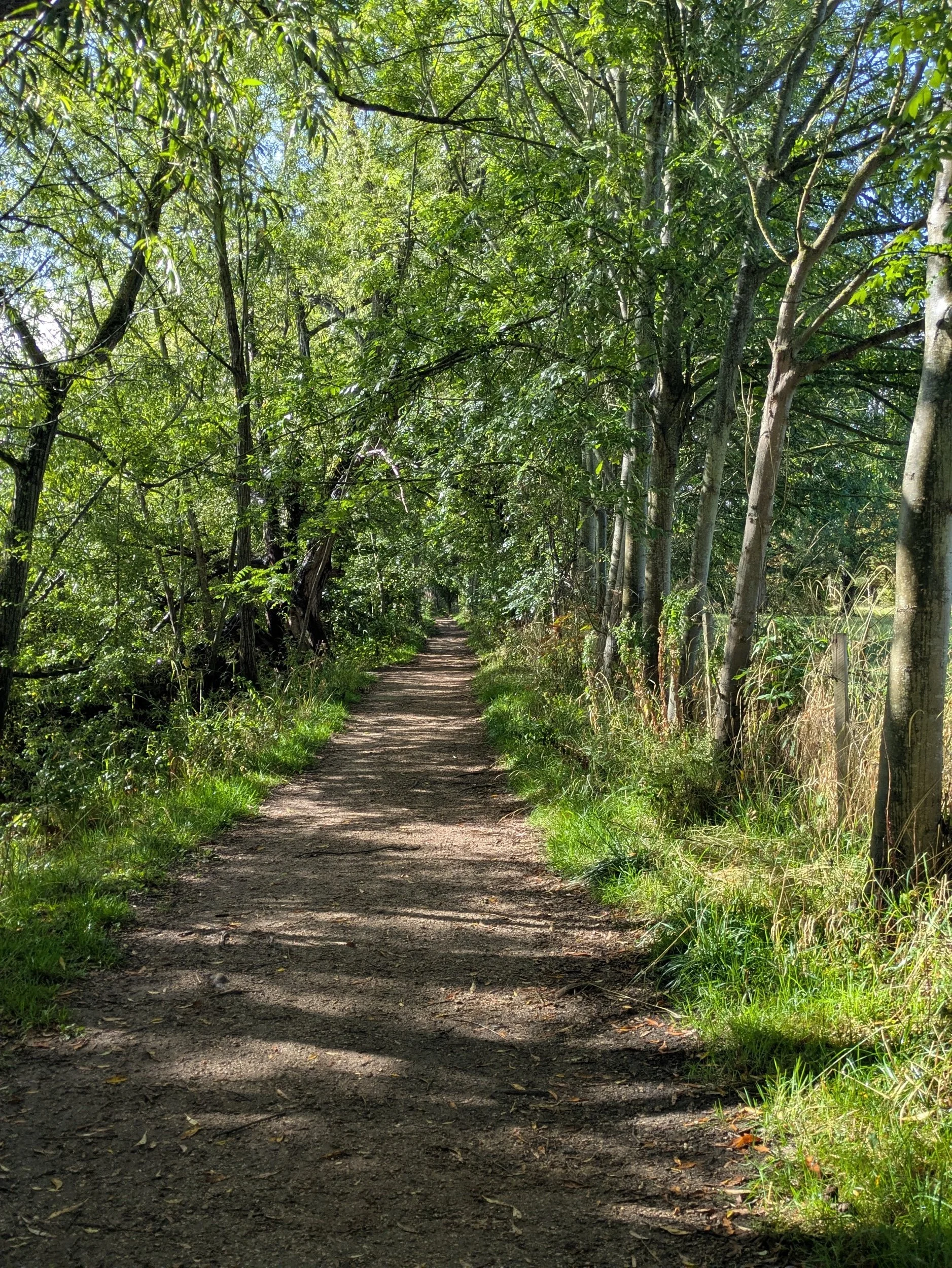

Once out by the river again I pass by the Oxford University Boat Club (very smart looking) and many private pontoons and then the path leads to a shaded tree-lined footpath, cross a footbridge and come out into a field of cattle, thankfully they completely ignore me as they are too busy munching grass! This field leads to a road bridge where this apt grafitti adorns the opposite bank.


On this part of the path as well as more private pontoons I pass a garden littered with objects, one of which is this AquaScrubber from the River & Rowing Museum in Henley. The path continues close by the river on a narrow strip of land littered with leaves , twigs and other natural debris. The weather is scattered sunshine currently! I pass through another field which harbours another Pill Box.


I pass by Cholsey Marsh nature reserve, a scarce habitat these days due to farming practices. Apparently is provides a home to a wealth of plants, birds, insects and other wildlife that depend on the wet reed and sedge beds including a colony of rare Desmoulin whorl snail! They’ve cleared an area of willow trees by the river and created a dead hedge to my right, a sight I’ll see a few more times this morning. Continuing along the path I pass under a canopy of Damson trees (too big to be Sloes) and then across a boardwalk before heading under a railway bridge.


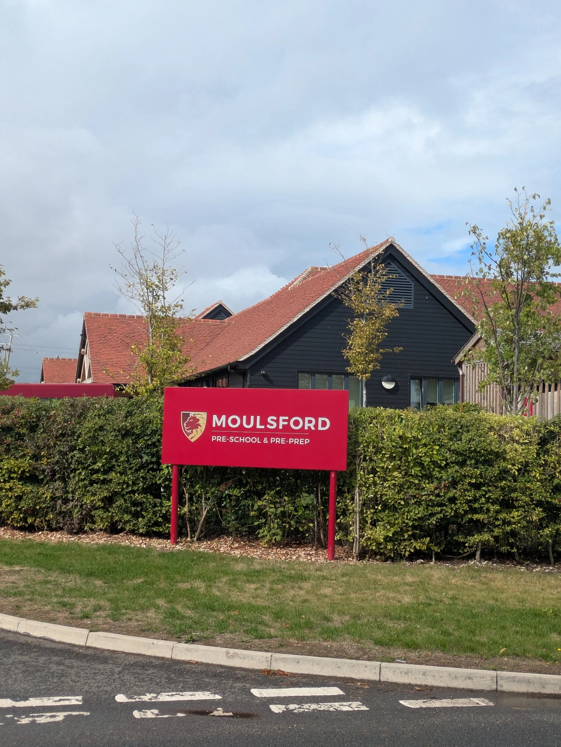

Beyond the railway bridge is a very narrow path with railway green fencing on one side and quite dense hedging on the other, in amongst the hedging I spot a dragonfly who stays still long enough for me to capture his/her beauty, I also spot a walnut tree and gather a few nuts to eat later. The path leads up a very claggy driveway between the sports fields of Moulsford Private School and onto the relatively busy main road. I stop to check my directions by an old school which still has its clock and bell (now a home). I pass the main Moulsford School and a row of old cottages before turning left down a small lane.


The lane has a gorgeous wall for quite some way down it and I reach The Beetle and Wedge Pub where I stop to get a stamp in my passport and for a cheeky comfort break. The Thames Path goes through the pub terrace and along where there are private moorings with some very interesting residences! Here they have made some great improvements to the path, but it doesn’t last long!


The path opens up onto a very wide floodplain and I pass through Cleeve Lock and weir, I must be getting close to Goring as I pass Goring Thames Sailing Club.. The path leads into a narrower tree-lined area and up and over a private cut. There are some expensive looking boathouses along this stretch, very elaborate! Not sure if they are mock Tudor or the real thing! More boardwalks lead to the back of St Mary’s Church where Lewis Carroll (Author of Alice in Wonderland) preached in 1864.


Reaching the High Street I walk along to the bridge over the Thames and spy Steve (my lunch date) waiting for me. We head to a café called Pierreponts and enjoy a delicious lunch (Coronation chicken baguettes) whilst the heavy laden clouds burst with a torrential downpour! Thankfully it isn’t sustained and afterwards I have a little wander into Goring to supplement my Anniversary gift for Steve!


Goring on Thames village hall has a stunning clock tower on the top of its village hall with some superior leadwork which was refurbished in 2016. Goring is also famous (apparently) for being where the late George Michael (Wham) lived and on the Thames Path beyond the bridge there is a fans memorial to him, reminds me a bit of Ianto’s Shrine (IYKYK). I’m now walking down the glistening tarmac on the riverside passing narrowboats and kicking up the carpet of Horse Chestnut Trees leaves this is a very pretty stretch! There is a very modern glass box jutting out over the water on the opposite bank.


Norbert finds a post to sit upon and demands his portrait be taken and the path continues quietly with the odd swan gracefully swimming by. I walk through a wider field which then leads me under a railway bridge which was one of Brunel’s Great Western masterpieces. Here the footpath narrows and runs between fences away from the river and weirdly this London Anglers Association symbol appears (not by the river!)
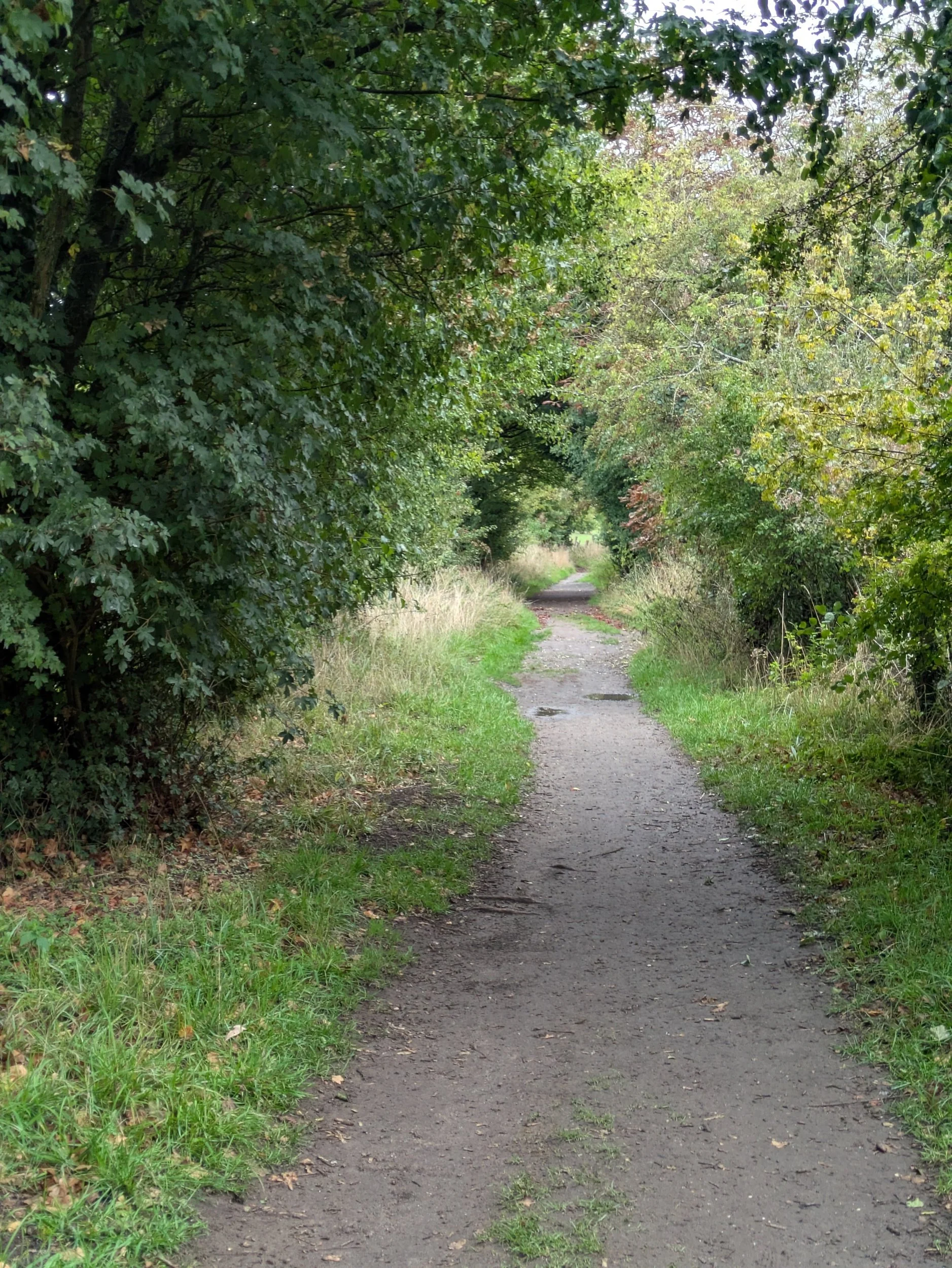


The path becomes more rural again and the scenery more undulating and there are wooded areas that are wonderfully providing great habitats for fungi! Dryads Saddle and Glistening Inkcaps (so delicate!) are the ones I spotted!


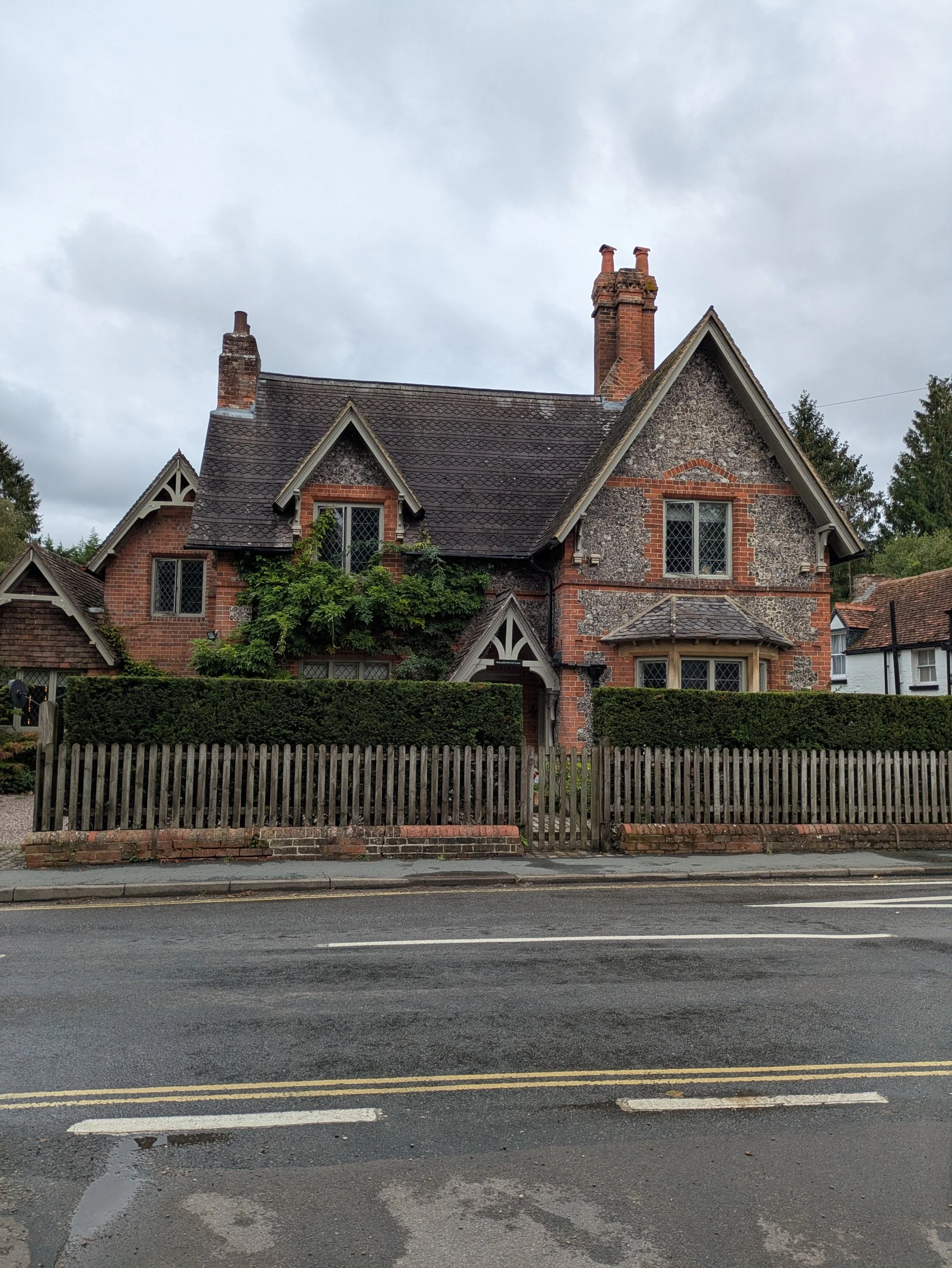
I head away from the river again and pass a sign for Hartleys Steps, which is weird because there are no steps, I carefully negotiate my way down the slope and then see the steps going steeply up away from me. Ugghhh. There are two men descending the steps and so I have to wait as the foliage is overgrowing the steps meaning it is single file currently and not easy to Nordic walk up either. The path levels out and leads to a very long driveway which passes Coombe Park and Rivendell Farm. It eventually leads to Whitchurch-on-Thames. The path leads along the road to the church.


Once around the church I come to the Toll Bridge, which is free for walkers , but cost Steve 60p I learnt later! I walk across the bridge and into a carpark where I spy Clara! I have had a good day collecting stamps for my passport!

Nordic Walking The Thames Path Leg Six: Abingdon to Wallingford
Abingdon to Wallingford
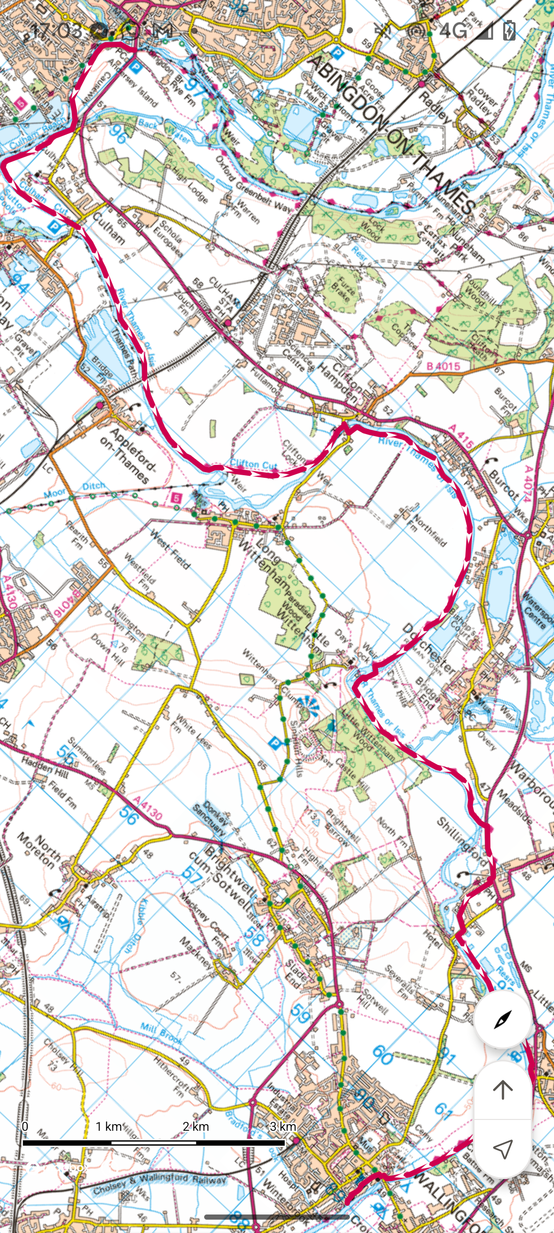
Leg Six: Abingdon to Wallingford
When: Tuesday 9th September, 10am
Miles walked: 16.29 miles
Steps taken: 32,562
Moving time: 4:50:18
Elevation gain: 74 ft


This morning is an absolutely gorgeous morning! Steve drops me off in a riverside car park and so there’s not far to walk to get to the start of my walk today! The bridge is looking stunning with the blue-sky back drop and the riverside is already quite busy with folk milling about, dog walkers and boaters. On the opposite bank is St Helen’s Church which is unusual as it is wider than it is long, with five aisles! As I begin to walk along the river I keep passing men (mostly) with vast amounts of fishing gear, it transpires that today is the start of the annual 3 day fishing event known as Thames Festival with over 60 competitors. They sit right out on the river on specially built seats! Their pegs go on for three fields! Well, it’s a nice day for it! It’s also a nice day for some rowers as I pass boathouses on the opposite bank.


The path continues around field edges and I spot a Red Admiral amongst the brambles and copious amounts of hops in the hedgerows. I see what looks like the cooling towers at Didcot Power Station in the distance, but they were demolished so I don’t have a clue what I am looking at! Answers on a postcard please! There’s a tractor in one of the fields, I think he may be spreading fertilizer, but they obviously have a better class of tractor following birds here in Oxfordshire because there are Red Kites swooping along behind it! I follow a shaded path for a bit and then reach Culham Lock. Culham Lock is one of the two deepest locks on the River Thames, the other is at Sandford.


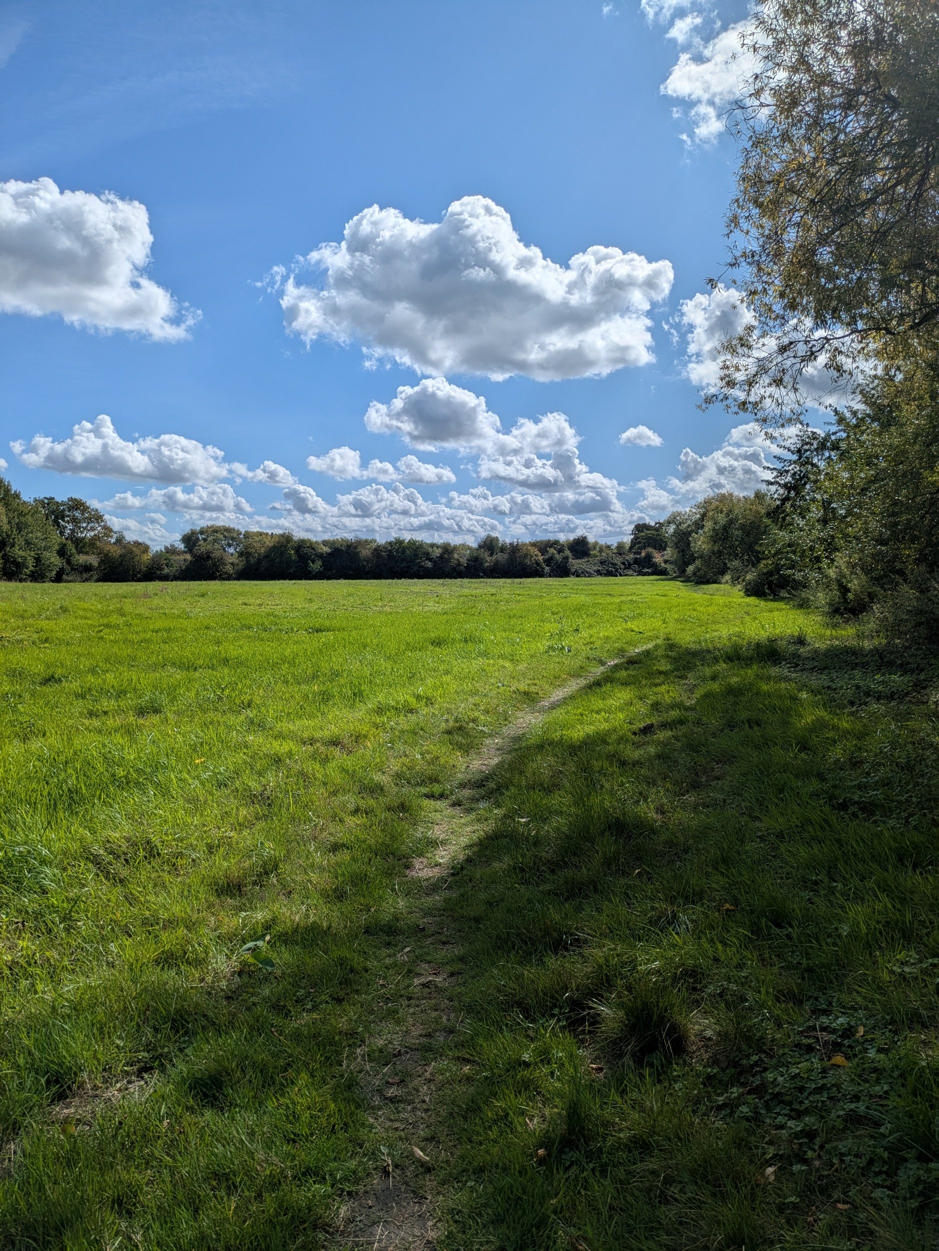


Once through Culham Lock I have to cross a road, but as I go through the gate I notice there are some rather tasty looking mini-plums and so I grab a handful, cross the road over Sutton Bridge and enjoy a tasty fresh snack on the path. The path goes under the railway.


The path here is dappled with sunlight and I pass through fields with pill boxes in them, spy a heron taking off (not quick enough with my phone to capture it)passing through fallen crab apple corridors and young willow trees standing like sentry guards on the riverside, it really is idyllic walking! I walk along Clifton Cut until I reach Clifton Lock which has the most amazing flower displays!


Including this glorious Brugmansia! It’s a short hop from here to Clifton Hampden and I’ve just received a text from Steve, he’s at the bridge in Clifton Hampden where he reckons is a good spot for a swim! The red brick bridge was opened in 1867, designed by Sir George Gilbert Scott and has seven Gothic arches and pointed abutments with random flared headers in Flemish bond, it is a beauty! I meet Steve on the riverside and we agree on a dip, by the time he has returned and we are changed a pair of swans have appeared with eight cygnets! Although still grey in colour they are almost adults size and I do not fancy getting in the water where there might be aggressive swans! So we wait until they have moved on…about twenty minutes! I get in a shallower tributary and my feet sink into the sandy silt, but the water is not too cold and I slowly acclimatise by wading further out. We enjoy a refreshing dip and dry off in sunshine, I decide to warm up by getting off back to the trail and having a brisk Nordic Walk where possible.


Walking across the bridge and heading along the opposite bank I spy the spire of a church that was hidden from view until now. I’m walking alongside the river on my left and a nature reserve to my right, this one is managed by Earth Trust (based in Oxfrodshire) and there are some information poles along the way with drawings of animals you can expect to see here, they have also created backwater channels and ponds here to enable wildlife to flourish. There are more Red Kites here!


In the distance I can see Wittenham Clumps, a pair of wooded chalk hills in the Thames Valley, more properly known as the Sinodun Hills, the name Wittenham Clumps refers to the two clumps of beech trees which crown both hills. These are the oldest known planted hilltop beeches in England dating back 300 years. There are big houses and boathouse along this stretch of river, some old and some more modern!


I’m meeting Steve at the foot of Wittenham Clumps for lunch today outside St Peter’s Church and to get there I have to go through Day’s Lock and then cross over the river on Little Wittenham Bridge and walk up the road, it’s a lovely spot and right opposite the entrance to go up to Wittenham Clumps.
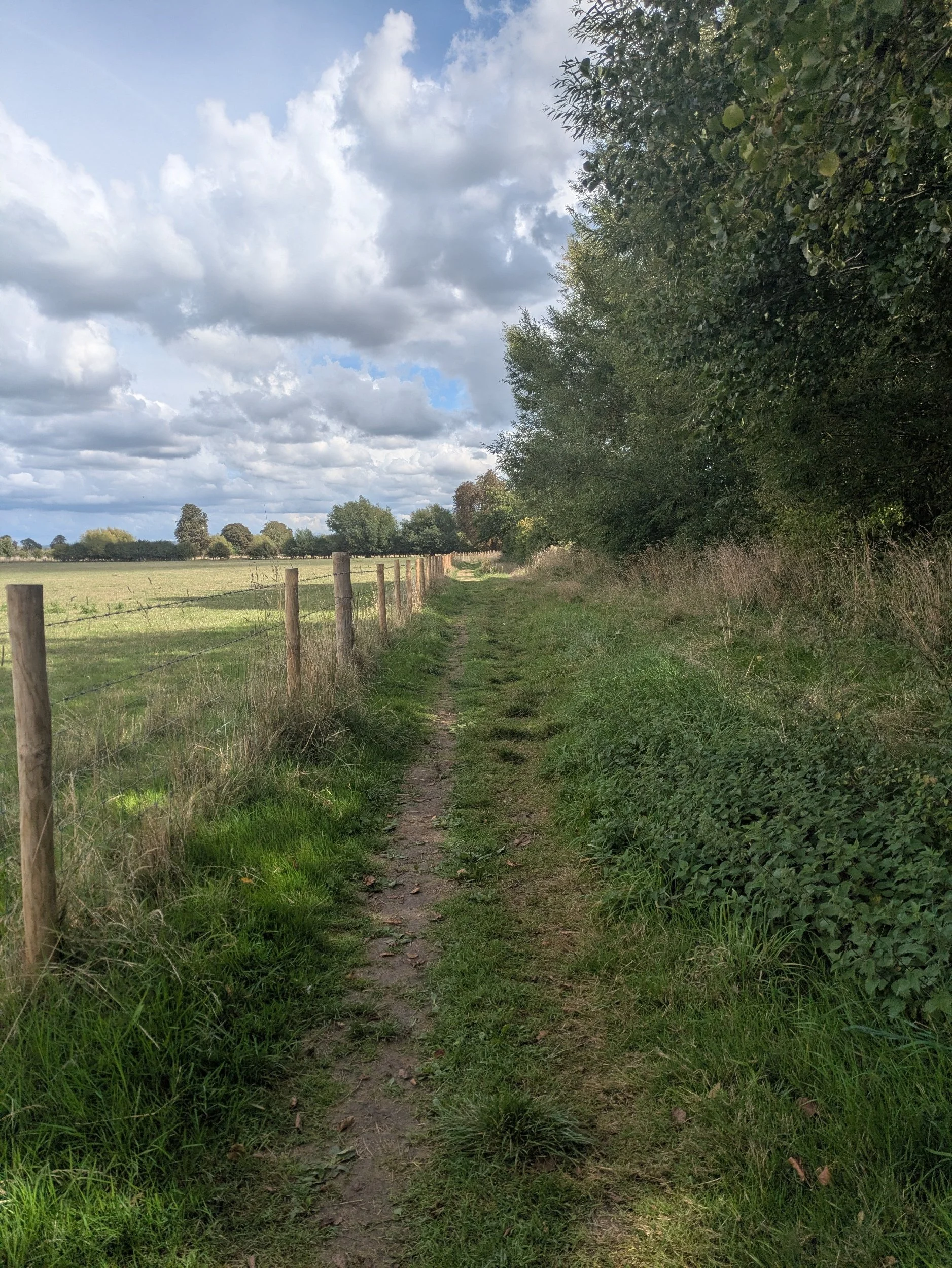


The next stretch of the Thames Path is back in fields again, passing Horse Chestnut trees that are signalling Autumn is on it’s way, dropping a carpet of burnished leaves for me to scuffle through. This area is near to Bishop’s Court Farm and is steeped in history and nearby Dorchester was one of the most important towns in the kingdom of Wessex in the reign of King Cynegils (Saxon King) in 611. It is believed that King Cynegils and other members of the royal family were baptised in the River Thames near here, by Saint Birinius, the first bishop of Dorchster. Cynegils daughter, Cyneburg was also married to King Oswald of Northumbria to cement relations between the two kingdoms, although it took nearly another 300 years to have a United Kingdom of England! Along the banks here I completely miss a turning taking me up to the road and have to back track to find my way, however I feel slightly better when I realise the waymarkers and posts are missing! I walk along the busy A4074 and turn towards Shillingford.


Passing down a quiet lane which leads to the river and then through alleyways I eventually come to Shillingford Bridge, I completely miss Shillingford Bridge Hotel where I needed to get a stamp for my passport though! The path along the river here has an interesting hurdle of a fallen tree in several parts making it awkward to clamber over and lovely tree tunnels where trees have arched over. It’s a great stretch of the path until… I hit the ‘closed for Benson Weir Refurbishment’ sign. I knew this was awaiting me and I had hoped to call for a ferry, but there is no-one available to take me today, so I will have to follow the lengthy diversion instead.


The diversion starts off down a little lane with pretty thatched cottages and I pass the tiniest deer I ever saw, it must have been injured because it saw me and didn’t scarper! The remaining diversion was dull and along a busy road and industrial area and I felt like giving up, however I soon was out on the Crowmarsh Gifford to Wallingford road and passing the campsite where we were staying, so I didn’t bother going all the way into Wallingford!


Nordic Walking The Thames Path Leg Five: Oxford to Abingdon
Oxford to Abingdon

Leg Five: Oxford to Abingdon
When: Monday 8h September, 11am
Miles walked: 11.61 miles
Steps taken: 23,646
Moving time: 3:29:33
Elevation gain: 50 ft


Today I set off to complete a more solo mission for the rest of the Thames Path, my husband Steve dropped me off near the Railway Station in Oxford to begin the next Leg of The Thames Path, he’ll be meeting me later and we’ll be camping in Wallingford for the next few nights. Starting on the same street where we picked up the bus on the last leg I cross Botley Road and head across a tributary on a girder bridge and along the grass in front of some riverside cottages. It is sunny and the glinting river is goading me on past willow trees and splendid buildings on the opposite bank.

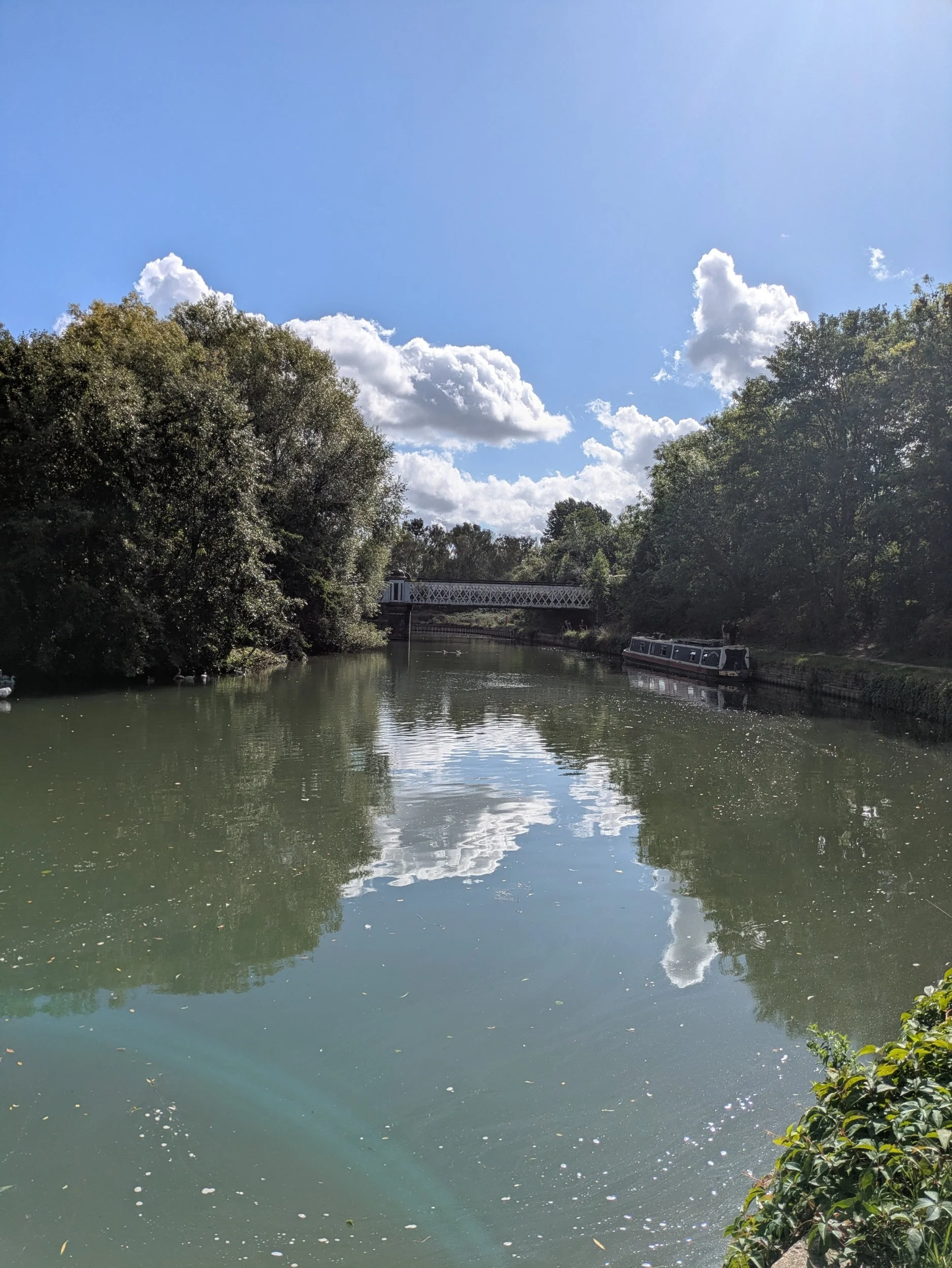

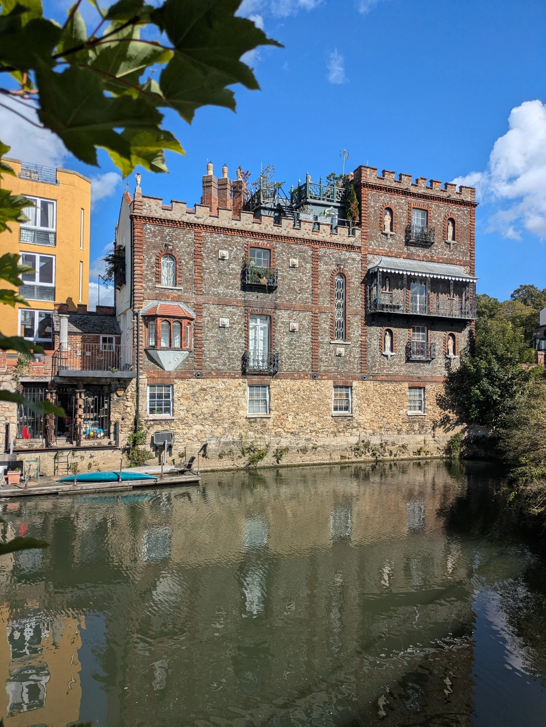
I pass by Osney Lock and Marina and the first ever community-owned hydroelectric power station on the River Thames, it uses an Archimedes screw to generate electricity from the river flowing through it! After Osney Lock I pass under the railway line, here the path is tree-lined and the shade is welcome today, there’s some interesting graffiti art under the bridges! I reach an interesting castle-looking building just before I have to go up to the road to cross a bridge. It turns out to be a folly and the bridge is named after it - Folly Bridge!


Once on the bridge, I turn left rather than cross over because I need to get a stamp for my passport from a café called the Paper Boat Café…unfortunately it does not open on Mondays! Across the road is a pub called The Head of the River, not because it is at the head of the river Thames, but because it is situated near the finishing line of the Oxford University Eights, a prestigious rowing event and the lead boat wins by reaching the head of the river! I cross over and head down the path. The stone I passed is opposite the college boathouses and is in memory of Colin Cox, it reads THE FINISH STONE TORPIDS AND EIGHTS, In memory of COLIN COX, 1943-1999, Oarsman and Boatman dedicated to club and college rowing, EN OPTIME FACIET!


Just by the diversion signs there is a sinking boat, which makes me a bit sad, because once upon a time this would have been someone’s pride and joy. Following the short diversion leads quickly back onto the path and on the opposite bank are the Oxford college boathouses, but no-one was rowing on the reach today. The stone featured in this gallery is a boundary stone from 1786, which is still standing where it stood according to the second series OS map made over 100 years ago, it marks the point along the Thames where the city’s liberties were taken to end at at the time.

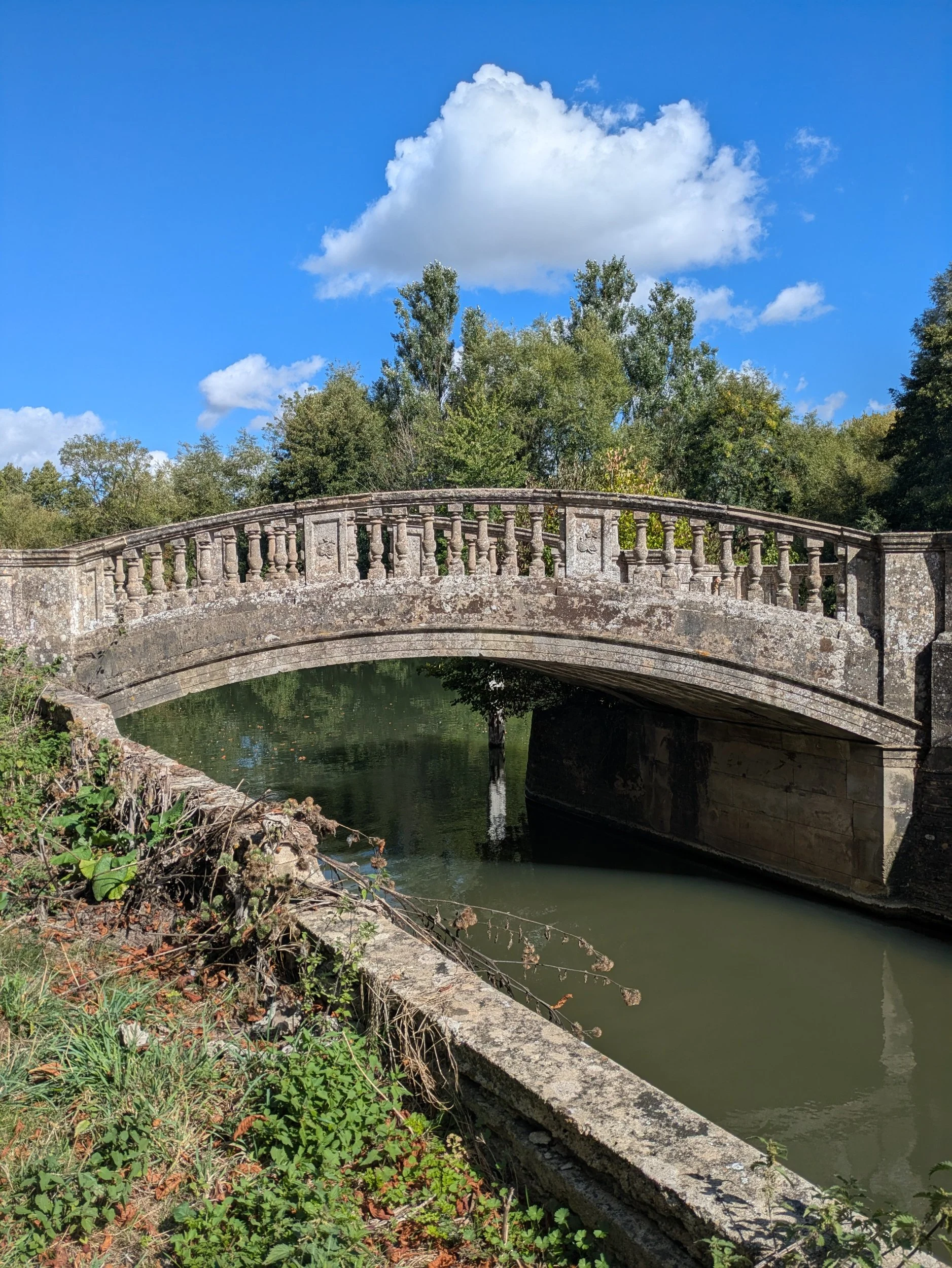


I pass a bright orange ex lifeboat which according to the poster on its side is going to be used on an expedition from Oxford to Russia to Iran (overland) by Boating Europe, you can find them on YouTube! Next we pass Iffley Lock which has an exquisite old stone footbridge, but was also the location of the very first Pound Lock on the River Thames, built here in the 1630’s.


Continuing along the path I head under a railway bridge passing some talented graffiti art and on the other side some paddleboarders float by some graffiti art depicting a fat cat slob in sunglasses wearing Thames Water pants and smoking a cigar. I love a bit of political or satirical art! The weather really is hotting up and the path is quiet when I pass through this unique kissing gate with a shoal of fish swimming across it. There is no information on why it is there or who created it! In the field beyond the fishy gate there is a huge block of stone with an inscription on it, I want to know why a couple in Devon bought a field in Oxfordshire?


On the opposite bank there is a stunning riverside property which is looking gorgeous in today’s sunshine! I encounter another diversion, a bridge is shut and so I have to follow the cycle path to Sandford, there are no helpful markers telling me where I need to go though! The cycle path runs alongside the railway track and when I reach a lane I need to turn down it to reach the river again!


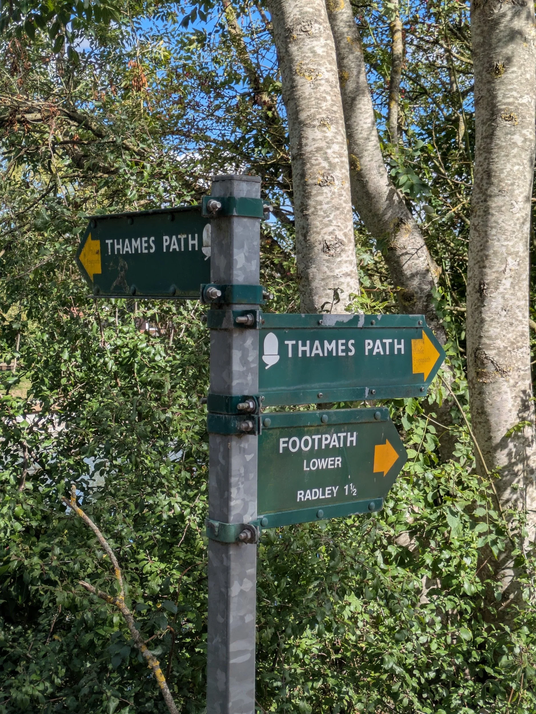
I reach Sandford-on-Thames and once I’ve worked out how to get across the lock , I meet Steve at the Kings Arms Pub for lunch. After a well-earned rest and lunch I retrace my steps back across the lock, admire the lock-keepers cottage and walk on towards Radley.


The next stretch of the walk is through fields with the odd shaded spot, there is loads of Himalayan Balsam growing along the water’s edge (it’s highly invasive and I know in other areas they are working hard with volunteer groups to try and eradicate it)


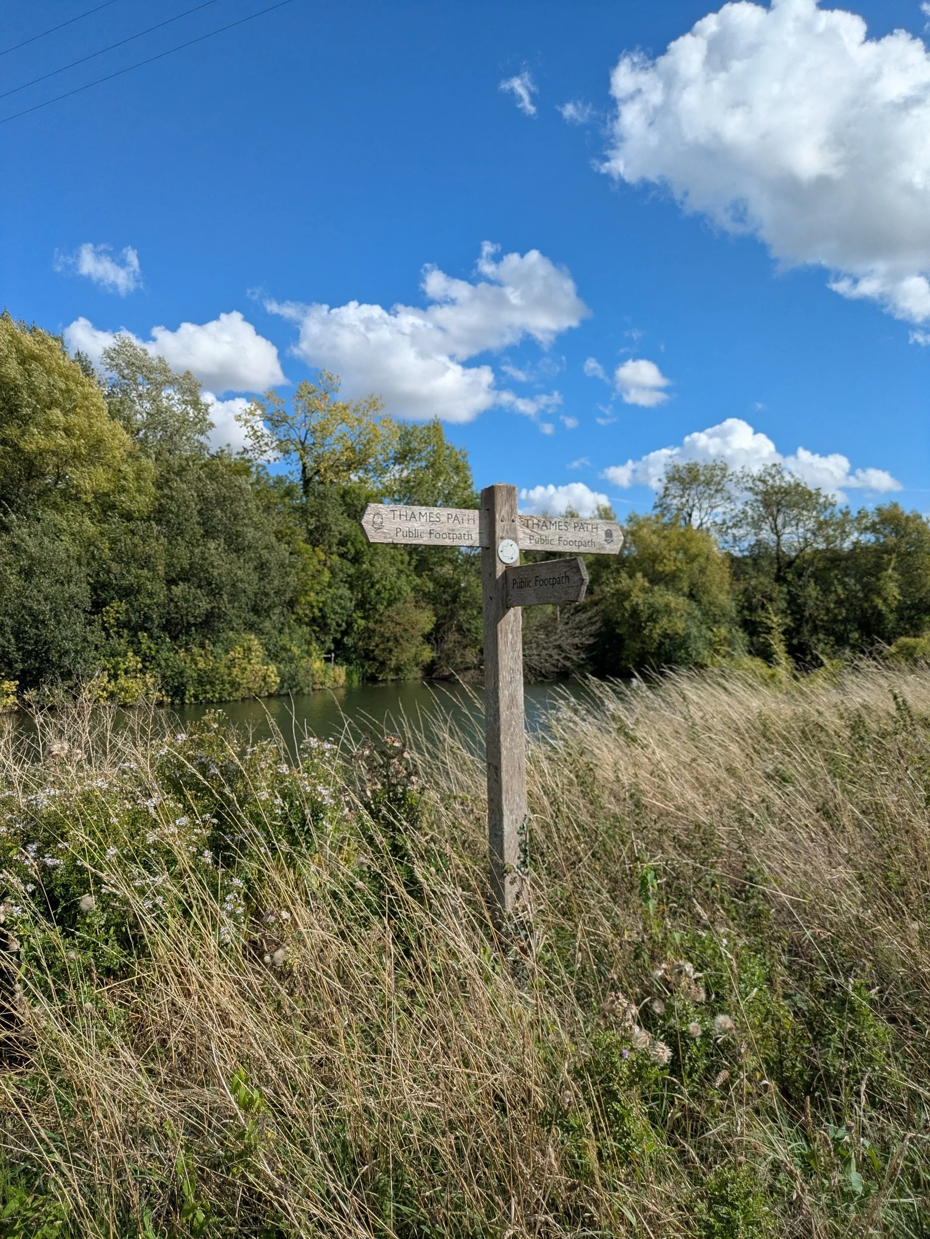


Eventually I come across the Radley College Boathouse and notice all of their boats feature a distinctive red cross patee from their coat of arms. Not far from here on the opposite bank is the grand looking Nuneham House, an 18th century villa in the Palladian style, currently owned by Oxford University, but used by the Brahma Kumaris World Spiritual University as a retreat centre, it has a very distinctive boathouse. I also spot a very decent area of bank erosion repair!


I pass through a wonderfully shaded path which crosses in front of this rather magnificent looking bungalow. and on the opposite bank is what looks like a dirt-bike track, but it is blissfully quiet today. I pass under another railway bridge (no graffiti this time) and am beginning to flag a little.
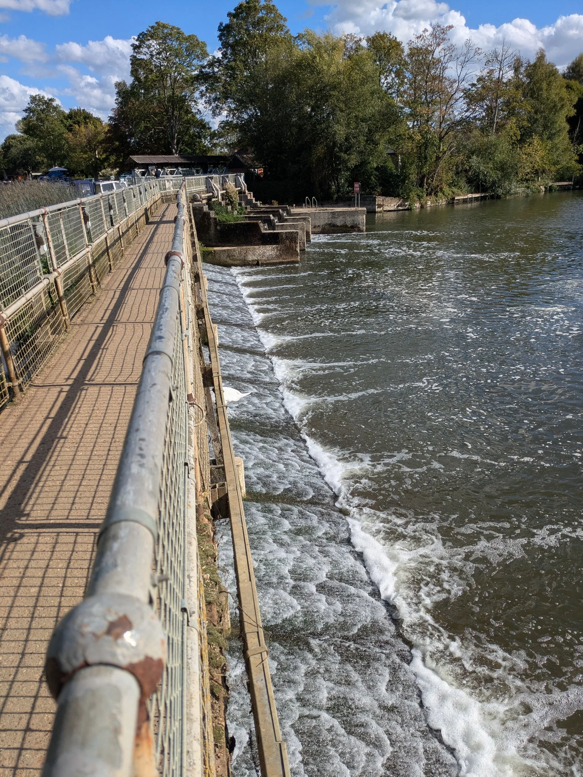


I am happy to pass a sign reading 1/2 mile to Abingdon Lock, but am not sure how much further it is to Abingdon itself! I’m crossing boardwalks so this area must get very wet at certain times of the year. I reach Abingdon Lock and traverse the long wier bridge with the gushing sound if the river beneath my feet. Abingdon was the location where the UTP was formed in 1939. The Upper Thames Patrol was a water-borne unit on the river Thames created to patrol and protect the Thames from Lechlade to Teddington against the very real threat of invasion, attack and sabotage. At its height the UTP had 6000 members and they were the first to recruit women!


Finally I reach Abingdon, it used to be the county town of Berkshire. Abingdon is a charming riverside town with many fine buildings. The town was once dominated by the Abbey and the town centre’s narrow streets still converge on the Abbey gateway, one of the few remains of what once was a vast complex of buildings.


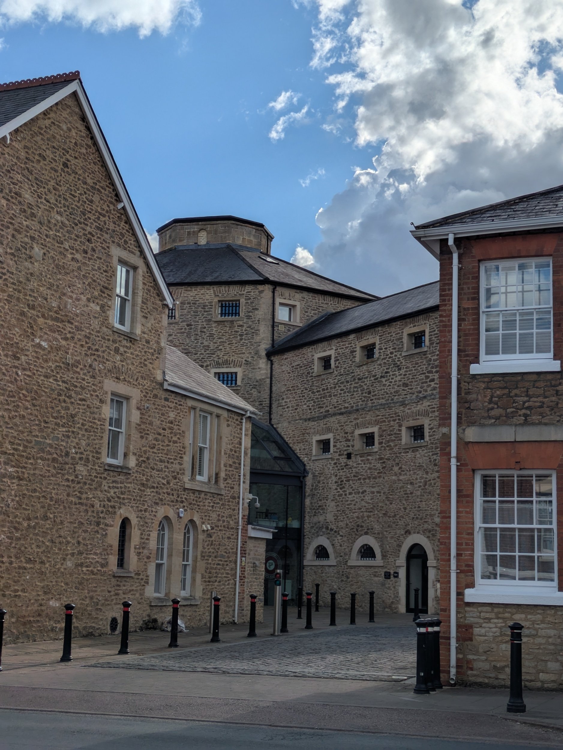

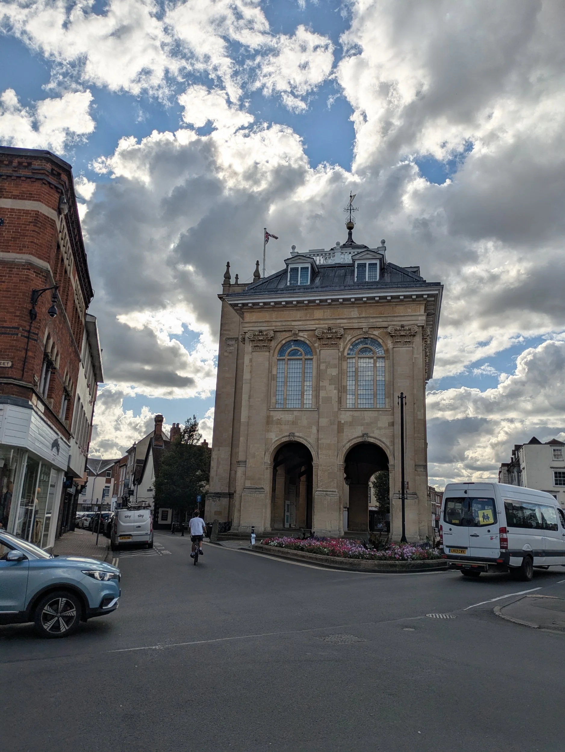

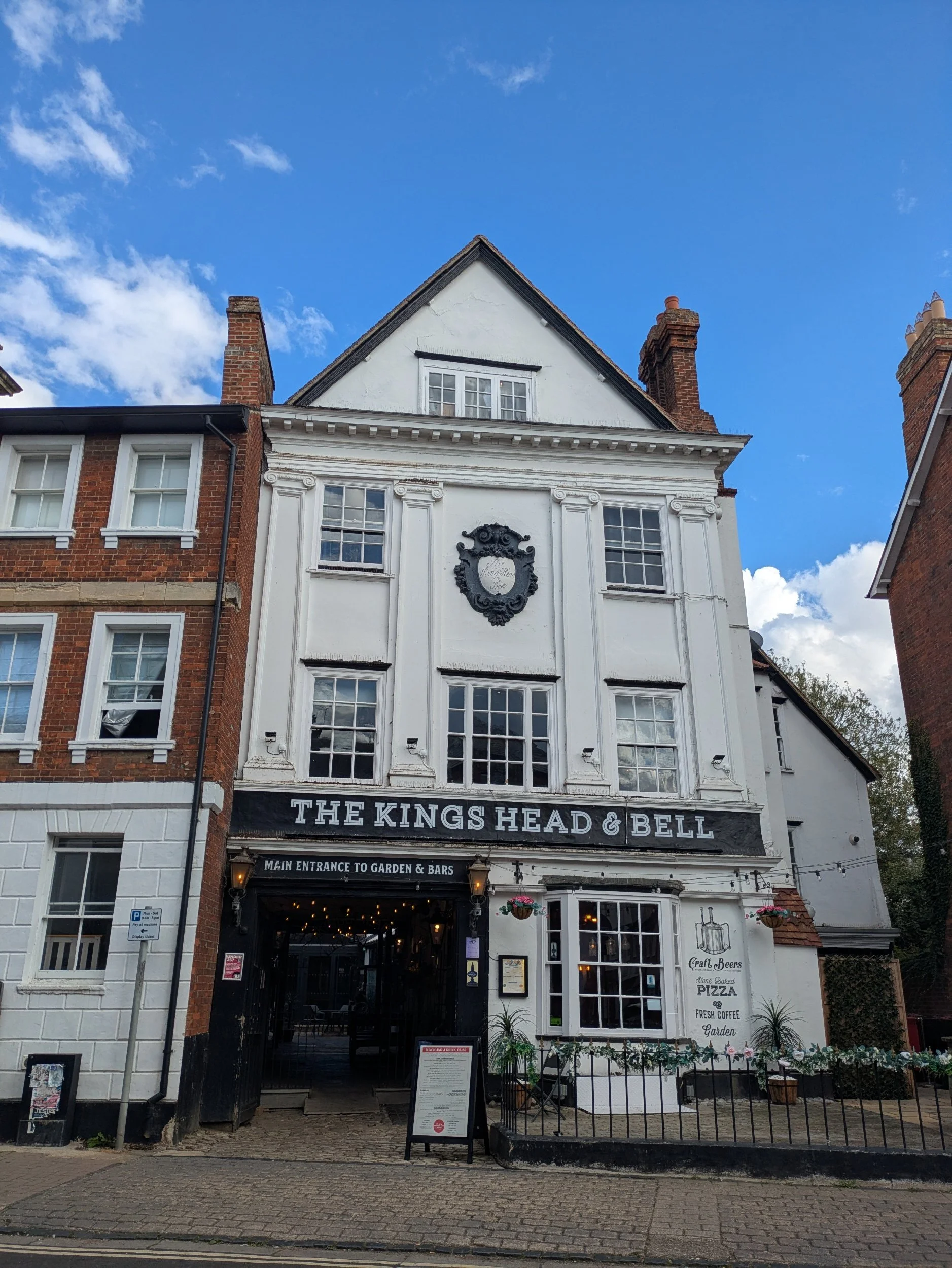
Some of the fine buildings I encountered on my brief wander into Abingdon, including the old Gaol (now apartments) I met Steve in the main square by the Town Hall.


On our way back to Clara we were beckoned into the free garden at St Ethelwold’s as we passed, it was stunning and had a great riverside location. The fellowship of St Ethelwold and the use of St Ethelwold’s House as a spiritual centre were the vision of Dorothea Pickering (1906–1997). The Fellowship was named after the 10th century Abbot of Abingdon Abbey; Dorothea longed for the return of Benedictine monks to Abingdon and had a vision that her house might house a community to allow this to happen. Dorothea wanted her house and garden to be a place where people could come together for prayer, meditation, times of quiet reflection and interfaith encounter. It was founded within the Christian tradition to be a place of interfaith dialogue and encounter embracing people of all faiths and spiritual paths.
Now onto Wallingford to set up camp!

Nordic Walking The Thames Path Leg Four: Newbridge to Oxford
Newbridge to Oxford

Leg Four: Newbridge to Oxford
When: Sunday 17th August, 9am
Miles walked: 15.14 miles
Steps taken: 31,748
Moving time: 4:56:03
Elevation gain: 31 ft


On Sunday 17th August three of us met at Oxford’s Seacourt Park & Ride car park, off Botley Road on the outskirts of Oxford. From there we drove one car to Newbridge and parked outside the Rose Revived Pub/Hotel and set off in glorious sunshine back towards Oxford. Passing through the riverside terrace of the pub (which looks like a lovely location for a riverside breakfast in the sunshine) we soon pick up the path again beyond the lawn. We are back on wide grassy paths through meadows with the sun shining brightly above us.


There’s a little permissive footpath around a conifer hedge as apparently the footpath gets very muddy (not sure that would be a problem this summer) and then we are back in meadows. We pass a beautiful wooden footbridge which is known as Hart’s Weir Footbridge as in years gone by there used to be a weir here, but it does seem weird in the middle of nowhere!
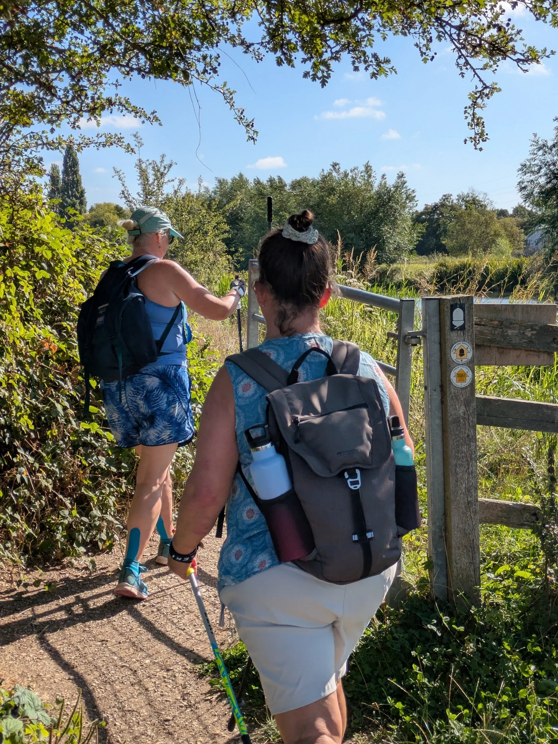


Back on the riverside it’s peaceful, tranquil even for a while before we hit Northmoor Lock. There is an abundance of wild flowers along the river, mostly Purple Loosestrife and Common Fleabane.


We carry on walking beside the river and stop in a lonesome shady area to have a drink and a big group of ramblers pass by. Soon we come into yet another wide open space as we approach Bablock Hythe, there’s quite a few folk milling about at the other end of the green space, I think some fishing may be occurring! Bablock Hythe is one of the most well-known river crossings on the Thames and has been since the Romans forded the great river here. In the II World War there was a vehicle chain ferry here, sadly the only Ferryman now is the pub. Unfortunately I cannot claim my stamp for my Walk The Thames Passport because the Ferryman is not open. Here the path leaves the riverside for a while, presumably to allow the vast Caravan Park at Thameside Court some premium riverside pitches! So we turn up the approach road passing the site and onto a road before eventually turning right to go several fields of sheep mostly all clamouring for the same strips of shade! Eventually we return to the riverside.


A few more twists and turns of the river and we are approaching Pinkhill Lock and cross over the ugly metal weir bridge to reach it.


After Pinkhill Lock the path diverts up to the B4044 due to the original path being eroded away, a short walk alongside this busy B-road passing a few houses, one called Wooden Shoes ( I wonder if they are Dutch) and the turning down the approach road to Oxford Cruisers boatyard (pretty bee garden here) and back onto the path by the river. Following the meandering riverside for a while before reaching Swinford.


Swinford Bridge is one of just two remaining Toll Bridges on the Thames. This one was built for the Earl of Abingdon around 1770. It’s free for pedestrians! However we walk under one of it’s magnificent arches and continue on our way.


Beyond Swinford Bridge is Eynsham Lock, another pretty well-cared for lock. Sarah had a chat with a boater who we have been seeing regularly on our walk today - they were impressed by our speed! Eynsham Lock also had picnic benches IN THE SHADE! Norbert decide we were definitely stopping here for our packed lunches! We all enjoyed not having to get down on the floor! After a good rest and fuel-up we set off to complete the journey to Oxford passing a large herd of cattle enjoying cooling-off in the shallows of the river on the opposite bank. Then a long stretch of isolation through meadows.


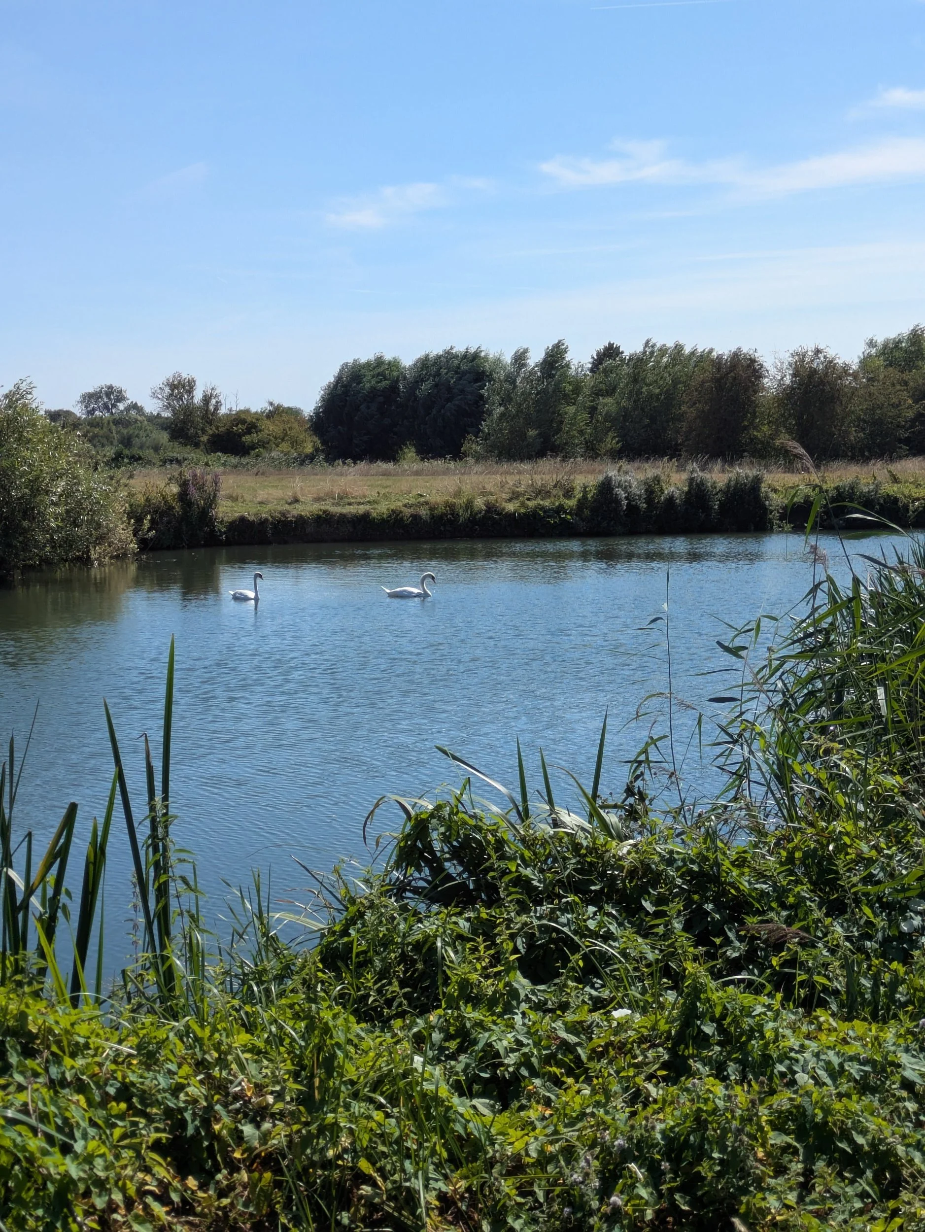
We did enjoy some shaded paths as we passed the edge of Wytham Great Wood, a 1000 acre wildlife haven bequeathed to Oxford University in 1942, an SSI. Eventually we reach King’s Lock which is apparently the northernmost point on the Thames Path and also has a low-carbon visitor centre built in 2007/8 and this experimental project looks to be carbon-neutral and serve as an example for further projects along the Thames waterways.


A twisty-turny path now leads us under the 1960’s built A34 by-pass bridge (not very pretty) and after undergoing stability monitoring since 2019, is now undergoing a project to strengthen the structure to the outer supporting legs. We continue on passing what looks like a Shepherds’ Hut on a floating pontoon (here starts the weird and wonderful range of ‘boats’ on the Thames!) and under Godstow Bridge.


We are all puzzled by the round bale of hay floating by the channel stream before the bridge, how? who? why? We pass the remains of Godstow Abbey which was a nunnery established in 1133 and where young girls of the nobility were often sent for ‘finishing’. Henry II met Rosamund Clifford here. Only the outer walls and ruins of the abbess’s chapel now remain. In 1541 most of the building were destroyed during the dissolution, those that remained were put to use when the Royalists used them during the English Civil War a century later. No metal detecting is allowed at this site! At Godstow the path became noticeably busier.


As we walk on towards Oxford the river becomes much broader and across the river is Port Meadow which is thought to have been grazed for over 4000 years and remains unchanged since King Alfred gifted the 120ha to the Freemen of Oxford as a reward for defending the Kingdom against the marauding Danes. The collective right to graze their animals free of charge was documented in the Domesday Book and has been exercised ever since. Lots of people were either on, in or near the water on this stunningly sunny Sunday in August, sailing, swimming, paddleboarding, sunbathing, dog-walking, cycling, kayaking to name but a few. There was a real buzz about the area.


Here we see a sign for ‘The Perch’ and decide to follow the queue of people under the willow-arched footpath that leads to the pub. Enjoying a lovely cold drink and the shade of the delightful ancient willow tree in the garden gives us much need oomph for the final foray into Oxford. Then it’s back to the path and over a footbridge to the other side of the river.


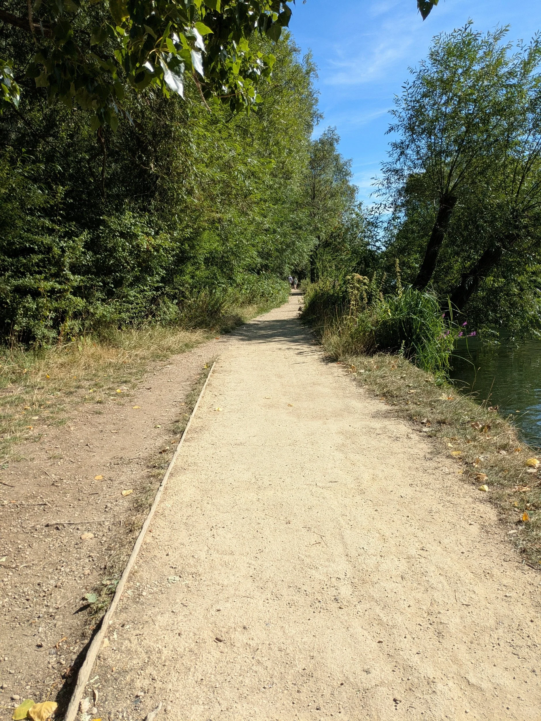

After crossing the river we spot another missed café opportunity! This is The Medley, a locally-owned seasonal bar (April to September) Pizza, pints and cocktails beer garden! Only accessed on foot! We continue down the dusty path towards Oxford.


Now, here is where, dear reader, we went wrong.
We ended up going too far along the river and past the silver footbridge (even though I stopped to take a picture of it) and ended up by the Rewley Road Swing Bridge, which is now a scheduled monument. I couldn’t make sense of where we had gone wrong and so we back-tracked. Karen went over the previously passed footbridge and discovered Thames Path signage ON THE OTHER SIDE!!! There were no signs on the side we were on! So duly relieved to have figured out how we ended up in the wrong place we travelled across the footbridge to join Karen and headed along a cute gravel path alongside the river at the back of some houses (riverside needs trimming) until a Footpath Closed sign stopped us in our tracks. Following the diversion brought us onto a road parallel with the Thames Path and I spied a number 400 bus ahead. Knowing this was the bus we needed to return to the Park & Ride, but not knowing where the bus stop was due to the ongoing works around Oxford Railway Station affecting the top of Botley Road, I waved my arms at the driver and opening the doors, I asked where we could get the bus and he said jump on and so we did! Delivered hot & sweaty by the ‘even hotter than outside’ bus to the P&R we completed our post-walk stretches by my car (which was cooling) and returned to Newbridge so Karen could collect her car. We had reached Oxford! Now according to the guide book Kemble to Oxford is 54 miles, but according to my Strava we have walked 58.94 miles, or 126,136 steps!!

Nordic walking the Thames Path Leg Three, part two: Tadpole Bridge to Newbridge
Tadpole Bridge to Newbridge
Leg Three, Part Two: Tadpole Bridge to Newbridge
When: Sunday 10th August, 9am
Miles walked: 6.24 miles
Steps taken: 13,818
Moving time: 2:05:37
Elevation gain: 8 ft
On Sunday 17th August three of us met at Oxford’s Seacourt Park & Ride car park, off Botley Road on the outskirts of Oxford. From there we drove one car to Newbridge and parked outside the Rose Revived Pub/Hotel and shortly before 9.30am set off in glorious sunshine back towards Oxford. We head through the terrace outside of the pub on the riverside to reach the towpath alongside the river, it looks like a great spot for breakfast in the sunshine! We are soon back onto lovely grassy paths with clear stretches of river alongside us. We continue following the meandering contours of the river through slightly shaded paths and open countryside.
Great wide expanses of grass are fantastic for Nordic walking and we stride on pass a lovely wooden footbridge that would take you over the river to Fyfield, but we are heading for Northmoor Lock.
Before reaching Northmoor we pass a big house on the opposite bank with a massive boathouse, I reckon I could live just in the boathouse! There is a lot of Purple Loosestrife and Common Fleabane on the river banks on this stretch, the insects love them!
We come to a wide expanse of grass that has quite a few people milling about on it, we are approaching Bablock Hythe, a hamlet that up until 1959 had a hand-propelled ferry to take cars and passengers across the Thames, this is apparently one of the best known crossings of the Thames since the Romans forded here, the pub is called The Ferryman and I’m supposed to get a stamp in my passport, but sadly it is not open yet, a photo will have to do. The Thames Path diverts away from the river here presumably because the caravan site here owns the next mile of riverside frontage! A long yomp out past the caravans and further along a road before turning right into fields and endless fields of sheep before finally we see the river once again.
After crossing the very ugly weir bridge we reach Pinkhill Lock, which has some beautiful flower borders.
Not long after Pinkhill Lock the Thames Path leaves the riverside again, this time due to erosion and the towpath being destroyed, so a small diversion up to the B4044, along for 250 yards before taking us down through Oxford Cruisers boatyard and back to the river. Then we are back following the twists and turns of the river all the way to Swinford,
Swinford Bridge has a toll to cross it (not for pedestrians), one of only two

Nordic Walking the Thames Path Leg Three, part one: Lechlade to Tadpole Bridge
Lechlade to Tadpole Bridge

Leg Three Part One: Lechlade on Thames to Tadpole Bridge
When: Saturday 9th August, 9am
Miles walked: 11.85 miles
Steps taken: 25,136
Moving time: 3:51:11
Elevation gain: 22 ft
Today we met at Tadpole Bridge on Buckland Road, Faringdon at 9am, parking one car in a handy lay-by across the river from The Trout at Tadpole Bridge (there’s a few with the same Trout name!) We headed the 20 minutes drive back to Lechlade-on-Thames and parked in the same side street as the last leg walking the 5 minutes back to the river. The weather is currently 16 degrees and cloudy, but with the promise of warming up I’m in shorts and a vest top, it’s a bit chilly right now! As we were walking towards Ha’penny Bridge I spotted this unusual feature on the wall as we were waiting to cross.

Crossing Ha’penny Bridge we head down the steps and go under the towpath arch, gated at both ends. This leads on to the riverside path that twists and bends it’s way along passing moored cruisers and narrowboats including one from canalministries.org.uk hosting the Waterways Chaplain.


This section between Lechlade and Newbridge is described as the ‘most splendidly isolated’ of the whole Thames Path. It is also the longest which is why we have split it in two! Going out of Lechlade the path is on the edge of a wide grassy bank and makes for nice easy Nordic walking, there are only a couple of swans or passing dog walkers for company.


We soon reach St John’s Lock, the first of many locks and weirs along the Thames. In front of the lock house stands the statue of Old Father Thames (made by Italian sculptor Rafaelle Monti), first commissioned in 1854 to adorn the fountains of Crystal Palace, but after the fire in 1936, it was bought by one of the Thames Conservators and originally placed at the Trewsbury Mead (source of the Thames) in 1958. Sadly after suffering some vandalism he was moved here in 1974 and is now under the watchful eye of the lockkeeper!


Traveling onwards following the twists and turns of the river, we cross over a footbridge to walk along the other side and pass a robust looking concrete pillbox, a World War II relic.
I’m now the proud holder of a Walk The Thames Passport and need to get it stamped at various locations to get my certificate at the end, so when we reach Buscot Lock (the smallest on the Thames), we cross the upper lock gates and the old weir, taking the small diversion into Buscot village and the lovely tearoom. Their stamp was lost and so I was given a sticker instead! We took advantage of the facilities and may have purchased a small treat to enjoy later! Returning back to the Thames by the same route passing some swimmers this time following the lock edge and through a gate before crossing a big concrete bridge back to the riverside again.


The river continues to meander passing pill boxes, cattle grazing (well there’s no grass, so they are being given supplementary feed) and quiet banks and we continue walking under cloudy skies with occasional blue sky periods. We decide to pause at one of the pill boxes to enjoy our treats and sort out a sock issue.


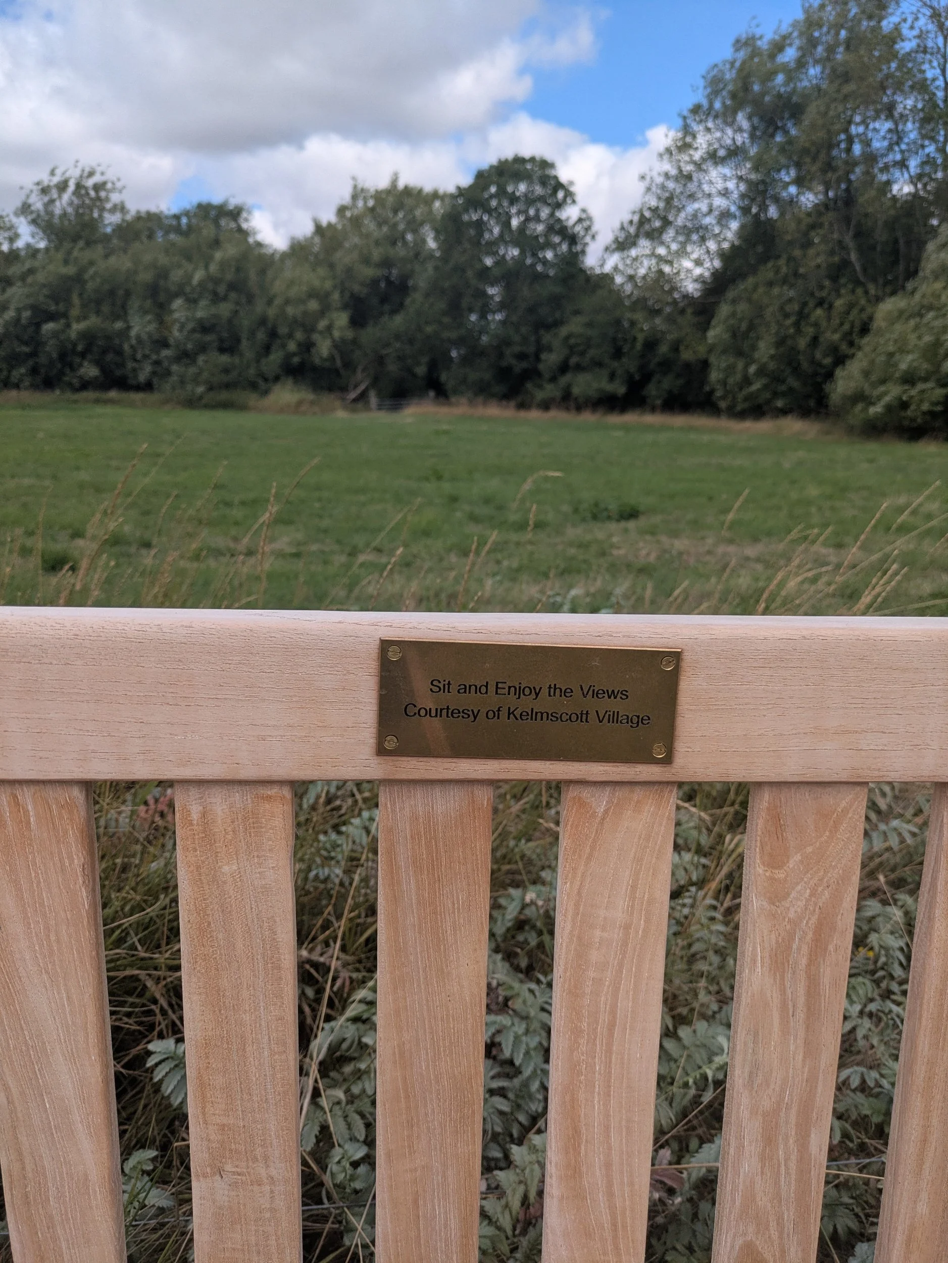


We pass the rustic wooden footbridge at Eaton which once led to the Anchor Inn (burnt down some years ago) and the old weir keepers cottage, there are some beautiful river views along this stretch as well as some really old willow trees that would have some stories to tell I’m sure! Typically we pass a lovely new-looking bench just after we had perched rather uncomfortably on the pill box, this has been provided by the villagers of Kelmscott. Around the corner we come to a wide track, left leads to Kelmscott Manor, the house William Morris called home for over 25 years. However we are turning right and continuing on the broad track. This comes to a kissing-gate and leads to open meadows again.


Whilst meandering around the river we pass two strange looking contraptions on the edge of the riverbank, sometimes it is very useful to be walking with a water expert! Apparently they are pasture pumps, designed to draw water from the river for cattle, horses or calves. This pump is nose operated as the animal drinks from the pump bowl they push against a lever, which in turn operates a piston and a diaphragm pumps water from the river! One will set you back more than £450!
We continue walking on to Grafton Lock, spotting the National Trail symbol wherever we can! There are a few boats are waiting to travel through the lock, the volunteers are working hard! This lock is well cared for with pretty flowers and picnic benches, I can’t believe they have to put a sign up to stop people urinating in their compost heap!
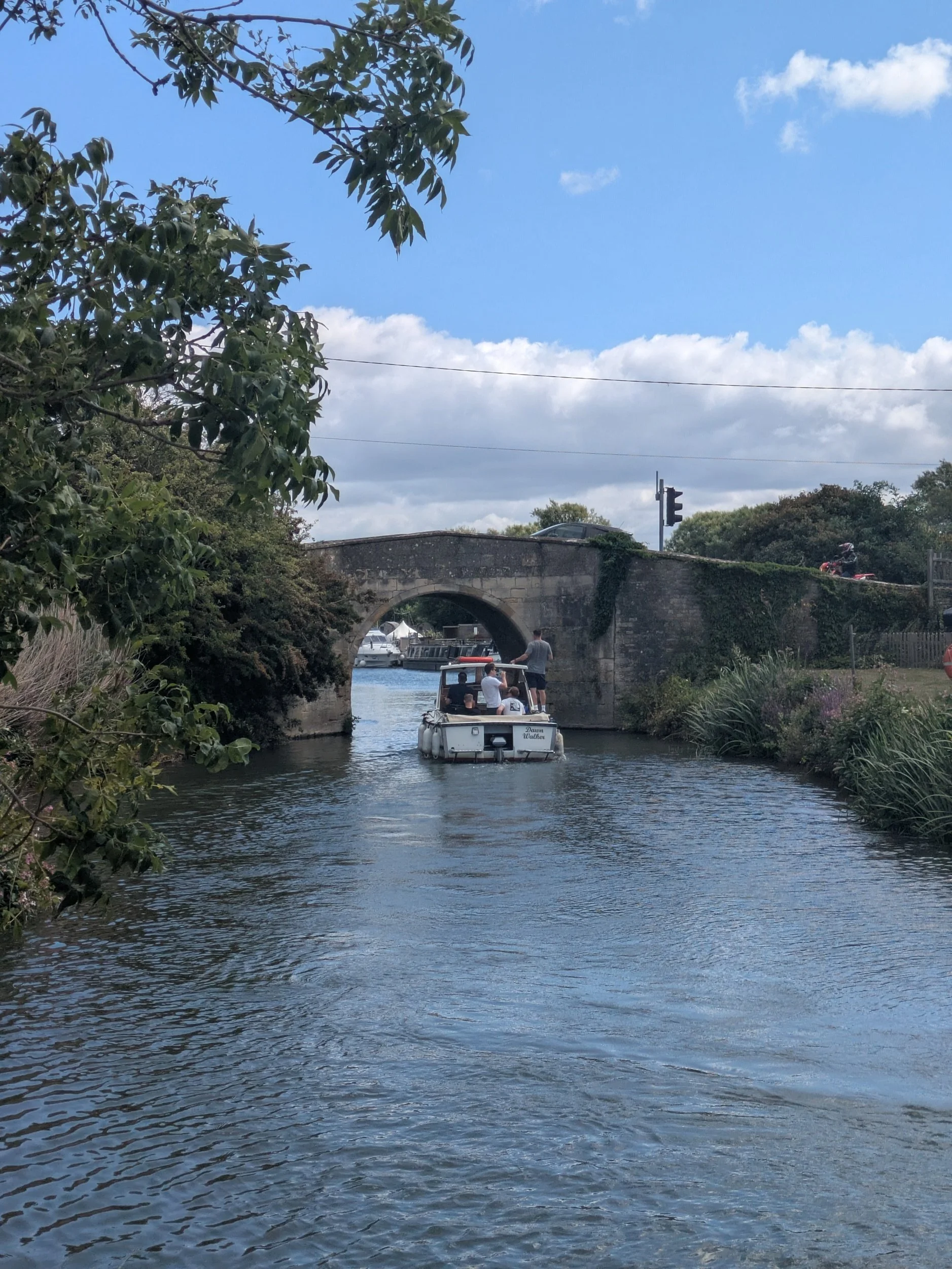


We pass moored boats that seem to have little gardens on the riverbank - nobody is aboard today though, it feels as if we are getting near to civilisation again as the path is very well worn and the vegetation here is neatly trimmed! We indeed turn the corner and can see Radcot Bridge! Parts of Radcot Bridge date from the 12th century and the river divides here with boats diverted through a newer bridge to the left. Radcot Bridge is the oldest bridge on the Thames and remains well preserved due to boats being diverted. Apparently the three gothic arches are ribbed beneath like a cathedral roof! There is evidence that there has been a bridge here as early as the 10th century. Radcot was an important crossing point between the Saxon Kingdoms of Wessex and Mercia as well as being the site of several Military actions in the 14th and 17th centuries including a civil war siege involving Oliver Cromwell.
We headed up steps by the newer bridge to the road and pause at Ye Olde Swan for a well-deserved lunch. After a delicious basket meal (I had scampi, Karen had halloumi) we returned to the bridge crossing it to continue on the Thames path. Passing a camping ground with tipis and an old pillbox as a campsite office/shop and then crossing a dilapidated old footbridge which had a sign requesting no large groups!


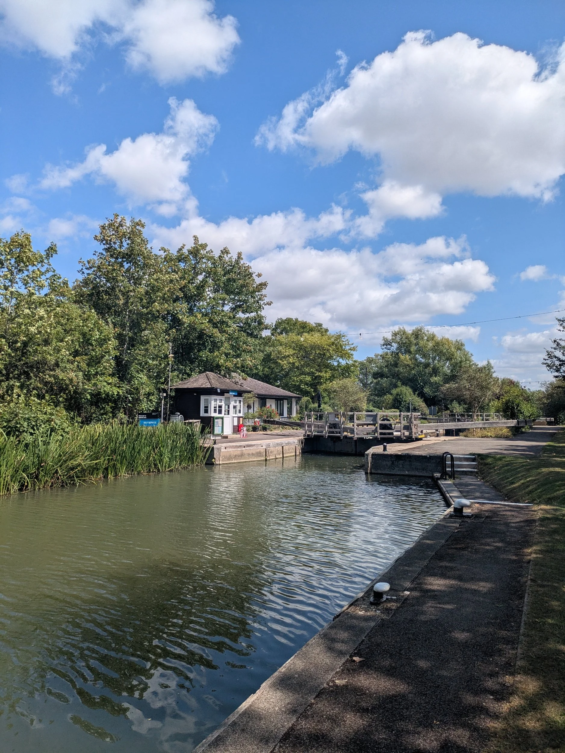

We passed a stunning herd of cattle looking very relaxed in the sunshine and admired a couple of beautiful boats before enjoying a good Nordic stretch of our legs on a nice grassy path, before we knew it we had reached Radcot Lock. A very pretty, well looked after lock with a gorgeous lockeeper’s cottage.


The next stretch includes some resistance training where we feel we are wading through the cut grass awaiting bailing! A few more minutes walking round the bends and we come to Rushey Lock, this lock has a rare example of a paddle-and-rhymer weir, which uses paddles (pictured by the fingerpost sign) dropped into place between the heavier posts with handles, the rhymers, to hold the water back. In order for river traffic to pass, some of these paddles were drawn out and after the initial flash of water the boats would go through the gap.


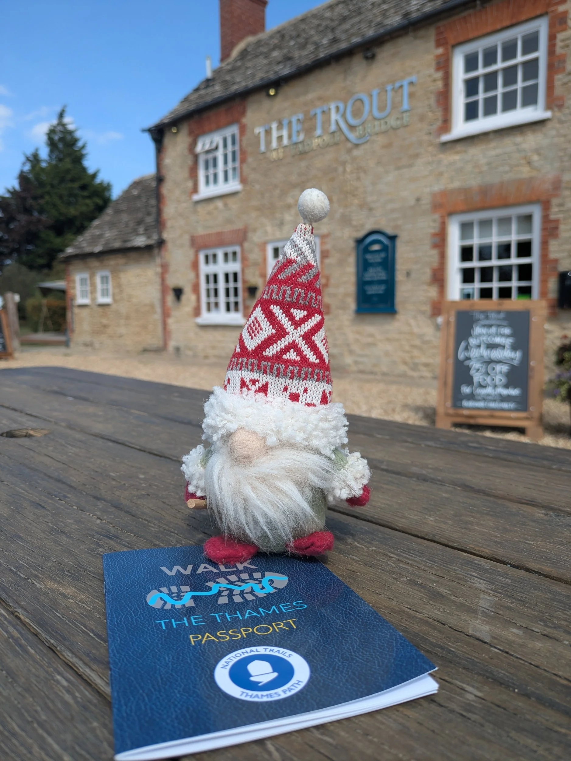
We cross over the weir and after initially going down the wrong path to a dead end, we find the lock access road which leads us to Tadpole Bridge , our destination for today! This remote bridge was built to carry the turnpike road to Bampton. One of the places to get a stamp today was also the Trout at Tadpole Bridge, so after completing our stretches I pop in to receive my stamp and Norbert gets to share the glory of another leg done.

Nordic walking The Thames Path Leg Two: Cricklade to Lechlade
Cricklade to Lechlade

Leg Two: Cricklade to Lechlade on Thames
When: Saturday 19th July, 8am
Miles walked: 11.75 miles
Steps taken: 25,236
Moving time: 3:53:34
Elevation gain: 64 ft
The second leg of Nordic walking the Thames Path didn’t get off to the best of starts. When planning dates for these legs I hadn’t realised that today was the Royal International Air Tattoo at Fairford and that would have a serious impact on traffic and travel times getting to Lechlade or rather back to Cricklade from Lechlade! So we decided to meet at 8am and hopefully not be snarled up too much, however the delaying factor ended up being meeting at the Riverside car park in Lechlade. Karen arrived to find the only way to pay is via the Ringo App (no coin or card options) and she had no signal…to avoid a fine (hopefully) she left the car park to go and park in a side street, but had no way of letting us know this as again, no signal on her mobile. So we arrived to no Karen and no idea where she was, so no option but to wait! Eventually Karen arrived soaked to the skin having walked along the main road to return to the car park, at least she was safe and sound if a bit bedraggled. I paid for an hours parking via the app (I had signal, thankfully) so as not to incur a fine - there are ANPR cameras at the entrance and I had been there more than ten minutes so didn’t chance it. We set off for Cricklade following Google maps, we were held up slightly by traffic queuing for Fairford on the A419, but it wasn’t too bad in the end. We eventually set off at 8.54am and it wasn’t raining in Cricklade…to start with!
Walking back down Cricklade High Street we picked up where we left off and turn right into Abingdon Court Lane, the Thames Path takes a left turn as the lane bends the other way and we’re soon crossing a stone slab stile into a field bordered on the left by the Thames. This area was once known as Hatchetts Green, it was an historic crossing point on the Thames where once stood a wooden footbridge spanning the river allowing barges to pass underneath, it existed until the 1930’s. In the late 19th century the river at Hatchetts Ford was used by local Baptists for baptisms, while the congregation watched from the banks and the bridge.
It is also an area once famous for cheese making, Abingdon Court Farm had a cheese house constructed in 1841. This cheese was mentioned in Jane Austen’s Emma, The North Wiltshire Cheese! Young cheese was sent by wagon, older cheese was sent down the Thames to London by barge! Abingdon Court Farm was the 17th century farmhouse of the Manor of Abingdon Court, one of the earliest manors of Cricklade having been created in 1008 by Aethelread!
We continue on beside the river and soon come to a standing stone marking the Millennium Wood, a community woodland planted as part of the Millennium celebrations. Here the path turns left and heads under the A419 bridge where we can see cars queueing for RIAT! We pass a pipeline bridge and after a little while we cross over a wooden footbridge to the other side of the Thames river, and the rain has started to fall heavier, so I relent and put my waterproof on! We’re following the curvy nature of the river until we cross the river once more. There are cattle in the distance, but thankfully they are unbothered by our existence.


The fields are soggy (makes a change) and we’re all getting wet shoes (and feet in some cases), wearing shorts means every bit of longer damp grass is making my legs wet and I’ll need to check for ticks later. There are pretty wild flowers growing along the path and various footbridges where presumably it floods in the winter months. Now there are patches of blue sky appearing and it certainly isn’t cold, the rain is easing. The fields are mainly full of crops or for cattle along here and they vary in length, but we are getting more glimpses of stretches of river that are pleasing to the eye! We traverse some of the wooden footbridges with care as in the wet they can be quite slippery. Slowly ticking off the miles to Castle Eaton.
There sadly is evidence of bank erosion along parts of this stretch with strings of barbed wire ready to garrotte you, that’s all that remains of the fences! On the opposite bank we pass Second Chance Touring & Residential Park, a family run holiday park for over forty years apparently! After a succession of double gated footbridges we arrive at Castle Eaton and the plane noise from RIAT is making itself known! Walking through the residential streets we pass the pretty Lych-gate of St Mary’s Church and turn right walking all the way down Blackford Lane until we reach Forty Acre Farm and Blackford Farm. I spot a couple of these cast iron lions head water fountains from the 1900’s in Castle Eaton, but can’t find any information about them. We are now halfway on our journey today!


We pause for a snack stop and to watch the noisy plane!
From Castle Eaton the river is more visible and there has clearly been some work done to replace old footbridges very recently, with lovely new composite ones, which are excellent! The paths have been cleared along here too which makes for very easy Nordic walking! The coats have come off too, it is quite humid now.


At Hannington Bridge we turn right onto a lane and are faced with some RIAT traffic speeding along this tiny lane (it’s one of the official routes we think) thankfully we soon turn off onto another track that leads to a bridlepath to Inglesham, here we are no longer alongside the river, it’s a couple of fields away to our left and we are alongside a ditch until we reach a field with a private airstrip (and some sheep) here there is quite a good sized stretch of river (looks good for a dip, but not today!) The path here was diverted to a riverside path in 2017, it used to run alongside the busy A361 road! We hug the riverside all the way to Inglesham!


As the river widens, we pass a group of kayakers (or are they canoes?) setting up for a riverside picnic.
At Inglesham we pass the church of St John the Baptist which looks shut, but the grounds have been strimmed recently and a sign on the door reveals it is a temporary door, we don’t stop and take a look, but on further research I wish we had! This church was saved by Victorian designer William Morris, who lived nearby at Kelmscott, in the 19th century ensuring it kept it’s medieval identity. It is described as a exquisitely beautiful and fascinating thirteenth-century church by the Churches Conservation Trust who now look after it. Apparently it has an amazing series of wall paintings from the thirteenth to the nineteenth century, often with one painted over another, sometimes seven layers thick and an unusual Saxon stone carving of the Madonna and Child set in the south wall. It remains much as it would have in Oliver Cromwell’s time, I shall have to go back!
We pass The Round House, which was one of five former lengthsmen’s cottages built along the Thames and Severn Canal in the 1790’s, built during the construction of the canal, which aimed to connect the River Thames with the River Severn. Lengthsmen were responsible for maintaining the canal. It is now part of a private residence and marks the start of the navigable River Thames downstream from this point. The canal closed in 1933, but parts are under restoration and the Lechlade end is now owned by The Cotswold Canals Trust. We pause on a bench by a wooden footbridge watching the birds ducking and diving under the bridge, none of us has any energy!
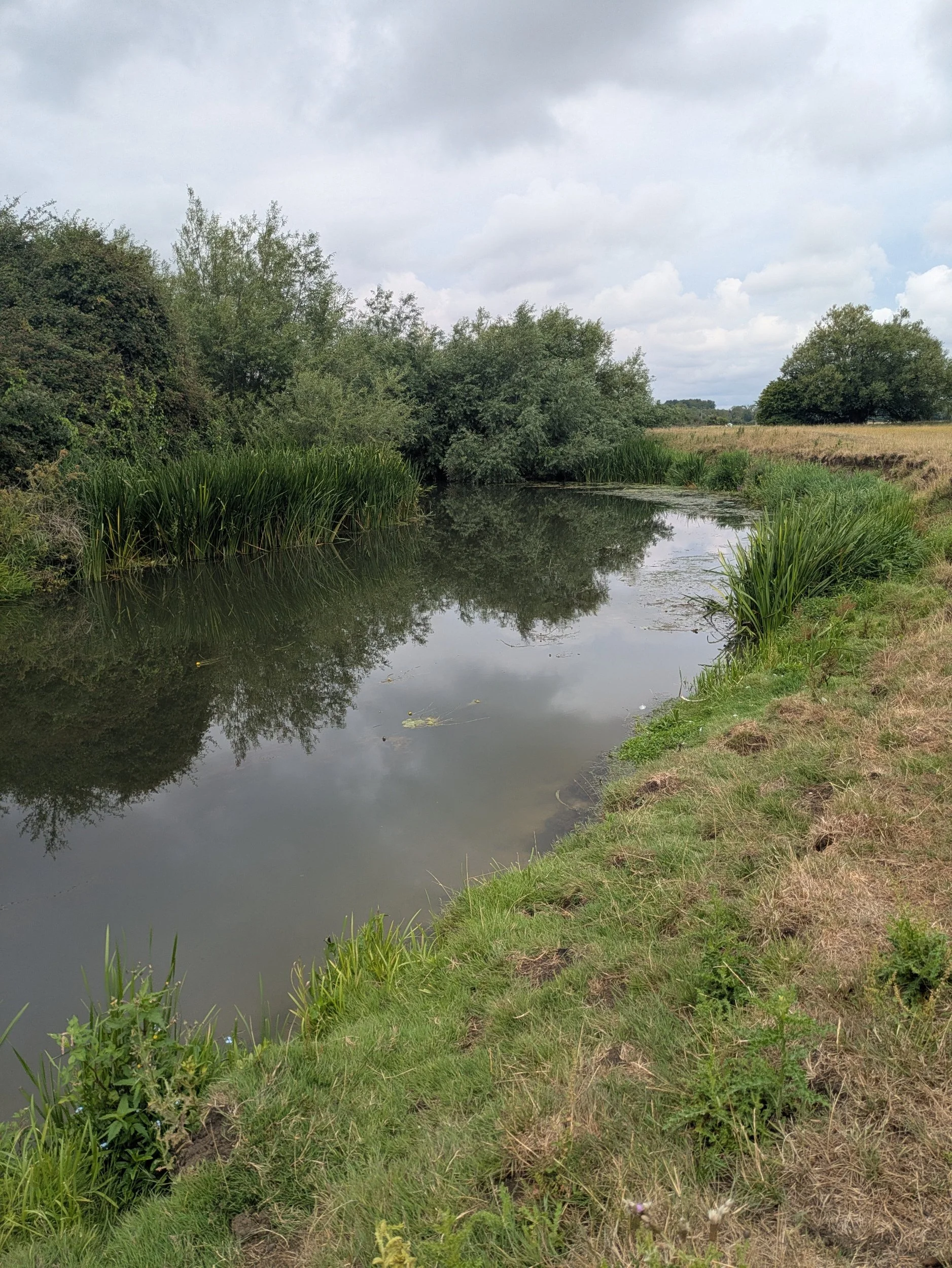


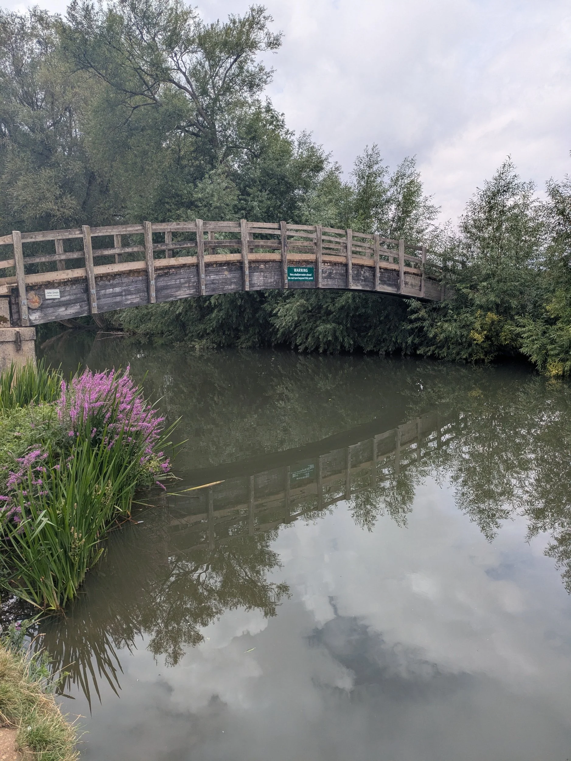

The river and riverside are noticeably busier the closer we get to Lechlade, with boats and barges moored up, even a swan pedalo passes by! The riverside is full of picnickers and the pub on the wharf opposite is full!
Before the Thames and Severn Canal was opened in 1789 Lechlade was the highest point on the Thames that laden barges could reach. The riverside was a busy wharf with boats being loaded with salt from Cheshire, wool and cheese from the Cotswolds destined for Oxford and London markets and Taynton stone from nearby Burford was shipped from here and used in iconic buildings such as St Paul’s Cathedral and Windsor Castle.
The Ha’penny Bridge has spanned the river here since 1782 and is one of 106 navigable bridges between here and London, the tiny old toll house is all that remains from the time when it would cost you a halfpenny to cross the bridge! Locals rebelled and the charge was dropped in 1839.
Norbert had to wait until the end of the walk today to get his five minutes of fame! We walk back to Karen’s car, complete our post-walk stretches and drive back to Cricklade (via RIAT thanks to Google maps!) where we decide to get lunch at The Wild Fig - highly recommended!


Nordic walking The Thames Path Leg One: Source to Cricklade
Nordic walking The Thames Path from the Source to the end at Woolwich.

Leg One: The Source of the River Thames, Trewsbury Mead to Cricklade
When: Sunday 13th July, 8am
Miles walked: 13.96
Steps taken: 30,198
Moving time: 4:37:01
Elevation gain: 56ft
This year I have chosen to Nordic walk another one of our amazing National Trails, The Thames Path, usually I would complete a long-distance trail during annual leave, but as the distance is 185.2 miles, it’s a big ask to complete within 14 days of holiday! As I live close by to the first two legs of the Thames Path I have opened up walking the first four legs of the Thames Path Trail to my Nordic walking group. They can join me from The Source to Oxford before I Nordic walk from Oxford to Woolwich during my holiday in September.
On leg one I am joined by Karen and Sarah from my Nordic walking group. There is no parking whatsoever near to the source of the River Thames and as the weather forecast was set to be very hot, none of us really wanted to add an extra 3km to todays total mileage by walking from the nearest parking in Kemble! So luckily my husband was able to drop us off at The Thames Head Inn (the nearest drop-off point, but only patrons can park here, I did ask) We set off to find the source at around 8.20am.
After a brief stretch walking on the road down towards the railway bridge, we turn left onto the public footpath alongside the railway on a narrow path next to a thin parcel of land. This leads to a crossing over the railway, once across the railway the path opens onto the parched, straw-like meadows leading to Trewsbury Mead where a ring of pebbles lie under the shade of an ancient large tree, the official source of the River Thames. There’s an inscribed stone (which of course our mascot Norbert has to have his picture on!) and a finger-post telling us exactly how far it will be to walk to Woolwich and to the sea.
The stone reads: The Conservators of the River Thames 1857-1974. This stone was placed here to mark the Source of the River Thames.


There is absolutely no water at the source or along most of the first stretch of the path and we pass through dry and hot open meadows until we reach the crossing at the A429. After crossing the road the path becomes much shadier (thank goodness!) as trees flank the path, but there is no water apart from the odd puddle! At this time of the morning the path is very quiet apart from a few dog-walkers and runners. We reach Parker’s Bridge and turn left onto the road to walk through the hamlet of Ewen.


Between the hamlet of Ewen and Neigh Bridge Country Park, the path passes through more Cotswolds meadows then reaches Upper Mill Farm passing an old mill race. The path closely follows the river from here passing Old Mill Farm and Kemble Mill, funny to think that there used to be so many watermills along this stretch of bone dry riverbed!


Traversing a long wooden footbridge we come into Neigh Bridge Country Park, a 21-acre site within the Cotswold Water Park near Somerford Keynes. On this hot and sunny Sunday nearly every bay we pass around the lake is full of groups enjoying the sunshine, or full of rubbish which is dis-heartening. Despite the no fires or BBQ’s rule clearly displayed at every entrance there is clear evidence of both and a large amount of waste has been dumped in the middle of the car park we walk through (that is not even a bin in the picture!) We have also had to navigate being passed by Triathlon runners (mostly polite)
From here we cross the main Spine Road passing more runners and head down the road towards Lower Mill Housing Estate, a luxury lakeside holiday park and nature reserve. We are walking between a very dried up Thames and a lovely full lake! The lakes here were once gravel pits that have been flooded and re-purposed, they are very important for the local flora and fauna as well as beavers and birds. The path continues between lakes until coming out onto the B4696 where we cross straight over to continue towards the village of Ashton Keynes. The riverbed here is so dry and cracked!


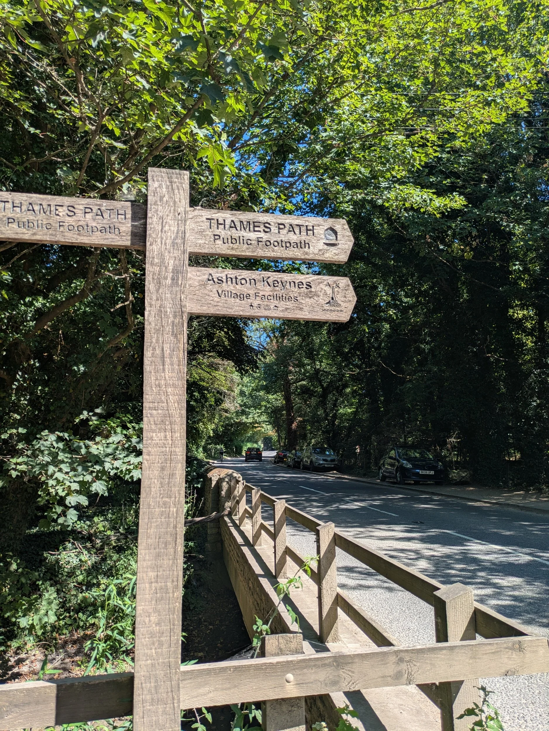

Ashton Keynes is an ancient village in North Wiltshire that appeared in the Domesday book, it has 20 bridges throughout the village crossing the Thames as it passes through! It is also unusual in the fact that it still has the remains of four ancient (14c) preaching crosses, they were damaged by Cromwell’s roundheads during the Civil War. Once we have wandered through the village we cross a recreation ground and go across Ashton Keynes Millennium Green - a green space for the village and the local wildlife! From there we walk through a narrow path between two lakes towards Waterhay.
The Thames Path now weaves its way around Manorbrook Lake where you can waterski, paddleboard, kayak and more. The water is very blue in this lake because they add a dye to the water to slow down weed and algae growth (harmeless to fish and humans!) the water quality has an ‘excellent’ rating! I’m tempted for a dip, but no swimming is allowed! The path goes between Manorbrook lake and Cleveland Lakes on a mostly shaded path (phew), it really is hotting up! We come to a wider grassy area in the shade and decide it is time to have a proper stop, sit down and have some lunch, get some air to feet (me) and regain some energy for the final stretch to Cricklade. I think we all found it quite difficult to get going again! The path soon turns away from the lakes and back to the river.


The path also now moves away from the shade and we are thrust into the open meadows leading to Cricklade with the full July sun beating down upon us. Sarah and I once attempted this part of the path from the other direction on another walk and had to turn back due to there being an extra river through the grass blocking the route! It is bone dry today. We come to the old railway line that runs for 6km between Cricklade and South Cerney and we turn right to go along it for a short while before turning left into North Meadow.
North Meadow is a National Nature Reserve, it is one of the finest examples of an old, traditional hay meadow in Europe and covers an area of 108 acres, it is protected as a Special Area of Conservation and a Site of Special Scientific Interest because around 80% of Britain’s Snakeshead Fritillaries grow here. There used to be many meadows like this along the upper Thames, but modern agriculture and gravel extraction destroyed their habitat.


At the other end of North Meadow the path takes us past these unusual small spotted ponies enjoying the shade of a willow tree (lucky them) and then through the edge of a housing estate passing a fingerpost telling us that we have walked 12 miles from the source and there’s still 172 miles to the Thames Barrier! At this point we are all really hot and bothered, I’m sure someone asked if we were nearly there yet! Even the ice-towels are not helping now after being exposed to the full afternoon sun. Finally reaching the High Street in Cricklade we return to our waiting parked car via Tesco Express, as we’re all in need of ice-cold refreshment. Soleros in the shade all round before doing our post walk stretches (giving Sarah’s car time to cool down) and head home.


Soleros in the shade!