
Nordic Walking The Thames Path Leg Twelve: Chertsey Bridge to Kingston-upon-Thames

Leg Twelve: Chertsey to Kingston-Upon-Thames
When: Tuesday 16th September, 10am
Miles walked: 12.72 miles
Steps taken: 25,974
Moving time: 3:52:50
Elevation gain: 62 ft


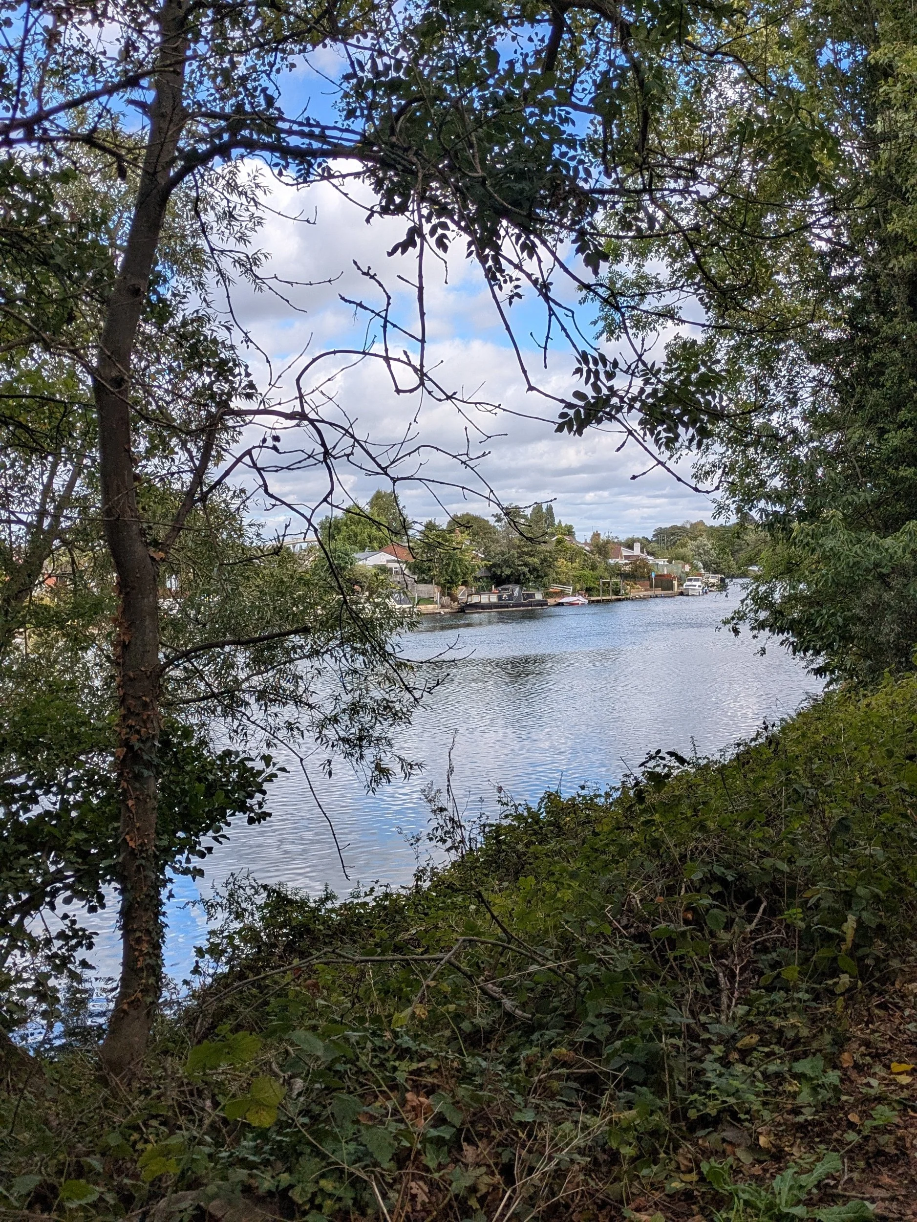
Oh what a beautiful morning! We have woken up to blue skies and sunshine this morning. I leave the campsite around 10am and set off for Kingston-upon-Thames. Crossing back over the bridge at Chertsey and walking into Dumsey Meadow an SSI, the only remaining grazed unimproved Thames-side meadow in Surry. The grass is cut for hay in August and then grazed by a herd of Belted Galloway. I am already in a much better mood than yesterday! Everything always looks better when the sun is shining.


It’s a great stretch of walking on strips of grass alongside the river with plenty of housing and bungalows to look at, there’s even a bell for visitors to ring for houses across the water on Pharoah’s Island! I’m listening to the new terms songs for Show Choir as I’m missing the first rehearsal tonight! Did you spot another pair of balcony dwellers? I pass the Thames Court Pub on my way to Shepperton Lock.


Shepperton Lock is very well tended with shortly mown grass and borders of flowers alongside the lock, I make use of the facilities and head down to the Ferry Coffee Shop to buy my ticket for the Ferry which costs £3.50 for a single very short journey! The Coffee Shop is worth stopping at with a selection of sweet and savoury food, hot and cold beverages and a small gift shop, as well as my ticket I buy a drink and some crisps and go and wait for the ferry. It soon comes and the journey is less than 5 minutes to the other side of the river where I begin a very pleasant walk on a wide path.


Just beyond a footbridge to the privately owned D’Oyly Carte Island where there’s a large café in Spring/Summer, events and Weddings held, I stop to drink my cup of tea and eat my crisps at a picnic table (bliss) in the sunshine.


After my brief pause in the sunshine I continue along the path enjoying the diverse transport options, watch a couple in a dinghy try to remove a willow tree that has fallen in the river - precarious! There be Pirates!! I scuttle past a boat flying the Jolly Roger! I’m heading towards Walton-on-Thames and pass a car park with a nice and easy slipway into the Thames, no-one using it today though! I’m approaching a rather splendid looking bridge ahead and after some delving I discover this award-winning bridge was only completed in 2013! Its slender yet dramatic hexagonal curved ivory coloured steel arches are rather eye-catching! This is the sixth bridge to be built in this location, the earliest back in the mid-1700s. Now if you want nerdy technical details this is a thrust arch bridge! It has two parallel steel arches spanning between the banks of the river and the deck is supported by 20 steel hangers suspended from the arches. In the consultation process they sought advice from a local swan sanctuary on the colour of the bridge as apparently swans can’t see very well and aren’t good at spotting contrasts, who knew?


The area around the bridge was re-landscaped and there is a unusual round building with a café and a shopping plaza a bit further up the road not far from the Walton Marina which I pass through next. The marina has a high footbridge over the channel allowing the boats into the marina and so I get a good view of the marina as I walk over it (trying not to drop my phone!)


Walton, which is mentioned in the Domesday Book, has existed since Anglo-Saxon times. Walton’s wharf was built in the 17th century to accommodate the steady flow of barges towed along the Thames by gangs of men and horses and is still used by the Hampton Court ferry.
One of the pubs (The Anglers of Walton) here was built in 1870 and was originally known as The Angler’s Cottage, after the innkeeper’s listed profession – fisherman.
Check out the name of the little cruiser…a message?


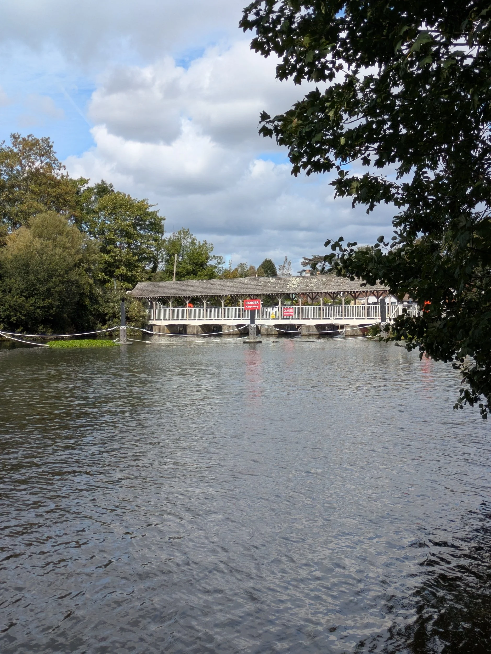


It’s a leafy corridor up to a pub called The Weir (guess what it is located by?) Lack of water depth to tow the laden barges became a problem in the early 19th Century and in 1812 Sunbury Lock was constructed, one of a serious of pound locks along the Thames. I like the logo of the St George’s College, Weybridge, Boat Club!
I haven’t really talked about the Thames Conservancy in any of my blogs yet, but the name keeps appearing on lockkeepers cottages so here’s what Wikipedia has to say about them:
The Thames Conservancy (formally the Conservators of the River Thames) was a body responsible for the management of that river in England. It was founded in 1857 to replace the jurisdiction of the City of London up to Staines. Nine years later it took on the whole river from Cricklade in Wiltshire to the sea at Yantlet Creek on the Isle of Grain. Its territory was reduced when the Tideway (upper and lower estuary) was transferred to the Port of London Authority in 1909. In 1974 the conservancy was taken into the Thames Water Authority, later to devolve to the Environment Agency in almost all respects.


A community run Ferry operates here enabling folk to travel between Walton and Sunbury more easily, it is run by volunteers on demand at weekends and on public holidays from Easter to September, what a great initiative. The path continues through a green corridor with brief glimpses of the river and I spot a coupe of lovely looking fungi on the side. I have also been passing a number of reservoirs, not that you can see them!
This stone is apparently a coal duty boundary marker, it marks a point where duty on coal was due to the Corporation of London. Coal imported into the City of London had been taxed since medieval times and, as it was originally all brought by sea to riverside wharfs, the collection of the duties was relatively easy. The City was a small (one square mile) but influential and rich part of London. The Port of London, within which the duties were payable, stretched far beyond the boundaries of the City, all the way along the Thames from Yantlet Creek to Staines. By the 19th century, however, there was increasing trade by canal and rail, and various acts of Parliament extended the catchment area to include these new modes of transport. The Coal Duty, London Act 1845 set the boundary at a radius of 20 miles from the General Post Office, London and permitted the erection of boundary markers to indicate where this boundary lay; and about fifty markers, inscribed with a reference to the act, were erected in the 1860’s.


Once the reservoirs end, the path widens and I start to pass a housing estate which runs along Hurst Park, on the opposite bank is Hampton. Hampton has a rich and varied history that dates back to the Saxon period. The area was originally a small village, but it gradually developed into a residential district in the 20th century. During the 18th century, Hampton became a popular destination for wealthy Londoners, who built grand houses and gardens in the area. Today, Hampton is a thriving and vibrant area, with a mix of historic landmarks and modern amenities, it certainly looks pretty from across the river!


Up until 1962 there had been a racecourse here on the banks of the river Thames, built during the Victorian ‘leisure revolution’, along with nearby Sandown Park, which opened in 1875, and Kempton Park, which opened three years later, Hurst Park was initially a National Hunt venue. However, the layout of the racecourse was soon modified to accommodate Flat racing. Hurst Park was still a popular venue at the time of its closure but, despite significant opposition, its owners opted for property development, rather than horse racing, on the site. Only a couple of gate pillars remain from the racecourse!
I pause to look at the Heritage Marker in Hurst Park, at Sadler's Ride, it tells the history of the area and includes an interactive sundial, which allows visitors to tell the time using their own shadow. I meet Steve and Clara in the car park here for a spot of lunch and a rest, there is a public toilet in the car park too! Across the river is Tagg’s Island a 400 metre long river island that is home to 62 houseboats, one of the biggest houseboat communities in the UK, they look like quite extensive dwellings!


After I have passed Molesey Lock I reach Hampton Court Bridge, climb up onto it and cross over the bridge, there is a family coat of arms on the bridge of Thomas Newland Allen who paid for the bridge to be built in 1866. This bridge is the fourth on the site. The bridge has three wide arches, is designed to be able to carry quite heavy traffic and is constructed of reinforced concrete, faced with red bricks and white Portland stone on its pontoons, dressings, and balustrades. The bridge was one of three authorised by Parliament in 1928. It was designed by the Surrey county engineer W. P. Robinson and the architect Sir Edwin Lutyens to reflect the style of the portions of Hampton Court Palace. I pass Hampton Court Palace, the original Tudor Hampton Court Palace was begun by Cardinal Thomas Wolsey in the early 16th century. But it soon attracted the attention of Henry VIII, who brought all his six wives here.
When William III and Mary II (1689-1702) took the throne in 1689, they commissioned Sir Christopher Wren to build an elegant new baroque palace. Later, Georgian kings and princes occupied the splendid interiors. When the royals left in 1737, impoverished 'grace and favour' aristocrats moved in. Queen Victoria opened the palace to the public in 1838, it has remained a magnet for millions of visitors.


I pass a set of magnificent gates and railings designed by Jean Tijou around the Privy garden and glimpses of the palace behind. Then I am onto Barge Walk, which runs for 5 km alongside the River Thames from Hampton Court Bridge to Kingston Bridge. This historic towpath has been part of the Hampton Court estate for 500 years. There are quite a few benches with dedications along here and it is a very pleasant walk along to Kingston-upon-Thames from here.


Along Barge Walk I spot a Old Dutch cargo barge, made from iron with a flat bottom, probably converted to a houseboat. There have been a lot of rowers passing by in the river too. On the opposite side of the river there is a beautiful church St Raphael, a building designed by architect Charles Parker in Italianate style, built in 1846 as a family chapel.


Ahead of me is the Kingston Bridge across the river Thames, the bridge, about 100 feet upstream from its predecessor, was built of Portland stone: comprising five elliptical arches. The abutments were finished with towers or bastions, and the whole bridge finished with a balustrade, with galleries projecting over. The length of the bridge is 382 feet by 27 feet in width.


Steve meets me on the bridge and we head to All Saints Church to see the newly unveiled Seven Saxon King Embroidery Project. Over a millennium ago, Kingston was an important ceremonial site where seven Saxon kings, including the esteemed first ‘Kings of England,’ are traditionally thought to have been crowned. All Saints Church, a Grade I listed building, had an important role in Kingston’s Saxon history. Before All Saints Church was built, the site was an important estate of the West Saxon Kings and host to Royal coronations. Well worth a visit! After a cuppa in the café we also go and find the Coronation stone. The Coronation Stone is an ancient sarsen stone block which is believed to have been the site of the coronation of seven Anglo-Saxon kings and as part of the team who created The Athelstan Pilgrim Way and with Athelstan’s connection to Malmesbury, we couldn’t visit Kingston-upon-Thames without seeing it.