
Nordic Walking The Thames Path Leg Eleven: Windsor to Chertsey

Leg Eleven: Windsor to Chertsey
When: Monday 15th September, 11am
Miles walked: 16.39 miles
Steps taken: 31,946
Moving time: 4:51:48
Elevation gain: 164 ft
Today I will be Nordic walking from Windsor to Chertsey Bridge and the days hasn’t started off well. We are much later starting than usual because we needed to do some washing (limited storage in Clara) and the campsite laundry room doesn’t open until 9am, which in reality is actually sometime after 9am when one of the wardens gets round to it. I eventually got my wash on at 9.15am. The weather forecast is mixed today and still very windy so I don’t trust leaving my washing outside the awning whilst we are out all day. So I hang it inside the awning hoping it will warm up enough to dry it! We get to Windsor around 11am and park in the station car park.


I head down to Eton to get a stamp for my passport from the information centre and the very friendly lady tells me where the one in Windsor is now located as they don’t have a Tourist Information Centre anymore. Windsor is bedecked in American and Union Jack flags ahead of the state visit by President Trump, I’m glad I won’t be here when he is as they are closing the section of Thames Path for two days because of it. There is already quite a police presence. Having walked all the way uphill into Windsor and found the giftshop that has the stamp I am told the Information point is not open today and so I cannot get a stamp…I’m fuming. I’m also desperate for the loo and so say goodbye to Steve and nip into Mcdonald’s whose main toilets are out of order, but the guy behind the counter takes pity on me and let’s me use the disabled/baby change loo, he probably picked up on my increasingly fuming vibe! Finally I make it back down to Windsor Town Bridge and take a left turn down the steps back onto the Thames Path, I now need a good Nordic Walk to bring calm to my being! Walking past an entrance to the Station car park (where Clara is parked) directly onto the path doesn’t help my rage!


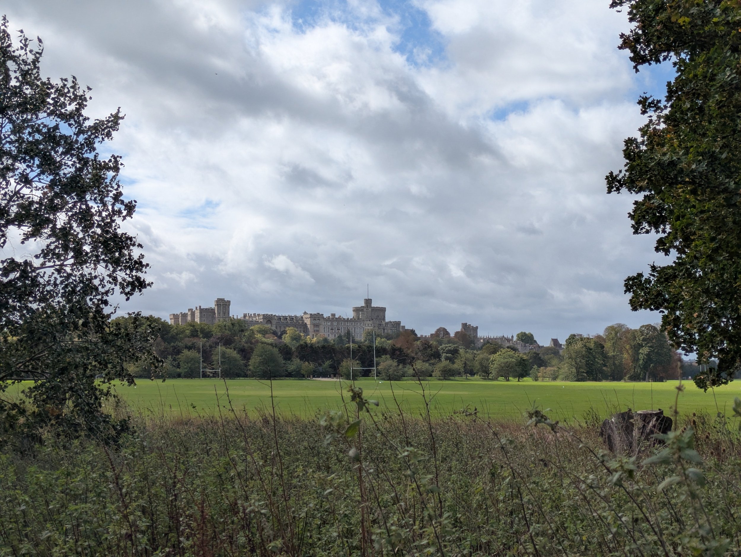

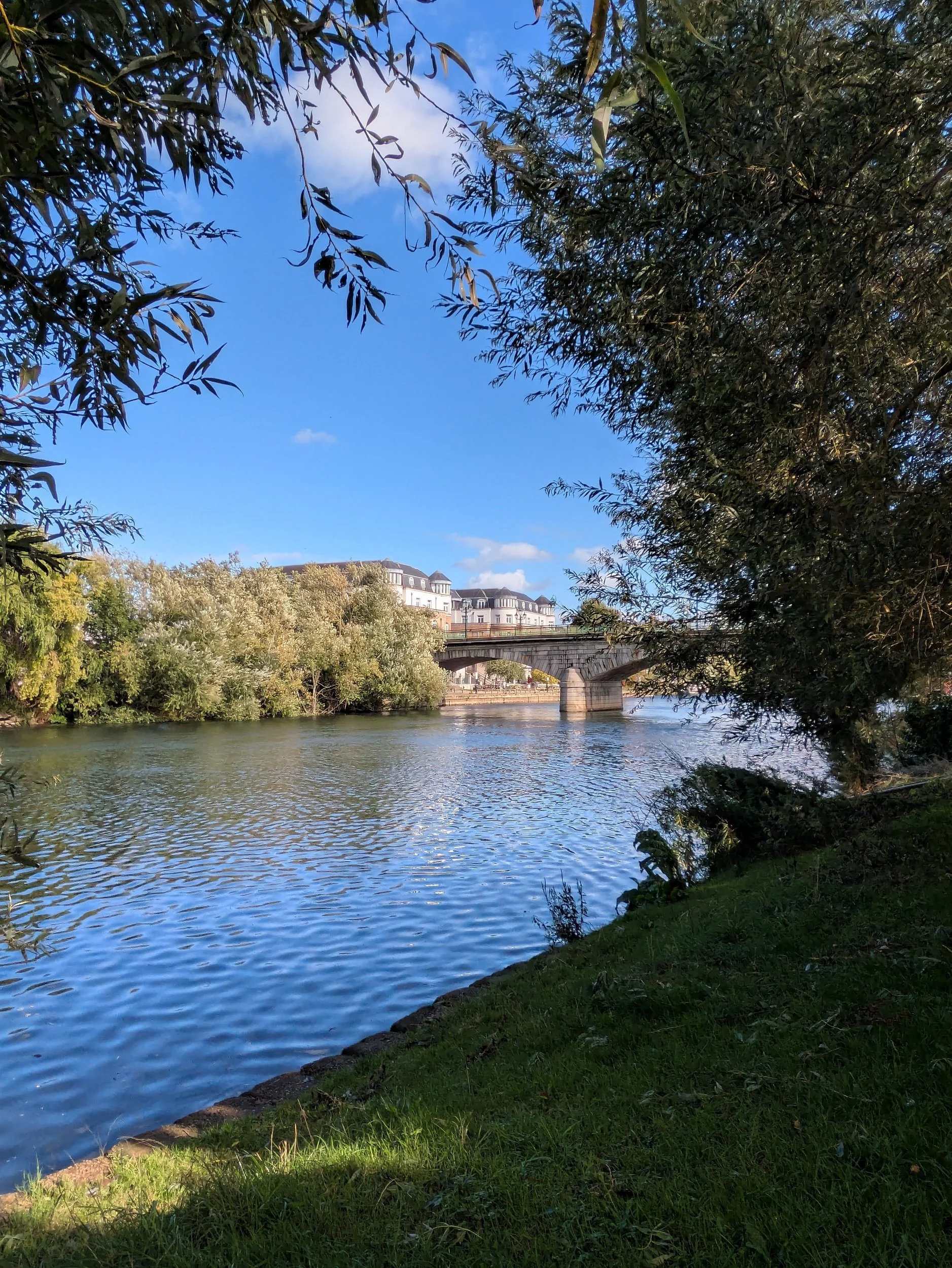
The path goes through Tom Jones boatyard and out onto a meadow which is part of The Home Park where I can get a view of Windsor Castle, then I go under the railway bridge and follow the river around the park. There are Police boats in the river!


The path goes up to a road and crosses Victoria Bridge which had it’s central crossing rebuilt in 1966 due to Tank damage from the Second World War weakening it. Once across the bridge I take the footpath on the other side of the river and continue to follow the Thames towards Datchet, coming out onto the main road.


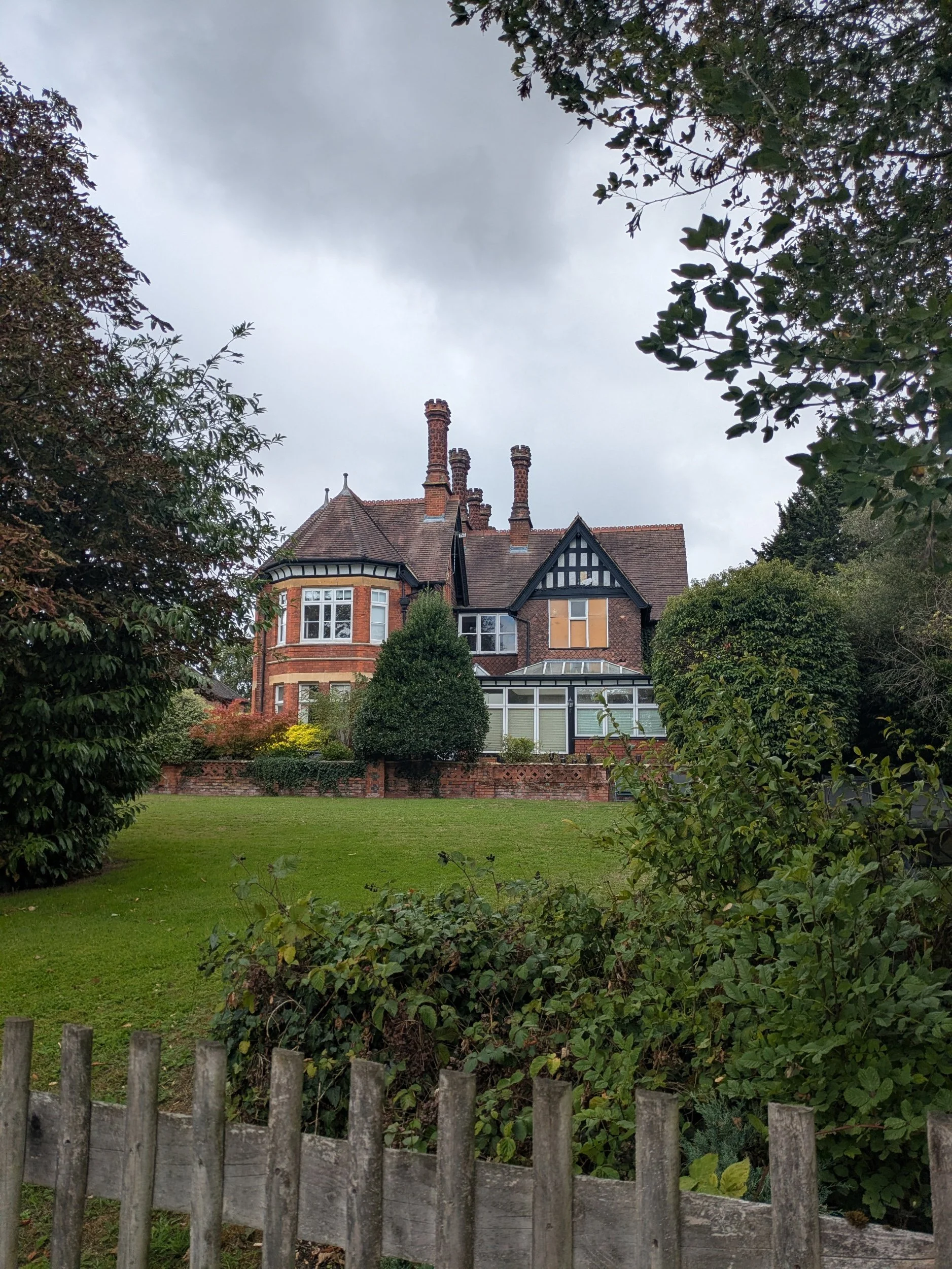
The path follows the main road for a bit then takes me down onto a path the other side of a hedge from the still away from the river and passing fields full of geese and a heron! Then I’m alongside the river again until I reach the Albert Bridge which was rebuilt in brick in 1927. Opposite is Albert Bridge Lodge, a mini castle used as a private retreat by members of the Royal Family and a residence for the Rangers of Windsor Great Park. It was built around the same time as the original Victoria Bridge and Albert Bridge 1850-51. Crossing the bridge I see the police rib again, they seem to be paying close attention to the bridges.


I’m now on my way to Old Windsor Lock with a path between vegetation I don’t see much of the river itself, however I am please to find a yellow Mirabelle plum tree with fruit I can actually reach growing in the hedgerow! Snack time- these are my favourites!


The Thames Path continues through to Runnymede with boathouses and dwellings either side of the river, I need to leave the path to visit the Magna Carta Tea Room to get a stamp for my passport, but guess what…IT IS CLOSED on Mondays. Hmmmph. The boat-like carved bench is designed to be sat and climbed on and was created by master carver Hugh Wedderburn with sculptor Isabel Coulton. It is carved form a fallen oak from the ancient woods at Runnymede.
I re-join the path and continue around the river passing the location where it is believed the Magna Carta was signed and find Steve and Clara in the car park, it is time for lunch.


Haymaking is a 16-piece willow sculpture in Runnymede meadow depicting a pre-industrial scene made by Willow Twisters and community groups from in and around Runnymede and sits in the meadow outside the Magna Carta Tearoom. Across the river, the white walls of St. Mary Magdalene’s Priory stand out against the trees, Nuns worshipped here for nearly 400 years before it was closed in 1536. In 1551 Sir Thomas Smith built himself a fine Courtier’s mansion with a small section of the priory surviving within its walls. In 1805 having pulled down Smith’s house, John Blagrove left the remains of the priory as a garden feature. Blagrove’s house burned doen in the 1960’s and was demolished in 1992, the chalk walls of the priory still stand!


On 14th June this statue of HM Queen Elizabeth II was unveiled in the Runnymede Pleasure grounds to celebrate the 800th commemoration of Magna Carta. A timeline in the stone slabs links the freedoms gained, many set out in Magna Carta, with the reigns of our sovereigns from the time of Edward the Confessor to our late Queen. On the way out of the park, I pass the Wraysbury Skiff, Punting, Dragons and Waka Am club. I reach Bell Weir Lock and painted on the side of the lock house are murals celebrating the 800th commemorations of Magna Carta. There is a lot of history in and around Runnymede! Apparently during the construction of the M25 in 1975 fragments of pottery dating back to c.750BC were found leading to the site of Runnymede Bridge being protected as a Scheduled Monument. The finds from the excavations can be found in the British Museum and a Bronze Age Runnymede mini-documentary was created by Egham Museum in 2016 and can be found at www.eghammuseum.org


There is now yet another diversion, a really boring alongside the road diversion, however it passes The Range and I have a little retail therapy (can’t carry much anyway) before continuing. I do pass a very grand Georgian entranceway which is a bit neglected and then I’m soon back on the trail.


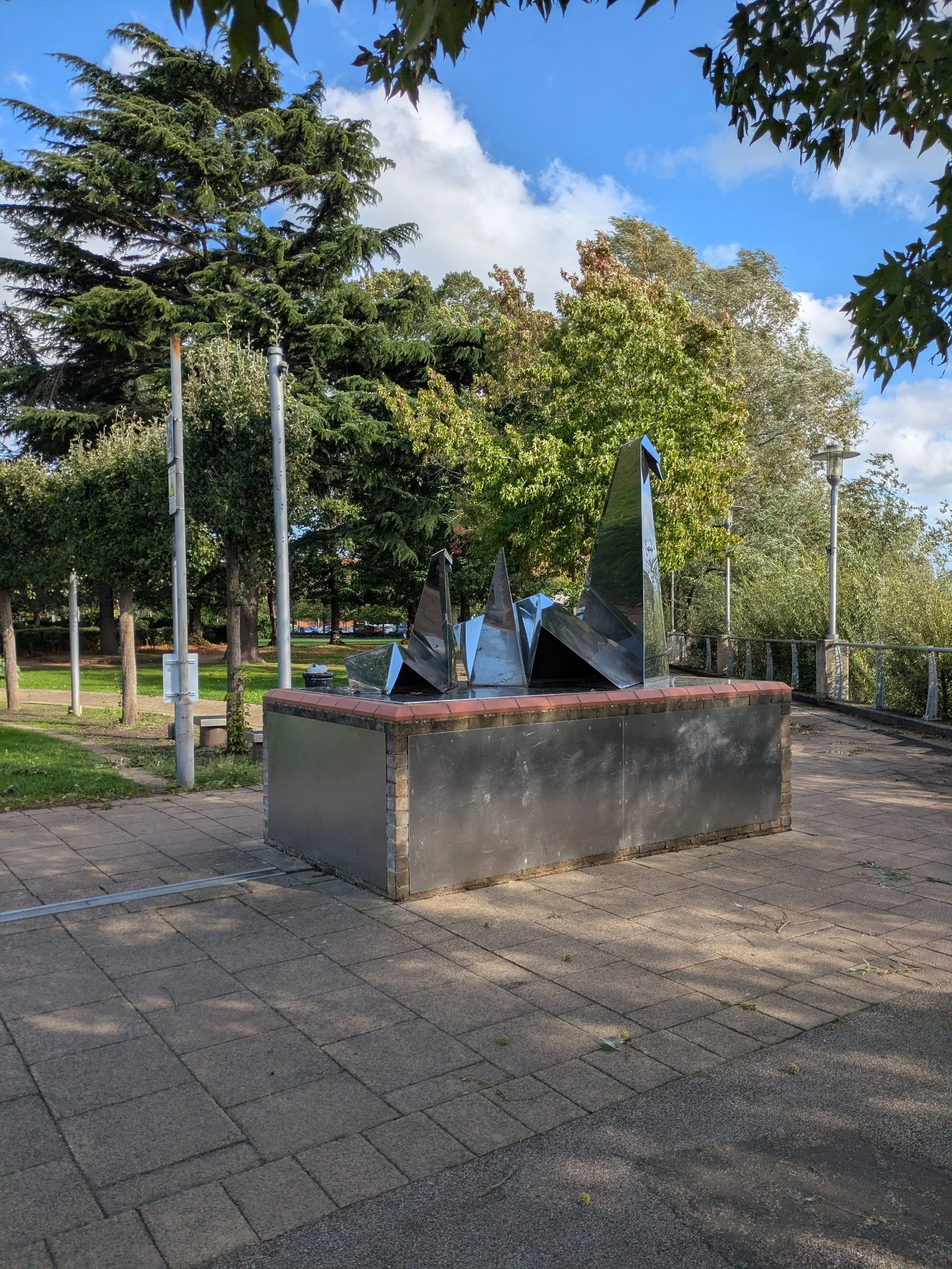
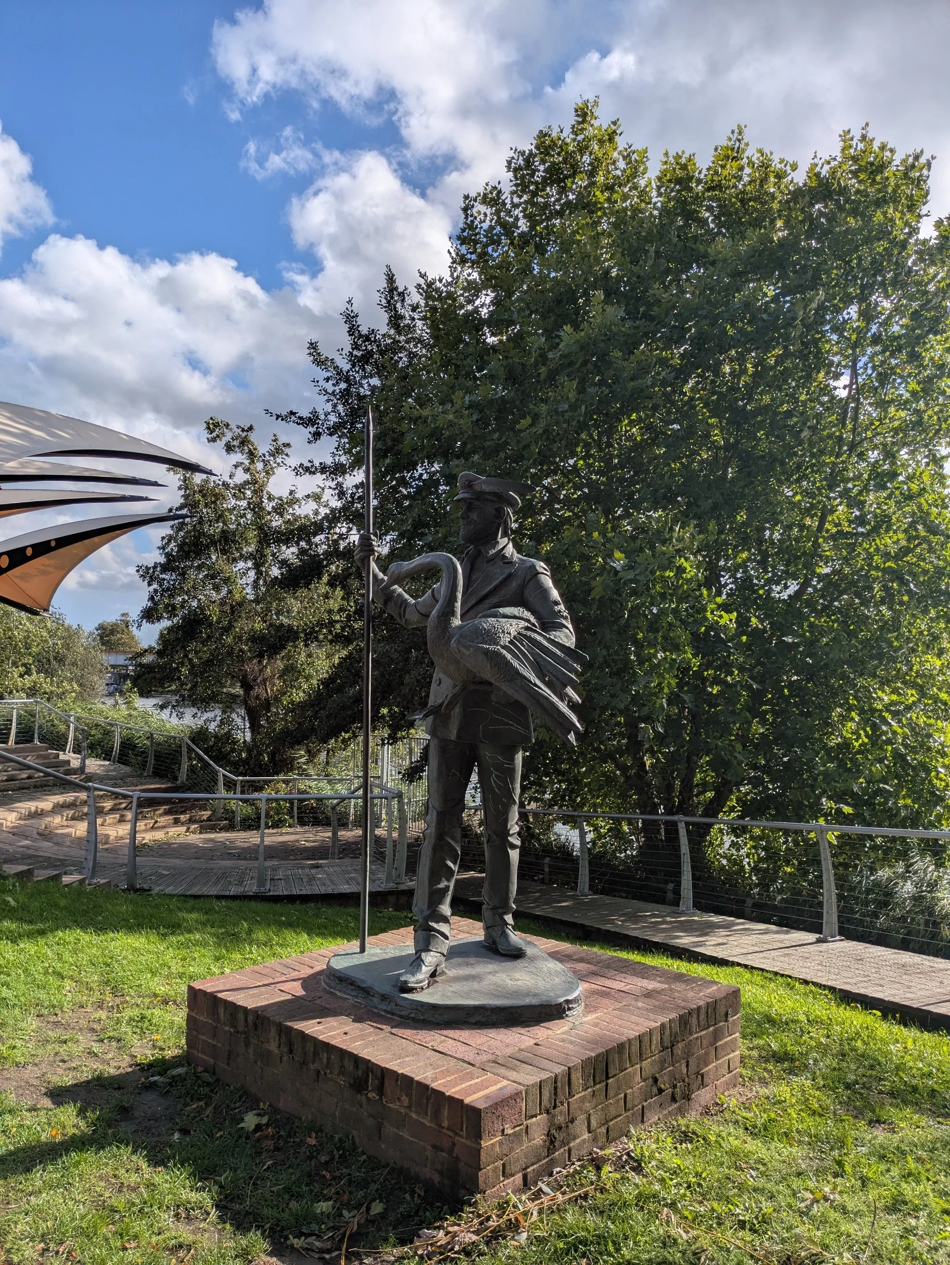

Over bridges and through tunnels the trail takes me into Spelthorne Borough and Staines-upon-Thames. I pass a replica of The London Stone, a boundary stone marking the extended jurisdiction in 1285 after King Richard I sold the rights over the River Thames between the estuary and Staines to the corporation of the City of London to pay for his Crusades! Here in Riverside Gardens there are also sculptures, The Origami Swans by Tom Brown and The Swan Master by Diane Thomson, swans feature heavily in Staines obviously!


Walking along the Thames Path under another railway bridge and the sun is shining beautifully, there are a lot of residential flats and houses, but I pass this striking church, built between 1892 and 1894, a rich red brick with stone dressings and a copper-clad spire with a beautiful lych-gate opening onto the towpath. St Peter’s Parish Church was used as a film location for the 1976 horror film The Omen. This flagpole in a front garden made me smile, the owner has put a whiteboard inside a waterproof pouch and attached it to the flagpole which reads: TODAY’S FLAG IS BELIZE, educational!


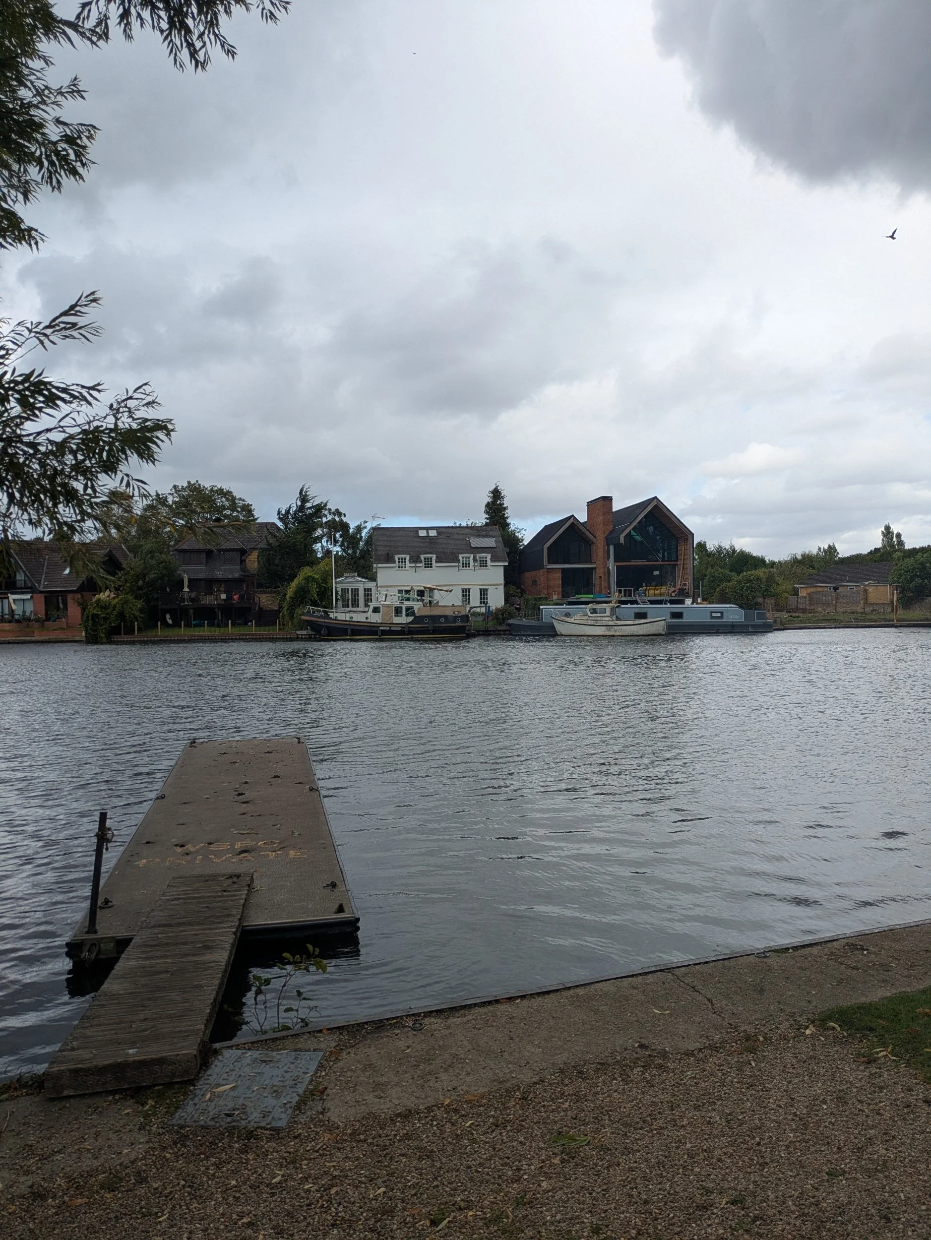
On the opposite bank there are some pretty snazzy properties, very sleek and modern. I pass through Penton Hook Lock, opposite is Penton Hook Island where the river Thames forms a big, almost complete loop here, the island was formed when Penton Hook Lock was built in 1815. It is a protected nature reserve, unfortunately it is currently closed to the public due to ash dieback. Have you spotted the Arctic visitor standing guard on a balcony? The path moves onto a quiet road and I pass a couple of Boathouses and Laleham Camping Club and pass underneath the M3 motorway bridge.


Way back in the 16th and 17th centuries there was a ford across the Thames here at Chertsey, later upgraded to a ferry. This part of the river was known as Laleham Gulls an area notorious for causing all sorts of difficulties in the shallows for river traffic. Eventually the Corporation of the City of London realised the need to improve navigation here and between 1811 and 1815 they built a series of large locks along the Thames, Chertsey being one of them. Behind the lock here is the campsite where we are staying and where I am walking to today, but I cannot access it from this side of the river and so on to Chertsey Bridge I go!
Chertsey Bridge is a Grade II listed structure dating from 1785, it has five round arches over the water, the central one being the biggest and one more on either side. Just before the bridge is a semi-detached pair of houses with a round window painted with a old scene of the Bridge painted onto it, which house does it belong to I wonder? I finally reach the bridge, climb up the steps to reach the road and walk over to the other side to find the campsite down the road.