
Nordic Walking The Thames Path Leg Thirteen: Kingston-upon-Thames to Putney Bridge
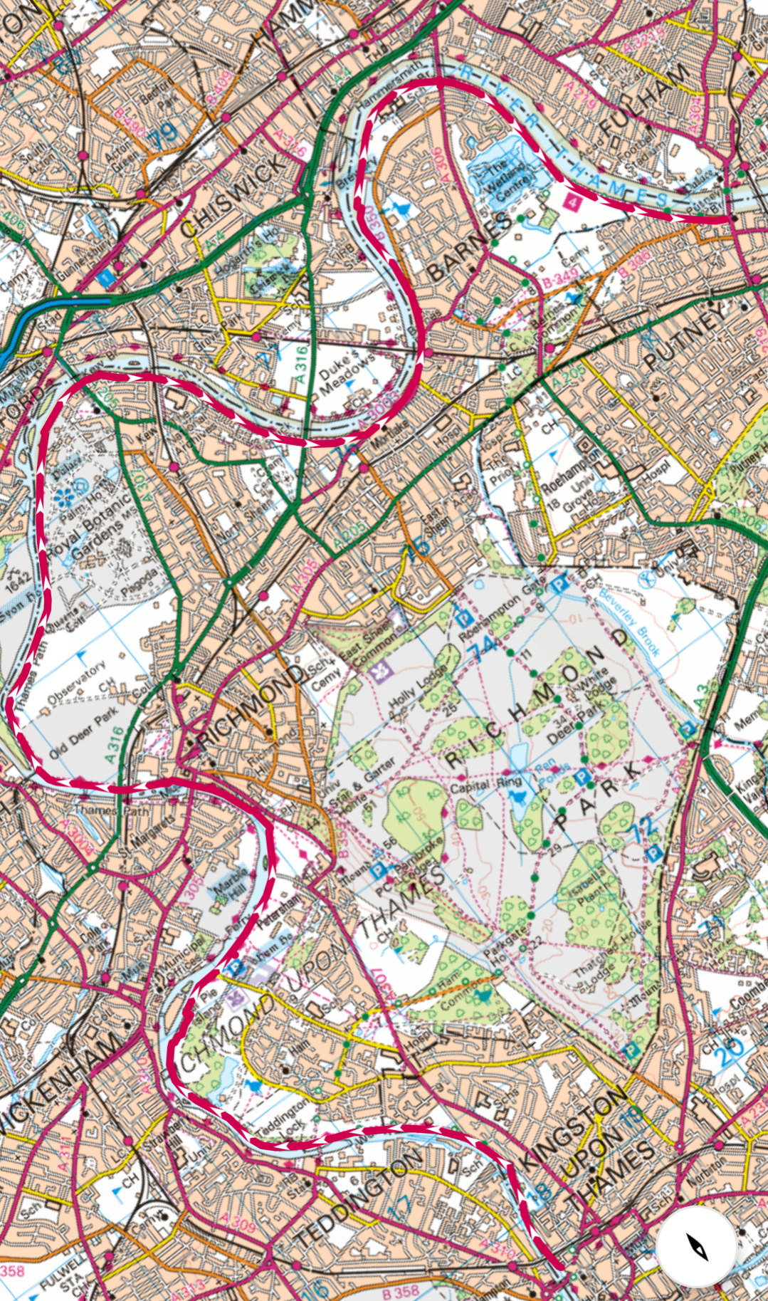
Leg Thirteen: Kingston-upon-Thames to Putney Bridge
When: Thursday 18th September 2025
Miles Walked: 15.58
Steps Taken: 34,118
Moving Time: 5:13:22
Elevation Gain: 120 ft
Today I am walking from Kingston-upon-Thames to Putney Bridge and I am not alone! One of my best friends is joining me on this leg, Lorna and I have been friends since we were eleven years old, we’ve been through a lot of lifes ups and downs together and the last time she joined me on a leg of a walk in 2020 it absolutely poured with rain, so I am hoping for a better weather day today!


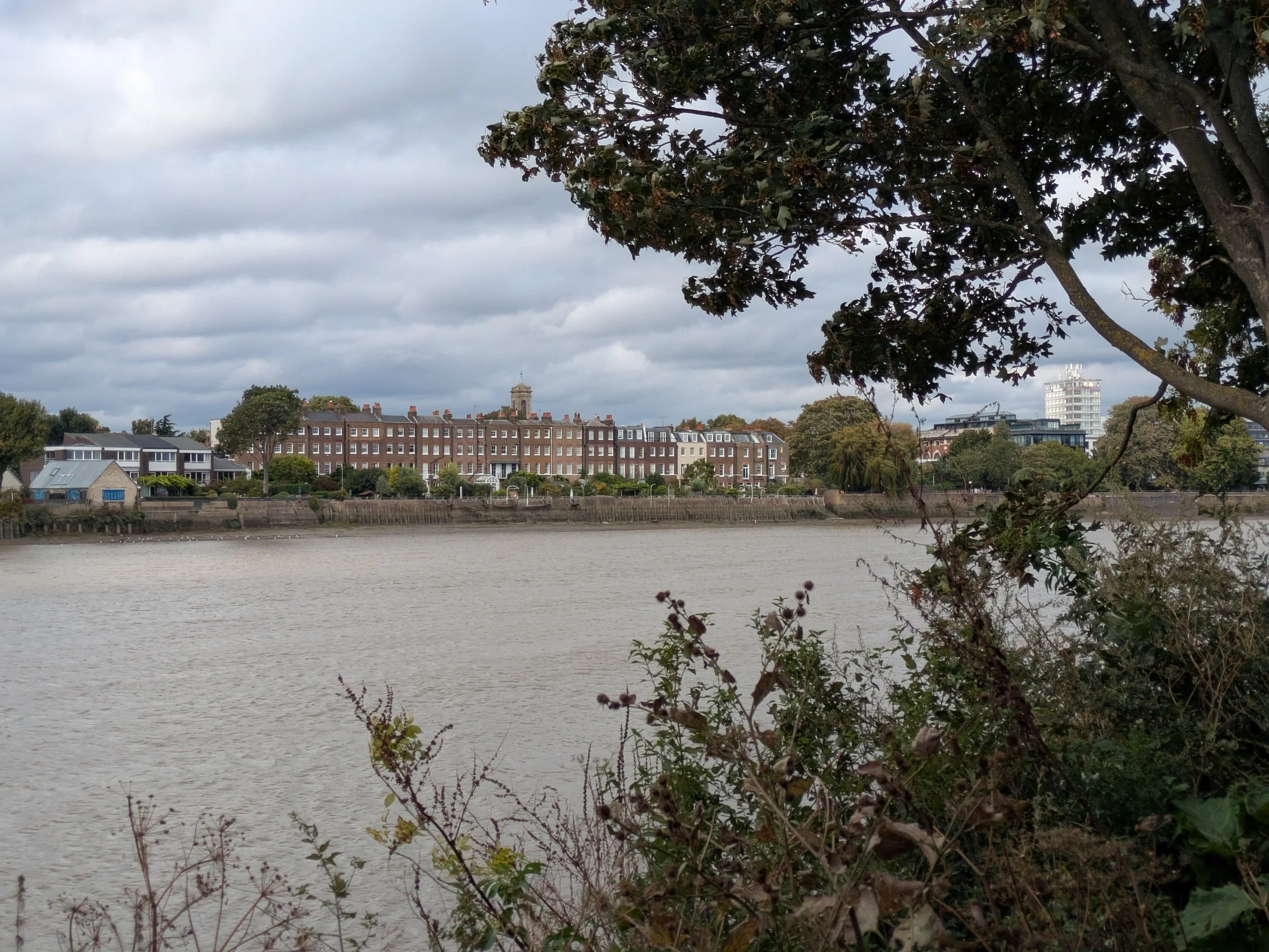
Steve dropped me off in Kingston-upon-Thames in the middle of stopped traffic and I leapt out having spotted Lorna on a bench, she crossed over and we shared a hug, it is so lovely to see her. She is one of those friends who you just pick up from where you left off even if months have passed since you last saw each other. We get onto the Thames Path away and I swear my mouth is moving faster than my feet! When you are chatting you forget to pay attention to the world around you and so I’ve probably missed loads on this leg. The first thing we spot is how like a ship this white block of flats looks like, I have spotted a few boat-like designs along the course of this journey, but it does really feel as if you are looking at the prow of a ship. The path is in quite a lovely park with lots of mature trees and benches to look out over the river and Lorna tries out a chair carved out of an old tree stump. We pass the former Albany Boathouse which has now been converted to offices and then pass this ultra modern property which after a bit of research it turns out to be an award-winning Architect (Fletcher Crane) designed one-off called Lower Ham, the glazed facade at the front is 9 metres tall, key living spaces frame the river aspect and the master bedroom suite benefits from panoramic views from Kingston to Teddington Lock. It also features a courtyard garden and reflecting pond. The unassuming front hides much more!


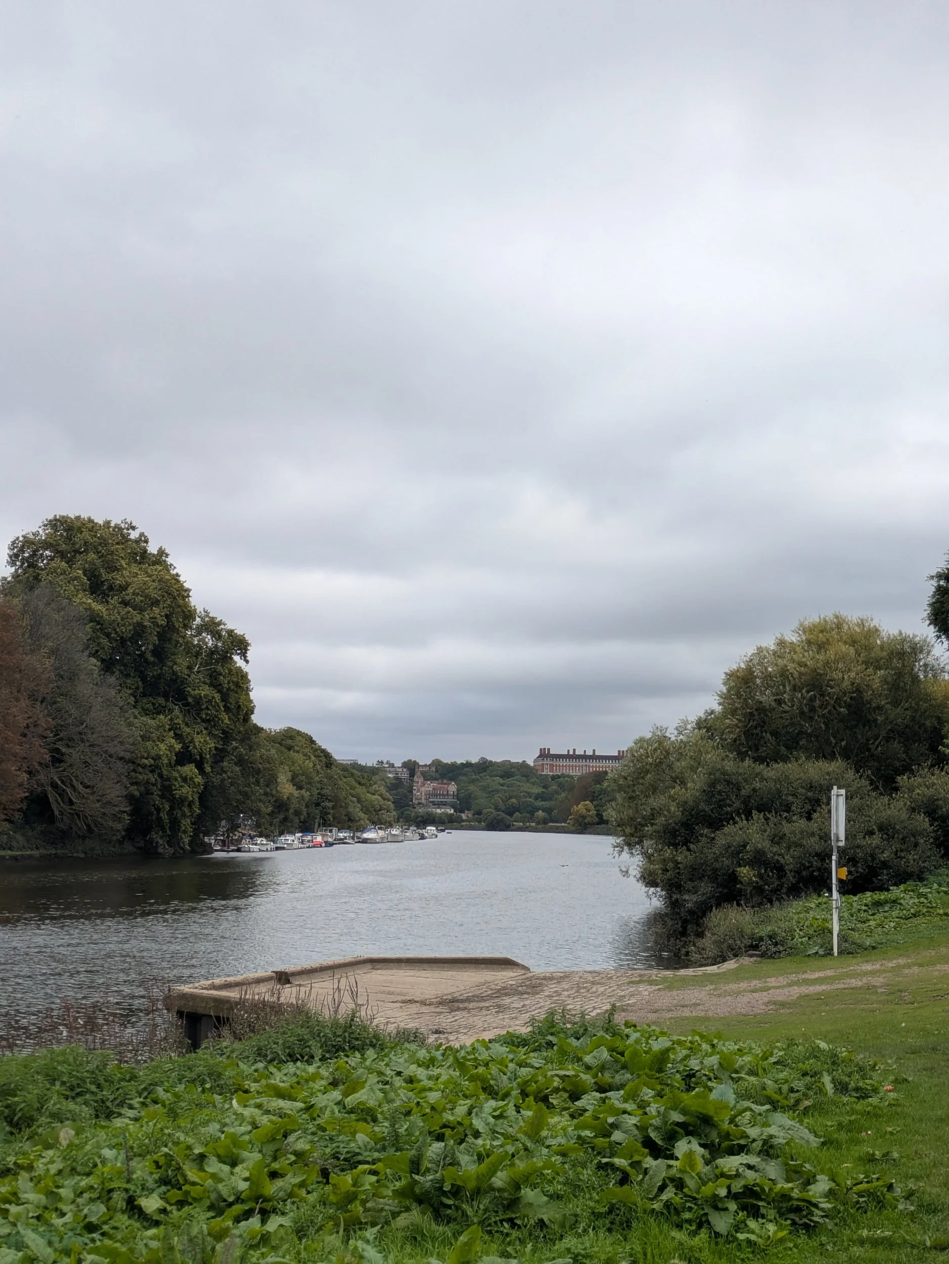
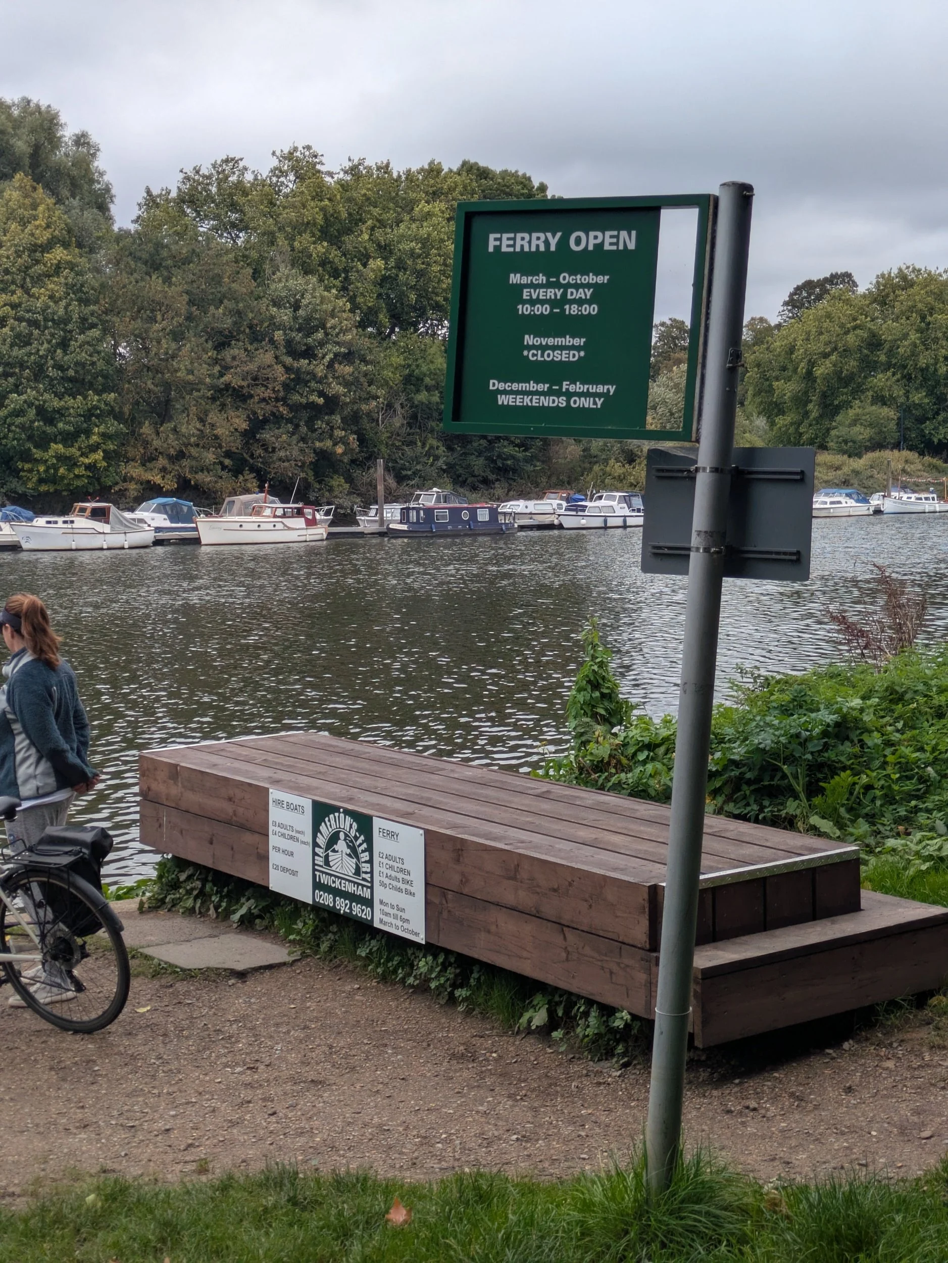
Once again there are rowers being coached in the river and a kayaker passes us by. We reach Teddington Lock where the Thames becomes tidal and this lock actually has three locks and a weir making it the biggest Lock system on the non-tidal Thames. We pass the 1909 Teddington Obelisk, a boundary marker marking the formal boundary between the upstream reaches which are governed by the Environment Agency and the downstream reaches governed by the Port of London Authority. We pass Eel Pie Island which is an 8.9-acre island (or ait) It is accessible by boat or from the north bank by a footbridge. The island had a club that was a major venue for jazz and blues in the 1960s. Its name may have come from Eel Pies that were served from the Inn on the island in the 19th Century. We are having a lovely time catching up and looking at all the boats and houses around including the magnificent Richmond Star and Garter Home on the hill, originally opened in 1916 by the British Red Cross Society to care for severely disabled young men returning from the battlegrounds of the First World War. It was sold in 2014 and is now private apartments. The path passes Hammerton’s Ferry where a cyclist is waiting to cross, it runs everyday from 10am-6pm, March to October.


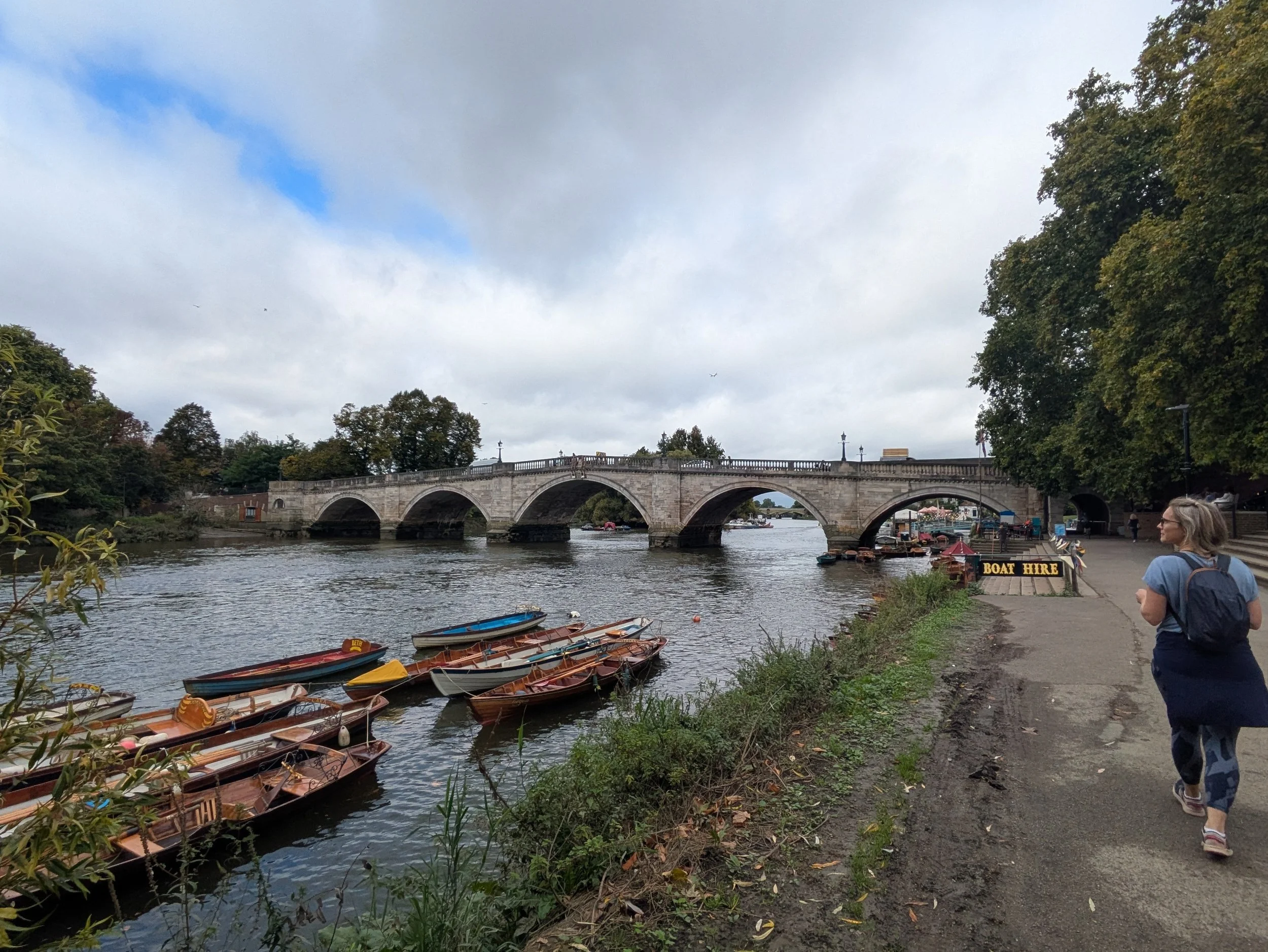

We can see in the distance the stunning Ham House to our right, this rare and atmospheric 17th-century house is the creation of the Duchess of Lauderdale and her husband, the Duke, who together transformed Ham into one of the grandest Stuart houses in England. Ham House is internationally recognised for its superb collection of paintings, furniture and textiles, largely brought together 400 years ago. Outside, the open and formal restored 17th-century gardens surround the house. We then pass Petersham Meadows, owned by the National Trust, a beautiful green space protected in 1902 by an Act of Parliament. 24 acres of water-meadow which famously formed part of the landscape from Richmond Hill depicted in the painting by JMW Turner. We arrive at Richmond Bridge a 1770’s stone arch bridge, the oldest across the Thames in London and the scene immediately before the bridge is giving me Cambridge and Oxford vibes with the long rowing boats all tied up together reminding me of punts.

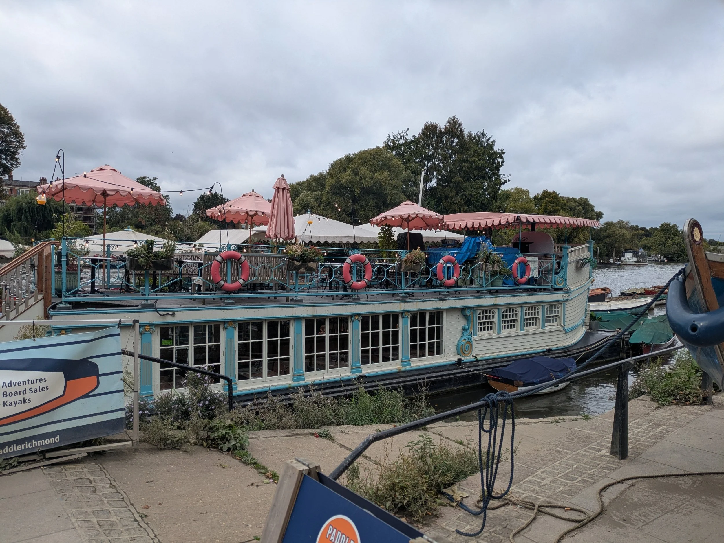


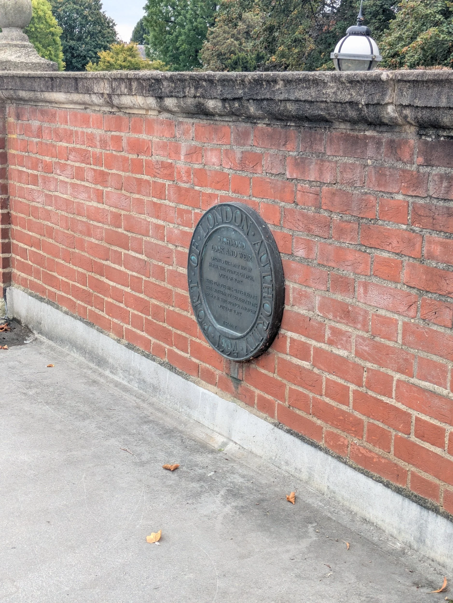
Beyond Richmond bridge there are more boathouses with businesses in and a floating restaurant moored up called Peggy Jean, an old Oxford barge from Jesus College, lovingly restored into this quirky restaurant. The menu is Aussie, with bottomless brunches, cocktails and more! The riverside buildings along here are very elegant, it must have been quite the place! We reach the Richmond Lock and Weir beyond the railway and road bridges and cross over it as there is a diversion further ahead around Kew due to a bank collapse, so for a while we’ll be walking along the North Bank and won’t be walking around the Old Deer Park - one of the most important spaces and landscape features in Richmond history for over 500 years apparently, it’s now playing fields and a golf course! Anyway back to The Richmond Lock and Weir which is a significant structure here, it consists of a half-tide lock and a rising low-tide barrage that allows for controlled navigation and water level maintenance. The lock and weir were officially opened in 1894 (by HRH Prince George, Duke of York), the weir features three vertical steel sluice gates that are raised during high tide to allow passage, while the gates are closed for the rest of the day. Lorna and I enjoyed its cream and pastel green colour pallete.


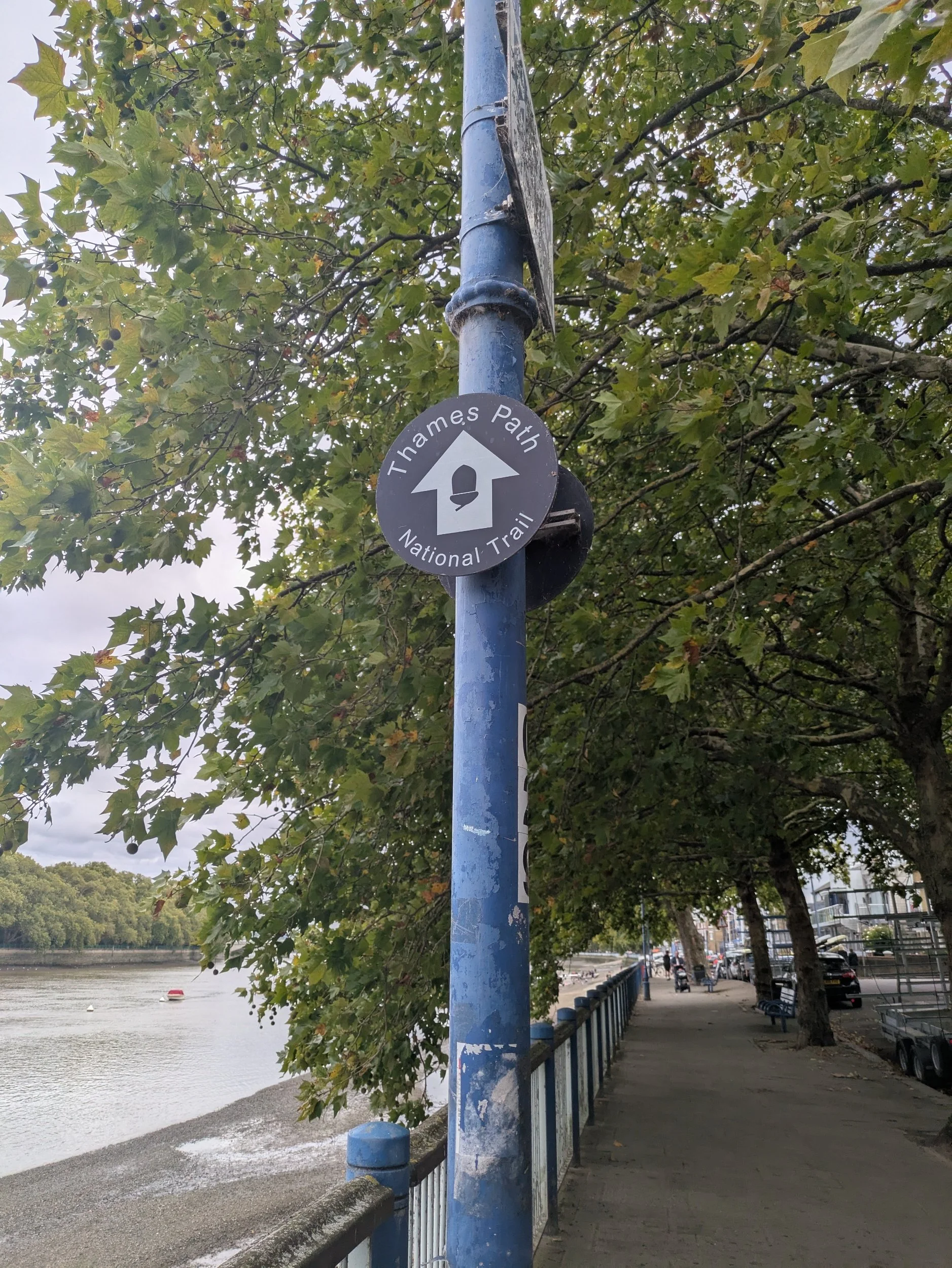
So we are now on the North Bank on the official diversion which looks complicated! We go through riverside paths to Isleworth keeping our eyes peeled for the little acorn signs! Passing through Lion Wharf where a chap looks to be fixing a wharfside crane, this wharf operated as a coal wharf. The wharf buildings that remain are now apartments with riverside views.


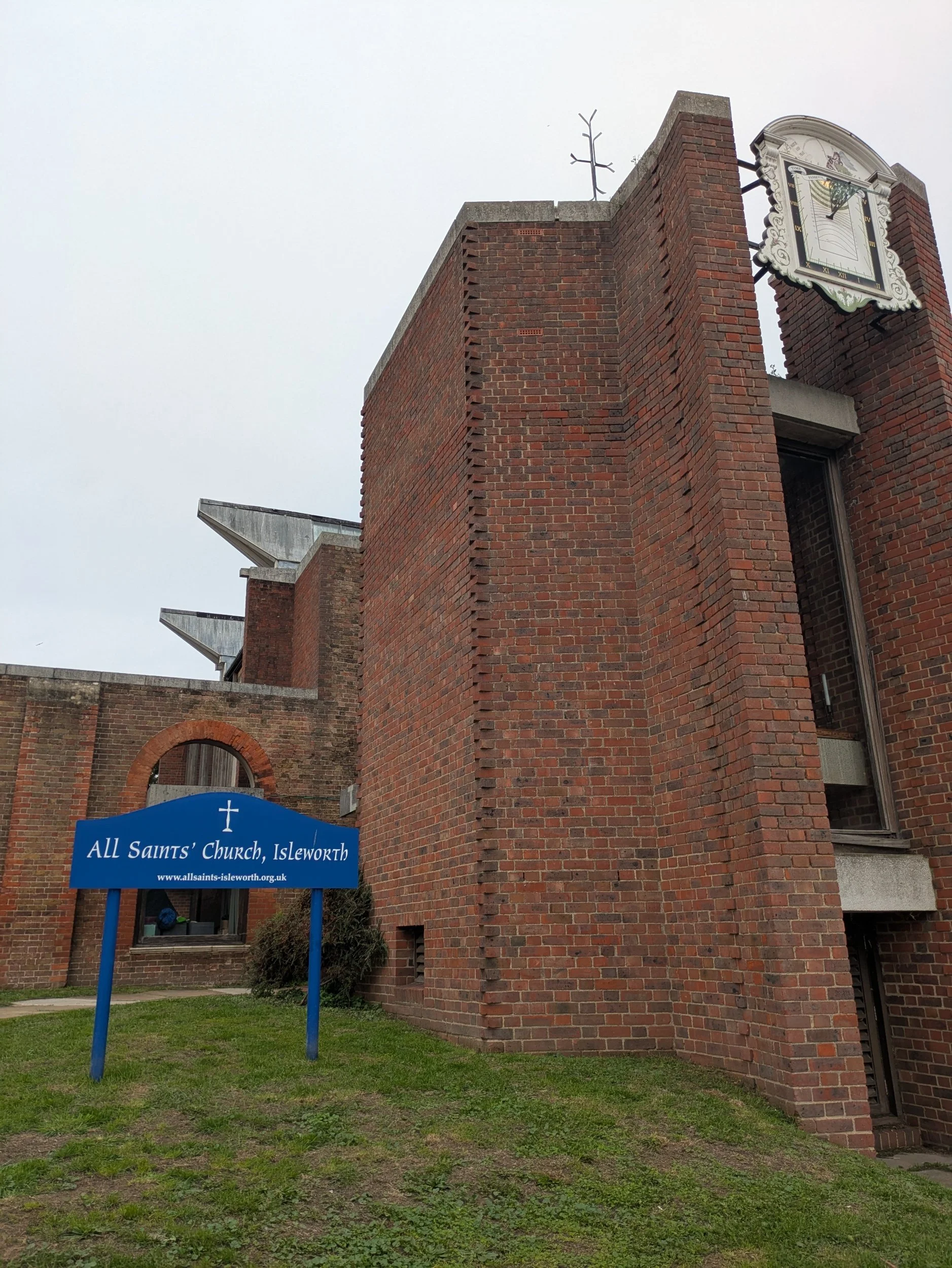

The old vicarage looks very grand and has interesting shaped railings. I haven’t taken many pictures of doors on this trip, but here are a pair that are very pleasing to my eye, no interesting door knockers, but the hint of the top of a column and the gothic arches (very church-like) made them stand out. Then we came to a very interesting sight…An old church tower with a very modern rest of the building. All Saints’ Church, Isleworth has fascinating history. In 1943, the whole church, save the 14th century Kentish ragstone tower and parts of the stonework, was burned to the ground. Not by WWII bombs (Isleworth was heavily bombarded during the war), but by two teenage boys. You can find out more here https://www.allsaints-isleworth.org/history and see an aerial shot.


We are now entering Syon Park, which features Syon House the London home of the Duke of Northumberland.
The house was built in the sixteenth century on the site of the Medieval Syon Abbey, by Edward Seymour, 1st Duke of Somerset and came to the family of the present owners in 1594. It stands in 200 acres of grounds designed by Capability Brown. The house has also been the site for many historical events including the imprisonment of Queen Katherine Howard before her execution in 1542, Lady Jane Grey (the 9 day Queen) was offered the crown here in 1553. The house was extensively refurbished in the 18th century using designs by Robert Adam, the most famous architect of the day. We decide to stop here for a bite of lunch in the Clocktower Café within the Hillier Garden Centre. A slightly disappointing lunch menu of cold, refrigerated, insipid looking tuna baguette, a shared pack of crisps and a cuppa later and we are off again continuing along the diversion through Brentford and passing the Thames Lock.


This area has a very industrial past with The Red Lion Brewery, a distillery, a windmill and a hotel all being taken over eventually by The Gas Works (closed in 1963) some light industry remains, but most of the area deemed too polluted for housing is now Watermans Park. The Gas Works were cleared and capped to make way for the park and Arts Centre which opened in 1983. Brentford street lights were lit by gas until 1960! We also pass by the London Museum of Water & Steam where you can find out about the story of London’s water supply, a hands-on experience which also has a narrow-gauge railway!


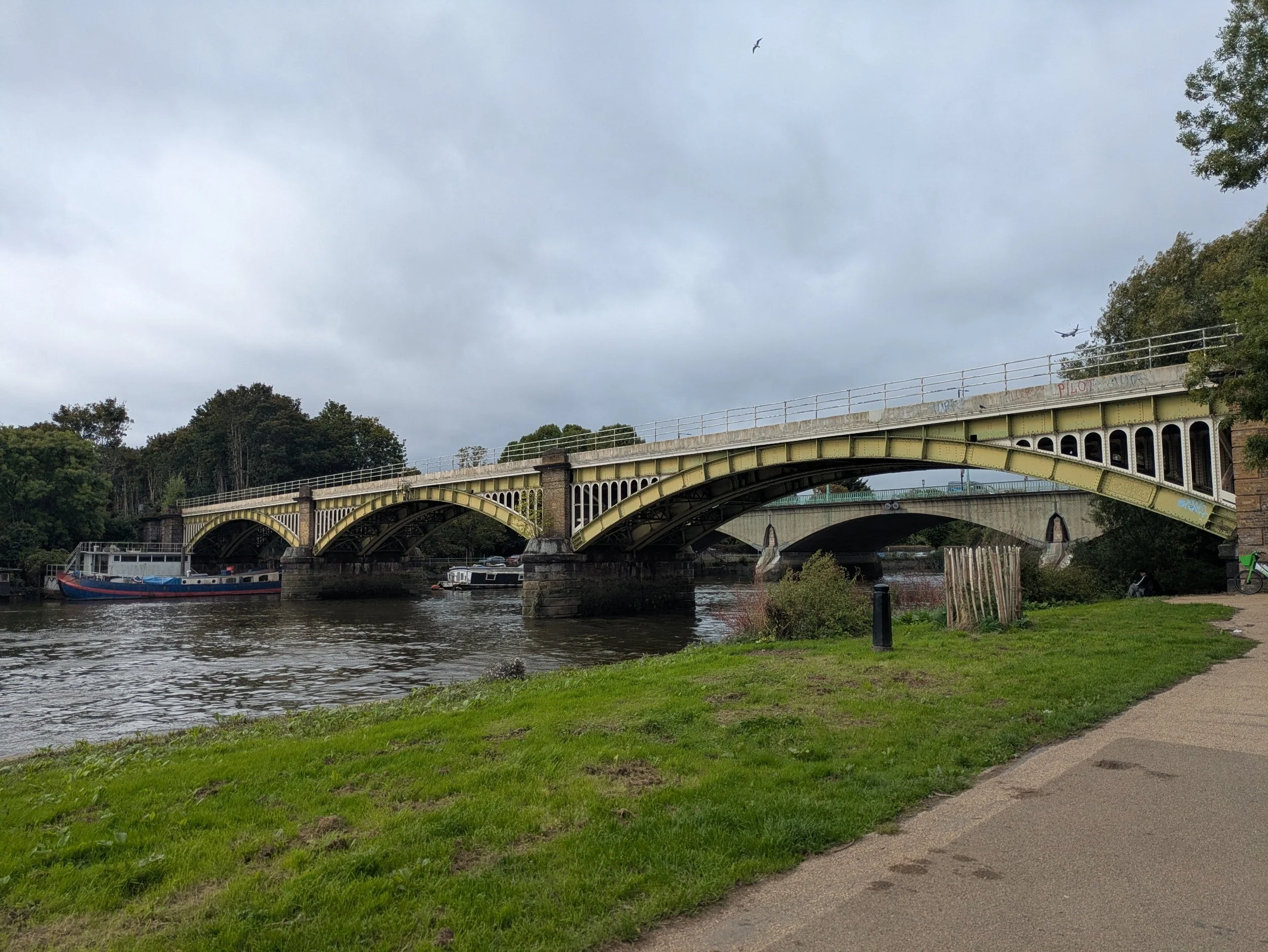
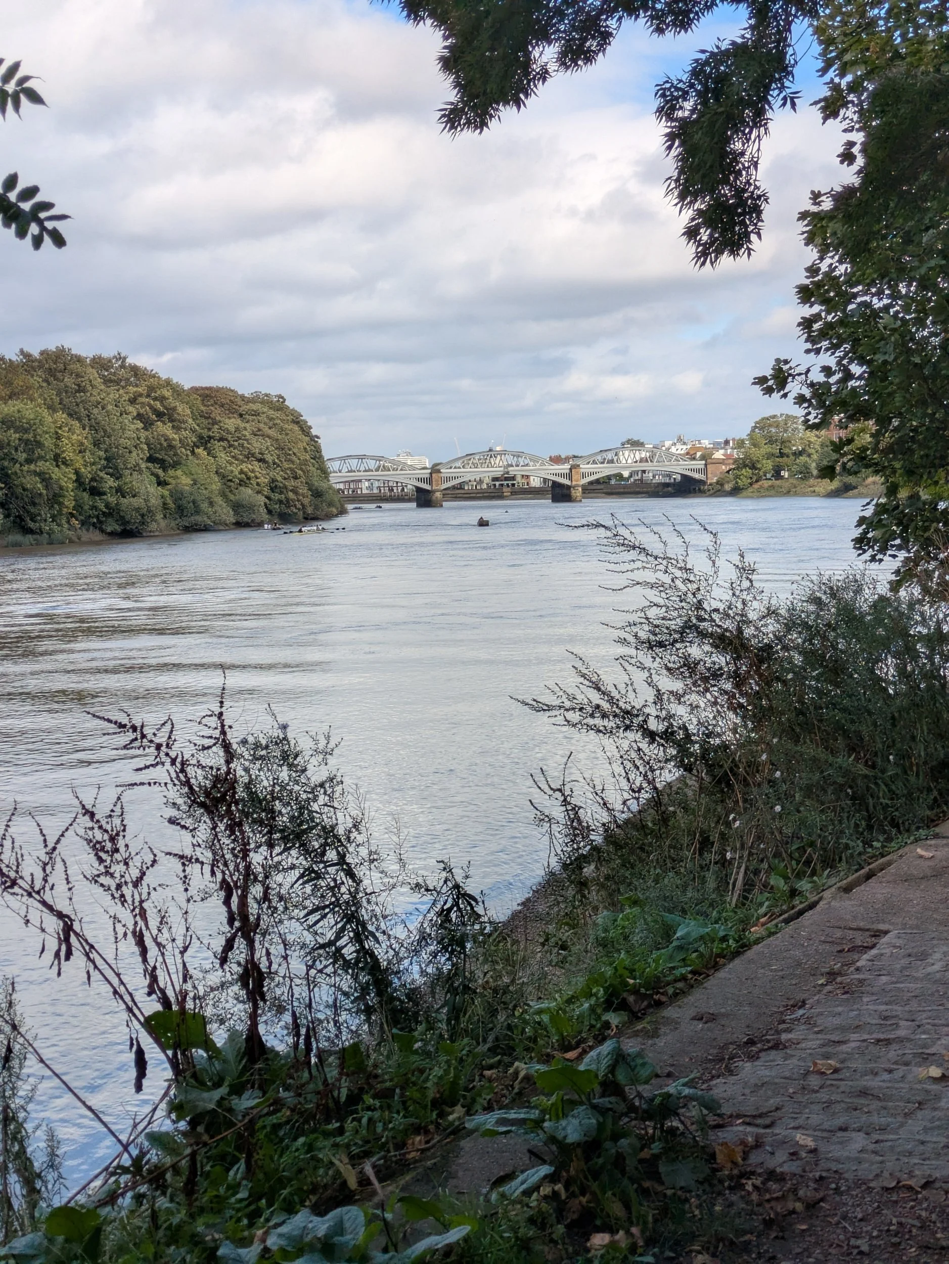
We cross over Kew Bridge and continue along the footpath towards Mortlake, back on a nice wide leafy path! More rowers pass us and we pass the Putney Town Rowing Club, are we venturing into Boat Race territory? The Boat Race between Cambridge and Oxford Universities has been held on this stretch of water every Easter since 1845. It’s a four mile, 374-yard course between Putney Bridge and Mortlake (just shy of Chiswick Bridge) which we are fast approaching. Chiswick Bridge is a reinforced concrete deck arch bridge, it is one of three bridges opened in 1933 as part of an ambitious scheme to relieve traffic congestion west of London. The bridge is built on the site of a former ferry. It is 606 feet long and faced with 3,400 tons of Portland stone. When the 150-foot central span opened it was the longest concrete span over the Thames.


We pass under Chiswick Bridge and pass what looks like a former mill, but turns out to be a former brewery. The Stag Brewery Regeneration project has received planning permission to redevelop the former Stag Brewery site with planning for 1.075 new homes, a secondary school and improved public spaces in Mortlake. We also pass this interesting Victorian Villa, known locally as The Tower, which sold for over £6.4 million last year! Barnes Bridge is a railway bridge constructed in 1849.


Beyond Barnes Bridge we pop into The Bull’s Head pub to get another Thames Path stamp for my passport and then we are back to spotting unusual items on balconies… this time it is a colourfully painted cow sculpture and a Storm Trooper from the Star Wars films just casually keeping watch over the passers-by. Over the river I spot this magnificent row of terraced houses, Hammersmith Terrace is a street of brick-built houses in Hammersmith, most of the seventeen houses in the terrace are Grade II listed. The street was built in about 1770 and has been home to several notable artists. The 70 foot gardens reach right down to the Thames, giving the owners riparian rights.

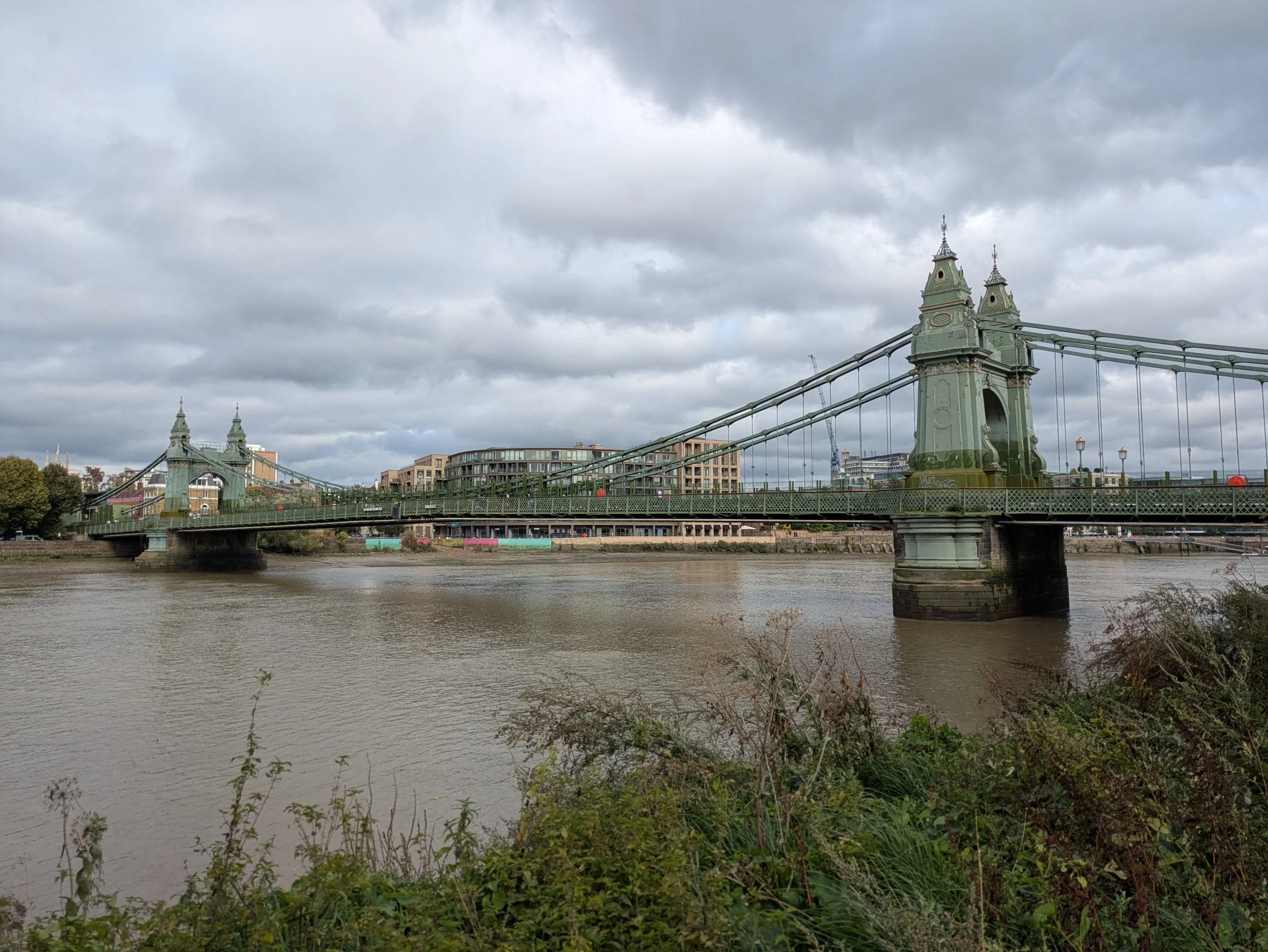


I have also been spotting a few fungi this afternoon! Hammersmith Bridge now comes into view, Hammersmith Bridge was designed by Sir Joseph Bazalgette and opened in 1887, using the same foundations that were built for an earlier bridge, which had to be replaced because it couldn't cope with the weight of the traffic. The bridge is 210m long and 13m wide and consists of a central roadway with a walkway on either side. It is a suspension bridge, with large chains. It is painted green and gold. It's London's weakest bridge, the bridge was closed to motorised traffic on April 10th 2019. After a lot of repair work the bridge reopened in April this year with new bicycle and pedestrian lanes on the "roadway" part of the bridge. The stone obelisk is a memorial to rowing coach Steve Fairbairn and marks one mile from the finish of the Head of The River Race- an annual against-the-clock rowing race for Eights which sees hundreds of boats competing in different categories.
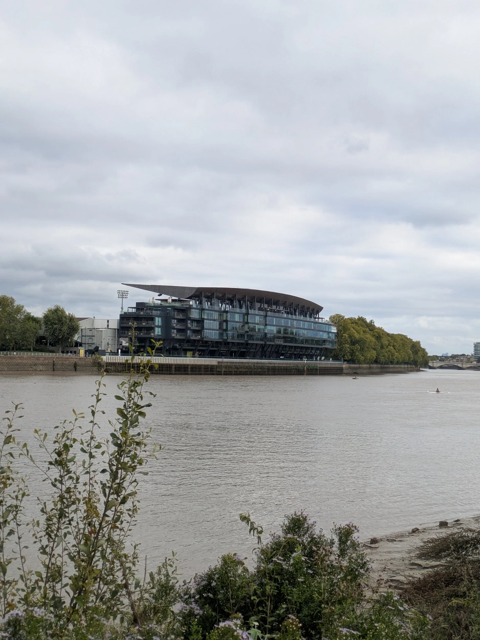
On the other side of the river is an impressive looking building which turns out to be the new Riverside Stand of Craven Cottage, home to Fulham Football Club since 1894. This redevelopment was started in 2019 and consists of 5 levels of restaurants, bars, premium hospitality lounges on matchdays and a 3-level skydeck with views across London!


The footpath now goes through a leafy area, with very autumnal looking Horse Chestnut trees and the sun keeps teasing us by briefly peeking out from behind the clouds. The frequency of boathouses along this stretch is becoming ridiculous and we pass many young people launching boats, bringing boats out of the water, cleaning boats after a rowing session and lots of boat trailers parked alongside the public slipway just before Putney Bridge. Pink seems to be the in colour for the male rowers!


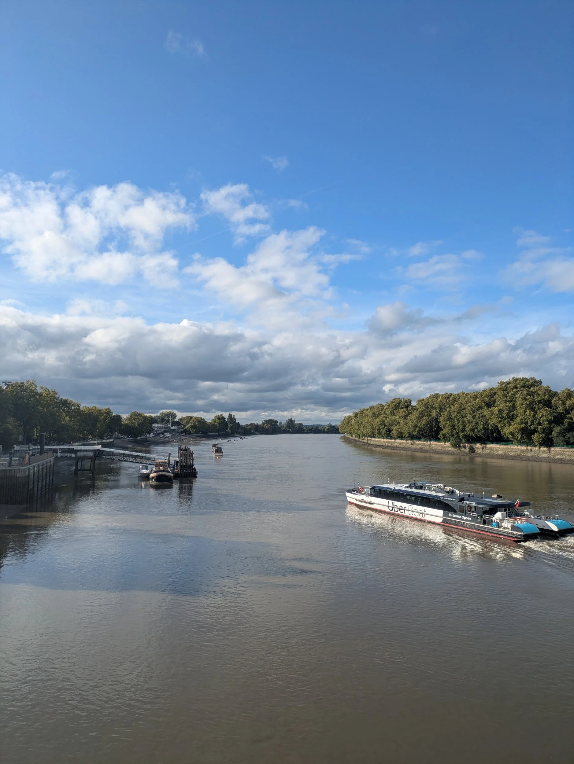
The London Rowing Club (blue balcony) was established here in 1856 and there are other good looking buildings on the Putney Embankment including Ruvigny Mansions, a Victorian mansion block. At Putney Pier you can pick up an Uber boat and it is where the University Boat Race starts! We soon reach Putney Bridge-an important river crossing spot since Roman times. A wooden toll bridge was erected in 1729, this bridge was designed by renowned architect Sir Jacob Acworth, officially known as the Fulham Bridge, it was the only bridge between the central London Bridge and Kingston Bridge at the time. The original wooden bridge was badly damaged following a collision with a river barge in 1870. The current stone bridge was designed by Sir Joseph Bazalgette (we’ve heard that name before) and was opened by the Prince and Princess of Wales in 1886. The bridge was later widened in 1933 and remains one of the busiest of all the Thames crossings. Upon reaching the bridge we decide to cross the busy bridge in search of the Tube station and try and find a café with a toilet, but alas the ones near the Tube station were sadly lacking. The sun did finally came out as we crossed the bridge!
The end of this day was a long one, we reached Putney bridge at 4.30pm and due to delays on some of the Tube lines, including no trains running on the Elizabeth Line at all (my route to Abbey Wood, where we are camping tonight) and us trying to find a café with a loo (we ended up in Pret at South Kensington, literally such a relief) we eventually went our separate ways and I misread the Tube map (should’ve gone to Specsavers) I ended up at Stratford (don’t ask). I finally reached Abbey Wood at 8pm, Steve met me as it was dark and a ten minute walk to the campsite. I clocked up 40,000 steps today. #exhausted