
Nordic Walking the Thames Path Leg Three, part one: Lechlade to Tadpole Bridge

Leg Three Part One: Lechlade on Thames to Tadpole Bridge
When: Saturday 9th August, 9am
Miles walked: 11.85 miles
Steps taken: 25,136
Moving time: 3:51:11
Elevation gain: 22 ft
Today we met at Tadpole Bridge on Buckland Road, Faringdon at 9am, parking one car in a handy lay-by across the river from The Trout at Tadpole Bridge (there’s a few with the same Trout name!) We headed the 20 minutes drive back to Lechlade-on-Thames and parked in the same side street as the last leg walking the 5 minutes back to the river. The weather is currently 16 degrees and cloudy, but with the promise of warming up I’m in shorts and a vest top, it’s a bit chilly right now! As we were walking towards Ha’penny Bridge I spotted this unusual feature on the wall as we were waiting to cross.

Crossing Ha’penny Bridge we head down the steps and go under the towpath arch, gated at both ends. This leads on to the riverside path that twists and bends it’s way along passing moored cruisers and narrowboats including one from canalministries.org.uk hosting the Waterways Chaplain.


This section between Lechlade and Newbridge is described as the ‘most splendidly isolated’ of the whole Thames Path. It is also the longest which is why we have split it in two! Going out of Lechlade the path is on the edge of a wide grassy bank and makes for nice easy Nordic walking, there are only a couple of swans or passing dog walkers for company.


We soon reach St John’s Lock, the first of many locks and weirs along the Thames. In front of the lock house stands the statue of Old Father Thames (made by Italian sculptor Rafaelle Monti), first commissioned in 1854 to adorn the fountains of Crystal Palace, but after the fire in 1936, it was bought by one of the Thames Conservators and originally placed at the Trewsbury Mead (source of the Thames) in 1958. Sadly after suffering some vandalism he was moved here in 1974 and is now under the watchful eye of the lockkeeper!


Traveling onwards following the twists and turns of the river, we cross over a footbridge to walk along the other side and pass a robust looking concrete pillbox, a World War II relic.
I’m now the proud holder of a Walk The Thames Passport and need to get it stamped at various locations to get my certificate at the end, so when we reach Buscot Lock (the smallest on the Thames), we cross the upper lock gates and the old weir, taking the small diversion into Buscot village and the lovely tearoom. Their stamp was lost and so I was given a sticker instead! We took advantage of the facilities and may have purchased a small treat to enjoy later! Returning back to the Thames by the same route passing some swimmers this time following the lock edge and through a gate before crossing a big concrete bridge back to the riverside again.


The river continues to meander passing pill boxes, cattle grazing (well there’s no grass, so they are being given supplementary feed) and quiet banks and we continue walking under cloudy skies with occasional blue sky periods. We decide to pause at one of the pill boxes to enjoy our treats and sort out a sock issue.


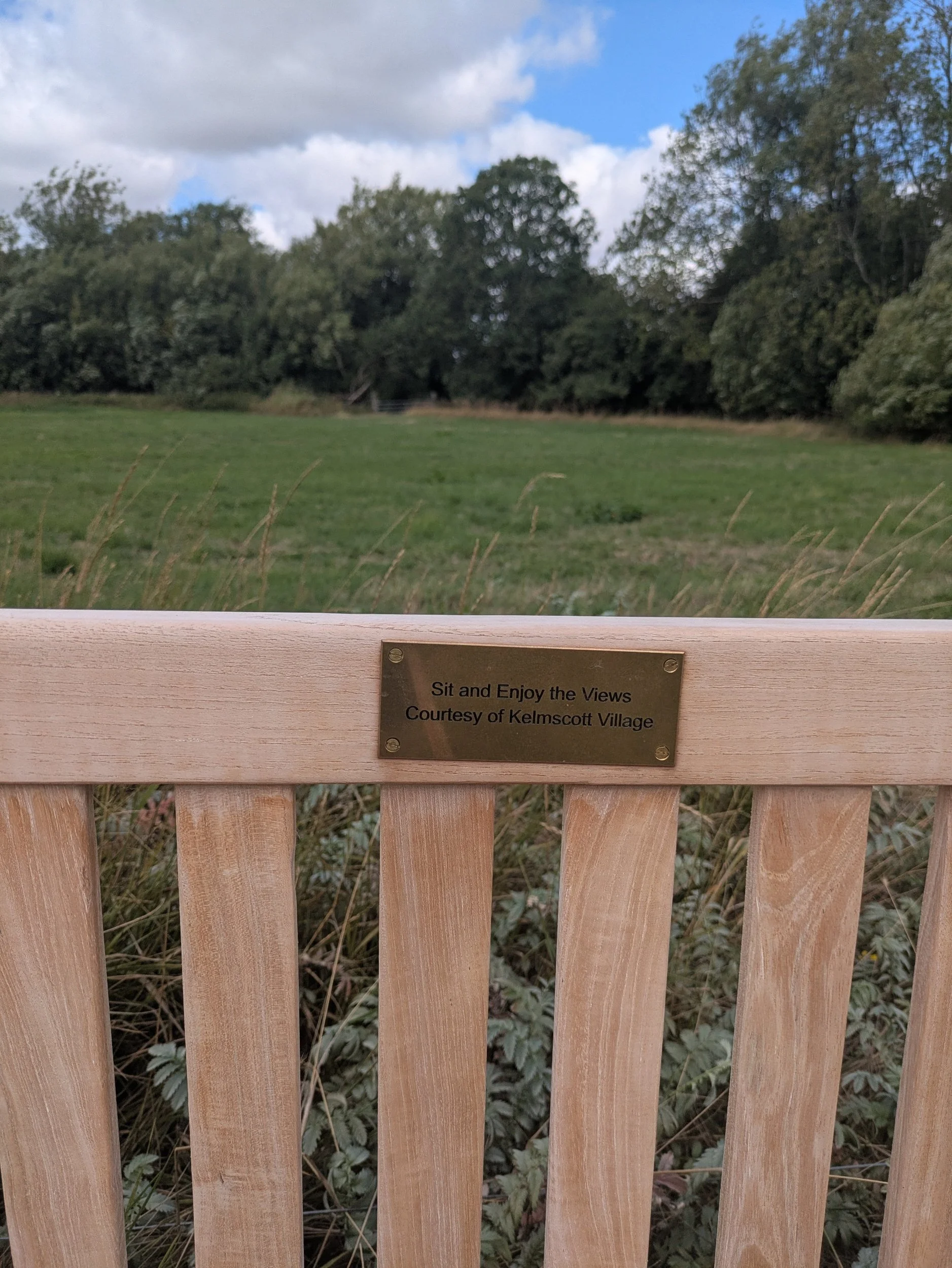


We pass the rustic wooden footbridge at Eaton which once led to the Anchor Inn (burnt down some years ago) and the old weir keepers cottage, there are some beautiful river views along this stretch as well as some really old willow trees that would have some stories to tell I’m sure! Typically we pass a lovely new-looking bench just after we had perched rather uncomfortably on the pill box, this has been provided by the villagers of Kelmscott. Around the corner we come to a wide track, left leads to Kelmscott Manor, the house William Morris called home for over 25 years. However we are turning right and continuing on the broad track. This comes to a kissing-gate and leads to open meadows again.


Whilst meandering around the river we pass two strange looking contraptions on the edge of the riverbank, sometimes it is very useful to be walking with a water expert! Apparently they are pasture pumps, designed to draw water from the river for cattle, horses or calves. This pump is nose operated as the animal drinks from the pump bowl they push against a lever, which in turn operates a piston and a diaphragm pumps water from the river! One will set you back more than £450!
We continue walking on to Grafton Lock, spotting the National Trail symbol wherever we can! There are a few boats are waiting to travel through the lock, the volunteers are working hard! This lock is well cared for with pretty flowers and picnic benches, I can’t believe they have to put a sign up to stop people urinating in their compost heap!
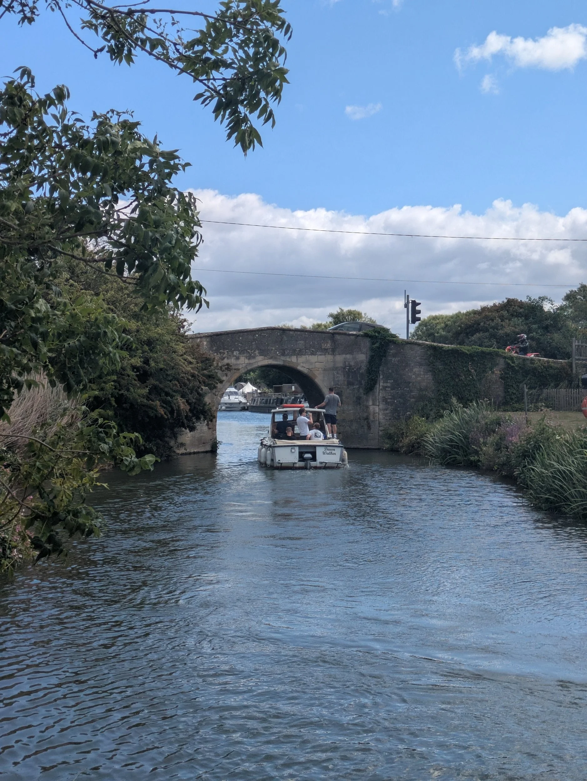


We pass moored boats that seem to have little gardens on the riverbank - nobody is aboard today though, it feels as if we are getting near to civilisation again as the path is very well worn and the vegetation here is neatly trimmed! We indeed turn the corner and can see Radcot Bridge! Parts of Radcot Bridge date from the 12th century and the river divides here with boats diverted through a newer bridge to the left. Radcot Bridge is the oldest bridge on the Thames and remains well preserved due to boats being diverted. Apparently the three gothic arches are ribbed beneath like a cathedral roof! There is evidence that there has been a bridge here as early as the 10th century. Radcot was an important crossing point between the Saxon Kingdoms of Wessex and Mercia as well as being the site of several Military actions in the 14th and 17th centuries including a civil war siege involving Oliver Cromwell.
We headed up steps by the newer bridge to the road and pause at Ye Olde Swan for a well-deserved lunch. After a delicious basket meal (I had scampi, Karen had halloumi) we returned to the bridge crossing it to continue on the Thames path. Passing a camping ground with tipis and an old pillbox as a campsite office/shop and then crossing a dilapidated old footbridge which had a sign requesting no large groups!


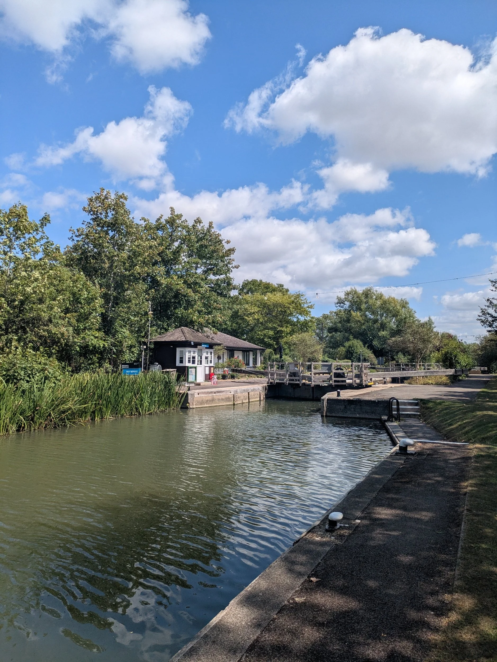

We passed a stunning herd of cattle looking very relaxed in the sunshine and admired a couple of beautiful boats before enjoying a good Nordic stretch of our legs on a nice grassy path, before we knew it we had reached Radcot Lock. A very pretty, well looked after lock with a gorgeous lockeeper’s cottage.


The next stretch includes some resistance training where we feel we are wading through the cut grass awaiting bailing! A few more minutes walking round the bends and we come to Rushey Lock, this lock has a rare example of a paddle-and-rhymer weir, which uses paddles (pictured by the fingerpost sign) dropped into place between the heavier posts with handles, the rhymers, to hold the water back. In order for river traffic to pass, some of these paddles were drawn out and after the initial flash of water the boats would go through the gap.


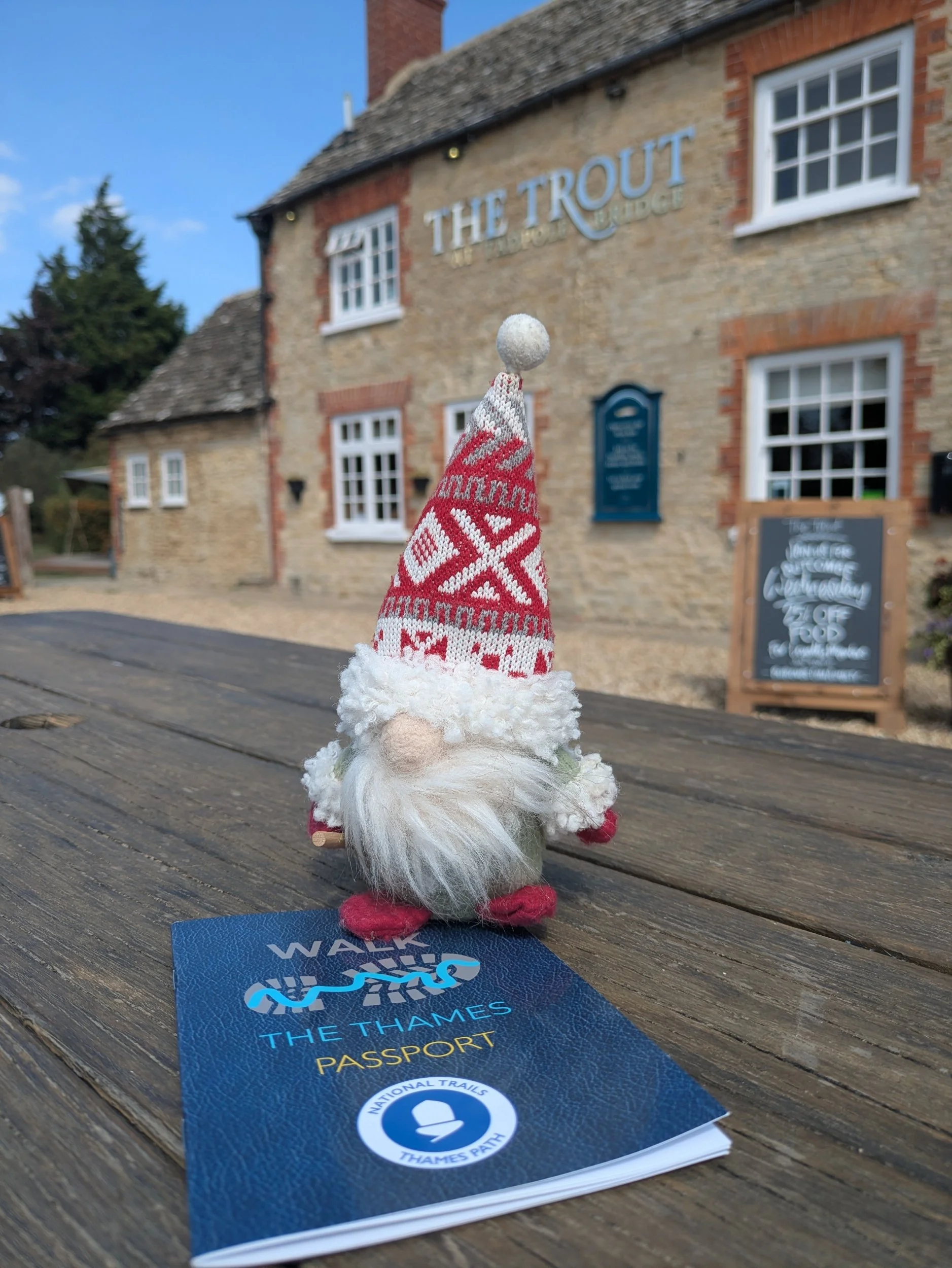
We cross over the weir and after initially going down the wrong path to a dead end, we find the lock access road which leads us to Tadpole Bridge , our destination for today! This remote bridge was built to carry the turnpike road to Bampton. One of the places to get a stamp today was also the Trout at Tadpole Bridge, so after completing our stretches I pop in to receive my stamp and Norbert gets to share the glory of another leg done.