
Nordic walking The Thames Path Leg Two: Cricklade to Lechlade

Leg Two: Cricklade to Lechlade on Thames
When: Saturday 19th July, 8am
Miles walked: 11.75 miles
Steps taken: 25,236
Moving time: 3:53:34
Elevation gain: 64 ft
The second leg of Nordic walking the Thames Path didn’t get off to the best of starts. When planning dates for these legs I hadn’t realised that today was the Royal International Air Tattoo at Fairford and that would have a serious impact on traffic and travel times getting to Lechlade or rather back to Cricklade from Lechlade! So we decided to meet at 8am and hopefully not be snarled up too much, however the delaying factor ended up being meeting at the Riverside car park in Lechlade. Karen arrived to find the only way to pay is via the Ringo App (no coin or card options) and she had no signal…to avoid a fine (hopefully) she left the car park to go and park in a side street, but had no way of letting us know this as again, no signal on her mobile. So we arrived to no Karen and no idea where she was, so no option but to wait! Eventually Karen arrived soaked to the skin having walked along the main road to return to the car park, at least she was safe and sound if a bit bedraggled. I paid for an hours parking via the app (I had signal, thankfully) so as not to incur a fine - there are ANPR cameras at the entrance and I had been there more than ten minutes so didn’t chance it. We set off for Cricklade following Google maps, we were held up slightly by traffic queuing for Fairford on the A419, but it wasn’t too bad in the end. We eventually set off at 8.54am and it wasn’t raining in Cricklade…to start with!
Walking back down Cricklade High Street we picked up where we left off and turn right into Abingdon Court Lane, the Thames Path takes a left turn as the lane bends the other way and we’re soon crossing a stone slab stile into a field bordered on the left by the Thames. This area was once known as Hatchetts Green, it was an historic crossing point on the Thames where once stood a wooden footbridge spanning the river allowing barges to pass underneath, it existed until the 1930’s. In the late 19th century the river at Hatchetts Ford was used by local Baptists for baptisms, while the congregation watched from the banks and the bridge.
It is also an area once famous for cheese making, Abingdon Court Farm had a cheese house constructed in 1841. This cheese was mentioned in Jane Austen’s Emma, The North Wiltshire Cheese! Young cheese was sent by wagon, older cheese was sent down the Thames to London by barge! Abingdon Court Farm was the 17th century farmhouse of the Manor of Abingdon Court, one of the earliest manors of Cricklade having been created in 1008 by Aethelread!
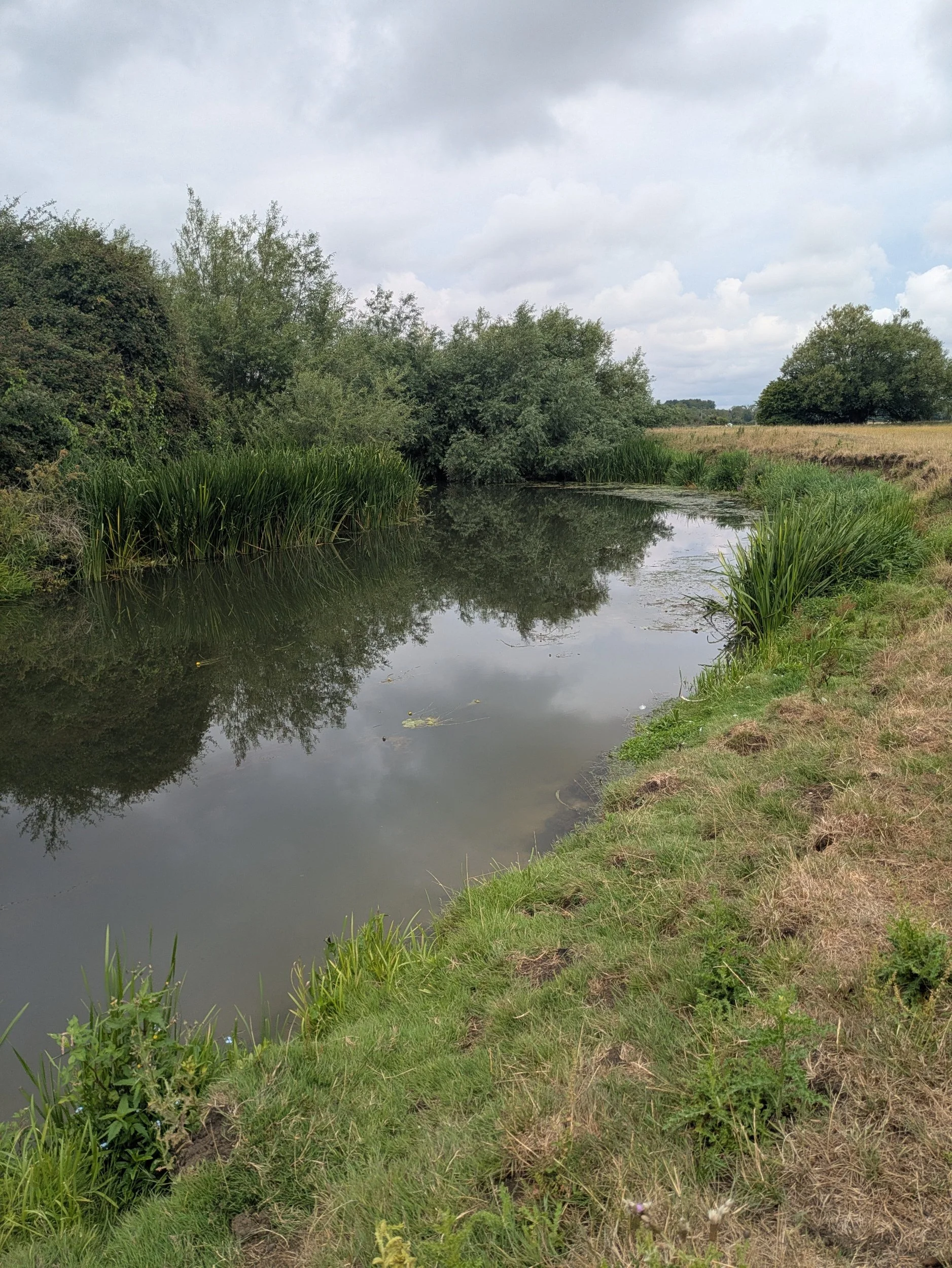
We continue on beside the river and soon come to a standing stone marking the Millennium Wood, a community woodland planted as part of the Millennium celebrations. Here the path turns left and heads under the A419 bridge where we can see cars queueing for RIAT! We pass a pipeline bridge and after a little while we cross over a wooden footbridge to the other side of the Thames river, and the rain has started to fall heavier, so I relent and put my waterproof on! We’re following the curvy nature of the river until we cross the river once more. There are cattle in the distance, but thankfully they are unbothered by our existence.


The fields are soggy (makes a change) and we’re all getting wet shoes (and feet in some cases), wearing shorts means every bit of longer damp grass is making my legs wet and I’ll need to check for ticks later. There are pretty wild flowers growing along the path and various footbridges where presumably it floods in the winter months. Now there are patches of blue sky appearing and it certainly isn’t cold, the rain is easing. The fields are mainly full of crops or for cattle along here and they vary in length, but we are getting more glimpses of stretches of river that are pleasing to the eye! We traverse some of the wooden footbridges with care as in the wet they can be quite slippery. Slowly ticking off the miles to Castle Eaton.
There sadly is evidence of bank erosion along parts of this stretch with strings of barbed wire ready to garrotte you, that’s all that remains of the fences! On the opposite bank we pass Second Chance Touring & Residential Park, a family run holiday park for over forty years apparently! After a succession of double gated footbridges we arrive at Castle Eaton and the plane noise from RIAT is making itself known! Walking through the residential streets we pass the pretty Lych-gate of St Mary’s Church and turn right walking all the way down Blackford Lane until we reach Forty Acre Farm and Blackford Farm. I spot a couple of these cast iron lions head water fountains from the 1900’s in Castle Eaton, but can’t find any information about them. We are now halfway on our journey today!


We pause for a snack stop and to watch the noisy plane!
From Castle Eaton the river is more visible and there has clearly been some work done to replace old footbridges very recently, with lovely new composite ones, which are excellent! The paths have been cleared along here too which makes for very easy Nordic walking! The coats have come off too, it is quite humid now.


At Hannington Bridge we turn right onto a lane and are faced with some RIAT traffic speeding along this tiny lane (it’s one of the official routes we think) thankfully we soon turn off onto another track that leads to a bridlepath to Inglesham, here we are no longer alongside the river, it’s a couple of fields away to our left and we are alongside a ditch until we reach a field with a private airstrip (and some sheep) here there is quite a good sized stretch of river (looks good for a dip, but not today!) The path here was diverted to a riverside path in 2017, it used to run alongside the busy A361 road! We hug the riverside all the way to Inglesham!


As the river widens, we pass a group of kayakers (or are they canoes?) setting up for a riverside picnic.
At Inglesham we pass the church of St John the Baptist which looks shut, but the grounds have been strimmed recently and a sign on the door reveals it is a temporary door, we don’t stop and take a look, but on further research I wish we had! This church was saved by Victorian designer William Morris, who lived nearby at Kelmscott, in the 19th century ensuring it kept it’s medieval identity. It is described as a exquisitely beautiful and fascinating thirteenth-century church by the Churches Conservation Trust who now look after it. Apparently it has an amazing series of wall paintings from the thirteenth to the nineteenth century, often with one painted over another, sometimes seven layers thick and an unusual Saxon stone carving of the Madonna and Child set in the south wall. It remains much as it would have in Oliver Cromwell’s time, I shall have to go back!
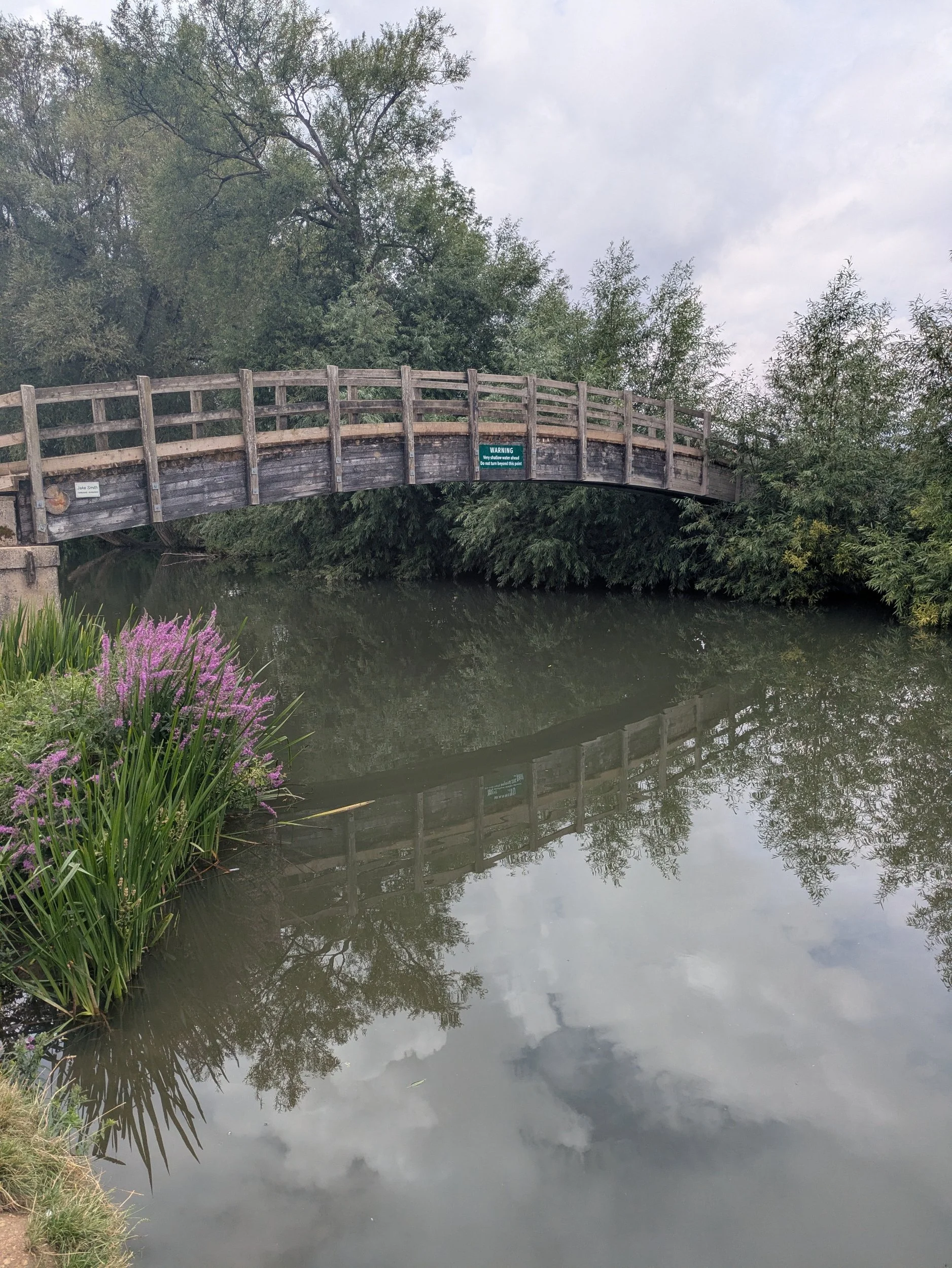
We pass The Round House, which was one of five former lengthsmen’s cottages built along the Thames and Severn Canal in the 1790’s, built during the construction of the canal, which aimed to connect the River Thames with the River Severn. Lengthsmen were responsible for maintaining the canal. It is now part of a private residence and marks the start of the navigable River Thames downstream from this point. The canal closed in 1933, but parts are under restoration and the Lechlade end is now owned by The Cotswold Canals Trust. We pause on a bench by a wooden footbridge watching the birds ducking and diving under the bridge, none of us has any energy!


The river and riverside are noticeably busier the closer we get to Lechlade, with boats and barges moored up, even a swan pedalo passes by! The riverside is full of picnickers and the pub on the wharf opposite is full!
Before the Thames and Severn Canal was opened in 1789 Lechlade was the highest point on the Thames that laden barges could reach. The riverside was a busy wharf with boats being loaded with salt from Cheshire, wool and cheese from the Cotswolds destined for Oxford and London markets and Taynton stone from nearby Burford was shipped from here and used in iconic buildings such as St Paul’s Cathedral and Windsor Castle.
The Ha’penny Bridge has spanned the river here since 1782 and is one of 106 navigable bridges between here and London, the tiny old toll house is all that remains from the time when it would cost you a halfpenny to cross the bridge! Locals rebelled and the charge was dropped in 1839.
Norbert had to wait until the end of the walk today to get his five minutes of fame! We walk back to Karen’s car, complete our post-walk stretches and drive back to Cricklade (via RIAT thanks to Google maps!) where we decide to get lunch at The Wild Fig - highly recommended!


